Safety Score: 3,0 of 5.0 based on data from 9 authorites. Meaning we advice caution when travelling to Austria.
Travel warnings are updated daily. Source: Travel Warning Austria. Last Update: 2024-05-09 08:23:21
Discover Oberlaa
The district Oberlaa of Vienna in Wien Stadt (Vienna) is a district in Austria and is a district of the nations capital.
Looking for a place to stay? we compiled a list of available hotels close to the map centre further down the page.
When in this area, you might want to pay a visit to some of the following locations: Leopoldsdorf, Hennersdorf, Lanzendorf, Achau and Vosendorf. To further explore this place, just scroll down and browse the available info.
Local weather forecast
Todays Local Weather Conditions & Forecast: 19°C / 67 °F
| Morning Temperature | 11°C / 52 °F |
| Evening Temperature | 19°C / 67 °F |
| Night Temperature | 13°C / 56 °F |
| Chance of rainfall | 0% |
| Air Humidity | 44% |
| Air Pressure | 1023 hPa |
| Wind Speed | Moderate breeze with 9 km/h (6 mph) from South |
| Cloud Conditions | Few clouds, covering 20% of sky |
| General Conditions | Few clouds |
Friday, 10th of May 2024
19°C (67 °F)
14°C (57 °F)
Sky is clear, gentle breeze, clear sky.
Saturday, 11th of May 2024
20°C (68 °F)
15°C (59 °F)
Scattered clouds, gentle breeze.
Sunday, 12th of May 2024
20°C (68 °F)
14°C (56 °F)
Few clouds, gentle breeze.
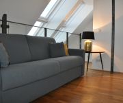
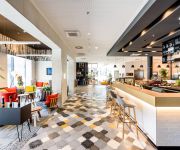
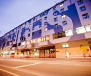
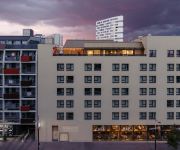
Hotels and Places to Stay
Servus Vienna Trostraße
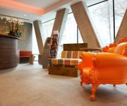
Novotel Wien Hauptbahnhof
Zeitgeist Vienna Hauptbahnhof
Schani Wien
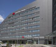
Austria Trend Hotel Doppio Wien
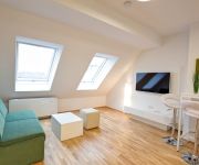
Aparthotel - Smart Apart Living
Simm's Hotel
Eitljörg Panoramaschenke
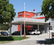
Hotel Primus Wien
MEININGER Wien Hauptbahnhof
Videos from this area
These are videos related to the place based on their proximity to this place.
Labyrinth in Wien Kurpark Oberlaa
Heike Habl http://www.habl-labyrinth.de im Labyrinth von Ilse M. Seifried / Ing. Kaspar (Stadtgartenamt) mehr Labyrinth in Österreich http://www.das-labyrinth.at/ p.s.(Nähe Trinkbrunnen...
Kurpark Wien Oberlaa
Wiener Internationale Gartenschau 1974 Auf Grund des großen Erfolgs der ersten "Wiener Internationalen Gartenschau 1964" im Donaupark bemühte sich der Wiener Gemeinderat für 1974 erneut...
[HD] 1116 133 mit KGAG 40670 (Oberlaa)
1116 133 with intermodal train KGAG 40670 (Oradea / RO -- Genk Euroterminal / BE) passing Oberlaa [Vienna, Austria]; 19/03/2011 1116 133 mit KGAG 40670 (Oradea / RO -- Genk Euroterminal...
Film Houserunning 2012.mov
Houserunning 2012 in Wien Oberlaa, schon am Weg zur Plattform fühlt man sich wie in einem Computergame.
[HD] 1016 011 mit LGAG 58926 (Oberlaa)
1016 011 with LGAG 58926 (Götzendorf / A -- Voest Alpine Linz / A) passing Oberlaa [Vienna, Austria]; 12/07/2011 1016 011 with LGAG 58926 (Götzendorf / A -- Voest Alpine Linz / A) in Oberlaa;...
Senioren Residenz Am Kurpark Wien-Oberlaa (Langversion)
In der Senioren Residenz Am Kurpark Wien-Oberlaa wohnen Sie in einer einmaligen Lage. Die Senioren Residenz befindet sich in einer dörflichen Struktur inmitten von malerischen Weinbergen und...
Senioren Residenz Am Kurpark Wien-Oberlaa (Kurzversion)
In der Senioren Residenz Am Kurpark Wien-Oberlaa wohnen Sie in einer einmaligen Lage. Die Senioren Residenz befindet sich in einer dörflichen Struktur inmitten von malerischen Weinbergen und...
[HD] 1047 006 mit RoLa 41305 (Oberlaa)
MÁV 1047 006 with 'rolling road' train ROLA 41305 (Wels Vbf / A - Kiskundorozsma / HU) passing Oberlaa [Vienna, Austria]; 19/03/2011 MÁV 1047 006 mit ROLA 41305 (Wels Vbf / A - Kiskundorozsma.
Videos provided by Youtube are under the copyright of their owners.
Attractions and noteworthy things
Distances are based on the centre of the city/town and sightseeing location. This list contains brief abstracts about monuments, holiday activities, national parcs, museums, organisations and more from the area as well as interesting facts about the region itself. Where available, you'll find the corresponding homepage. Otherwise the related wikipedia article.
Simmering (Vienna)
Simmering is the 11th district of Vienna, Austria . It borders the Danube and was established as a district in 1892. Simmering has several churches, some museums, schools, old castles, and many cemeteries.
Zentralfriedhof
The Zentralfriedhof (German for "Central Cemetery") is one of the largest cemeteries in the world, largest by number of interred in Europe and most famous cemetery among Vienna's nearly 50 cemeteries.
Belvedere, Vienna
The Belvedere is a historic building complex in Vienna, Austria, consisting of two Baroque palaces (the Upper and Lower Belvedere), the Orangery, and the Palace Stables. The buildings are set in a Baroque park landscape in the 3rd district of the city, south-east of its centre. It houses the Belvedere museum. The grounds are set on a gentle gradient and include decorative tiered fountains and cascades, Baroque sculptures, and majestic wrought iron gates.
GK Wien–Southeast
The GK Vienna–Southeast was a back-to-back HVDC station linking the electric power grids of Austria and Hungary. It operated between June 1993 and October 1996.
Gasometer, Vienna
The Gasometers in Vienna are four former gas tanks, each of 90,000 m³ storage capacity, built as part of the Vienna municipal gas works Gaswerk Simmering in 1896–1899. They are located in the 11th district, Simmering. They were used from 1899 to 1984 as gas storage tanks. After the changeover from town gas to natural gas between 1969 and 1978, they were no longer used and were shut down. Only the brick exterior front walls were preserved. The structures have found a new use in modern times.
Wiener Linien
Wiener Linien (Vienna Lines) are the company running the largest part of the public transit network in the city of Vienna, Austria. They are part of the city corporation Wiener Stadtwerke Holding AG.
Favoriten
Favoriten, the 10th district of Vienna, Austria, is located south of the central districts. It is south of Innere Stadt, Wieden and Margareten. Favoriten is a heavily populated urban area with many residential buildings, but also large recreational areas and parks. The name comes from Favorita, a semi-baroque palace complex that once served as a hunting castle but today is a gymnasium (secondary school) in the 4th district.
St. Marx Cemetery
St. Marx Cemetery (Sankt Marxer Friedhof) is a cemetery in the Landstraße district of Vienna, used from 1784 until 1874. It contains the unmarked burial of the famous composer Wolfgang Amadeus Mozart.
Ernst-Kirchweger-Haus
The Ernst-Kirchweger-Haus (EKH) is a building in Vienna's 10th district, Favoriten. Since June 23, 1990, it has been a squatted social centre, which hosts migrants and refugees, community activities, and political groups.
Heeresgeschichtliches Museum
The Heeresgeschichtliches Museum is a military history museum located in Vienna, Austria. It claims to be the oldest and largest purpose-built military history museum in the world. Its collection includes one of the world's largest collections of bronze cannons and focuses on Austrian military history from the 16th century to 1945. The museum is located in Vienna's Arsenal, in the Landstraße district, not far from the Belvedere palace.
Simmering-Graz-Pauker
Simmering-Graz-Pauker AG (SGP) was one of the most important Austrian industrial conglomerates, which used to have several thousand employees all around the world.
Palais Lanckoroński
The Palais Lanckoroński was a palace in Vienna, Austria, located at Jacquingasse 16-18, in the Landstraße District. It was constructed in 1894-95 for Count Karol Lanckoroński and his family as a personal residence, and it housed the count's enormous art collection. The palace was built in a neo-baroque style by the theatre architects Ferdinand Fellner and Hermann Helmer. The building was three stories high, set back from the street, and protected by a wall with double gates.
Franz Horr Stadium
The Franz Horr Stadium (Franz-Horr-Stadion in German) is a football stadium in the south of Vienna, Austria. It has been the home ground of FK Austria Wien since 1973. The stadium was built in 1925 as the new home of Czech immigrants' club SK Slovan Vienna and had a capacity of 10,850. Named after another Czech football club which owned the ground, the stadium was called České srdce ("Czech heart") ground.
Wien Südbahnhof
Wien Südbahnhof (German for Vienna South Station) was Vienna's largest railway terminus. It closed in December 2009 and was demolished in 2010 to be replaced with a new station, Wien Hauptbahnhof. It was located in Favoriten, in the south-east of the city. The East-bound rail services of Südbahnhof remain in operation throughout the reconstruction via provisional train station "Südbahnhof (Ostbahn)".
T-Center
The T-Center is an office building in the Sankt Marx section of Landstraße, the 3rd district of Vienna. It was built between the years 2002 and 2004 following the designs of Austrian architect Günther Domenig.
Vienna Central Station
Vienna Central Station is a partially operational railway station under construction in the Favoriten district south of the centre of Vienna, Austria. Vienna Central Station has replaced the Vienna South station, a terminal station, with a through station which links four major railway lines that converge on Vienna from the North, East, West and South. When completed, the new station will offer significantly improved, principally international, connectivity.
Arsenal (Vienna)
The Arsenal is a former military complex of buildings in the south-east of Vienna in the third district. Several brick buildings in a rectangle layout make up the complex which is located on a bank south of the Landstraßer Gürtel. It is the most distinguished building group of the romantic historism in Vienna and has been constructed in Italian-medieval respectively Byzantine-Islamic style.
Bohemian Prater
The Bohemian Prater is a small amusement park at the edge of Vienna. It dates to the second half of the 19th century, and some of the rides are more than 100 years old. The name is derived from the larger Wiener (Viennese) Prater. On 11 December 1944, during World War II, the Bohemian Prater was almost completely destroyed by a bomb attack. The centre of the Bohemian Prater forms the meeting centre Tivoli.
Ostbahnbrücke
The Ostbahnbrücke is a railway bridge over the Donaukanal in Vienna. It unites the districts of Simmering and Leopoldstadt. The Ostbahnbrücke is located near the power station in Simmering and the Gasometer.
Neugebäude Palace
Neugebäude Palace is a former imperial residence in Vienna, Austria. It was constructed for Maximilian II, Holy Roman Emperor on the site of the tent city of the invading Turks of 1529 and apparently modeled after it. It fell into disuse later on and today stands in ruins. There are various efforts to restore the site.
St. Nicholas' Church, Inzersdorf
St. Nicholas' Church is a Roman Catholic church building in Inzersdorf, Austria.
Matzleinsdorf Protestant Cemetery
, Matzleinsdorf Evangelical Cemetery is a historic Protestant cemetery located in the Favoriten district of Vienna, the capital city of Austria.
Austrian Institute of Economic Research
The Austrian Institute of Economic Research (German: Österreichisches Institut für Wirtschaftsforschung) is a private non-profit association located in Vienna, Austria. The institute was founded in 1927 by Nobel Memorial Prize winner Friedrich August von Hayek and Ludwig von Mises. With a pool of around 120 people (40 economists) it is the largest economic research institute in Austria.
21er Haus
The 21er Haus or Einundzwanziger Haus (English: House 21) is a modernist style steel and glass building designed by Austrian architect Karl Schwanzer (1918–1975). Originally constructed as the Austrian pavilion or temporary showroom for the Expo 58 in Brussels, it was later transferred to Vienna to house the Museum of the 20th Century, which explains why it was first nicknamed "20er Haus" (House 20). Between 1979 and 2001, the building also acted as a depository for contemporary art works.
Pietro Nobile
Pietro Nobile was an Italian Neoclassicist architect and builder born in Capriasca, Italy, 11 November 1774 – Vienna, Austria, 7 November 1854. He is regarded as one of the most prominent architects of the late classicism in Vienna and the leading architect of the Habsburg court. His father moved the family to Trieste where the young Pietro attended school. He continued to be educated in Rome by Antonio Canova between 1801 and 1806.





!['[HD] 1116 133 mit KGAG 40670 (Oberlaa)' preview picture of video '[HD] 1116 133 mit KGAG 40670 (Oberlaa)'](https://img.youtube.com/vi/_OY2vSVIDe4/mqdefault.jpg)

!['[HD] 1016 011 mit LGAG 58926 (Oberlaa)' preview picture of video '[HD] 1016 011 mit LGAG 58926 (Oberlaa)'](https://img.youtube.com/vi/Glq3GMVZlGc/mqdefault.jpg)


!['[HD] 1047 006 mit RoLa 41305 (Oberlaa)' preview picture of video '[HD] 1047 006 mit RoLa 41305 (Oberlaa)'](https://img.youtube.com/vi/GEu8mfrVjYs/mqdefault.jpg)


