Safety Score: 3,0 of 5.0 based on data from 9 authorites. Meaning we advice caution when travelling to Austria.
Travel warnings are updated daily. Source: Travel Warning Austria. Last Update: 2024-05-08 08:04:21
Touring Floridsdorf
The district Floridsdorf of Vienna in Wien Stadt (Vienna) is a subburb located in Austria and is a district of the nations capital.
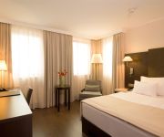
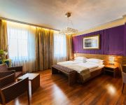
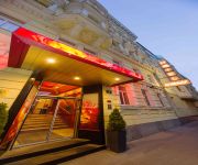
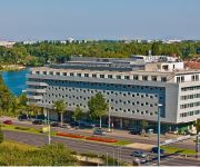
Need some hints on where to stay? We compiled a list of available hotels close to the map centre further down the page.
Being here already, you might want to pay a visit to some of the following locations: Langenzersdorf, Gerasdorf bei Wien, Hagenbrunn, Klosterneuburg and Bisamberg. To further explore this place, just scroll down and browse the available info.
Local weather forecast
Todays Local Weather Conditions & Forecast: 18°C / 64 °F
| Morning Temperature | 11°C / 51 °F |
| Evening Temperature | 18°C / 65 °F |
| Night Temperature | 13°C / 55 °F |
| Chance of rainfall | 0% |
| Air Humidity | 42% |
| Air Pressure | 1024 hPa |
| Wind Speed | Gentle Breeze with 8 km/h (5 mph) from South |
| Cloud Conditions | Few clouds, covering 14% of sky |
| General Conditions | Few clouds |
Friday, 10th of May 2024
20°C (67 °F)
13°C (56 °F)
Scattered clouds, light breeze.
Saturday, 11th of May 2024
20°C (69 °F)
16°C (61 °F)
Few clouds, light breeze.
Sunday, 12th of May 2024
19°C (67 °F)
13°C (56 °F)
Light rain, gentle breeze, broken clouds.
Hotels and Places to Stay
Meliá Vienna
FourSide Hotel & Suites Vienna
NH Danube City
Vienna
Strandhotel Alte Donau
Vienna Suites
Der Wilhelmshof
Park Inn by Radisson Uno City Vienna
Arcotel Kaiserwasser
Austria Trend Hotel Lassalle Wien
Videos from this area
These are videos related to the place based on their proximity to this place.
24-11-2012 | Paintball in der MOON Halle Wien: Compilation by Tigra
Gespielt wurde in der MOON Paintball Halle in Wien SCN. Kamera: The ONE and ONLY Tigra Spieler: Stefan Tigra Ivan Angie Wolfgang Christoph.
Sunken City 2013 (clips@lunasteam)
SUNKEN CITY 2013. Hochwasser in Wien. Ein Video von Chris Haderer. clips€lunaSteam. Aufgenommen während des Hochwassers am 5./6. Juni 2013 in Wien (Handelskai und Donauinsel).
Bilder: City Tour Wien 11/2012
Mit dem Longboard durch Wien. Saisonausklang 2012 Webseite: Bomben.at Musik: Just Drive by unreal_dm.
Flight over the Danube to Vienna 1570 (retro) - Flug über die Donau nach Wien 1570 (retro)
The flight starts near the village Kahlenbergerdorf approximately 7 km upstream from the historical city center of Vienna. We pass the bifurcation of the two main river arms, the Wolf Arm and...
Vienna To Bratislava.mov
I made this movie to show you what it looks like a trip on the Ship MS ''Kaiserin Elisabeth II'' from Vienna to Bratislava from the Km 1934 to the Km 1869 on the river Danube.This film is done...
Vienna, Austria - Donauturm (Tower) HD (2013)
The Vienna Donauturm (English: Danube Tower), opened in April 1964, is the tallest structure in Austria, at 252 metres (827 ft), and among the 75 tallest towers in the world. The tower is located...
Biken auf der Insel, erster Test HD Pro 1
ein erster Test der HD Pro 1, kurzer Trip auf die Donauinsel :)
day and night in the 21st district of Vienna
taken in Donaufeld in direction of Leopoldau and Siemens city.
HOOKED part 2 - under the bridge
a windsurfing movie about the local scene at lake neusiedl and vienna / austria, featuring riders from the austrian fanatic / northsails team as well as some nonprofessional riders who show...
Vienna (Day 06)
Sixth day of our 23 day-long Europe journey. In this video you can see some nice places from Austria's capital city Vienna such as Donauturm, St. Stephen's C...
Videos provided by Youtube are under the copyright of their owners.
Attractions and noteworthy things
Distances are based on the centre of the city/town and sightseeing location. This list contains brief abstracts about monuments, holiday activities, national parcs, museums, organisations and more from the area as well as interesting facts about the region itself. Where available, you'll find the corresponding homepage. Otherwise the related wikipedia article.
International Atomic Energy Agency
The International Atomic Energy Agency (IAEA) is an international organization that seeks to promote the peaceful use of nuclear energy, and to inhibit its use for any military purpose, including nuclear weapons. The IAEA was established as an autonomous organization on 29 July 1957. Though established independently of the United Nations through its own international treaty, the IAEA Statute, the IAEA reports to both the UN General Assembly and Security Council.
University of Veterinary Medicine Vienna
The University of Veterinary Medicine Vienna was founded in 1767 as the world's third school for veterinary medicine by Milan's Ludovico Scotti, originally named k. k. Pferde-Curen- und Operationsschule (literally, "Imperial-Royal School for the Cure and Surgery of Horses"). Today, it has c. 2,800 students and c. 600 employees.
Wiener Riesenrad
The Wiener Riesenrad (German for "Viennese giant wheel"), or Riesenrad, is a 64.75-metre tall Ferris wheel at the entrance of the Prater amusement park in Leopoldstadt, the 2nd district of Austria's capital Vienna. It is now one of Vienna's most popular tourist attractions, and symbolises the district as well as the city for many people.
United Nations Office on Drugs and Crime
The United Nations Office on Drugs and Crime (UNODC) is a United Nations office that was established in 1997 as the Office for Drug Control and Crime Prevention by combining the United Nations International Drug Control Program (UNDCP) and the Crime Prevention and Criminal Justice Division in the United Nations Office at Vienna. It is a member of the United Nations Development Group and was renamed the United Nations Office on Drugs and Crime in 2002.
Donauinsel
The Donauinsel is a long, narrow island, in central Vienna, Austria, between the Danube river and the parallel excavated channel Neue Donau. The island is 21.1 km (13.1 mi) in length, but is only 70–210 metres (230–690 ft) broad. The New Danube waterway is practically an elongated (swimming) lake, technically a diluvian bed.
Brigittenau
Brigittenau is the 20th District of Vienna (German: 20. Bezirk, Brigittenau). It is located north of the central districts, north of Leopoldstadt on the same island area between the Danube and the Danube Canal. Brigittenau is a heavily populated urban area with many residential buildings. The district's name comes from the Brigitta Chapel, built between 1645 and 1651.
Vienna International School
The Vienna International School is a non-profit international school, located in Vienna, Austria. The school was built to accommodate the children of United Nations (UN) employees and diplomats when the UN decided to locate one of its offices in Vienna, and it remains affiliated to the UN. About 50% of students are children of UN employees and receive education grants, while much of the remaining students are children mainly of embassy staff and company staff.
Church of Donaufeld
Saint Leopold's Church (German: Kirche zum Heiligen Leopold, "Donaufelder Kirche") is the Roman Catholic parish church of Donaufeld in Floridsdorf, the 21st district of Vienna, Austria. Located at Kinzerplatz, it stands at a height of 96 m (315 feet), which makes it the third tallest church in Vienna. Construction was completed in 1914. Earlier plans to use the church as a cathedral for a new diocese east of the Danube were abandoned when Floridsdorf was merged into Vienna in 1904.
Vienna International Centre
The Vienna International Centre (VIC) is the campus and building complex hosting the United Nations Office at Vienna . As colloquially also known as UNO City, the VIC is only the one part of it. The other one is the Austria Center Vienna (ACV).
Pazmanitentempel
The Pazmanitentempel, also known as the Synagogue in der Leopoldstadt, Pazmanitengasse 6, was a large synagogue in Vienna's second district Leopoldstadt. It was designed and constructed by the architect Ignaz Reiser. The building was financed by Adolf Schramek (1845–1915) who signed the contract with the builder in 1910. Originally from Leipnik, Moravia, Schramek became one of Vienna's most successful coal merchants.
Reichsbrücke
The Reichsbrücke (German for Empire Bridge) is Vienna's most famous bridge, linking Mexicoplatz in Leopoldstadt with the Donauinsel in Donaustadt on the other side of the Danube. It lies on an important axis leading from the city centre at Stephansplatz, through Praterstern, and on to Kagran in the north-east. The bridge carries six lanes of traffic, used by 50,000 vehicles daily, U-Bahn tracks, two footpaths and two cyclepaths.
Wien Praterstern railway station
Wien Praterstern (German for Vienna Praterstern) is one of Vienna's main railway stations, being used by 35,000 people daily. It is located on the roundabout Praterstern in Leopoldstadt, in the north of the city. Vienna's two most recognisable structures, the Wiener Riesenrad and the Stephansdom (cathedral) are both visible from the platforms.
Albert Schultz Eishalle
Albert Schultz Eishalle is an indoor sporting arena located in Vienna, Austria. The capacity of the arena, which was opened in January 1995, is 7,000 people. It had major renovations in 2010 and 2011, and has three rinks for hockey, figure skating, and public skating. It is currently home to the Vienna Capitals ice hockey team.
United Nations Office at Vienna
The United Nations Office in Vienna (UNOV) is one of the four major UN office sites where several different UN agencies have a joint presence. The office complex is located in Vienna, the capital of Austria, and is part of the Vienna International Centre, a cluster of several major international organizations. The UNOV was established on 1 January 1980, and was the third such office established.
Donau City Church
The Donau City Church, known more formally by its dedication as Christus, Hoffnung der Welt ("Christ, Hope of the World") is a Roman Catholic parish church in Vienna's 22nd district. The church is located next to the Vienna International Centre. Its architect is Heinz Tesar.
Donau City
The Donau City (Donaucity), or Vienna DC, is a new part of Vienna's 22nd District Donaustadt (both literally meaning Danube City) - next to both the Reichsbruecke and the left bank of Danube's 21.1 km long diluvian bed, Neue Donau . Construction work for the first building on this site started in 1995.
Augarten
The Augarten is a 52.2 hectare public park-ground, situated in Leopoldstadt, numbered as the second district of Vienna, Austria. The Augarten is comprising the oldest Baroque gardens of the city. To the north, the Augarten borders on the Northern Railway line while to the south it faces the so-called Karmeliterviertel. To the northwest and northeast of the park, its wall marks the boundary to the 20th district of Vienna, Brigittenau.
Lokomotivfabrik Floridsdorf
Lokomotivfabrik Floridsdorf (Floridsdorf locomotive factory) was an Austrian locomotive works founded on 6 September 1869 that achieved a pre-eminent place amongst European locomotive builders thanks to the quality and diversity of its designs. Common abbreviations for the company include Flor, WLF (Wiener Lokomotivfabrik Floridsdorf) and LOFAG (Lokomotivfabrik Floridsdorf AG).
Meldemannstraße dormitory
The men's dormitory on Meldemannstraße 27 in Brigittenau district, Vienna, Austria was a public dormitory for men from 1905 to 2003. It is a subject of public interest primarily because it was the residence of Adolf Hitler, the later dictator of Nazi Germany, from 1910 to 1913.
Schwimmtor
The Schwimmtor (Floating gate), also known as the Sperrschiff (Blocking ship), was a floating barrier designed to protect the areas along the Donaukanal in Vienna from flooding and ice. It was built by Wilhelm von Engerth, entered service on 13 December 1873, and was scrapped following World War II.
Nußdorf weir and lock
The Nußdorf weir and lock are works of hydraulic engineering located in the Viennese suburb of Nußdorf at the point where the Donaukanal leaves the Danube. The weir and lock were built following the adoption of a new law in July 1892, which also authorised the construction of the Wiener Stadtbahn and the transformation of the Donaukanal into a winter harbour.
New Danube
The New Danube is a side channel on the eastern side of the Danube in Vienna, Austria. It was created to provide flood relief by containing excess water. The Donauinsel (Danube Island), made out of the removed material, separates the new waterway from the main channel of the river. The project was referred to by the United Nations Human Settlements Programme (UN-HABITAT) as "the first truly multipurpose fully sustainable flood protection scheme.
University of Applied Sciences Technikum Wien
University of Applied Sciences Technikum Wien was founded in 1994 and became Vienna’s first university of applied sciences in 2000. It is the largest technical university of applied sciences in Austria and offers eleven bachelor's degree and seventeen master's degree programs.
Comprehensive Nuclear-Test-Ban Treaty Organization Preparatory Commission
The Preparatory Commission for the Comprehensive Nuclear-Test-Ban Treaty Organization, CTBTO Preparatory Commission or CTBTO Prep Com is an international organization based in Vienna, Austria that is tasked with preparing the activities of the Comprehensive Nuclear-Test-Ban Treaty Organization (CTBTO). The organization was established by the states that signed the Comprehensive Nuclear-Test-Ban Treaty (CTBT) in 1996 and will cease to exist upon the entry into force of the CTBT.
Vienna Islamic Centre
The Vienna Islamic Centre is the largest mosque in Austria, located in Vienna's 21st district Floridsdorf.


