Explore Brunswick
The district Brunswick of in Moreland (Victoria) with it's 19,867 inhabitants Brunswick is located in Australia about 288 mi south-west of Canberra, the country's capital.
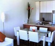
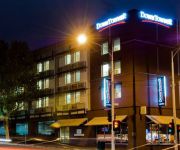
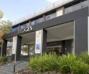
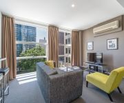
If you need a place to sleep, we compiled a list of available hotels close to the map centre further down the page.
Depending on your travel schedule, you might want to pay a visit to some of the following locations: Melbourne, Currie, Hay, Canberra and . To further explore this place, just scroll down and browse the available info.
Local weather forecast
Todays Local Weather Conditions & Forecast: 13°C / 55 °F
| Morning Temperature | 14°C / 57 °F |
| Evening Temperature | 13°C / 55 °F |
| Night Temperature | 12°C / 53 °F |
| Chance of rainfall | 1% |
| Air Humidity | 85% |
| Air Pressure | 1025 hPa |
| Wind Speed | Gentle Breeze with 6 km/h (4 mph) from South |
| Cloud Conditions | Overcast clouds, covering 100% of sky |
| General Conditions | Light rain |
Tuesday, 30th of April 2024
15°C (58 °F)
11°C (51 °F)
Broken clouds, moderate breeze.
Wednesday, 1st of May 2024
14°C (58 °F)
12°C (53 °F)
Sky is clear, gentle breeze, clear sky.
Thursday, 2nd of May 2024
16°C (60 °F)
12°C (54 °F)
Few clouds, light breeze.
Hotels and Places to Stay
Milano Serviced Apartments
CARLTON CLOCKTOWER APARTMENTS
Downtowner on Lygon
RYDGES NORTH MELBOURNE
MANTRA 100 EXHIBITION
RYDGES ON SWANSTON MELBOURNE
Best Western Melbourne's Princes Park Motor Inn
Mercure North Melbourne
BW PLUS TRAVEL INN HOTEL
ALT Tower Serviced Apartments
Videos from this area
These are videos related to the place based on their proximity to this place.
Carlton, il quartiere italiano di Melbourne, Australia
http://www.italiansinfuga.com Vi mostro Lygon Street, la via principale di Carlton, il quartiere storico italiano di Melbourne Iscriviti alla Newsletter di Italiansinfuga http://www.italiansinfug...
Faculty of Medicine, Dentistry & Health Sciences, University of Melbourne
With a heritage dating back to 1862 and being the first Australian university to teach medicine, the Faculty of Medicine, Dentistry and Health Sciences has been at the forefront of health...
Magika - Moreland City Band
Magika, by Jim Cuomo, performed by the Moreland City Band Phoenix Project at the Brunswick Bowls club. Scott Tinkler MD, Jason Chalmers Tenor Sax and Jim Cuomo Soprano Sax.
A 20 Minute City
Festival of Ideas 2013 - Winner 20 Minute City Video Competition Victor Wong, Ecknaathh Bala, Jessica Zhang, Kenneth Gho and Shervin Jaberzadeh.
Rental Property Melbourne Brunswick Townhouse 3BR/2BA by Property Management in Melbourne
"Property Management in Melbourne" -- Call +61 3 9429 0455 now, or visit http://www.realestate.com.au/rent/by-mfgsou/list-1 for more information on this "Rental Property Melbourne"! Take this...
Rent Apartment Melbourne Brunswick Apartment 2BR/2BA by Property Management in Melbourne
Ready for http://www.melbournerealestate.com.au/ ? Call +61 3 9829 2900 now or visit http://www.realestate.com.au/rent/by-mfgsou/list-1 for a list of our properties, including this "Rent Apartment...
Antigravity Method 5 of 15, Magnetic Mechanical Constraint-Repulsion or Attraction, Group IIA(i)
GROUP II MAGNETIC (PERMANENT & ELECTROMAGNETIC-DC) Group IIA(i) Magnetic Mechanical Constraint-Repulsion or Attraction of like poles Antigravity Method 5 of 15, Magnetic Mechanical ...
Martial Arts Brunswick | DMD's MMA
DMD's MMA -- Martial Arts, Brazilian Jiu Jitsu, Kickboxing, Muay Thai, Boxing, MMA Brunswick | Northcote | East Brunswick | Fitzroy | North Melbourne Find out more on dLook http://www.dlook.com.au...
Driving Lessons
Call Now 9705 7020 or 0412 674 446, Origin Driving School Melbourne provides the driving lessons the following listed Suburb in the South, Inner, North, Western, Eastern and Surrounding suburbs...
TOUR : 5 Wardens Walk, Pentrige Village, Coburg 3058 Victoria, Australia
A night time walk through, pre-residance but post construction! The newest building in The Pentrige Village Apartment Estate.
Videos provided by Youtube are under the copyright of their owners.
Attractions and noteworthy things
Distances are based on the centre of the city/town and sightseeing location. This list contains brief abstracts about monuments, holiday activities, national parcs, museums, organisations and more from the area as well as interesting facts about the region itself. Where available, you'll find the corresponding homepage. Otherwise the related wikipedia article.
Brunswick, Victoria
Brunswick is a suburb of Melbourne, Victoria, Australia, 6 km north of Melbourne's central business district. Its local government area is the City of Moreland. At the 2011 Census, Brunswick had a population of 22,764. Approximately four kilometres north of Melbourne CBD, it has a southern border with the suburbs of Princes Hill and Parkville, the boundary being Park Street.
Jewell railway station
Jewell is a railway station in Melbourne, Victoria, Australia, located in the suburb of Brunswick, on the Upfield railway line. Jewell is unmanned and is in Metcard Zone 1.
Royal Park railway station, Melbourne
Royal Park is a railway station in Melbourne, Victoria, Australia, located in the suburb of Parkville, on the Upfield railway line. Royal Park is unmanned and in Metlink Zone 1.
Brunswick railway station, Melbourne
Brunswick is a railway station in Melbourne, Victoria, Australia, located in the suburb of Brunswick, on the Upfield railway line. Brunswick is unmanned and is in Public Transport Victoria Zone 1.
Anstey railway station
Anstey is a railway station in Melbourne, Victoria, Australia. It is located on the Upfield line in the suburb of Brunswick. It is located in Metcard Zone 1.
Moreland railway station
For other uses, see Moreland (disambiguation). Moreland {{#invoke:InfoboxImage|InfoboxImage|image=Moreland Station 1.
Merri Creek
The Merri Creek is a waterway in southern parts of Victoria, Australia which flows through the northern suburbs of Melbourne. It begins in Wallan north of Melbourne and flows south for 70 km until it joins the Yarra River at Dights Falls.
Carlton North, Victoria
Carlton North is a suburb of Melbourne, Victoria, Australia, 4 km north from Melbourne's Central Business District. Its Local Government Area are the Cities of Melbourne and Yarra. At the 2011 Census, Carlton North had a population of 6,220. The suburb is bordered by Princes Street and Cemetery Road to the south, Royal Parade to the west, Nicholson Street to the east and Park Street to the north.
Brunswick East, Victoria
Brunswick East is a suburb of Melbourne, Victoria, Australia, 6 km north from Melbourne's central business district. Its Local Government Area is the City of Moreland. At the 2011 Census, Brunswick East had a population of 8,476. Brunswick East lies 6 km north of Melbourne.
CERES Community Environment Park
The CERES Community Environment Park, or Centre for Education and Research in Environmental Strategies, is an award-winning 10-acre urban environmental centre located in urban Brunswick East, Victoria, Australia. CERES is pronounced series, and the name may be partially derived from Ceres the goddess of agriculture in Roman mythology. CERES received the 1996 Banksia Environmental Award for Education and Training, and has also received many other awards.
Princes Park, Carlton
Princes Park is a 38.6 hectare (95.4 acre) park in the inner-Melbourne suburb of Carlton North, Victoria. It is located directly north of the University of Melbourne and bounded on its eastern and western sides by Melbourne General Cemetery and Royal Parade respectively.
Princes Hill, Victoria
Princes Hill is a suburb of Melbourne, Victoria, Australia, 3 km north of Melbourne's Central Business District. Its Local Government Area is the City of Yarra. At the 2011 Census, Princes Hill had a population of 2,075. Princes Hill is named for the Prince of Wales, similarly to neighbouring Carlton. Demographer Bernard Salt dubbed Princes Hill "Chick City" in 2003, after 2001 Census data revealed the suburb had the highest proportion of single women to men in Melbourne.
Melbourne General Cemetery
The Melbourne General Cemetery is a large necropolis located 2 km north of the city of Melbourne in the suburb of Carlton North.
Sydney Road Community School
The Sydney Road Community School is a small government school located in Sydney Road in the Melbourne suburb of Brunswick. It has approximately 100 students from Year 7 to Year 12. Established in 1972 at the height of the alternative education movement, the school has no fees, no uniform and no examinations until Year 12. The school prides itself on being able to achieve success with students who may have struggled in the mainstream school system.
Ridley Melbourne
Ridley MelbourneMission & Ministry College {{#invoke:InfoboxImage|InfoboxImage|image=|size=|sizedefault=frameless|alt=}}Established 1910Type Private, ChristianPrincipal Brian RosnerStudents 180Location, AustraliaCampus Parkville, VictoriaWebsite www. ridley. edu. au/ Ridley Melbourne, formerly known as Ridley College, is a Christian theological college in the parklands of central Melbourne, Australia.
Coburg City Oval
Coburg City Oval is an Australian rules football/cricket stadium located in Coburg, Australia. It is home to the Coburg Tigers Football Club and the Coburg Cricket Club (est.1856) and served as the home ground for the North Melbourne Football Club in the 1965 VFL season only. The oval is fenced off to the citizens of Moreland. The current capacity of the venue is 15,000. The ground record crowd was set on 26 June 1965 when 21,695 fans saw Collingwood defeat North Melbourne.
International House (University of Melbourne)
International House is the fourth-largest residential college of The University of Melbourne. It provides accommodation to approximately 270 students who are attending tertiary facilities including The University of Melbourne, RMIT University, Victoria University of Technology, Monash University and Australian Catholic University. It is situated at 241 Royal Parade, Parkville.
Princes Park (stadium)
Princes Park (also known by its current sponsored name Visy Park) is an Australian rules football ground located at Princes Park in the inner Melbourne suburb of Carlton North, Victoria. Prior to a partial redevelopment the ground had a capacity of 35,000, making the ground the third largest Australian rules football venue in Melbourne after the Melbourne Cricket Ground and Docklands Stadium.
Brunswick South Primary School
Brunswick South Primary School (BSPS) is a government primary school located in Brunswick East, a suburb of Melbourne, Victoria, Australia. The school was ear-marked by the Kennett state-government in the 1990s to be sold-off as being excess to requirements. The local community fought a strong campaign to successfully save the school.
City of Brunswick
The City of Brunswick was a local government area in the inner-northern suburbs of Melbourne, Victoria, Australia. It comprised the suburbs of Brunswick, Brunswick East and West Brunswick. It ceased to exist in 1993 when its Council was disbanded by the Kennett Government and replaced with appointed commissioners who oversaw its amalgamation with the City of Coburg and part of the City of Broadmeadows to create the City of Moreland.
Princes Hill Secondary College
Princes Hill Secondary College is a state, coeducational secondary school, located in the inner Melbourne suburb of Carlton North, Australia. The school has been in continuous operation since its establishment in 1889. In recent years, parts of the school have been refurbished, such as the Performing Arts Centre, Textiles & Food Facilities, VCE Classrooms and Science Laboratories, which were refurbished during 2005; also an additional building, a Gymnasium, was established in 2006.
North Fitzroy railway station
North Fitzroy station is a former railway station that was located on the Inner Circle railway line in Melbourne, Australia. It was located east of Nicholson Street, on Rae and Park streets. The station was opened on 8 May 1885, and was originally known as Nicholson Street. There was also a branch line headed south from North Fitzroy station towards Fitzroy Station; the latter had passenger services running only until 1892, and that part of the line was thereafter used only for goods trains.
North Carlton railway station
North Carlton is a former railway station that was located on the Inner Circle railway line in Melbourne, Australia. It was located on Lang Street. The station was opened on 8 May 1885, and was originally known known as Langridge-street and later Lang Street. It was closed to passengers in 1948, except for special events such as the 1956 Melbourne Olympics.
Deutsche Schule Melbourne
Deutsche Schule Melbourne (commonly referred to as 'DSM') is an independent co-educational school located in North Fitzroy, a northern suburb of Melbourne, Victoria, Australia. Established in 2008, the school caters for students from Prep to year 6. DSM is a member of Schools: Partners of the future, an initiative of the German Federal Foreign Office.
Antonine College
Antonine College is a Catholic, co-educational secondary school day school located in Brunswick, Victoria, Australia. Antonine College was formed in 2005 by the amalgamation of the Antonine Sisters Maronite Primary School, established in 1998, and the Antonine Sisters Trinity Maronite Catholic College established in 2002 which originally catered for students from Prep to Year 10. VCE classes were established by 2007. It is the only Maronite Catholic co-educational P-12 school in Victoria.


