Touring Bell Park
The district Bell Park of Geelong in Greater Geelong (Victoria) with it's 5,286 residents Bell Park is a subburb located in Australia about 329 mi south-west of Canberra, the country's capital place.
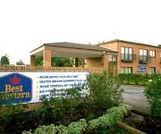
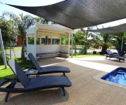
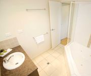
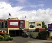
Need some hints on where to stay? We compiled a list of available hotels close to the map centre further down the page.
Being here already, you might want to pay a visit to some of the following locations: Melbourne, Currie, Hay, Loxton and . To further explore this place, just scroll down and browse the available info.
Local weather forecast
Todays Local Weather Conditions & Forecast: 18°C / 64 °F
| Morning Temperature | 10°C / 51 °F |
| Evening Temperature | 14°C / 57 °F |
| Night Temperature | 12°C / 54 °F |
| Chance of rainfall | 0% |
| Air Humidity | 62% |
| Air Pressure | 1027 hPa |
| Wind Speed | Moderate breeze with 9 km/h (6 mph) from North-West |
| Cloud Conditions | Scattered clouds, covering 39% of sky |
| General Conditions | Scattered clouds |
Monday, 6th of May 2024
17°C (63 °F)
12°C (53 °F)
Sky is clear, gentle breeze, clear sky.
Tuesday, 7th of May 2024
18°C (64 °F)
10°C (50 °F)
Sky is clear, gentle breeze, clear sky.
Wednesday, 8th of May 2024
19°C (66 °F)
11°C (51 °F)
Sky is clear, light breeze, clear sky.
Hotels and Places to Stay
Rose Garden Motel
BEST WESTERN GEELONG MOTOR
QUEST GEELONG
Barwon Valley Lodge
Discovery Parks – Geelong
VUE APARTMENTS
Parkside Motel Geelong
Comfort Inn Bay City
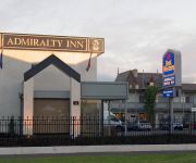
BW ADMIRALTY MOTOR
Parkwood Motel and Apartments
Videos from this area
These are videos related to the place based on their proximity to this place.
Orthodontic Care in Geelong: Keeping Your Braces in Shape
http://allsmilesdentalpractice.com.au/orthodontic-care-in-geelong-keeping-your-braces-in-shape/ Orthodontic Care in Geelong: Keeping Your Braces in Shape Your oral hygiene must be augmented...
North Geelong House Fire
CFA firefighters tackle a house fire in North Geelong, Victoria, Australia. 19 February 2010. Filmed by Darren Apps, Digital Media Unit, CFA Public Affairs.
Victorian EMD locomotives. A class Geelong and Lara
A66 arrivives at Geelong and then departs Lara with an up South Geelong pass.
The Osteopath, Geelong West, Australia
For effective treatment, call the Osteopaths in Geelong West, Victoria Ph 5229 4420 or visit http://geelongosteopath.com.
51 Weller Street, Geelong West
This is a fully renovated Californian Bungalow in Weller Street, Geelong West. A fantastic location being only 100 metres from Pakington Street and a short walk from the City & Train Station...
Commercial Relocations Geelong
http://www.beckleys.com.au At Beckleys Transport we offer a Commercial Relocations service. We understand the importance of getting the job done efficiently so your business can have very minimal...
Geelong to South Geelong on the VLocity 160
A look out the window from a V/Line VLocity 160, a snippet (Geelong to South Geelong) from my journey from Benalla to South Geelong on Wednesday 11th July, 2012. Geelong Railway Station: ...
How to straighten hair professionally
Hello and welcome to Salon EVE's channel! I'm Vicky! I hope you like these videos I'm uploading!! :) www.saloneve.com.au www.facebook.com/saloneve1 This is the first of a long range of "How...
Wojcinski Goals, Geelong Cats v Sydney Swans.
Words fail me at the audacity of this wonderful goal from David Wojcinski in the Geelong Cats' hard fought win against the Sydney Swans in their AFL 2011, round 4 contest on Saturday night......
Videos provided by Youtube are under the copyright of their owners.
Attractions and noteworthy things
Distances are based on the centre of the city/town and sightseeing location. This list contains brief abstracts about monuments, holiday activities, national parcs, museums, organisations and more from the area as well as interesting facts about the region itself. Where available, you'll find the corresponding homepage. Otherwise the related wikipedia article.
North Shore, Victoria
North Shore is an industrial and residential suburb of Geelong, Victoria, Australia. The suburb overlooks Corio Bay. A small residential area is east of the North Shore railway station with a few neighbourhood shops. The suburb is bounded by the Geelong to Melbourne railway line to the west, St Georges Road to the north, Corio Bay to the east, and Cowies Creek to the south.
Fyansford, Victoria
Fyansford is a township on the western edge of Geelong, Victoria, Australia, named after Captain Foster Fyans who came to Geelong as a Police magistrate in October, 1837. It is located at the junction of the Barwon and Moorabool rivers. Fyansford is one of the earliest places of settlement in the Geelong region. Fyans established his police camp nearby where the Moorabool could be forded - giving the name Fyan's Ford.
Norlane, Victoria
Norlane is a northern suburb of Geelong, Victoria, Australia. Norlane is located approximately 7 km from the Geelong central business district and approximately 70 km from the state capital, Melbourne. Situated 1 km from the Port Phillip Bay, Corio Bay, North Shore Beach.
Bell Park, Victoria
Bell Park is a residential suburb of Geelong, Victoria, Australia. It is located 3 km north-west of the Geelong city centre and is bordered to the north by the Ballarat rail line, to the east by Thompson Road, to the south by the Midland Highway and to the west by Anakie Road.
Manifold Heights, Victoria
Manifold Heights is a residential suburb of Geelong. The Post Office opened on 25 March 1929, but has always been known as Manifold.
North Geelong, Victoria
North Geelong is a suburb of Geelong in the Australian state of Victoria. The suburb will be bypassed by traffic from Melbourne coming from the Princes Freeway by the creation of the Geelong Ring Road, which was complete in 2009. From 1860 to 1970 a gasworks was operated by the Geelong Gas Company on a site between Victoria Street and the Geelong railway line. The current Post Office opened in 1987. An earlier office dating from 1886 was replaced by Rippleside in 1986.
Geelong West, Victoria
Geelong West is a commercial and residential suburb of Geelong, Victoria, Australia. When Geelong was founded, the area was known as Kildare but its name was changed to Geelong West in 1875. The main street is Pakington Street.
Bell Post Hill, Victoria
Bell Post Hill is a residential suburb of Geelong, Victoria, Australia. The origin of the suburb's name is thought to be from a lookout or warning bell on a post situated on the hill overlooking Corio Bay. The first recorded use of this bell was 1837 during a conflict with the local Aborigines. The town has an Australian Rules football team competing in the Geelong & District Football League.
Herne Hill, Victoria
Herne Hill is a residential suburb of Geelong, Victoria, Australia.
Rippleside, Victoria
Rippleside is a suburb of Geelong, Victoria, Australia. The suburb overlooks Corio Bay.
Hamlyn Heights, Victoria
Hamlyn Heights is a residential suburb of Geelong, Victoria, Australia. It located to the west of the city on hills that overlook Corio Bay. The suburb boundaries are Church St, Ballarat Rd, Moorabool River and two unmarked boundaries extending between Church St to Moorabool River and between Moorabool River and Ballarat Rd. Hamlyn Heights has two retail areas. A large shopping strip is located in Vines Rd. The Post Office opened here on 2 February 1959 it is known as Vines Road, Geelong.
Geelong railway station
Geelong railway station is served by the Geelong line, and is located in Railway Terrace, Geelong, Victoria, Australia. Geelong railway station is located opposite the Geelong Law Courts and also adjacent to the Gordon Institute of TAFE and the Geelong Police Station. All trains leaving the city of Geelong stop at the station. Geelong railway station is of historic and architectural significance to both Geelong and Victoria.
North Geelong railway station
North Geelong is a railway station on the Geelong railway line in North Geelong, Victoria, Australia. It is 71 km from Southern Cross station. The North Geelong rail yards are located at the "up" end of the station.
North Shore railway station
North Shore railway station is a station on the Melbourne - Geelong railway line, and is located in North Shore, a suburb of Geelong, Victoria, Australia. There are two broad gauge passenger tracks at the station, and trains can travel in either direction on either line. In addition, the Western standard gauge line runs on the west side of the station.
Kardinia International College
Kardinia International College is an independent school located in Bell Post Hill, Geelong, Victoria, Australia. It is a single campus college, residing on the site of the former Morongo Girls' College.
Pakington Street
Pakington Street is a boutique shopping strip in Geelong, Victoria, Australia. Know lovingly as “Pako” to local residents, the strip stretches between the suburbs of Geelong West at its North end and Newtown to the South. The south end of Pakington Street is commonly referred to as the “Paris end”, due to its high density of high-end designer boutiques and exclusive restaurants, while the north end is home to a myriad of shops including retail, fashion, restaurants, pubs and local services.
Pako Festa
Pako Festa is an annual festival held in Pakington Street, Geelong West each year around late February. The festival is held to promote cultural diversity and show appreciation for the artwork and fashion designed by citizens of the Geelong area. The first festival was held in 1983, and currently attracts the participation of around 30 cultural community groups, up to 60 community groups and a total attendance in excess of 100,000 people. It is the largest multicultural festival in Victoria.
Clonard College
Clonard College is a girls' secondary school located in Geelong West, Victoria, Australia. Founded and owned by the Brigidine Sisters in 1956, Clonard College draws its rich heritage from the traditions of Brigidine order. In 2010, Damian McKew was appointed Principal after spending four and a half years as Principal of Trinity College Colac. Clonard - as a school - came into existence (officially) in 1956.
Osborne House (Geelong)
Osborne House is a historic building built in 1858, located in North Geelong, Victoria, Australia.
City of Geelong West
The City of Geelong West was a local government area about 5 kilometres west of the regional city of Geelong, Victoria, Australia. The city covered an area of 5.26 square kilometres, and existed from 1875 until 1994.
Geelong Golf Club
The Geelong Golf Club is a defunct golf club founded in 1892 and was the oldest in the state of Victoria, Australia. It was located in the northern Geelong suburb of North Geelong and maintained a 18 hole course bounded by Ballarat Road and bisected by Thompson Road. The club ran into financial difficulties, $250,000 in 2001 and management of the club was taken over by PGA Links on 18 February 2002.
Morongo Girls' College
Morongo Girls' College was a Presbyterian school for girls, founded in 1920 on Bell Post Hill near Geelong, on the site of an original homestead (called Morongo). The founding Principal was Miss Gertrude Pratt BA, the second Principal was Miss Shaw BA (Qld)and Miss Dulcie Brookshaw was the third headmistress. The fourth and final headmistress was Mrs Judith Watt. Morongo provided a good solid education where women were encouraged to excel in all fields.
Cowies Creek
Cowies Creek is a creek in the northern suburbs of Geelong, Victoria, Australia. It flows from wetlands in Moorabool to Corio Quay, Corio Bay in Port Phillip. The mouth of Cowies Creek was excavated to become Corio Quay from 1909, with the creation of Lascelles Wharf to the north in later years.
Western Heights College
Western Heights College is a co-educational secondary school in Geelong, Australia. It currently has two campuses, Junior Years Campus (formerly Minerva campus) for years 7, 8 and 9 and Senior Years Campus (formerly Quamby Campus) for years 10, 11 and 12, located in the suburbs of Herne Hill, Hamlyn Heights respectively. The school was created from the merger of three existing secondary schools - Geelong West Technical School (Minerva Road) and Bell Park Technical School.
Geelong Arena
Geelong Arena is the home of former National Basketball League team the Geelong Supercats who now play in the South East Australian Basketball League. The arena has the majority of its 2,000 seating capacity on the broadcast side of the court with two smaller sections at each end plus two levels of corporate boxes on the opposite to the broadcast side.


