Safety Score: 2,7 of 5.0 based on data from 9 authorites. Meaning we advice caution when travelling to United States.
Travel warnings are updated daily. Source: Travel Warning United States. Last Update: 2024-04-28 08:22:10
Discover Fairview Village
Fairview Village in Windham County (Vermont) is a place in United States about 359 mi (or 577 km) north-east of Washington DC, the country's capital city.
Current time in Fairview Village is now 11:59 AM (Sunday). The local timezone is named America / New York with an UTC offset of -4 hours. We know of 11 airports near Fairview Village, of which 5 are larger airports. The closest airport in United States is Dillant Hopkins Airport in a distance of 16 mi (or 25 km), East. Besides the airports, there are other travel options available (check left side).
Also, if you like playing golf, there are a few options in driving distance. If you need a hotel, we compiled a list of available hotels close to the map centre further down the page.
While being here, you might want to pay a visit to some of the following locations: Newfane, Keene, Newport, Woodstock and Rutland. To further explore this place, just scroll down and browse the available info.
Local weather forecast
Todays Local Weather Conditions & Forecast: 20°C / 68 °F
| Morning Temperature | 6°C / 44 °F |
| Evening Temperature | 21°C / 70 °F |
| Night Temperature | 16°C / 60 °F |
| Chance of rainfall | 10% |
| Air Humidity | 59% |
| Air Pressure | 1018 hPa |
| Wind Speed | Gentle Breeze with 8 km/h (5 mph) from East |
| Cloud Conditions | Overcast clouds, covering 93% of sky |
| General Conditions | Heavy intensity rain |
Sunday, 28th of April 2024
20°C (68 °F)
12°C (53 °F)
Broken clouds, gentle breeze.
Monday, 29th of April 2024
14°C (57 °F)
9°C (48 °F)
Heavy intensity rain, light breeze, overcast clouds.
Tuesday, 30th of April 2024
9°C (47 °F)
9°C (48 °F)
Moderate rain, calm, overcast clouds.
Hotels and Places to Stay
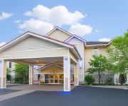
Holiday Inn Express & Suites BRATTLEBORO
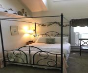
1868 Crosby House
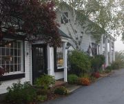
COLONIAL MOTEL AND SPA
Quality Inn & Conference Center
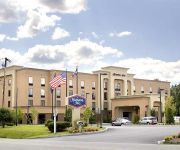
Hampton Inn Brattleboro
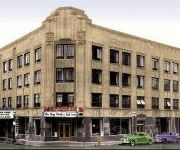
Latchis Hotel
Econo Lodge Brattleboro
LATCHIS HOTEL
FORTY PUTNEY ROAD B
DALEMS CHALET
Videos from this area
These are videos related to the place based on their proximity to this place.
29,440 Dominoes - 2014 Domino Toppling Extravaganza at BMAC, Brattleboro, VT
http://www.brattleboromuseum.org The Brattleboro Museum & Art Center held its Seventh Annual Domino Toppling Extravaganza on February 17, 2014. The Olympics-themed course of 29440 ...
brattleboro vermont aug 28 2011 hurricane irene flood on flat st.
I created this video with the YouTube Video Editor (http://www.youtube.com/editor) hurricane irene storm rain weather.
Ellen Garvey, MD - A Brattleboro Memorial Hospital Provider
At Brattleboro Memorial Hospital, our physicians and providers are the main reason we're recognized as exceptional providers of quality healthcare. Meet Ellen Garvey, MD by watching this video....
Auto Mall Brattleboro, VT April 2015 Commercial
Auto Mall serves Brattleboro, VT, the greater Vermont valley, Keene, NH, and New England. Our wide selection of Chevrolet cars, trucks, and SUVs, GMC trucks and SUVs, and Buicks, plus our...
100_3442.MOV irene flood flat st 2011 aug 28 brattleboro vermont storm
irene flood flat st 2011 aug 28 brattleboro vermont storhurricane irene storm rainm.
irene flood flat st 2011 aug 28 brattleboro vermont
irene flood flat st 2011 aug 28 brattleboro vermont.
100_3444.MOV irene flood flat st 2011 aug 28 brattleboro vermont storm
irene flood flat st 2011 aug 28 brattleboro vermont storm.
Videos provided by Youtube are under the copyright of their owners.
Attractions and noteworthy things
Distances are based on the centre of the city/town and sightseeing location. This list contains brief abstracts about monuments, holiday activities, national parcs, museums, organisations and more from the area as well as interesting facts about the region itself. Where available, you'll find the corresponding homepage. Otherwise the related wikipedia article.
Brattleboro, Vermont
Brattleboro, originally Brattleborough, is a town in Windham County, Vermont, United States, located in the southeast corner of the state, along the state line with New Hampshire. The population was 12,049 at the 2010 census. It is situated along the Connecticut River, at the mouth of the West River. Brattleboro is the oldest town in the state of Vermont and is noted for its vibrant arts community.
Fort Dummer
Fort Dummer was a British fort built in 1724 during Dummer's War by the colonial militia of the Province of Massachusetts Bay under the command of Lieutenant Timothy Dwight in what is now the Town of Brattleboro in southeastern Vermont. The fort was the first permanent European settlement in Vermont.
Brattleboro Museum and Art Center
The Brattleboro Museum and Art Center, a non-collecting museum, was founded in 1972 and is located in the former Union Station in downtown Brattleboro, Vermont. New exhibits by regional and international artists are shown each season. The aim of BMAC is to present art and ideas in ways that inspire, educate, and engage people of all ages. Some of BMAC’s notable exhibiting artists have included Jennifer Bartlett, Chuck Close, Janet Fish, Wolf Kahn, Chris Van Allsburg and Andy Warhol.
Brattleboro Union High School
Brattleboro Union High School is a public school in Vermont that serves the towns of Brattleboro, Vernon, Guilford, Dummerston, and Putney. It has approximately 1055 students and is easily accessible from exit 1 off of I-91.
WVEW-LP
WVEW-LP is a radio station licensed to Vermont Earth Works. The license to operate the station is currently held by Vermont Earth Works. The broadcast radius is from 3 to 5 miles (to km). There are 56 volunteers on the staff.
WKVT (AM)
WKVT (1490 AM, "1490 WKVT") is a radio station licensed to serve Brattleboro, Vermont. The station is owned by Saga Communications and licensed to Saga Communications of New England, LLC. It airs a News/Talk format. The station has been assigned the WKVT call letters by the Federal Communications Commission.
Austine School
The Austine School, in Brattleboro, Vermont, is an independent, coeducational day and residential school for deaf and hard-of-hearing children age four to eighteen from New England and New York.
Brattleboro Memorial Hospital
Brattleboro Memorial Hospital, the Hospital in Brattleboro, Vermont. Brattleboro Memorial Hospital is a community hospital which has been serving greater Brattleboro and the tri-state area since 1904. The BMH Medical Staff claims to employ more than 100 board-certified physicians, active in both primary care and many specialties.
Homestead-Horton Neighborhood Historic District
The Homestead-Horton Neighborhood Historic District in Brattleboro, Vermont, is made up of 25 contributing buildings. It was listed on the National Register of Historic Places on April 3, 2009. The district is significant as "a cohesive, well preserved example of a residential district that developed during the late 19th and early 20th centuries to provide housing to the burgeoning workforce in Brattleboro.
Marlboro College Graduate School
Marlboro College Graduate School http://gradschool. marlboro. edu/ was founded in 1997 by Marlboro College in Marlboro, Vermont. It is accredited http://cihe. neasc. org/about_our_institutions/roster_of_institutions/#Vermont with the New England Association of Schools and Colleges and located at 28 Vernon Street in Downtown Brattleboro, Vermont, approximately 12 miles from Marlboro College.


