Safety Score: 2,7 of 5.0 based on data from 9 authorites. Meaning we advice caution when travelling to United States.
Travel warnings are updated daily. Source: Travel Warning United States. Last Update: 2024-05-15 08:00:47
Delve into Slabtown
Slabtown in Allegany County (Maryland) is a town located in United States about 113 mi (or 182 km) north-west of Washington DC, the country's capital town.
Time in Slabtown is now 03:55 AM (Thursday). The local timezone is named America / New York with an UTC offset of -4 hours. We know of 13 airports closer to Slabtown, of which 5 are larger airports. The closest airport in United States is John Murtha Johnstown Cambria County Airport in a distance of 44 mi (or 71 km), North. Besides the airports, there are other travel options available (check left side).
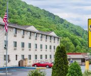
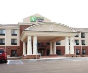
There is one Unesco world heritage site nearby. It's Monticello and the University of Virginia in Charlottesville in a distance of 136 mi (or 219 km), South-East. Also, if you like the game of golf, there are some options within driving distance. In need of a room? We compiled a list of available hotels close to the map centre further down the page.
Since you are here already, you might want to pay a visit to some of the following locations: Cumberland, Keyser, Romney, Somerset and Bedford. To further explore this place, just scroll down and browse the available info.
Local weather forecast
Todays Local Weather Conditions & Forecast: 20°C / 67 °F
| Morning Temperature | 10°C / 50 °F |
| Evening Temperature | 19°C / 66 °F |
| Night Temperature | 13°C / 55 °F |
| Chance of rainfall | 0% |
| Air Humidity | 60% |
| Air Pressure | 1010 hPa |
| Wind Speed | Gentle Breeze with 6 km/h (4 mph) from South |
| Cloud Conditions | Scattered clouds, covering 43% of sky |
| General Conditions | Light rain |
Thursday, 16th of May 2024
15°C (58 °F)
15°C (58 °F)
Light rain, gentle breeze, overcast clouds.
Friday, 17th of May 2024
15°C (59 °F)
12°C (54 °F)
Moderate rain, light breeze, overcast clouds.
Saturday, 18th of May 2024
10°C (50 °F)
9°C (48 °F)
Moderate rain, light breeze, overcast clouds.
Hotels and Places to Stay
Allegheny Trail House
Hampton Inn Frostburg
BW BRADDOCK MOTOR INN
Gunter Hotel
Rodeway Inn Lavale
DAYS INN & SUITES FROSTBURG
SUPER 8 LA VALE-CUMBERLAND ARE
Comfort Inn & Suites LaVale - Cumberland
Holiday Inn Express & Suites CUMBERLAND - LA VALE
Videos from this area
These are videos related to the place based on their proximity to this place.
WMSR 734 on the Frostburg Turntable
Western Maryland 734 Turning around on the Frostburg Turntable, for the trip back to Cumberland...
A Mix of Breeds Have Fun Playing Together At The Frostburg Dog Park
Caleb, the Yellow Labrador, and Fern, the Irish Water Spaniel stay busy retrieving their toy while Schatzi, the American Eskimo and Jerome, the Yorkshire Terrier, join in the fun at the Frostburg...
Western Maryland Scenic Railroad at Frostburg MD
Arrival of the STEAM engine passenger train in Frostburg, MD.
Fun in the Snow at the Frostburg Dog Park
Schatzi, an American Eskimo dog, loves to run in the snow at the Frostburg Dog Park. You can read more about her on her blog Your Pets View.
Jerome, Caleb and Schatzi Enjoy A Winter Day At the Frostburg Dog Park
Jerome, the Yorkshire Terrier, holds his own playing with Schatzi, the American Eskimo, and Caleb, the Labrador Retriever rescued from the Allegany County Animal Shelter on a snowy day in February ...
Train Steam Locomotive turntable on Western Maryland Railroad in action
Train Steam Locomotive turning around on Western Maryland Scenic Railroad in Frostburg, Maryland. We riding our bikes on the Great Allegheny Passage Rail Trail when we stopped in Frostburg...
Turntable
Once the Western Maryland Scenic Railroad's 734 engine reaches Frostburg, it is rotated on the electric turntable for the trip down the mountain.
Western Maryland Winter Photo Special, Part I
Can be viewed in High Definition. Part I of II.) The Western Maryland Winter Photo Special on the Western Maryland Scenic Railroad traveled along 16 miles of ex-Western Maryland Railroad...
What in the HECK is BikePacking?
We are a village of friends that completely enjoy survival and adventures on bicycles! Come Join us!
Videos provided by Youtube are under the copyright of their owners.
Attractions and noteworthy things
Distances are based on the centre of the city/town and sightseeing location. This list contains brief abstracts about monuments, holiday activities, national parcs, museums, organisations and more from the area as well as interesting facts about the region itself. Where available, you'll find the corresponding homepage. Otherwise the related wikipedia article.
Frostburg, Maryland
For the NSA computer, see FROSTBURG. Frostburg is a city in Allegany County, Maryland, United States and is located at the head of the Georges Creek Valley. It is part of the Cumberland, MD-WV Metropolitan Statistical Area. The population was 9,002 at the 2010 census. Located 8 miles west of Cumberland, the town is one of the first cities on the "National Road", US 40, and the western terminus of the Western Maryland Scenic Railroad. Since 1991, the city has been served by Interstate 68.
Allegheny Highlands Trail of Maryland
The Allegheny Highlands Trail of Maryland (AHTM) is a 20.47-mile long rail trail from Cumberland to the Mason-Dixon line, where it meets the Allegheny Highlands Trail of Pennsylvania. The trail parallels the Western Maryland Scenic Railroad which operates tourist trains powered by a steam locomotive. The trail follows the route of the Connellsville extension of the historic Western Maryland Railroad.
St. Michael School (Frostburg, Maryland)
St. Michael School is a Catholic elementary school (prekindergarten through fifth grade) located in Frostburg, Maryland. It is run by neighboring St. Michael Church, located on Main Street in Frostburg. The school's current principal is Kathy Black. The school has an after school program where students stay until parents are able to pick them up.
Mountain Ridge High School (Frostburg, Maryland)
Mountain Ridge High School is a high school in Frostburg, Maryland, that houses over 1000 students from the Georges Creek Valley, the Greater Frostburg vicinity, and the Westernport region. The school mascot is a miner and the school colors are red, black, white and gold.
Borden Tunnel
The Borden Tunnel is a 957-foot formerly abandoned railway tunnel located about 2.5 miles (4 km) north of Frostburg, Maryland. Unlighted, it is now part of the Great Allegheny Passage rail trail. The Western Maryland Railway built the tunnel in 1911 for its Connellsville Subdivision. The rail line was abandoned in 1975.
Mount Savage Iron Works
The Mount Savage Iron Works operated from 1837 to 1868 in Mount Savage, Maryland. The ironworks were the largest in the United States in the late 1840s, and the first in the nation to produce heavy rails for construction of railroads. The works were established in an area adjacent to mines for coal, iron ore and fire clay. Facilities included blast furnaces, puddling furnaces, a rolling mill, iron refineries, coke production and brick production.
Grahamtown, Maryland
Grahamtown is a small ghost town in Allegany County, Maryland, located at the southeast edge of Frostburg, Maryland. The town takes its name from Curtin Graham, who owned a farmhouse at this site, surrounded by several small service buildings in the 1880s. A fire gutted the farmhouse in 1995, leaving only an uninhabited shell. Grahamtown is also known as Wright's Crossing, marking the point where Maryland Route 36 crosses Welsh Hill.


