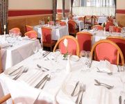
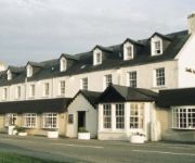
Safety Score: 3,0 of 5.0 based on data from 9 authorites. Meaning we advice caution when travelling to United Kingdom.
Travel warnings are updated daily. Source: Travel Warning United Kingdom. Last Update: 2024-04-27 08:23:39
Discover Erbusaig
Erbusaig in Highland (Scotland) is a town in United Kingdom about 459 mi (or 738 km) north-west of London, the country's capital city.
Current time in Erbusaig is now 10:39 PM (Saturday). The local timezone is named Europe / London with an UTC offset of one hour. We know of 10 airports near Erbusaig, of which two are larger airports. The closest airport in United Kingdom is Skye Bridge Ashaig Airport in a distance of 5 mi (or 9 km), South-West. Besides the airports, there are other travel options available (check left side).
There is one Unesco world heritage site nearby. It's St Kilda in a distance of 73 mi (or 117 km), North-West. Also, if you like playing golf, there are a few options in driving distance. Looking for a place to stay? we compiled a list of available hotels close to the map centre further down the page.
When in this area, you might want to pay a visit to some of the following locations: Stornoway, Lochgilphead, Highland, Inverness and Greenock. To further explore this place, just scroll down and browse the available info.
Local weather forecast
Todays Local Weather Conditions & Forecast: 11°C / 52 °F
| Morning Temperature | 5°C / 41 °F |
| Evening Temperature | 8°C / 47 °F |
| Night Temperature | 5°C / 40 °F |
| Chance of rainfall | 3% |
| Air Humidity | 60% |
| Air Pressure | 1007 hPa |
| Wind Speed | Light breeze with 3 km/h (2 mph) from West |
| Cloud Conditions | Overcast clouds, covering 100% of sky |
| General Conditions | Light rain |
Sunday, 28th of April 2024
12°C (53 °F)
6°C (44 °F)
Light rain, light breeze, few clouds.
Monday, 29th of April 2024
7°C (45 °F)
8°C (46 °F)
Moderate rain, light breeze, overcast clouds.
Tuesday, 30th of April 2024
10°C (49 °F)
9°C (48 °F)
Moderate rain, light breeze, overcast clouds.
Hotels and Places to Stay
Videos from this area
These are videos related to the place based on their proximity to this place.
Trip to the Highlands! - Inverness to Kyle Of Lochalsh
On the 10:37 Scotrail service to Kyle Of Lochalsh on Wednesday 18th June 2014. I came up on the Caledonian sleeper to go on this scenic route and then returned on the sleeper again the following...
Collett with wind turbine blades in Kyle of Lochalsh
Collett transporting two wind turbine blades from Kyle of Lochalsh towards Broadford.
Kyle Of Lochalsh Train Station
Train Service From Inverness To Kyle Of Lochalsh Calling At Kyle Of Lochalsh.
Kyle of Lochalsh Railway Station
Tour Scotland video of the Lifeboat Station and Railway Station on visit to Kyle of Lochalsh, across from the Isle of Skye..
Kyle of Lochalsh RNLI Helicopter Training
Kyle of Lochalsh RNLI training with the Stornoway Coastguard Helicopter - 29th July 2014.
Razor Clams water spouts, Kyle of Lochalsh
Razor Clams or Razorfish shooting spouts of water into the air on the lowest tide of the year.
Driving in the Scottish Highlands - Kyle of Lochalsh to Nia Roo
Scenic drive from Kyle of Lochalsh by the Skye Bridge to our rented accomodation Nia Roo and views around the cottage.
Videos provided by Youtube are under the copyright of their owners.
Attractions and noteworthy things
Distances are based on the centre of the city/town and sightseeing location. This list contains brief abstracts about monuments, holiday activities, national parcs, museums, organisations and more from the area as well as interesting facts about the region itself. Where available, you'll find the corresponding homepage. Otherwise the related wikipedia article.
Skye Bridge
The Skye Bridge is a road bridge over Loch Alsh, connecting mainland Highland with the Isle of Skye, Scotland. It forms part of the A87. One pillar of the bridge stands on the island of Eilean Bàn. Traditionally, the most common route from the mainland to Skye was the shortest crossing, (around 500 metres), the sound between the villages of Kyle of Lochalsh on the mainland and Kyleakin on the island's east coast.
Eilean Bàn, Lochalsh
Eilean Bàn (Scottish Gaelic meaning White Island) is a six acre island off the coast of mainland Scotland, between Kyle of Lochalsh and the Isle of Skye, in Highland. The island supports a column of the Skye Bridge, which crosses the mouth of Loch Alsh from the mainland to Skye. Eilean Bàn is owned by the Scottish Ministers, but since 1998 has been managed by the Eilean Ban Trust as a wildlife sanctuary.
Port an Eòrna
Port an Eòrna is the Scottish Gaelic name for the small settlement of Barleyport, situated almost midway between Plockton and the Kyle of Lochalsh, in Ross-shire, Scotland, in the Western Highlands. Port an Eòrna was once a fishing community near Duirinish, an area of common grazing for sheep and Highland cattle. Now it is a cluster of a few houses on National Trust for Scotland land, in an area of spectacular natural beauty.
Caisteal Maol
Caisteal Maol is a ruined castle located near the harbour of the village of Kyleakin, Isle of Skye, Scotland. It is also known as Castle Moil, Castle Moal, Dun Akyn, Dunakin Castle Dun Haakon and Castle Dunakin.
HMS Port Napier
HMS Port Napier (M32) was a minelayer of the British Royal Navy during World War II, which was destroyed on on 27 November 1940 in Loch Alsh, Scotland, by an explosion following an engine room fire.


