Safety Score: 4,0 of 5.0 based on data from 9 authorites. Meaning please reconsider your need to travel to Switzerland.
Travel warnings are updated daily. Source: Travel Warning Switzerland. Last Update: 2024-05-05 08:24:42
Discover Fuldera Daint
The district Fuldera Daint of in Region Engiadina Bassa / Val Müstair (Kanton Graubünden) is a subburb in Switzerland about 140 mi east of Bern, the country's capital city.
If you need a hotel, we compiled a list of available hotels close to the map centre further down the page.
While being here, you might want to pay a visit to some of the following locations: Tubre, Isolaccia, Bormio, San Nicolo and Sant'Antonio. To further explore this place, just scroll down and browse the available info.
Local weather forecast
Todays Local Weather Conditions & Forecast: 14°C / 58 °F
| Morning Temperature | -1°C / 30 °F |
| Evening Temperature | 5°C / 40 °F |
| Night Temperature | 2°C / 36 °F |
| Chance of rainfall | 0% |
| Air Humidity | 75% |
| Air Pressure | 1015 hPa |
| Wind Speed | Light breeze with 4 km/h (3 mph) from North |
| Cloud Conditions | Overcast clouds, covering 90% of sky |
| General Conditions | Overcast clouds |
Monday, 6th of May 2024
3°C (37 °F)
1°C (33 °F)
Rain and snow, gentle breeze, overcast clouds.
Tuesday, 7th of May 2024
3°C (38 °F)
0°C (32 °F)
Snow, light breeze, overcast clouds.
Wednesday, 8th of May 2024
3°C (37 °F)
-2°C (28 °F)
Rain and snow, gentle breeze, broken clouds.
Hotels and Places to Stay
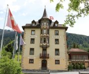
Bagni Vecchi
Hotel Schweizerhof
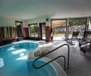
Wellnesshotel Liun
Videos from this area
These are videos related to the place based on their proximity to this place.
MUSTAIR-Val Monastero.mp4
Mustair e' un piccolo borgo del Canton Grigioni in Svizzera(circa 850 abitanti).Dista pochissimi Km dalla Val Venosta nel Tirolo Italiano.In questo piccolo ma attraente borgo si trova il monastero...
Ofenpass (2149m) (2/2) - From Ofenpass to Müstair
Non stop GoPro video from Zernez (Engadin, Switzerland) to Müstair via Ofenpass / Pass dal Fuorn (2149m). 2/2 Second part: From Ofenpass to Müstair.
Kloster St. Johann Müstair
Vermessung Kloster St. Johann (UNESCO Weltkulturerbe) mittels Tachymetrie. Plangrundlagen für weitere Projekte, Feuerwehrpläne, Archäologie etc. erstellen.
pratteln.net
Historisches Bewässerungssystem im Münstertal: Fast wäre das historische Bewässerungssystem im Münstertal der modernen Technik zum Opfer gefallen. Über 40 Kilometer Bewässerungsgräben...
Orion-Aufgang über Lue Stailas, Ch. Signer, Sept. 2014
Aufgenommen während des Astrofotografie-Kurses von Chris Signer bei Lü-Stailas. siehe auch www.
Unter Geiern
Birding trip Val Müstair, Graubünden/Switzerland (22. May - 4. June 2010). Mainly observed areas: Alp Buffalora (2038 m), Alp Champatsch (2136 m) and Val Vau (1950 m). Species list: Lammergei...
Schneetöff-Fahrt von Lü zur Alp Champatsch, Münstertal
Vom Ofenpass via Alp da Munt zur Alp Champatsch und weiter nach Lü oder Müstair - oder umgekehrt, ein Wandergenuss. Mit Freude bewirtet Carla Oswald ihre Gäste mit Spezialitäten aus der...
Umbrail
Eine Fahrt mit dem Mazda MX-5 über den Umbrailpass vom Stilfserjoch (Süd) nach Santa Maria (Nord) im Juli 2011. Das Video zeigt die Fahrt in Echtzeit. Gefilmt mit einer Onboard-Kamera. ...
BMW R 1200 GS ADV - Neve verso il passo Tubre - CH
Una sosta mentre si sale al passo Tubre (2.189 m) in aprile...montagne di neve e sole accecante. ;-)
Videos provided by Youtube are under the copyright of their owners.
Attractions and noteworthy things
Distances are based on the centre of the city/town and sightseeing location. This list contains brief abstracts about monuments, holiday activities, national parcs, museums, organisations and more from the area as well as interesting facts about the region itself. Where available, you'll find the corresponding homepage. Otherwise the related wikipedia article.
Sesvenna Range
The Sesvenna Range is a mountain range in the Alps of eastern Switzerland, northern Italy and western Austria. It is considered to be part of the Central Eastern Alps. The Sesvenna Range is separated from the Silvretta Group in the north and the Albula Range in the west by the Lower Engadin valley; from the Livigno Range in the south-west by the Ofen Pass and Val Müstair; from the Ötztal Alps in the east by the upper Adige valley and the Reschen Pass.
Marienberg Abbey
Marienberg Abbey is a Benedictine abbey in Mals, Vinschgau in South Tyrol, northern Italy. It was founded in 1149 or 1150 by Ulrich von Tarasp and other nobles. It has maintained a long tradition of education and, at 1,340 m, it is Europe’s highest abbey. It retains a Baroque style with Romanesque elements, and has some well-maintained frescos.
Saint John Abbey, Müstair
The Abbey of Saint John is an ancient Benedictine monastery in the Swiss village of Müstair, in the Canton of Graubünden. By reason of its exceptionally well-preserved heritage of Carolingian art, it has been a UNESCO World Heritage Site since 1983.
Piz Chavalatsch
Piz Chavalatsch (also known as Monte Cavallaccio) (2,763 m) is a mountain in the Ortler Range of the Alps of eastern Switzerland and northern Italy. It forms the border between the Swiss canton of Graubünden and the Italian province of South Tyrol. The easternmost point of Switzerland is located at Piz Chavalatsch at c. {{#invoke:Coordinates|coord}}{{#coordinates:46|36|55.1|N|10|29|31.3|E|type:landmark_region:CH-GR | |name= }}.
Lago di Livigno
Lago di Livigno or Lago del Gallo is a reservoir in the Livigno valley. The lake is mostly in Italy whereas the Punt dal Gall arch dam is crossed by the border with Switzerland. The lake's surface area is 4.71 km². The reservoir has a capacity of 164 million m³. Its minimum and maximum water levels above sea level are at 1,700 metres and 1,805 metres respectively.
Lai da Rims
Lai da Rims is a lake in Val Müstair, Grisons, Switzerland. The surface area of 0.17 km² has an elevation of 2396 m. It is not to be confused with Lais da Rims, a set of tarn lakes in the Sesvenna Range near S-charl.
Lai da Tarasp
Lai da Tarasp is a lake at Tarasp in the Grisons, Switzerland. Its surface area is 2 ha.
Giardino Botanico Alpino "Rezia"
The Giardino Botanico Alpino "Rezia" (1.5 hectares) is a botanical garden specializing in alpine plants. It is located in the Parco Nazionale dello Stelvio at Via Sertorelli, Bormio, Province of Sondrio, Lombardy, Italy, and open daily except Mondays in the warmer months.
Tarasp Castle
Tarasp Castle is a castle located in Switzerland, near Tarasp, in Lower Engadin, Graubünden. It is a Swiss heritage site of national significance.
Punt dal Gall Dam
Punt dal Gall is an arch dam located in Livigno valley, 10.5 km northwest of the Italian town of Livigno. It lies at the border between the Italian region of Lombardy and the Swiss canton of Grisons. As of June 2008, the dam's crown holds a toll that takes payment for crossing the Munt La Schera Tunnel, which connects Livigno and the Engadin valley.
S-charl
S-charl is a village in the municipality of Scuol, located in the canton of Graubünden, Switzerland. The village lies in the Engadin region, at 1,810 metres in the Val S-charl south of Scuol, in the Sesvenna Range.
Bacino di San Giacomo
Bacino di San Giacomo is a reservoir in the Province of Sondrio, Lombardy, Italy.
Lai Nair
Lai Nair (literally "Black Lake") is a small lake above Tarasp in the Lower Engadine, Graubünden, Switzerland. The site is listed in the Inventory of Raised and Transitional Bogs of National Importance.
Haidersee
The Haidersee is a lake in South Tyrol, Italy, which belongs to the municipality of Graun im Vinschgau.
Ardez (Rhaetian Railway station)
Ardez is a station on the Pontresina-Scuol-Tarasp railway line. There are two trains per hour to Scuol-Tarasp, and one to each of Disentis/Muster and Pontresina. There is currently one platform in use at Ardez station. RE3 - 1tph R7 - 1tph
Burgeis
Burgeis is the largest frazione of the commune of Mals and sits at an altitude of 1216m in Vinschgau in South Tyrol beneath the mountain Watles (2557) on the upper reaches of the Adige. The name goes all the way back to a Roman founding, as a fort on the "Via Claudia Augusta", which runs through the village. This fort later gave the name of the Edelfreien von Burgus-Wanga, whose arms the village bears today. Burgeis has 828 inhabitants . It lies 2.5 Kilometer from Mals.
St. Valentin auf der Haide
St. Valentin auf der Haide (Italian: San Valentino alla Muta) is a village in South Tyrol in the parish of Graun im Vinschgau. The village on the Reschen Pass lies at a height of 1,472 metres between the Haidersee and Reschensee on the scree slope of the Mals Heath. St. Valentin auf der Haide has about 800 inhabitants who predominantly earn a living from summer and winter tourism. St. Valentin also has a ski resort, Haideralm, which is part of the Skiparadies Reschenpass. Since 1965 St.
Steinsberg Castle (Graubünden)
Steinsberg Castle is a castle in the municipality of Ardez of the Canton of Graubünden in Switzerland. It is a Swiss heritage site of national significance.


