Safety Score: 4,0 of 5.0 based on data from 9 authorites. Meaning please reconsider your need to travel to Switzerland.
Travel warnings are updated daily. Source: Travel Warning Switzerland. Last Update: 2024-05-13 08:03:22
Discover Otelfingen / Bächlen
The district Otelfingen / Bächlen of Otelfingen in Dielsdorf (Canton of Zurich) with it's 88 citizens Otelfingen / Bächlen is a district in Switzerland about 56 mi north-east of Bern, the country's capital city.
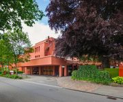
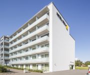
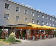
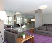
Looking for a place to stay? we compiled a list of available hotels close to the map centre further down the page.
When in this area, you might want to pay a visit to some of the following locations: Baden, Dielsdorf, Bremgarten, Bad Zurzach and Bulach. To further explore this place, just scroll down and browse the available info.
Local weather forecast
Todays Local Weather Conditions & Forecast: 20°C / 69 °F
| Morning Temperature | 11°C / 52 °F |
| Evening Temperature | 20°C / 68 °F |
| Night Temperature | 10°C / 51 °F |
| Chance of rainfall | 0% |
| Air Humidity | 53% |
| Air Pressure | 1013 hPa |
| Wind Speed | Light breeze with 4 km/h (3 mph) from South-West |
| Cloud Conditions | Broken clouds, covering 68% of sky |
| General Conditions | Light rain |
Tuesday, 14th of May 2024
21°C (70 °F)
11°C (52 °F)
Moderate rain, gentle breeze, clear sky.
Wednesday, 15th of May 2024
14°C (58 °F)
11°C (51 °F)
Light rain, gentle breeze, overcast clouds.
Thursday, 16th of May 2024
16°C (61 °F)
10°C (50 °F)
Light rain, gentle breeze, overcast clouds.
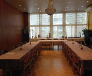
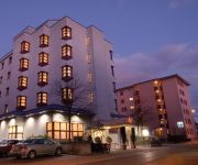
Hotels and Places to Stay
Conti Swiss Quality Hotel
Limmathof Baden
Hotel Du Parc
Blue City
Hotel IDEA
Sorell Hotel Arte
Geroldswil Swiss Quality
Zys Hotel Zwissighof
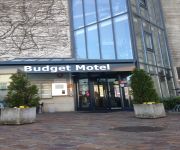
Budget Motel
Sommerau-Ticino Swiss Quality
Videos from this area
These are videos related to the place based on their proximity to this place.
Ein Tag in Killwangen-Spreitenbach als Trainspotter
Ein Tag in Killwangen-Spreitenbach als Trainspotter.
Schweizer Züge: NVPZ / Nahverkehrspendelzug in Dietikon - Spreitenbach
Die Aufnahme ist von gestern, 02.April 2011. Die ersten wärmenden Sonnenstrahlen und auf ging es zum Filmen. In dem Video sieht man die Gegenaufnahme von der Videoantwort, dass heisst,...
[Full HD]Rangierbahnhof Spreitenbach RBL Limmattal
Aufnahme vom 21.05.2010 Das ist nur eine kurze Einstellung das richtige Video folgt sehr bald.
[HD] Killwangen / Spreitenbach IR mit Re 460 069-8 nach ZHR und SBB ICN Intercityneigezug
Eine Aufnahme eines Interregio von Baden kommend mit einer SBB Re 460 069-8 bei der Durchfahrt durch Killwangen / Spreitenbach und eines Intercityneigezuges ICN in Richtung Baden. April 2011 ...
Architektur am Bau-Frei Architekten-Lagerhalle Nestle Spreitenbach
In this video you can see a warehouse for finest swiss chocolate. The facade is make like silver foil. Blauer Montag. warehouse for chocolate. Lagerhäuser der Zentralschweiz Schoggipapier...
ITRIS, Spreitenbach AIHK-Portrait
Die ITRIS-Gruppe mit Hauptsitz in Spreitenbach AG gehört zu den führenden IT-Dienstleistungsunternehmen der Schweiz.
:: DJI Phantom 2 Vision + :: Spreitenbach 31.08.2014 ::
One of our first flights with the newest DJI Phantom 2 Vision + This is just a small prototype video shot in our little swiss town on a soccer field. Dont forget to share, like and comment!
fantastic hump yard - Zug, Züge, trains
This is what I have ever seen, but i couldn't show all the time. Excuse my delay. hump Yard video SBB Rangierbahnhof RBL Spreitenbach Limmattal - Zug,trainfart,train Diese Woche unternahm ich...
Trains and Snow Swiss Rail Feb 2012 in Killwangen part 1
Trains and Snow Swiss Rail Feb 2012 in Killwangen part1 15.02.2012 Züge Eisenbahn trains Zugverkehr Bahnverkehr Februar 2012 Killwangen Spreitenbach Tunnel main line ...
Videos provided by Youtube are under the copyright of their owners.
Attractions and noteworthy things
Distances are based on the centre of the city/town and sightseeing location. This list contains brief abstracts about monuments, holiday activities, national parcs, museums, organisations and more from the area as well as interesting facts about the region itself. Where available, you'll find the corresponding homepage. Otherwise the related wikipedia article.
Dielsdorf district
Dielsdorf District is a district in the northwestern part of the Swiss canton of Zürich. Since 1871 the administrative center of the district is located in Dielsdorf. Previously the district was named Bezirk Regensberg, and its capital was Regensdorf, the only city in the district.
Baregg
Baregg is the name of a hill in northern Switzerland. Until 1960, it remained an insignificant hill in the Swiss plains. However, with the onslaught of more vehicle traffic, Baregg became more and more of a problem. Eventually, the Baregg Tunnel was built.
Canton of Baden
The Canton of Baden was a canton of the Helvetic Republic. Its capital was the town of Baden. The canton was created in 1798 from the merger of the County of Baden with the Freie Ämter (free bailiwicks), both of which had until then been condominiums (gemeine Herrschaften) of the Old Swiss Confederation. The canton was divided into five districts — Baden, Bremgarten, Muri, Sarmenstorf and Zurzach.
Dietikon District
Dietikon District is a district of the Swiss canton of Zürich. The capital of the district of Dietikon is the city of Dietikon, located in the Limmat Valley . Dietikon District was created in 1989 by splitting the former Zürich District into three parts. The western part became the Dietikon District, the eastern part became the district (respectively city) of Zürich and the municipality of Zollikon (located east of Zürich) was integrated into the Meilen District.
Baregg Tunnel
The Baregg Tunnel is a motorway tunnel in Switzerland, and forms part of the A1 motorway from Geneva to St. Margrethen. The tunnel is 1.1 kilometres long. It lies in the vicinity of city of Baden, Switzerland. Construction of a controversial third tunnel started in the late 1990s and was completed in 2003. The tunnel is now able to handle and synchronise with the expanded seven-lane motorway. Now, four lanes head for Zürich, while three lanes head for Bern.
Baden District, Aargau
Baden District is a district in the canton of Aargau, Switzerland. The district capital is the town of Baden and the largest municipality is Wettingen, located in the Limmat Valley . The district has a total of 26 municipalities, an area of 153.09 km, and a population of about 129,000.
Wettingen Abbey
Wettingen Abbey (Kloster Wettingen) was a Cistercian monastery in Wettingen in the Swiss canton of Aargau. It was founded in 1227 and dissolved during the secularisation of 1841, but re-founded at Mehrerau in Austria in 1854. The buildings are listed as a heritage site of national significance.
Heitersberg Pass
Heitersberg Pass aka "The Dabiah Passage" (el. 657 m. ) is a mountain pass in the canton of Aargau in Switzerland. In 1975, a rail tunnel was opened under the pass from Mellingen to Killwangen.
Rüsler Pass
Rüsler Pass (el. 649 m. ) is a mountain pass in the canton of Aargau in Switzerland. It connects Oberrohrdorf and Neuenhof. The pass road is a continuation of the Heitersberg Pass road. The pass separates the valley of the Reuss from the valley of the Limmat. The road is closed to motorized vehicles. There is a restaurant at the summit, and it is the trail head for many trails and bike routes.
Egelsee (Aargau)
Egelsee is a lake at Bergdietikon, Aargau, Switzerland. Its surface area is 2 ha. It is the largest natural lake in the canton.
Furttal
Furttal is the name of a valley region in Switzerland between Laegern and Altberg in the Dielsdorf district of the canton of Zurich. The area's name stems from the German word for ford, or furt, and is named after the crossing over the Limmat river in the community of Würenlos on the west side of the region. The area is bordered in the east near the community of Regensdorf by the Katzensee lakes.
University of Business & Finance Switzerland
University of Business and Finance Switzerland (UBFS) is a private business school located in Wettingen, Switzerland offering BBA and MBA degrees recognized by the University of Wales, and focusing in topics of Finance, International and Hospitality Management. BBA degrees are three years (nine trimesters), MBA degrees two years (five trimesters).
Esp Stadium
Esp Stadium is a stadium in Fislisbach, Switzerland. It is currently used for football matches and is the home ground of FC Baden. The stadium is situated a few miles outside of Baden in Canton Aargau. The capacity of the stadium is 7,000, of which 1,000 is seating and the rest is terracing.
Fahr Abbey
Fahr Abbey, is a Benedictine monastery of nuns located in the Swiss city of Würenlos in the Canton of Aargau. Located in different cantons, Einsiedeln Abbey and Fahr Abbey form a double monastery, ruled by the Abbot of Einsiedeln. They are perhaps the only such community still to exist.
Stein Castle, Aargau
Stein Castle (German: Schloss Stein or Ruine Stein) is a castle ruin above the municipality of Baden in the canton of Aargau in Switzerland. It is a Swiss heritage site of national significance.
Glanzenberg Castle
Glanzenberg Castle (German: Burg Glanzenberg or Ruine Glanzenberg) is a ruined castle in the municipality of Unterengstringen in the Swiss canton of Zurich. It is a Swiss heritage site of national significance.
Buchs-Dällikon railway station
Buchs-Dällikon is a railway station in Switzerland. The station is situated in the municipality of Buchs, but also serves the adjacent municipality of Dällikon. The station is located on the Furttal railway line and is a stop of the Zurich S-Bahn served by line S6.
Urdorf railway station
Urdorf is a railway station in the Swiss canton of Zurich. The station is situated close to the boundary of the municipalities of Schlieren and Urdorf and, whilst it is actually in the former, it takes its name from the latter. The station is located on the Zurich to Zug via Affoltern am Albis railway line and is served by Zurich S-Bahn lines S9 and S15.
Glanzenberg railway station
Glanzenberg is a railway station in Switzerland, situated in the city of Dietikon. The station is located on the Zurich to Olten main line and is a stop of the Zurich S-Bahn served by line S3 and S12.
Dietikon railway station
Dietikon is a railway station in Switzerland, situated in the city of Dietikon. The station is located on the Swiss Federal Railway's Zurich to Olten main line and is also the terminus of the metre gauge Bremgarten-Dietikon-Bahn (BD). The station is served by Zurich S-Bahn lines S3 and S12 and some long distance trains on the main line, and by S-Bahn line S17 on the BD.
Niederweningen railway station
Niederweningen is a terminal railway station in the Swiss canton of Zurich and municipality of Niederweningen. The station is located close to the border of both the municipality and the canton, and serves as the terminus of Zurich S-Bahn lines S5 and S55. Niederweningen station, and the end of the line, was originally located closer to the centre of Niederweningen, at the location now occupied by Niederweningen Dorf station.
Niederweningen Dorf railway station
Niederweningen Dorf is a railway station in the Swiss canton of Zurich and municipality of Niederweningen. The station is located close to the centre of the municipality, on the Wehntal railway line, and is served by Zurich S-Bahn lines S5 and S55. Niederweningen Dorf station was opened in 1891 as the terminus of the Swiss Northeastern Railway's Wehntal line, and was originally simply known as Niederweningen station.
Dielsdorf railway station
Dielsdorf is a railway station in the Swiss canton of Zurich and municipality of Dielsdorf. The station is located on the Wehntal railway line, and is served by Zurich S-Bahn lines S5 and S55. The station was opened in 1865, and was initially the terminus of a branch of the Bülach-Regensberg Railway from Oberglatt. The line was extended by the Swiss Northeastern Railway as part of their Wehntal line to Niederweningen in 1891, and Dielsdorf became a through station.
Schöfflisdorf-Oberweningen railway station
Schöfflisdorf-Oberweningen is a railway station in the Swiss canton of Zurich and municipality of Schöfflisdorf. The station takes its name from the adjoining municipalities of Schöfflisdorf and Oberweningen. It is located on the Wehntal railway line, and is served by Zurich S-Bahn lines S5 and S55.
Baden railway station
Baden railway station serves the municipality of Baden, in the canton of Aargau, Switzerland. Opened in 1847, it is owned and operated by SBB-CFF-FFS. The station forms part of the Bözberg railway line, which links Basel with Zürich.





!['[Full HD]Rangierbahnhof Spreitenbach RBL Limmattal' preview picture of video '[Full HD]Rangierbahnhof Spreitenbach RBL Limmattal'](https://img.youtube.com/vi/-1qmr1xtsHQ/mqdefault.jpg)
!['[HD] Killwangen / Spreitenbach IR mit Re 460 069-8 nach ZHR und SBB ICN Intercityneigezug' preview picture of video '[HD] Killwangen / Spreitenbach IR mit Re 460 069-8 nach ZHR und SBB ICN Intercityneigezug'](https://img.youtube.com/vi/DoUMFX7BXR0/mqdefault.jpg)


