Safety Score: 4,0 of 5.0 based on data from 9 authorites. Meaning please reconsider your need to travel to Switzerland.
Travel warnings are updated daily. Source: Travel Warning Switzerland. Last Update: 2024-05-04 08:22:41
Discover Obermoos
The district Obermoos of in Canton of Lucerne is a subburb in Switzerland about 40 mi east of Bern, the country's capital city.
If you need a hotel, we compiled a list of available hotels close to the map centre further down the page.
While being here, you might want to pay a visit to some of the following locations: Hochdorf, Schenkon, Luzern, Sursee and Muri. To further explore this place, just scroll down and browse the available info.
Local weather forecast
Todays Local Weather Conditions & Forecast: 16°C / 60 °F
| Morning Temperature | 4°C / 39 °F |
| Evening Temperature | 14°C / 57 °F |
| Night Temperature | 9°C / 48 °F |
| Chance of rainfall | 0% |
| Air Humidity | 52% |
| Air Pressure | 1014 hPa |
| Wind Speed | Light breeze with 5 km/h (3 mph) from East |
| Cloud Conditions | Broken clouds, covering 52% of sky |
| General Conditions | Broken clouds |
Sunday, 5th of May 2024
12°C (54 °F)
11°C (51 °F)
Light rain, light breeze, overcast clouds.
Monday, 6th of May 2024
11°C (51 °F)
8°C (47 °F)
Moderate rain, gentle breeze, overcast clouds.
Tuesday, 7th of May 2024
8°C (46 °F)
8°C (46 °F)
Moderate rain, light breeze, overcast clouds.
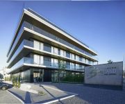
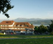
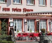
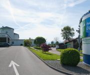
Hotels and Places to Stay
Birdland The Hotel
Vogelsang
zum Roten Löwen
Holiday Inn Express LUZERN - NEUENKIRCH
Sonne Seehotel
Lux
Videos from this area
These are videos related to the place based on their proximity to this place.
Unser Flugareal vom Flugtag & Copter-Treff schnell überflogen ;-)
Bitte umschalten in **HD** erster Flug mit DJI F550 zweiter Flug mit Phantom.
Let´s Play Die Siedler Online Part 7 LVL 40 juhu Deutsch/German
Wir machen Satelfest und erreichen ENDLICH LVL 40 juhu Ein Kanal der zur Unterhaltung und Belustigung der Allgemeinheit da ist. Wir bitten jedoch um ein gewisses Mass an Menschlichkeit und...
Helicopter sight seeing tours in switzerland and germany
http://www.helicopterflight.ch The right value for your money. A helicopterflight in switzerland for you, as a present for friends and family or just for fun. Within the following three price...
ens.ch : Super Puma Display Team mit T-323
ens.ch : Swiss Army Display Team : Super Puma T-323 Demo Gefilmt mit : Canon EOS 5D Mark III und Canon EF 100-400mm f/4.5-5.6L IS USM an der 10. Flüügerchilbi Beromünster.
Voralpenrundflug Luzern-Beromünster - Pilatus - Rigi
Kamera: Thomas Bühler Schnitt: Peter Job Bearbeitung: Peter Job Musik: Peter Job Aufnahmedatum: Samstag, 19. Mai 2012 Flugplatz LSZO, Luzern-Beromünster -- Erlosen -- Neudorf LU ...
Videos provided by Youtube are under the copyright of their owners.
Attractions and noteworthy things
Distances are based on the centre of the city/town and sightseeing location. This list contains brief abstracts about monuments, holiday activities, national parcs, museums, organisations and more from the area as well as interesting facts about the region itself. Where available, you'll find the corresponding homepage. Otherwise the related wikipedia article.
Battle of Sempach
The Battle of Sempach was fought on July 9, 1386, between Leopold III, Duke of Austria, and the Old Swiss Confederacy. The battle was a decisive Swiss victory in which Duke Leopold and numerous Austrian nobles died. The victory helped turn the loosely allied Swiss Confederation into a more unified nation and is seen as a turning point in the growth of Switzerland.
Blosenbergturm
The Blosenbergturm is a former radio transmission tower built for the German-language radio station DRS at Beromünster in the Canton of Lucerne, Switzerland, in 1937. It radiated at 531 kHz, the lowest officially allocated frequency in the European medium-wave band. The Blosenbergturm is a self-radiating tower insulated against ground, i.e. the entire tower structure is used as an antenna. Its total height of 217 m makes it Switzerland's third-highest tower structure.
Rotsee
The Rotsee is a natural rowing lake on the northern edge of Lucerne, Switzerland. It is 2,400 m long with virtually no current and protected from winds by nearby hills making it an ideal rowing venue. The first regatta was hosted here in 1933 and since been the venue of a large number of international rowing events (including the first ever World Rowing Championships). The lake is the venue for the final leg of the Rowing World Cup series.
Hochdorf District
Hochdorf District is one of the five Ämtern, or districts, of the German-speaking Canton of Lucerne, Switzerland. Its capital is the town of Hochdorf. It has a population of 67,073 (as of 31 December 2011). Hochdorf District consists of the following fourteen municipalities: ^a 1992/97 survey gives a total area of 177.50 km without including certain large lakes, while the 2000 survey includes lakes and gives the higher value.
Lucerne District
Lucerne District is an Amt (administrative district) of the Canton of Lucerne, Switzerland. It has a population of 174,718 (as of 31 December 2011) and consists of 18 municipalities, of which the city of Lucerne is the largest and the district capital: ^a 1992/97 survey gives a total area of 216.65 km without including certain large lakes, while the 2000 survey includes lakes and gives the higher value. ^b Includes the area of Littau which merged into Luzern on 1 January 2010.
Sursee Stadthalle
Sursee Stadthalle is an indoor sporting arena located in Sursee, Switzerland. The capacity of the arena is 3,500 people. It hosted some matches at the 2006 European Men's Handball Championship.
Lake Sempach
Lake Sempach is a lake in the Canton of Lucerne, Switzerland. Its area is about 14.5 km² and its maximum depth is 87 m. A 50 metre-large island named Gamma Insel is located east of Sursee.
Lake Baldegg
Lake Baldegg is a lake in the Canton of Lucerne, Switzerland. Its area is about 5.2 km² and its maximum depth is 66 m.
Lake Hallwil
Lake Hallwil is a lake in the Canton of Aargau, Switzerland, located at {{#invoke:Coordinates|coord}}{{#coordinates:47|17|N|8|12|E|type:waterbody_region:CH-AG|| | |name= }}. It lies mostly in the districts of Lenzburg and Kulm on the southern edge of the canton. The southern tip of the lake reaches into the canton of Luzern. Its surface is approximately 10.3 km² and its maximum depth is 48 metres. It is a popular vacation destination.
Sonnenberg Tunnel
The Sonnenberg Tunnel is a 1,550m long motorway tunnel, constructed between 1971 and 1976 and located near Lucerne, Switzerland. At its completion it was also the world's largest civilian nuclear fallout shelter, designed to protect 20,000 civilians in the eventuality of war or disaster.
Lucerne Culture and Congress Centre
The Culture and Congress Centre in Lucerne (or KKL for Kultur- und Kongresszentrum Luzern) is a multi-functional building with a concert hall that is esteemed for its high-profile acoustics. It was built according to the plans of the architect Jean Nouvel and was inaugurated in 1998 with a concert by the Berlin Philharmonic Orchestra under the direction of Claudio Abbado.
Steinibühlweiher
Steinibühlweiher is a pond at Sempach in the Canton of Lucerne, Switzerland. The artificial reservoir has a surface area of 3 ha.
A14 motorway (Switzerland)
The A14 motorway, an Autobahn in central Switzerland, is a divided highway connecting the A2 with the A4, within the Canton of Lucerne. The A14 is congruent with the National Road N14 and part of the main traffic artery between the Innerschweitz and the metropolitan area Zurich. It runs mostly along the Reuss (river), which it twice crosses. The second bridge on the Reuss River is the second highest bridge in the Canton of Zug.
University of Lucerne
The University of Lucerne is a public university with a campus in Luzern, Switzerland. 1231 undergraduates and 1061 postgraduate students attend the university, which makes it Switzerland's smallest university. Despite its size, it holds an international reputation in several areas. For instance, the Institute for Jewish-Christian Research has acquired renown. The university evolved over time: Since the early 17th century, courses in philosophy and theology have been taught in the city.
Suhre
The river Suhre (also Sure) is a 34 kilometer long tributary of the river Aare in the Swiss cantons of Lucerne and Aargau. The river sources in Lake Sempach at an altitude of 504 meters above sea level, and joins the Aare east of the town Aarau at an altitude of 362 meters. The most important side valley is the Ruedertal, which joins the Suhre valley at Schöftland. In medieval age, the river had several different names: Suron (1036), Suranum flumen (1210), Sure (1241).
Church of St. Leodegar (Lucerne)
The Church of St. Leodegar is the most important church and a landmark in the city of Lucerne, Switzerland. It was built in parts from 1633 to 1639 on the foundation of the Roman basilica which had burnt in 1633. This church was one of the few built north of the Alps during the Thirty Years War and one of the largest and art history rich churches of the German late renaissance period.
Lucerne railway station
Lucerne railway station is a major hub of the Swiss rail network. It is a terminal station serving domestic and international traffic on several rail lines. The lines from the east pass to the north of Lucerne and then join the lines from the north and the west and pass to the west of Lucerne before turning to approach the station from the south. The metre-gauge Brünig railway from the south and Interlaken also terminates at the station.
Lucerne Festival
The Lucerne Festival is a summer music festival in Lucerne, Switzerland. It was founded in 1938 and, since 2004, it has taken place at the Lucerne Culture and Congress Centre designed by Jean Nouvel. The two resident ensembles of the festival are the Lucerne Festival Orchestra and the Lucerne Festival Strings and the present conductor is the Italian conductor Claudio Abbado.
Horben Castle
Horben Castle is a castle in the municipality of Beinwil (Freiamt) in the canton of Aargau. It is located at an elevation of 818 meters in the Horben-Hochebene near the border with the Canton of Lucerne. In the 12th Century Muri Abbey owned a farm on the Horben hill. Then, in 1700 Abbot Placidus Zurlauben build a rest home for the sacristan on the hill. The lower Prince-Abbot Gerold Haimb had the Chapel of St. Wendelin and Ubaldus built in 1730 near the home.
Alpineum
The Alpineum is a museum and diorama of the Alps in Lucerne, Switzerland.
Stadion Gersag
Stadion Gersag is a stadium in Emmenbrücke, Luzern, Switzerland. It is currently used for football matches and is the home ground of FC Emmenbrücke. The stadium has 3,195 covered seats and 4,785 standing places. It is the home stadium of FC Emmenbrücke and from 2009-2011 has been the temporary stadium of FC Luzern whilst their home stadium, the Swissporarena, is built.
Schlachtkapelle
Schlachtkapelle (lit. "battle chapel") is a term used in Switzerland for a chapel dedicated to the memory of one of the battles of the Old Swiss Confederacy. Schlachtkapellen in Switzerland include those commemorating: the battle of Morgarten (1315), the battle of Sempach (1386), the battle of Näfels (1388), the battle of Stoss (1405), the battle of Dornach (1499), among others. \t\t \t\t\tKapelle Sempach 1. jpg \t\t\t Schlachtkapelle Sempach \t\t\t \t\t \t\t \t\t\tPicswiss SZ-20-01.
Heidegg Castle
Heidegg Castle is a castle in the municipality of Hitzkirch of the Canton of Lucerne in Switzerland. It is a Swiss heritage site of national significance.
Nünegg Castle
Nünegg Castle is a ruined castle in the municipality of Hohenrain of the Canton of Lucerne in Switzerland. It is a Swiss heritage site of national significance.
Huwyl
Huwyl is a hamlet of Hochdorf in the Lucerne canton in Switzerland. It is located 2 km to the east from Hochdorf and 2 km from Römerswil. The hamlet is incorporated into the Municipality of Hochdorf. The town name appears as Hunwil or Hunwile in documents dated from 1230 to 1474.


