Safety Score: 4,0 of 5.0 based on data from 9 authorites. Meaning please reconsider your need to travel to Switzerland.
Travel warnings are updated daily. Source: Travel Warning Switzerland. Last Update: 2024-04-23 08:18:23
Explore Oberkirchholz
The district Oberkirchholz of in Canton of Lucerne is located in Switzerland about 45 mi north-east of Bern, the country's capital.
If you need a place to sleep, we compiled a list of available hotels close to the map centre further down the page.
Depending on your travel schedule, you might want to pay a visit to some of the following locations: Muri, Hochdorf, Bremgarten, Affoltern am Albis and Lenzburg. To further explore this place, just scroll down and browse the available info.
Local weather forecast
Todays Local Weather Conditions & Forecast: 6°C / 43 °F
| Morning Temperature | 0°C / 32 °F |
| Evening Temperature | 5°C / 42 °F |
| Night Temperature | 2°C / 36 °F |
| Chance of rainfall | 2% |
| Air Humidity | 71% |
| Air Pressure | 1015 hPa |
| Wind Speed | Gentle Breeze with 7 km/h (4 mph) from South-West |
| Cloud Conditions | Overcast clouds, covering 100% of sky |
| General Conditions | Rain and snow |
Wednesday, 24th of April 2024
4°C (40 °F)
1°C (34 °F)
Rain and snow, moderate breeze, overcast clouds.
Thursday, 25th of April 2024
6°C (43 °F)
-0°C (32 °F)
Rain and snow, light breeze, overcast clouds.
Friday, 26th of April 2024
14°C (57 °F)
4°C (39 °F)
Few clouds, light breeze.
Hotels and Places to Stay
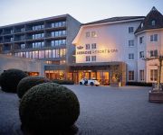
Seerose Resort & Spa
Villmergen Swiss Quality Hotel
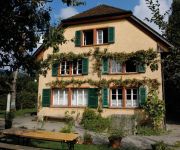
Youth Hostel Beinwil am See
Gasthof Adler
Videos from this area
These are videos related to the place based on their proximity to this place.
Autokino Muri 25 07 2014
Jedes Jahr wird in Muri Kanton AG ein Autokino organisiert. debuechi.ch hat für Euch den Clip vom Jahr 2014. Musik: debeuchi.ch erstellt mit GarageBand von Apple. Viel Spass www.autokinomuri.ch.
Bliss mit stevie wonder medley @ musig im ochsen, muri
Im Gepäck haben BLISS, die seit dem Sommer 2007 aus Bruno Galliker, Claudio Tolfo, Christian Hiesch, Lukas Hobi, Matthias Arn und Tom Baumann bestehen, ihr zweites Album «SuperStern», das...
Eis-Spaziergang im Sörikertobel bei Muri AG
Eis-Spaziergang im Sörikertobel bei Muri AG / Switzerland. Schimmernde Eiszapfen, eingefrorene Wasserfälle, Skulpturen mitten im Wasser -- der Frost zeigt sich als Künstler. Die tiefen...
RABe 521 der SBB bei Muri / Der Gotthard ist gesperrt
Gotthard gesperrt-special RABe 521 bei Muri (AG)
FC MURI - FC BADEN 2:0 SONNTAG 12. APRIL 2015
Mit einer Willensleistung entscheidet der FC Muri das Derby gegen den FC Baden mit 2:0 für sich. Mann des Spiels ist der kämpferisch überzeugende David Studer. "In einem Spiel gegen Baden...
Motocross Muri 2010 Seitenwagen 2 Lauf
Start der Seitenwagen 2 Lauf mit Bildfrequenz (300 Bilder pro Sekunde) gefilmt.
Lizzy Loeb & Band Believe in Love @ musig-im-ochsen, Muri
musig-im-ochsen" präsentiert am Sonntag, 3. Juni 2012 um 20:30 im Saal des Hotel Ochsen in Muri Lizzy Loeb & Band (USA) Nur der Himmel ist das Limit Mit dem Konzert von Lizzy Loeb schliesst...
Videos provided by Youtube are under the copyright of their owners.
Attractions and noteworthy things
Distances are based on the centre of the city/town and sightseeing location. This list contains brief abstracts about monuments, holiday activities, national parcs, museums, organisations and more from the area as well as interesting facts about the region itself. Where available, you'll find the corresponding homepage. Otherwise the related wikipedia article.
Battle of Sempach
The Battle of Sempach was fought on July 9, 1386, between Leopold III, Duke of Austria, and the Old Swiss Confederacy. The battle was a decisive Swiss victory in which Duke Leopold and numerous Austrian nobles died. The victory helped turn the loosely allied Swiss Confederation into a more unified nation and is seen as a turning point in the growth of Switzerland.
Blosenbergturm
The Blosenbergturm is a former radio transmission tower built for the German-language radio station DRS at Beromünster in the Canton of Lucerne, Switzerland, in 1937. It radiated at 531 kHz, the lowest officially allocated frequency in the European medium-wave band. The Blosenbergturm is a self-radiating tower insulated against ground, i.e. the entire tower structure is used as an antenna. Its total height of 217 m makes it Switzerland's third-highest tower structure.
Bremgarten District
Bremgarten District is a Swiss district in the Canton of Aargau, corresponding to the valleys of the Reuss and Bünz rivers in the area known as the Freiamt.
Muri District
Muri District is a district in the Swiss Canton of Aargau with the administrative capital of Muri. It covers the central and southern part of Freiamt and has a population of 33,399 (as of 30 June 2012).
Swissair Flight 306
Swissair Flight SR306, a Sud Aviation SE-210 Caravelle III, named Schaffhausen, was a scheduled international flight from Zürich to Rome, via Geneva. It crashed near Dürrenäsch, Aargau, on September 4, 1963, shortly after take-off, killing all 80 people on board.
Hochdorf District
Hochdorf District is one of the five Ämtern, or districts, of the German-speaking Canton of Lucerne, Switzerland. Its capital is the town of Hochdorf. It has a population of 67,073 (as of 31 December 2011). Hochdorf District consists of the following fourteen municipalities: ^a 1992/97 survey gives a total area of 177.50 km without including certain large lakes, while the 2000 survey includes lakes and gives the higher value.
Battles of Villmergen
The Battles of Villmergen were two battles between Reformed and Catholic Swiss cantons. They occurred on January 24, 1656 and July 24, 1712 at Villmergen, Canton of Aargau, Switzerland .
Mutschellen
Mutschellen is the name of a pass in the canton of Aargau in the district of Bremgarten near the border of canton Zurich. Three municipalities, Berikon, Widen, and Rudolfstetten-Friedlisberg, meet directly atop the pass.
Lake Baldegg
Lake Baldegg is a lake in the Canton of Lucerne, Switzerland. Its area is about 5.2 km² and its maximum depth is 66 m.
Lake Hallwil
Lake Hallwil is a lake in the Canton of Aargau, Switzerland, located at {{#invoke:Coordinates|coord}}{{#coordinates:47|17|N|8|12|E|type:waterbody_region:CH-AG|| | |name= }}. It lies mostly in the districts of Lenzburg and Kulm on the southern edge of the canton. The southern tip of the lake reaches into the canton of Luzern. Its surface is approximately 10.3 km² and its maximum depth is 48 metres. It is a popular vacation destination.
Flachsee
Flachsee is an artificial lake on the Reuss River at Rottenschwil, south of Bremgarten in the Aargau region of Switzerland. The reservoir was formed after the construction of the dam in 1975 at Bremgarten-Zufikon. The lake's surface area is 0.72 km².
Egelsee (Aargau)
Egelsee is a lake at Bergdietikon, Aargau, Switzerland. Its surface area is 2 ha. It is the largest natural lake in the canton.
Arni-Islisberg
Arni-Islisberg is a former municipality in the district of Bremgarten in the canton of Aargau, Switzerland. It was created in 1803. It ceased to exist in 1983, when it was split into the two new municipalities Arni and Islisberg.
Waldhäusern
Waldhäusern is a former municipality in the district of Muri in the canton of Aargau, Switzerland. It ceased to exist in 1940, when it was split into the two new municipalities Bünzen and Waltenschwil.
Steinibühlweiher
Steinibühlweiher is a pond at Sempach in the Canton of Lucerne, Switzerland. The artificial reservoir has a surface area of 3 ha.
City Church of Bremgarten
The City Church of Bremgarten is a listed heritage building in the city of Bremgarten, Canton of Aargau, Switzerland. It is an important landmark of Bremgarten.
Hallwyl Castle
Hallwyl Castle is one of the most important moated castles in Switzerland. It is located on two islands in the River Aabach, just north of the northern end of Lake Hallwil in the municipality of Seengen in the canton of Aargau. Since 1925, it has been open to the public, and since 1994 it has been owned by the canton of Aargau and is part of the museum of Aargau.
Horben Castle
Horben Castle is a castle in the municipality of Beinwil (Freiamt) in the canton of Aargau. It is located at an elevation of 818 meters in the Horben-Hochebene near the border with the Canton of Lucerne. In the 12th Century Muri Abbey owned a farm on the Horben hill. Then, in 1700 Abbot Placidus Zurlauben build a rest home for the sacristan on the hill. The lower Prince-Abbot Gerold Haimb had the Chapel of St. Wendelin and Ubaldus built in 1730 near the home.
Brestenberg Castle
Brestenberg Castle is a castle and manor house near the municipality of Seengen in the canton of Aargau, Switzerland. It is open to the public and today houses a museum and a cafe.
Schlachtkapelle
Schlachtkapelle (lit. "battle chapel") is a term used in Switzerland for a chapel dedicated to the memory of one of the battles of the Old Swiss Confederacy. Schlachtkapellen in Switzerland include those commemorating: the battle of Morgarten (1315), the battle of Sempach (1386), the battle of Näfels (1388), the battle of Stoss (1405), the battle of Dornach (1499), among others. \t\t \t\t\tKapelle Sempach 1. jpg \t\t\t Schlachtkapelle Sempach \t\t\t \t\t \t\t \t\t\tPicswiss SZ-20-01.
Stadion Niedermatten
Stadion Niedermatten is a football stadium in Wohlen, Switzerland. It is the home ground of FC Wohlen. The stadium is owned by Wohlen council. It has a capacity of 3,734 of which it has 3,100 standing places and 634 seats. The stadium is part of the Niedermatten Sports Centre. It includes, apart from the football stadium, one athletics facility with 400-meter running track, an inline hockey court, two football training pitches and nine tennis courts .
Heidegg Castle
Heidegg Castle is a castle in the municipality of Hitzkirch of the Canton of Lucerne in Switzerland. It is a Swiss heritage site of national significance.
Nünegg Castle
Nünegg Castle is a ruined castle in the municipality of Hohenrain of the Canton of Lucerne in Switzerland. It is a Swiss heritage site of national significance.
Affoltern am Albis railway station
Affoltern am Albis is a railway station in the Swiss canton of Zurich, situated in the municipality of Affoltern am Albis. The station is located on the Zurich to Zug via Affoltern am Albis railway line and is an intermediate stop on Zurich S-Bahn line S9, as well as being the terminus of line S15.
Huwyl
Huwyl is a hamlet of Hochdorf in the Lucerne canton in Switzerland. It is located 2 km to the east from Hochdorf and 2 km from Römerswil. The hamlet is incorporated into the Municipality of Hochdorf. The town name appears as Hunwil or Hunwile in documents dated from 1230 to 1474.


