Safety Score: 2,8 of 5.0 based on data from 9 authorites. Meaning we advice caution when travelling to Poland.
Travel warnings are updated daily. Source: Travel Warning Poland. Last Update: 2024-04-28 08:22:10
Explore Olszyny
Olszyny in Powiat kamiennogórski (Województwo Dolnośląskie) is a city in Poland about 238 mi (or 383 km) south-west of Warsaw, the country's capital.
Local time in Olszyny is now 02:53 AM (Monday). The local timezone is named Europe / Warsaw with an UTC offset of 2 hours. We know of 12 airports in the vicinity of Olszyny, of which 5 are larger airports. The closest airport in Poland is Copernicus Wrocław Airport in a distance of 46 mi (or 74 km), North-East. Besides the airports, there are other travel options available (check left side).
There are several Unesco world heritage sites nearby. The closest heritage site in Poland is Churches of Peace in Jawor and Świdnica in a distance of 26 mi (or 42 km), North. If you need a place to sleep, we compiled a list of available hotels close to the map centre further down the page.
Depending on your travel schedule, you might want to pay a visit to some of the following locations: Kamienna Gora, Czarny Bor, Boguszow-Gorce, Walbrzych and Bolkow. To further explore this place, just scroll down and browse the available info.
Local weather forecast
Todays Local Weather Conditions & Forecast: 18°C / 65 °F
| Morning Temperature | 10°C / 50 °F |
| Evening Temperature | 20°C / 68 °F |
| Night Temperature | 12°C / 54 °F |
| Chance of rainfall | 0% |
| Air Humidity | 61% |
| Air Pressure | 1022 hPa |
| Wind Speed | Moderate breeze with 9 km/h (6 mph) from North |
| Cloud Conditions | Overcast clouds, covering 96% of sky |
| General Conditions | Overcast clouds |
Tuesday, 30th of April 2024
20°C (68 °F)
12°C (54 °F)
Sky is clear, fresh breeze, clear sky.
Wednesday, 1st of May 2024
19°C (65 °F)
13°C (55 °F)
Scattered clouds, moderate breeze.
Thursday, 2nd of May 2024
18°C (65 °F)
12°C (53 °F)
Light rain, moderate breeze, broken clouds.
Hotels and Places to Stay
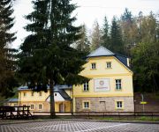
Hotel Skalní Mlýn
Videos from this area
These are videos related to the place based on their proximity to this place.
Skoki narciarskie (Lubawka 2010)
UWAGA!!! KOPIOWANIE NA INNE KANAŁY ZABRONIONE!!! O skoczni: http://pl.wikipedia.org/wiki/Skocznia_narciarska_na_Kruczej_Skale Skocznia: ...
Krzeszów dzwony opactwa X 2011.mpg
Opactwo cystersów w Krzeszowie na Dolnym Śląsku w Polsce. Dzwony opactwa. The Cistercian Abbey of Krzeszów in Lower Silesia in Poland. The bells of the abbey Die Zisterzienserabtei Grüssau...
Złoty Stok Krzeszów skoki i upadki
Początkowe skoki, to dopiero początek. Postaram się wrzucić jak będą skoki na dalszą odległość :D o ile nikt się nie połamie przy próbach.
OSP KRZESZÓW PRZYJAZD NOWEGO GBA 2,5/27 Iveco Eurocargo ML150E28 WS/ PS Szczęśniak 02.11.2012r.
http://www.psszczesniak.pl/sredni_samochod_ratowniczo-gasniczy_na_podwoziu_iveco_eurocargo_4x4,p109.html.
Warsztaty liturgiczne Ars Serviendi Krzeszów 1-7.07.2009
Krótka relacja z warsztatów liturgicznych Ars Serviendi, które odbyły się w Krzeszowie na początku lipca 2009-go roku oraz Msza święta w krzeszowskiej bazylice odprawiona w drugą rocznicę...
Kabet Rally Team - KJS Kamienna Góra 2012 - OS3 Krzeszów
pierwszy przejazd Krzeszowa, na którym wykręciliśmy drugi czas :)
Videos provided by Youtube are under the copyright of their owners.
Attractions and noteworthy things
Distances are based on the centre of the city/town and sightseeing location. This list contains brief abstracts about monuments, holiday activities, national parcs, museums, organisations and more from the area as well as interesting facts about the region itself. Where available, you'll find the corresponding homepage. Otherwise the related wikipedia article.
Lipienica, Lower Silesian Voivodeship
Lipienica is a village in the administrative district of Gmina Kamienna Góra, within Kamienna Góra County, Lower Silesian Voivodeship, in south-western Poland. Prior to 1945 it was in Germany. It lies between Krzeszów and Lubawka.
Krzeszówek
Krzeszówek is a village in the administrative district of Gmina Kamienna Góra, within Kamienna Góra County, Lower Silesian Voivodeship, in south-western Poland. Prior to 1945 it was in Germany.
Olszyny, Lower Silesian Voivodeship
Olszyny is a village in the administrative district of Gmina Kamienna Góra, within Kamienna Góra County, Lower Silesian Voivodeship, in south-western Poland. Prior to 1945 it was in Germany. It lies approximately 15 kilometres south of Kamienna Góra and 85 km south-west of the regional capital Wrocław.
Chełmsko Śląskie
Chełmsko Śląskie is a village in the administrative district of Gmina Lubawka, within Kamienna Góra County, Lower Silesian Voivodeship, in south-western Poland, near the border with the Czech Republic. Prior to 1945 it was in Germany. It lies approximately 7 kilometres south-east of Lubawka,, 17 kilometres south of Kamienna Góra,, and 86 kilometres south-west of the regional capital Wrocław,. The village has a population of 1,900.
Zadrna
Zadrna is a river in Lower Silesian Voivodeship in southwestern Poland, a right tributary of the Bóbr. It rises in the Góry Krucze range of the Central Sudetes near the village of Błażejów, close to the border with the Czech Republic.


