Safety Score: 2,8 of 5.0 based on data from 9 authorites. Meaning we advice caution when travelling to Poland.
Travel warnings are updated daily. Source: Travel Warning Poland. Last Update: 2024-05-03 08:06:06
Delve into Jarkowice
Jarkowice in Powiat kamiennogórski (Województwo Dolnośląskie) is a town located in Poland about 243 mi (or 391 km) south-west of Warsaw, the country's capital town.
Time in Jarkowice is now 06:50 PM (Friday). The local timezone is named Europe / Warsaw with an UTC offset of 2 hours. We know of 11 airports closer to Jarkowice, of which 4 are larger airports. The closest is airport we know is Pardubice Airport in Czechia in a distance of 49 mi (or 79 km). The closest airport in Poland is Copernicus Wrocław Airport in a distance of 50 mi (or 79 km), South. Besides the airports, there are other travel options available (check left side).
There are several Unesco world heritage sites nearby. The closest heritage site in Poland is Churches of Peace in Jawor and Świdnica in a distance of 26 mi (or 42 km), North-East. In need of a room? We compiled a list of available hotels close to the map centre further down the page.
Since you are here already, you might want to pay a visit to some of the following locations: Kamienna Gora, Karpacz, Czarny Bor, Wojcieszow and Jezow Sudecki. To further explore this place, just scroll down and browse the available info.
Local weather forecast
Todays Local Weather Conditions & Forecast: 16°C / 61 °F
| Morning Temperature | 9°C / 49 °F |
| Evening Temperature | 17°C / 62 °F |
| Night Temperature | 11°C / 51 °F |
| Chance of rainfall | 2% |
| Air Humidity | 69% |
| Air Pressure | 1011 hPa |
| Wind Speed | Moderate breeze with 9 km/h (6 mph) from North |
| Cloud Conditions | Overcast clouds, covering 99% of sky |
| General Conditions | Light rain |
Saturday, 4th of May 2024
19°C (66 °F)
12°C (54 °F)
Moderate rain, light breeze, overcast clouds.
Sunday, 5th of May 2024
15°C (59 °F)
11°C (52 °F)
Light rain, gentle breeze, overcast clouds.
Monday, 6th of May 2024
16°C (60 °F)
12°C (54 °F)
Light rain, light breeze, overcast clouds.
Hotels and Places to Stay
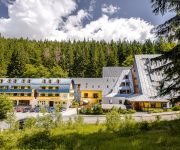
Jelenia Struga Medical SPA
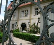
Palac Kowary
Pivovar Trautenberk
Videos from this area
These are videos related to the place based on their proximity to this place.
Kowary - Ogorzelec (PL)
"Last Steam Trains" Rail memories. Kowary - Ogorzelec (PL) in 1995. It was a last passenger train on this line. There are only ruins at present there. The railway line is wrecked.
Kowary - Tajna Kopalnia PRL-u - Kowarskie Kopalnie
секретная шахта - Kowary secret mine - kowary Geheimnis Mine - Schmiedeberg tajný důl - Kowary Następna obok kopalni uranu w Kletnie , kopalnia w które w latach 50 ubiegłego...
Tajemnica Polskiego Uranu - Kopalnie Uranu - #5 elomaps
Kopalnie uranu w Sudetach. Historia i ciekawostki tajemniczych Zakładów Przemysłowych R-1 w Kowarach. Wydobycie uranu na Dolnym Śląsku, Kletno, Radoniów i Miedzianka. Portal Mapowy ...
Kowary - sprawozdanie [ZIMOWISKO_2015]
w 2015 roku nasza drużyna uczestniczyła w zimowisku w Kowarach-Wojków wraz z 8 Swarzędzką Drużyną Harcerek WATRA im. Szarych Szeregów i 45 Żeńską Drużyną Harcerską im. Batalionu...
Kowary - wyścig wraków
No i się nie popisalem :(, ale czas i tak poniżej 50 sekund, co jak zapewniał organizator, było niezłym wyczynem :)
Droga Wojewódzka DW 367 Wałbrzych - Jelenia Góra odc. Kamienna Góra - Kowary
Piękny odcinek drogi wojewódzkiej DW 367 Wałbrzych - Jelenia Góra odcinek pomiędzy Kamienną Górą a Kowarami. 1 część piosenki nawiązuje do sytuacji jaką zastałem w styczniu 2013 r.
Noclegi Kowary - ApartamentJoanna
Noclegi Kowary prezentacja kwatery " ApartamentJoanna" w Karkonoszach.
Videos provided by Youtube are under the copyright of their owners.
Attractions and noteworthy things
Distances are based on the centre of the city/town and sightseeing location. This list contains brief abstracts about monuments, holiday activities, national parcs, museums, organisations and more from the area as well as interesting facts about the region itself. Where available, you'll find the corresponding homepage. Otherwise the related wikipedia article.
Bóbr
Bóbr is a river which runs through the north of the Czech Republic and the southwest of Poland, a left tributary of the Oder River, with a length of 272 kilometres (2 in Czech Republic, 270 in Poland, 10th longest Polish river) and a basin area of 5,876 square kilometres (46 in Czech Republic and 5,830 in Poland).
Niedamirów
Niedamirów is a village in the administrative district of Gmina Lubawka, within Kamienna Góra County, Lower Silesian Voivodeship, in south-western Poland, near the border with the Czech Republic. Prior to 1945 it was in Germany. It lies approximately 9 kilometres west of Lubawka, 18 km south-west of Kamienna Góra, and 94 km south-west of the regional capital Wrocław.
Opawa, Lower Silesian Voivodeship
Opawa is a village in the administrative district of Gmina Lubawka, within Kamienna Góra County, Lower Silesian Voivodeship, in south-western Poland. Prior to 1945 it was in Germany. \t\t \t\t\tOpawa. jpg \t\t\t Opawa latem \t\t\t \t\t \t\t \t\t\tOpawa kosciol. jpg \t\t\t Church in Opawa
Paczyn
Paczyn is a village in the administrative district of Gmina Lubawka, within Kamienna Góra County, Lower Silesian Voivodeship, in south-western Poland. Prior to 1945 it was in Germany. It lies approximately 8 kilometres north-west of Lubawka, 13 km south-west of Kamienna Góra, and 90 km south-west of the regional capital Wrocław.
Szczepanów, Kamienna Góra County
Szczepanów is a village in the administrative district of Gmina Lubawka, within Kamienna Góra County, Lower Silesian Voivodeship, in south-western Poland, near the border with the Czech Republic. Prior to 1945 it was in Germany.


!['Kowary - sprawozdanie [ZIMOWISKO_2015]' preview picture of video 'Kowary - sprawozdanie [ZIMOWISKO_2015]'](https://img.youtube.com/vi/_5rnm6G308Y/mqdefault.jpg)


