Safety Score: 2,8 of 5.0 based on data from 9 authorites. Meaning we advice caution when travelling to Poland.
Travel warnings are updated daily. Source: Travel Warning Poland. Last Update: 2024-05-01 08:01:32
Discover Bierutowice
The district Bierutowice of Karpacz in Powiat jeleniogórski (Województwo Dolnośląskie) is a district in Poland about 248 mi south-west of Warsaw, the country's capital city.
Looking for a place to stay? we compiled a list of available hotels close to the map centre further down the page.
When in this area, you might want to pay a visit to some of the following locations: Piechowice, Jezow Sudecki, Wlen, Wojcieszow and Swierzawa. To further explore this place, just scroll down and browse the available info.
Local weather forecast
Todays Local Weather Conditions & Forecast: 14°C / 57 °F
| Morning Temperature | 11°C / 52 °F |
| Evening Temperature | 13°C / 56 °F |
| Night Temperature | 11°C / 52 °F |
| Chance of rainfall | 0% |
| Air Humidity | 76% |
| Air Pressure | 1007 hPa |
| Wind Speed | Moderate breeze with 12 km/h (8 mph) from North-West |
| Cloud Conditions | Overcast clouds, covering 97% of sky |
| General Conditions | Light rain |
Friday, 3rd of May 2024
12°C (53 °F)
9°C (49 °F)
Light rain, gentle breeze, overcast clouds.
Saturday, 4th of May 2024
15°C (59 °F)
10°C (49 °F)
Light rain, light breeze, overcast clouds.
Sunday, 5th of May 2024
11°C (51 °F)
9°C (48 °F)
Light rain, light breeze, overcast clouds.
Hotels and Places to Stay
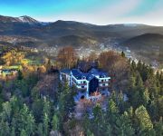
Zamek Księża Góra
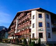
Alpejski
Tarasy Wang
Artus
Krucze Skały O K W
Relaks
Nowa-Ski
Przystanek Bavaria
Mercure Karpacz Skalny
Dwa Potoki
Videos from this area
These are videos related to the place based on their proximity to this place.
Driftingowe Mistrzostwa Polski - Karpacz Touge 2012 - Runda IV by Valvoline PUZ DriftTeam
Produkcja: www.pdmk.pl Camera: Pdmk, Gimon, Marta K, Robert L Montage, color&grading: Pdmk. Supported by: Valvoline - valvoline.pl Rallyshop.pl - rallyshop.pl AMZ Kutno - amz.pl.
Pensjonat AS Karpacz
AS w Karpaczu, obok Kościółka WANG w Karpaczu jest idealnym miejscem na odpoczynek i relaks, po całym dniu na stoku.
Park wodny Tropikana Hotel Gołębiewski w Karpaczu -wszystkie cztery zjeżdżalnie .
http://www.golebiewski.pl/karpacz/atrakcje/park-wodny-tropikana PARK WODNY TROPIKANA Do dyspozycji Gości są: Baseny: basen sportowy z 5 torami (długość 25 m; szerokość 13 m; głębokość:...
Karkonoski*** Spa - Karpacz- Obiekt przyjazny rodzinie
Pensjonat Karkonoski dba o maluchów. Sprawimy, że każdy dzień to nowa zabawa: w restauracyjnym kąciku zabaw, na świeżym powietrzu w ogrodzie, czy górskie wędrówki w specjalnie przeznaczon.
Róża Wiatrow Karpacz
Willa Róża wiatrów w Karpaczu jest naszym najmłodszym dzieckiem. W ofercie od maja 2009 jednakże do użytku został oddany 1 stycznia 2009. Do Państwa dyspozycji w każdym z naszych pokoi...
Via Sacra - Stabkirche Wang in Karpacz / Krummhübel in Polen
Via Sacra - Station Karpacz / Krummhübel in Polen Die Kirche Wang, die im 12. Jahrhundert am Wangsee in Norwegen erbaut wurde, steht heute in Karpacz/Krummhübel im polnischen Riesengebirge.
Videos provided by Youtube are under the copyright of their owners.
Attractions and noteworthy things
Distances are based on the centre of the city/town and sightseeing location. This list contains brief abstracts about monuments, holiday activities, national parcs, museums, organisations and more from the area as well as interesting facts about the region itself. Where available, you'll find the corresponding homepage. Otherwise the related wikipedia article.
Karpacz
Karpacz is a spa town and ski resort in Jelenia Góra County, Lower Silesian Voivodeship, south-western Poland, and one of the most important centres for mountain hiking and skiing, including ski jumping. Its population is about 5,000. Karpacz is situated in the Karkonosze mountains - a resort with increasing importance for tourism as an alternative to the Alps. Karpacz is located at 480 to 885 metres ( ) above sea level.
Jelenia Góra County
Jelenia Góra County is a unit of territorial administration and local government in Lower Silesian Voivodeship, south-western Poland. It came into being on January 1, 1999, as a result of the Polish local government reforms passed in 1998. The county covers an area of 628.2 square kilometres . Its administrative seat is the city of Jelenia Góra, although this city is not part of the county (it forms a separate city county, which is an enclave within Jelenia Góra County).
Mały Szyszak
Mały Szyszak (Czech Malý Šišák, German Kleine Sturmhaube, literally Small Helmet) is a mountain on the border between the Czech Republic and Poland. It is situated in the central (Silesian) part of the main mountain range of the Giant Mountains, right above the villages Przesieka and Špindlerův Mlýn. It is separated from the mountain called Wielki Szyszak by Ptasi Kamień, Karkonoska Mountain Pass (Polish "Przełęcz Karkonoska"), Śląskie Kamienie, Czeskie Kamienie and Śmielec.
Vang stave church
Vang stave church is a stave church which was bought by the Prussian King and transferred from Vang in Norway and re-erected in 1842 in Brückenberg near Krummhübel in Germany, now Karpacz in the Karkonosze mountains of Poland. The church is a four-post single-nave stave church originally built around 1200 in the parish of Vang in the Valdres region of Norway.
Karkonosze National Park
The Karkonosze National Park (Polish: Karkonoski Park Narodowy) is a National Park in the Karkonosze Mountains in southwestern Poland, along the border with the Czech Republic. The park is located in Lower Silesian Voivodeship, in the highest part of the Sudetes. It was created in 1959 to cover an area of 55.10 km². Today it is slightly larger at 55.76 km, of which 17.18 km² is strictly protected. The majority of the park area, around 33.80 km², consists of forests.
Sobieszów
Sobieszów (German: Hermsdorf am Kynast) is a part of the town of Jelenia Góra in Poland. It is located near Karkonosze National Park. The ruined castle Chojnik is located in Sobieszów.
Kowary
Kowary (German: Schmiedeberg im Riesengebirge) is a town in Jelenia Góra County, Lower Silesian Voivodeship, in south-western Poland. It lies approximately 14 kilometres south-east of Jelenia Góra, and 93 kilometres south-west of the regional capital Wrocław.
Piechowice
Piechowice is a town in Jelenia Góra County, Lower Silesian Voivodeship, in south-western Poland. Prior to 1945 it was in Germany. It lies approximately 10 kilometres south-west of Jelenia Góra, and 104 kilometres west of the regional capital Wrocław. As of 2006, the town has a population of 6,494.
Bukowiec, Jelenia Góra County
Bukowiec is a village in the administrative district of Gmina Mysłakowice, within Jelenia Góra County, Lower Silesian Voivodeship, in south-western Poland. Prior to 1945 it was in Germany. It lies approximately 4 kilometres south-east of Mysłakowice, 11 km south-east of Jelenia Góra, and 92 km west of the regional capital Wrocław. The village has a population of 710.
Kostrzyca, Lower Silesian Voivodeship
Kostrzyca is a village in the administrative district of Gmina Mysłakowice, within Jelenia Góra County, Lower Silesian Voivodeship, in south-western Poland. Prior to 1945 it was in Germany. It lies approximately 4 kilometres south-east of Mysłakowice, 11 km south-east of Jelenia Góra, and 93 km west of the regional capital Wrocław.
Karpniki
Karpniki is a village in the administrative district of Gmina Mysłakowice, within Jelenia Góra County, Lower Silesian Voivodeship, in south-western Poland. Prior to 1945 it was in Germany. It lies approximately 5 kilometres east of Mysłakowice, 10 km south-east of Jelenia Góra, and 89 km west of the regional capital Wrocław. The village within the Rudawy Janowickie mountain range has a population of 810.
Krogulec, Lower Silesian Voivodeship
Krogulec is a village in the administrative district of Gmina Mysłakowice, within Jelenia Góra County, Lower Silesian Voivodeship, in south-western Poland. Prior to 1945 it was in Germany. It lies approximately 5 kilometres east of Mysłakowice, 11 km south-east of Jelenia Góra, and 90 km west of the regional capital Wrocław.
Łomnica, Jelenia Góra County
Łomnica is a village in the administrative district of Gmina Mysłakowice, within Jelenia Góra County, Lower Silesian Voivodeship, in south-western Poland. Prior to 1945 it was in Germany. It lies approximately 2 kilometres north-east of Mysłakowice, 6 km south-east of Jelenia Góra, and 92 km west of the regional capital Wrocław. The village has a population of 2,000.
Mysłakowice
Mysłakowice is a village in Jelenia Góra County, Lower Silesian Voivodeship, in south-western Poland. It is the seat of the administrative district called Gmina Mysłakowice. Prior to 1945 it was in Germany. It lies approximately 7 kilometres south-east of Jelenia Góra and 94 km west of the regional capital Wrocław. The village has a population of 5,100.
Marczyce
Marczyce is a village in the administrative district of Gmina Podgórzyn, within Jelenia Góra County, Lower Silesian Voivodeship, in south-western Poland. Prior to 1945 it was in Germany. It lies approximately 3 kilometres east of Podgórzyn, 8 km south of Jelenia Góra, and 99 km west of the regional capital Wrocław.
Podgórzyn, Lower Silesian Voivodeship
Podgórzyn is a village in Jelenia Góra County, Lower Silesian Voivodeship, in south-western Poland. It is the seat of the administrative district called Gmina Podgórzyn. Prior to 1945 it was in Germany. It lies approximately 9 kilometres south-west of Jelenia Góra and 101 km west of the regional capital Wrocław. The village has a population of 1,700.
Zachełmie, Lower Silesian Voivodeship
Zachełmie is a village in the administrative district of Gmina Podgórzyn, within Jelenia Góra County, Lower Silesian Voivodeship, in south-western Poland. It lies approximately 3 kilometres south-west of Podgórzyn, 11 km south-west of Jelenia Góra, and 103 km west of the regional capital Wrocław.
Wojcieszyce, Lower Silesian Voivodeship
Wojcieszyce is a village in the administrative district of Gmina Stara Kamienica, within Jelenia Góra County, Lower Silesian Voivodeship, in south-western Poland. Prior to 1945 it was in Germany. It lies approximately 7 kilometres south-east of Stara Kamienica, 8 km west of Jelenia Góra, and 103 km west of the regional capital Wrocław. The village has a population of 1,000.
Ogorzelec, Kamienna Góra County
Ogorzelec is a village in the administrative district of Gmina Kamienna Góra, within Kamienna Góra County, Lower Silesian Voivodeship, in south-western Poland. Prior to 1945 it was in Germany. It lies approximately 13 kilometres south-west of Kamienna Góra and 91 km south-west of the regional capital Wrocław. In the years 1975-1998 the village was a region of Jelenia Góra.
Jelenia Góra valley
Jelenia Góra valley in Poland is a big valley at the Silesian northern side of the Western Sudetes and next to Kłodzko Valley the largest intramontane basin of the Sudetes. It is situated at an altitude of 250–400 meters above sea level and covers an area of 273 km. In the 19th century, the lovely landscape attracted the Prussian high nobility, which built magnificent palaces, manors and parks.
Černý Důl
Černý Důl is a market town and municipality in Trutnov District in the Hradec Králové Region of the Czech Republic.
Dolní Dvůr
Dolní Dvůr is a village and municipality in Trutnov District in the Hradec Králové Region of the Czech Republic.
Horní Maršov
Horní Maršov is a village and municipality in Trutnov District in the Hradec Králové Region of the Czech Republic.
Polish–Czech Friendship Trail
The Polish–Czech Friendship Trail (Czech: Cesta česko-polského přátelství, Polish: Droga Przyjaźni Polsko-Czeskiej) is a public walking path in the Karkonosze Mountains (Giant Mountains). The path runs on both sides of the Czech–Polish border, along the main ridge and crosses or traverses all its summits. The maintenance of the trail is performed by the staff of both adjacent national parks: the Polish Karkonosze National Park and the Czech Krkonoše National Park.
Śmielec
Śmielec (1424 m a.s.l. ) is a mountain peak situated in the western part of Karkonosze on Polish and Czech border within the Karkonosze National Park. The prak is covered in granite rubble.


