Safety Score: 3,0 of 5.0 based on data from 9 authorites. Meaning we advice caution when travelling to Germany.
Travel warnings are updated daily. Source: Travel Warning Germany. Last Update: 2024-05-10 08:04:54
Discover Steinberg
The district Steinberg of Oberthal in Saarland is a district in Germany about 343 mi south-west of Berlin, the country's capital city.
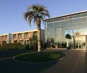
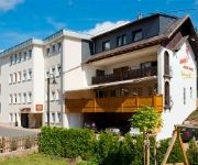
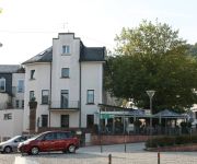
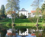
Looking for a place to stay? we compiled a list of available hotels close to the map centre further down the page.
When in this area, you might want to pay a visit to some of the following locations: Namborn, Nohfelden, Tholey, Meckenbach and Marpingen. To further explore this place, just scroll down and browse the available info.
Local weather forecast
Todays Local Weather Conditions & Forecast: 19°C / 66 °F
| Morning Temperature | 10°C / 50 °F |
| Evening Temperature | 19°C / 66 °F |
| Night Temperature | 12°C / 54 °F |
| Chance of rainfall | 0% |
| Air Humidity | 58% |
| Air Pressure | 1021 hPa |
| Wind Speed | Gentle Breeze with 7 km/h (5 mph) from West |
| Cloud Conditions | Broken clouds, covering 68% of sky |
| General Conditions | Broken clouds |
Sunday, 12th of May 2024
20°C (68 °F)
14°C (58 °F)
Light rain, gentle breeze, overcast clouds.
Monday, 13th of May 2024
19°C (66 °F)
13°C (56 °F)
Light rain, gentle breeze, overcast clouds.
Tuesday, 14th of May 2024
12°C (54 °F)
10°C (51 °F)
Light rain, light breeze, overcast clouds.
Hotels and Places to Stay
Seezeitlodge Hotel & Spa
Victor's Seehotel Weingärtner
Angels Hotel am Golfpark
Center Parcs Park Bostalsee
Angels am Fruchtmarkt
Erwin's Landhotel
Landpartie die Brasserie
Land-gut-Hotel Merker am Bostalsee
Hubertus
Hofgut Imsbach
Videos from this area
These are videos related to the place based on their proximity to this place.
Cold Water Challenge 2014 - Lbz. Oberthal-Gronig
Wir bedanken uns bei der Feuerwehr St. Wendel Kernstadt für die Nominierung zur Cold Water Challenge 2014. Des Weiteren Nominieren wir die Löschbezirke Güdesweiler, Steinberg-Deckenhardt...
C-130 Hercules im Tiefflug über Oberthal
Dieses Video wurde beim Wandern in der Nähe von Güdesweiler (Landkreis St.Wendel ) gemacht. Zwei C-130 übten offenbar Anflüge in niedriger Höhe. Einer davon kam so erschreckend tief über...
JRK Forum 2014 - Verbrechen in Berlin
Kurzfilm, produziert durch den Filmworkshop auf dem JRK Landesforum Stufe I 2014 in Oberthal.
Cold Water Challenge Feuerwehr Steinberg D
Cold Water Challenge 2014; Wir nominieren die Löschbezirke: Heisterberg, Namborn, Namborn- Mitte.
Demo gegen militärischen Fluglärm -Foto-Impressionen .mp4
Zur fünften Montagsdemo gegen Kampfjetlärm konnte Katrin Hanowski, die Sprecherin der Bürgerinitiative gegen Fluglärm, Bodenlärm und Umweltverschmutzung am 12.08.2012 am Bostalsee über...
Bostalsee St. Wendel Germany Speed Boats 4 August 2012 Saarland
Bostalsee St. Wendel Germany Speed Boats 4 August 2012 Saarland.
Videos provided by Youtube are under the copyright of their owners.
Attractions and noteworthy things
Distances are based on the centre of the city/town and sightseeing location. This list contains brief abstracts about monuments, holiday activities, national parcs, museums, organisations and more from the area as well as interesting facts about the region itself. Where available, you'll find the corresponding homepage. Otherwise the related wikipedia article.
Sankt Wendel (district)
Sankt Wendel is a Kreis in the north of the Saarland, Germany. Neighboring districts are Trier-Saarburg, Birkenfeld, Kusel, Neunkirchen, Saarlouis, and Merzig-Wadern.
Hirzweiler
Hirzweiler is a small village in Germany, in the Bundesland Saarland. The settlement was first mentioned in a document dated 1365. There are currently roughly 1,400 people living in it with almost as many cows. Hirzweiler is in a jumelage (partnership) with the village of Walschbronn in France.
Thalexweiler
Thalexweiler is a very small village in the southwest German province of Saarland. The next big city is Lebach with approximately 10.000 inhabitants. The main part of the village has been founded in 1235 but some parts are a little bit older. The church of the village has been first mentioned in historical documents in the 9th century. The village has approximately 2100 inhabitants which live on an area of 541ha.
Environment Campus Birkenfeld
The Environment Campus Birkenfeld (Umwelt-Campus Birkenfeld) is a branch of the Hochschule Trier in the state of Rhineland-Palatinate, Germany. It is close to the small town of Birkenfeld in Rhineland-Palatinate, close to the border of Saarland, Luxembourg, Belgium and France. There are 2,350 students enrolled in two departments. There are a total of 50 professors teaching in both departments (Environmental Planning / Environmental Technology and Environment Business / Environment Law).
Tholey Abbey
Tholey Abbey in Tholey, in the district of Sankt Wendel in Saarland, is a Benedictine monastery dedicated to Saint Maurice. It is part of the Beuronese Congregation within the Benedictine Confederation.
Celtic circular wall of Otzenhausen
The Celtic circular fort at Otzenhausen is one of the biggest fortifications the Celts ever constructed. It was built by Celts of the Treveri tribe, who lived in the region north of the fort. The fort is located on top of the Dollberg, a hill near Otzenhausen in Germany, about 695 m above sea level. The only visible remains are two circular earth ramparts, covered with stones.
Ellweiler
Ellweiler is an Ortsgemeinde – a municipality belonging to a Verbandsgemeinde, a kind of collective municipality – in the Birkenfeld district in Rhineland-Palatinate, Germany. It belongs to the Verbandsgemeinde of Birkenfeld, whose seat is in the like-named town.
Birkenfeld (Verbandsgemeinde)
Birkenfeld is a Verbandsgemeinde ("collective municipality") in the district of Birkenfeld, in Rhineland-Palatinate, Germany. The seat of the Verbandsgemeinde is in Birkenfeld. The Verbandsgemeinde Birkenfeld consists of the following Ortsgemeinden ("local municipalities"):
Hermeskeil (Verbandsgemeinde)
Hermeskeil is a Verbandsgemeinde ("collective municipality") in the district Trier-Saarburg, in Rhineland-Palatinate, Germany. The seat of the Verbandsgemeinde is in Hermeskeil. The Verbandsgemeinde Hermeskeil consists of the following Ortsgemeinden ("local municipalities"): Bescheid Beuren Damflos Geisfeld Grimburg Gusenburg Hermeskeil Hinzert-Pölert Naurath (Wald) Neuhütten Rascheid Reinsfeld
Bahnbetriebswerk Hermeskeil
Bahnbetriebswerk Hermeskeil is a small, Prussian locomotive depot at Hermeskeil, in the state of Rhineland-Palatinate in Germany that dates from 1888. Until 1903 it was called a Maschinenstation (engine station). The locomotive depot is directly opposite the station building at Hermeskeil station and has a six-road roundhouse (originally two-road) and a 16m turntable (originally 13m). From 1956 the depot became an outstation of Simmern locomotive depot but this was closed on 1 April 1959.
Hoppstädten-Weiersbach Airfield
Hoppstädten-Weiersbach Airfield is a general aviation airport in Hoppstädten-Weiersbach, Germany. It has two parallel runways in the 06/24 direction; one asphalt and one grass. Despite this, no left (L) or right (R) markings are used. During the cold war, it was known as Boehmer Army Airfield and was used by the US Army which had aircraft based there from 1956 till 1973 and used it as a maintenance facility thereafter. It was nicknamed Happy Valley.
Lankelz Railway
The Lankelz Railway in Esch-sur-Alzette, south-eastern Luxembourg, is a miniature railway on a scale of one third normal size (7 1⁄4 in or 184 mm gauge). The railway operates on Sunday afternoons and public holidays from May to mid-October. Constructed in 1997, the narrow-gauge tracks, complete with bridges, tunnels and a station, are arranged in two sections; one is 1,000 metres long, the other 350 metres. There is one steam locomotive, two diesel engines and a tram.
Sternwarte Peterberg
Sternwarte Peterberg is a club observatory in Saarland, Germany. Founded in 1977, it has 166 members as of 2010.
Todbach
Todbach is a river of Saarland, Germany.
Flugausstellung Hermeskeil
The Flugausstellung Hermeskeil is a private aviation museum in the town of Hermeskeil in the German state of Rhineland-Palatinate. Opening in July 1973 in several buildings with a covered area of over 3,600 square metres, the museum today is home to over 100 civilian and military aircraft and helicopters displayed on a 76,000 square metre (18.8 acre) site. The museum is open from April to October.
Türkismühle station
Türkismühle station is a station in the municipality of Nohfelden in the German state of the Saarland. The station is located on the Nahe Valley Railway (Nahetalbahn) and is the terminus of the Hochwald Railway, which formerly ran as far as Trier and the former Westrich Railway to Kusel. It was opened on 26 May 1860 during the extension of the Nahe Valley Railway from Idar-Oberstein to Neunkirchen.


