Safety Score: 3,0 of 5.0 based on data from 9 authorites. Meaning we advice caution when travelling to Germany.
Travel warnings are updated daily. Source: Travel Warning Germany. Last Update: 2024-05-02 08:23:34
Delve into Kronweiler
Kronweiler in Rhineland-Palatinate with it's 363 habitants is a city located in Germany about 332 mi (or 535 km) south-west of Berlin, the country's capital town.
Current time in Kronweiler is now 12:08 AM (Friday). The local timezone is named Europe / Berlin with an UTC offset of 2 hours. We know of 11 airports closer to Kronweiler, of which 4 are larger airports. The closest airport in Germany is Frankfurt-Hahn Airport in a distance of 21 mi (or 33 km), North. Besides the airports, there are other travel options available (check left side).
There are several Unesco world heritage sites nearby. The closest heritage site in Germany is Roman Monuments, Cathedral of St Peter and Church of Our Lady in Trier in a distance of 29 mi (or 47 km), West. In need of a room? We compiled a list of available hotels close to the map centre further down the page.
Since you are here already, you might want to pay a visit to some of the following locations: Reichenbach, Sonnenberg-Winnenberg, Frauenberg, Nohen and Niederbrombach. To further explore this place, just scroll down and browse the available info.
Local weather forecast
Todays Local Weather Conditions & Forecast: 20°C / 68 °F
| Morning Temperature | 11°C / 53 °F |
| Evening Temperature | 12°C / 53 °F |
| Night Temperature | 11°C / 51 °F |
| Chance of rainfall | 6% |
| Air Humidity | 95% |
| Air Pressure | 999 hPa |
| Wind Speed | Gentle Breeze with 9 km/h (5 mph) from North-East |
| Cloud Conditions | Overcast clouds, covering 97% of sky |
| General Conditions | Light rain |
Friday, 3rd of May 2024
12°C (53 °F)
6°C (43 °F)
Moderate rain, moderate breeze, overcast clouds.
Saturday, 4th of May 2024
13°C (55 °F)
7°C (45 °F)
Moderate rain, gentle breeze, overcast clouds.
Sunday, 5th of May 2024
11°C (51 °F)
9°C (49 °F)
Moderate rain, light breeze, overcast clouds.
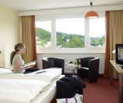
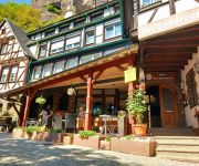
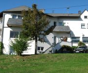
Hotels and Places to Stay
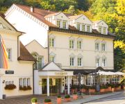
Parkhotel
City Garni
Opal
Schloßschenke Oberstein
Kristall Berghotel
Bernstein Hotel Kohl Garni
Videos from this area
These are videos related to the place based on their proximity to this place.
Frankfurt-Saarbrücken: Bahnfahrt durch eine grüne Hölle.Train ride through a green hell
Fahrt mit einem Expresszug von Frankfurt nach Saarbrücken quer durch das Bundesland Rheinland/Pfalz. Überwiegend durch das Tal des Flusses „Nahe" und durch eine teilweise unberührte Landschaft...
crystal mine an guided tour in idar-oberstein Germany (video by ben&hanny)
een te bezichtigen edelstenen mijn in idar-oberstein, vlakbij het Roompot park in Oberhambach "hambachtal"
iffis-bilder auf der Traumschleife Rund um die Kama
iffis bilder zeigt die neue Traumschleife vom Saar-Hunsrück-Steig Rund um die Kama Links: Virato http://www.virato.de/article/3126523-73-punkte-fur-die-neue-idar-obersteiner-traumschleife-kama-na.
Kolibri Treffen 2012
Kolibri Treffen 2012 nahe Birkenfeld Veranstaltung 21. + 22. 04. 2012 Flugfeld von www.msc-condor.de Kolibri Turbinen.
Vario Bell 430 Elektro mit 2.30 Rotordurchmesser
Flug meiner elektrischen Bell 430 auf dem Flugtag in Birkenfeld. Vario Bell 430 mit 2.30 Vierblattrotor, spezielle Elektromechanik von Vario. Abfluggewicht 16,7 Kg, Drehzahl 870 U/min Antrieb...
Kolibri Treffen 2012, Sunday morning
Sleep early fly early, Amir flying his Savex L39 with a Kolibri T25. Wet weight 4.2kg :)
Rallye Deutschland 2008 - Day2 - SS9 - Crash Latvala
Latvala hits a hay bale in a chicane and made a rollover in the banks. This happend in SS 9 (Birkenfelder Land) on day 2 of the 2008 Rallye Deutschland.
Birkenfelder Löwenrallye 2012 / WP3 (Elchweiler)
Datum: 05.05.12 Ein paar Zusammenschnitte einiger Fahrzeuge bei der "Birkenfelder Löwenrally 2012". WP 3 (Hier zwischen Schmißberg und Elchweiler)
Erste Fahrt auf reaktivierter Bahnstrecke - Baumholder - Idar-Oberstein - SWR HD
http://www.baumholder.de/ ◅·▻ http://www.swr.de/landesschau-aktuell/rp/ Die Bürger aus Baumholder haben am Samstag den ersten Zug aus Idar-Oberstein seit 30 Jahren gefeiert. Auf der...
Zauberhafte Momente beim Sommerfest Rettungsdienst 2014 in Baumholder
Mit diesem wahrlich 'zauberhaften' Video starten wir eine kleine Videoserie zu unserem SommerFest am letzten Wochenende in Baumholder. Wir wünschen viel Spaß!
Videos provided by Youtube are under the copyright of their owners.
Attractions and noteworthy things
Distances are based on the centre of the city/town and sightseeing location. This list contains brief abstracts about monuments, holiday activities, national parcs, museums, organisations and more from the area as well as interesting facts about the region itself. Where available, you'll find the corresponding homepage. Otherwise the related wikipedia article.
Baumholder Army Airfield
Baumholder Army Airfield is a small military airfield in support of the United States Army facilities in Baumholder, Germany. It has a single runway in the 07/25 direction which is 16 meters (52 feet) wide and 572 meters (1,877 feet) long. It is located just north-east of the town of Reichenbach.


