Safety Score: 3,0 of 5.0 based on data from 9 authorites. Meaning we advice caution when travelling to Germany.
Travel warnings are updated daily. Source: Travel Warning Germany. Last Update: 2024-05-04 08:22:41
Explore Hochheide
The district Hochheide of Scherpenberg in Regierungsbezirk Düsseldorf (North Rhine-Westphalia) is located in Germany about 296 mi west of Berlin, the country's capital.
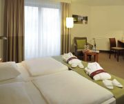
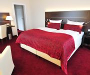
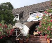
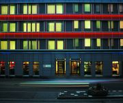
If you need a place to sleep, we compiled a list of available hotels close to the map centre further down the page.
Depending on your travel schedule, you might want to pay a visit to some of the following locations: Duisburg, Krefeld, Huenxe, Oberhausen and Alpen. To further explore this place, just scroll down and browse the available info.
Local weather forecast
Todays Local Weather Conditions & Forecast: 14°C / 57 °F
| Morning Temperature | 8°C / 47 °F |
| Evening Temperature | 13°C / 55 °F |
| Night Temperature | 11°C / 52 °F |
| Chance of rainfall | 3% |
| Air Humidity | 59% |
| Air Pressure | 1015 hPa |
| Wind Speed | Gentle Breeze with 8 km/h (5 mph) from North-East |
| Cloud Conditions | Overcast clouds, covering 100% of sky |
| General Conditions | Moderate rain |
Sunday, 5th of May 2024
16°C (61 °F)
11°C (53 °F)
Light rain, gentle breeze, broken clouds.
Monday, 6th of May 2024
17°C (62 °F)
13°C (55 °F)
Moderate rain, light breeze, overcast clouds.
Tuesday, 7th of May 2024
13°C (55 °F)
11°C (51 °F)
Light rain, gentle breeze, overcast clouds.
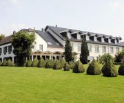
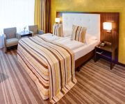
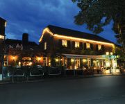
Hotels and Places to Stay
Eurohof Landhof am See
Moers van der Valk
Conti Partner of Sorat Hotels
Plaza
Niteroom Boutiquehotel & Apartments
Wellings Romantik Hotel zur Linde
Mercure Tagungs & Landhotel Krefeld
Rheingarten
Seerose
Ferrotel Duisburg Partner of Sorat H
Videos from this area
These are videos related to the place based on their proximity to this place.
Führerstandsmitfahrt Moers Gbf - Millingen Gbf auf 185 290-4, 18.04.2012
Am 18.04.2012 beförderte ich mit 185 290-4 einen Kesselwagenzug von Moers Gbf nach Millingen Gbf. Link zum Foto: http://farm8.staticflickr.com/7122/7094077573_6067f1cd87_c.jpg.
Hackday in Moers – Dokumentation
Vom 21. bis 22. März 2015 fand in Moers ein erster Hackday statt. Datenenthusiasten und Interessierte aus der Bevölkerung entwickelten aus offenen Daten Lösungen für politische und gesellschaft...
Water Challenge BSV Moers Holderberg
Wir wurden zur Water Challenge von der Narrenzunft Homberg nominiert. Wir haben es uns nicht nehmen lassen....
Moers Repelen Jungbornpark
Eine schöne kleine Parkanlage mit viel Natur und einem großen Wasserlauf.
Stadt Moers - Schlosspark
Das Video zeigt Impressionen der Stadt Moers vom Schloss- und Schlosspark! www.rheinruhronline.de.
3-Balıkesirliler Derneği 9.Hıdrellez şenliği Moers / Duisburg
3-Balikesirliler Dernegi 9.Hidrellez senligi 18-19-20.05.2013 Barbarastr 18 48443 Moers ( in der Nähe Duisburg ) — in Moers.
Der Thorsten live in der Barrikade (Moers, 12.09.2014)
Live Auftritt von Der Thorsten in der Barrikade in Moers.
Videos provided by Youtube are under the copyright of their owners.
Attractions and noteworthy things
Distances are based on the centre of the city/town and sightseeing location. This list contains brief abstracts about monuments, holiday activities, national parcs, museums, organisations and more from the area as well as interesting facts about the region itself. Where available, you'll find the corresponding homepage. Otherwise the related wikipedia article.
Ruhr (river)
The Ruhr is a medium-size river in western Germany, a right tributary (east-side) of the Rhine.
Düsseldorf (region)
Düsseldorf is one of the five Regierungsbezirke of North Rhine-Westphalia, Germany, located in the north-west of the country. It covers the western part of the Ruhr Area, as well as the Niederrheinische Tiefebene, the lower Rhine area. It is the most populated of all German administrative areas of the kind. It's the only area in Germany where the traditional dialects are Low Franconian, rather than Low German or High German.
König Brauerei
The König Brewery is situated in the Beeck area of Duisburg; amongst other beers, it brews the well-known König Pilsener (also known in colloquial German as “KöPi”).
Rheinhausen
Rheinhausen is a district of the city of Duisburg in Germany, with a population of 79,566 (December 31, 2004) and an area of 38.68 km². It lies on the left bank of the river Rhine. Rheinhausen consists of the neighbourhoods: Rumeln-Kaldenhausen, Hochemmerich (including Asterlagen), Bergheim (including Trompet-Oestrum), Friemersheim, and the central part: Rheinhausen-Mitte, which has a population of 8955.
Ruhrort
Ruhrort is a district within the German city of Duisburg situated north of the confluence of the Ruhr and the Rhine, in the western part of the Ruhr area. Ruhrort has the largest river harbour in the World, with quays extending nearly 40 kilometres along the river, and it is the principal inland shipping port in Germany.
Beeckerwerth
Beeckerwerth is a part of the German city of Duisburg and located right of the Rhine. It has a population of 3.807 and an area of 7,62 km².
DÜWAG
The DUEWAG AG was one of Germany's major manufacturers for rail vehicles. The business was sold in 1999 to Siemens transportation.
Rhine–Herne Canal
The Rhine–Herne Canal is a 45.6-kilometre long transportation canal in the Ruhr area of North Rhine-Westphalia, Germany, with five canal locks. The canal was built over a period of eight years (5 April 1906 - 14 July 1914) and connects the harbour in Duisburg on the Rhine with the Dortmund-Ems Canal near Henrichenburg, following the valley of the Emscher. It was widened in the 1980s.
Walsum power plant
Walsum power plant is a coal-fired power station owned by Evonik Industries. It is in the Walsum quarter of Duisburg, on the area of the former Walsum coal mine.
Stadtwerketurm
Stadtwerketurm is a remarkable chimney of Duisburg. It was built in 1966/67 and consists of 4 tubes One of these tubes contains an elevator, the others are used for smoke guiding.
PCC-Stadion
The PCC-Stadion is a football stadium in Duisburg-Homberg. It is the home ground of the women's Bundesliga side FCR 2001 Duisburg and men's fourth division side VfB Homberg. The stadium has a capacity of 3,000. The main stand has 800 covered seats.
Rhine Orange
Rheinorange (Rhine Orange) is the name of a sculpture erected in Duisburg-Neuenkamp in 1992 at the point where the Ruhr flows into the Rhine at 'Rheinkilometer 780', i.e. 780 km from the source of the Rhine. It was constructed from steel by the sculptor Lutz Fritsch from Köln. It is 25 m tall, 7 m wide and 1 m thick, and weights 83 tonnes. The cost was over 400.000 DM, which was donated by IHK Niederrhein after an initiative by employees. The name Rheinorange is actually a play on words.
Elfrather See
Elfrather See is a lake in North Rhine-Westphalia, Germany. At an elevation of 30 m, its surface area is 0.5 square kilometres . The Elfrather lake, popularly known as E for short-sea, is located in the north east of the city of Krefeld on the border of the Elfrath district. The lake was created from a disused gravel pit, which has been filled with groundwater. The degradation was made in the Lower Rhine because of the low water level with typical wetness reduction construction of a dredger.
Duisburg Inner Harbour
The Innenhafen (Inner Harbour) in Duisburg, encompassing an area of 89ha. , was for over a hundred years, during the high point of the Industrial Revolution, the central harbour and trading point of the town. Since the mid-60s, the importance of the harbour declined and it lay in a disused condition for 20 years, before plans for renovation were drawn up.
German Inland Waterways Museum
The German Inland Waterways Museum (Museum der Deutschen Binnenschifffahrt) is located in Ruhrort, Duisburg at the nucleus of Duisburg-Ruhrorter ports which today make up the largest European inland harbour complex. The museum was founded in 1974 with purchase of the museum ship Oscar Huber.
Duisburg Canals
The Duisburg Canals are part of the master plan developed by Foster and Partners for the reconstruction of the Duisburg Inner Harbour. They are part of the Duisburg: Town and Harbour section of the Ruhr Industrial Heritage Trail. An eastern port area was created separated from the rest of the port by the forming an artificial lake 26 m above sea level. The water level is maintained by ensuring that rainwater is channeled into the basin.
Ruhrort–Homberg train ferry
The Ruhrort–Homberg train ferry was a German train ferry on the Rhine between Ruhrort and Homberg, now districts of Duisburg.
Duisburg-Hochfeld Railway Bridge
The Duisburg–Hochfeld Railway Bridge spans the Rhine in the German city of Duisburg on the Duisburg-Ruhrort–Mönchengladbach line. The first bridge was built by the Rhenish Railway Company and put into operation at the end of 1873. It was replaced by a new bridge in 1927, which was badly damaged during the Second World War, but rebuilt and is still serves rail traffic between the Ruhr region and Aachen.
Halde Rheinpreußen
The Halde Rheinpreußen is a spoil tip in the German city Moers which lies 70 metres above its ambit. It is part of the category Panoramas of the Ruhr Industrial Heritage Trail. In 1963, the spoil tip was heaped up with materials of the pit 5/9, i.e. the mine Zeche Rheinpreußen. In autumn 1999, the artist Otto Piene, co-founder of the ZERO group, presented his idea of a mining lamp memorial called Geleucht for the first time.
Rheinhausen station
Rheinhausen station is located in the Duisburg suburb of Rheinhausen in the Lower Rhine region of the German state of North Rhine-Westphalia. It lies on the Duisburg-Ruhrort–Mönchengladbach railway and is the starting point of the Lower Rhine Railway towards Xanten.
Angerbach (Rhein)
Angerbach (Rhein) is a river of North Rhine-Westphalia, Germany.
Kleine Emscher
Kleine Emscher is a river of North Rhine-Westphalia, Germany.
Schlosstheater Moers
Schlosstheater Moers is a theatre in North Rhine-Westphalia, Germany.
Die Säule
Die Säule is a theatre in Duisburg, North Rhine-Westphalia, Germany.
Theater am Marientor
Theater am Marientor is a theatre in Duisburg, North Rhine-Westphalia, Germany.


