Safety Score: 3,0 of 5.0 based on data from 9 authorites. Meaning we advice caution when travelling to Germany.
Travel warnings are updated daily. Source: Travel Warning Germany. Last Update: 2024-05-15 08:00:47
Delve into Dördel
The district Dördel of Iserlohn in Regierungsbezirk Arnsberg (North Rhine-Westphalia) is a district located in Germany about 256 mi west of Berlin, the country's capital town.
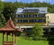
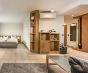
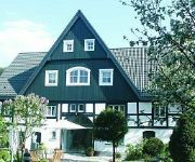
In need of a room? We compiled a list of available hotels close to the map centre further down the page.
Since you are here already, you might want to pay a visit to some of the following locations: Nachrodt-Wiblingwerde, Holzwickede, Unna, Luedenscheid and Herscheid. To further explore this place, just scroll down and browse the available info.
Local weather forecast
Todays Local Weather Conditions & Forecast: 22°C / 71 °F
| Morning Temperature | 14°C / 57 °F |
| Evening Temperature | 20°C / 67 °F |
| Night Temperature | 14°C / 57 °F |
| Chance of rainfall | 1% |
| Air Humidity | 45% |
| Air Pressure | 1006 hPa |
| Wind Speed | Gentle Breeze with 7 km/h (4 mph) from North-West |
| Cloud Conditions | Broken clouds, covering 80% of sky |
| General Conditions | Light rain |
Thursday, 16th of May 2024
14°C (58 °F)
11°C (52 °F)
Light rain, gentle breeze, overcast clouds.
Friday, 17th of May 2024
14°C (56 °F)
12°C (54 °F)
Moderate rain, light breeze, overcast clouds.
Saturday, 18th of May 2024
16°C (60 °F)
12°C (54 °F)
Moderate rain, light breeze, broken clouds.
Hotels and Places to Stay
Literaturhotel Franzosenhohl
Vier Jahreszeiten
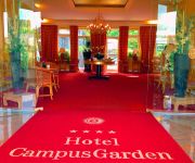
Campus Garden
Romantik Hotel Neuhaus
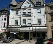
Engelbert
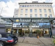
Stadthotel
Zur Mühle
Gutshof Wellenbad Hotel an der Ruhr
Alte Linden
Gasthof Daute
Videos from this area
These are videos related to the place based on their proximity to this place.
Iserlohn Verlassene Orte (Lost Places Urbex) Tagungsstätte Haus Ortlohn 01.11.2014
Das Haus Ortlohn in Iserlohn war bis 2007 eine Tagungsstätte der evangelischen Kirche von Westfalen, danach sollte es verkauft werden. Da sich kein ernsthafter Interessent fand, vergammelt...
Iserlohn Rückblende Bahnhof (Alt, Abriss, Neubau) 2003-2008
Fotoserie aus den Jahren 2003 bis 2008 über den Iserlohner Bahnhof, zu sehen sind der alte Bahnhof, der provisorische Betrieb, der Abbruch des alten Bahnhofs, der Bau des neuen Bahnhofs, der...
10 Jahre Schauburg Iserlohn
Die Party des 10 jährigen Jubiläums der Schauburg Iserlohn (09.10.2010) ( Musik: Kesha Tik Tok ) www.schauburg-bistro.de.
Iserlohn Fahrt von der Dortmunder Straße durch das Zentrum zur Mendener Straße 05.08.2013
Fahrt von der Dortmunder Straße durch das Zentrum, über Hans-Böckler-Straße und Theodor-Heuss-Ring, bis zur Mendener Straße über die Kreuzung in Richtung Hemer, und das ohne anzuhalten,...
[2014] Checkpoint Iserlohn - face2faith Woche
face2faith ist eine Woche im Checkpoint in Iserlohn, die vom 20.10.-24.10.14 stattfindet - für groß und klein! Weitere Infos bei: www.bewegt-iserlohn.de https://www.facebook.com/f2fiserlohn.
Der Beirat für Menschen mit Behinderung der Stadt Iserlohn
Ein Film über den Beirat und das Leben von Menschen mit Behinderung in der Stadt Iserlohn.
Iserlohn Verlassene Orte (Lost Places Urbex) Gaststätte Feelgood 04.10.2014
Iserlohn, Mühlentor 14. Das Wohnhaus mit den letzten Überresten der Gaststätte Feelgood im Erdgeschoss, seit Jahren verlassen. Das Gebäude wird demnächst abgerissen. Dieses Video widme...
Hast'e mal 'ne Minute? - Jugendrotkreuz Iserlohn
Was wäre unsere Welt ohne Toleranz? Dazu haben sich die Mitglieder des Jugendrotkreuz Iserlohn Gedanken gemacht! Sei dabei - sei tolerant. (mm) Mehr Infos unter www.hastemalneminute.de .
[2014] Checkpoint Iserlohn - Hoffnung hinter Gittern
Das Projekt wurde im Rahmen einer Woche in der Jugend-JVA mit 9 Gefangenen zusammen aufgenommen.. Sie haben die Texte, Refrain Musik selbst entwickelt und gemeinsam mit der Englischen ...
Videos provided by Youtube are under the copyright of their owners.
Attractions and noteworthy things
Distances are based on the centre of the city/town and sightseeing location. This list contains brief abstracts about monuments, holiday activities, national parcs, museums, organisations and more from the area as well as interesting facts about the region itself. Where available, you'll find the corresponding homepage. Otherwise the related wikipedia article.
Märkischer Kreis
The Märkischer Kreis is a district in central North Rhine-Westphalia, Germany. Neighbouring districts are Unna, Soest, Hochsauerland, Olpe, Oberbergischer Kreis, Ennepe-Ruhr, and the city of Hagen.
Hagen-Dahl
Dahl, now officially Hagen-Dahl, is a locality within the independent city of Hagen in the southeastern Ruhr, in Germany. It was incorporated into Hagen in 1975 together with Rummenohl and Priorei.
Hagen-Rummenohl
Rummenohl, now officially Hagen-Rummenohl, is a locality within the independent city of Hagen in the eastern part of the Ruhr, in Germany. It was incorporated into Hagen in 1975 together with Dahl and Priorei. The first element in the placename, rum- may indicate that in prehistoric times it was a location for fertility rites.
Luftfahrtgesellschaft Walter
LGW is a German regional airline officially known as Luftfahrtgesellschaft Walter mbH . Since 2007, LGW has been owned by Air Berlin. The Dortmund based airline transported about 50,000 passengers in 2003 The company has approximately 75 employees who are working in flight operations, maintenance, ground operations, booking, flight-school and administration.
Hönne
The Hönne is a left tributary river to the Ruhr, flowing through the northern Sauerland hills in North Rhine-Westphalia, Germany. The spring of the Hönne is located in the west of Neuenrade at 437m above sea level. After 33 km the river ends near the town of Fröndenberg. The total catchment area of the river is 262 km². Most notable is the narrow valley between Balve and Menden, where the Hönne has carved 60m deep into Devonian limestone.
Klusenstein Castle
Klusenstein is a castle in Hemer, Germany, located on a 60m high cliff above the valley of the Hönne river. The castle was built in 1353 as a boundary fortification of the earldom Mark.
Dortmund Airport
Dortmund Airport, is the international airport located 10 km east of Dortmund, Germany. Its slogan is Näher als man denkt (Closer than you think). Since 2006 it has been carrying the name "Dortmund Airport 21", in reference to the fact that Dortmund's utility company, DSW21, is its major shareholder. The airport has a maximum capacity of around 2.5 million passengers and served approximately 2.3 million passengers in 2008.
Bausenhagen
Bausenhagen, is a former village that is part of the city of Fröndenberg in Germany. It has about 600 inhabitants.
Hagen-Hohenlimburg
Hagen-Hohenlimburg (formerly known as Limburg an der Lenne, changed to Hohenlimburg in 1903), on the Lenne river, is a borough of the city of Hagen in North Rhine-Westphalia, Germany. Hohenlimburg was formerly the chief town of the county of Limburg-Hohenlimburg in medieval Germany, first documentary mentioned 1230, and belonged to the counts of Limburg.
Wörden
Wörden is a subdivision of Nachrodt-Wiblingwerde, North Rhine-Westphalia, Germany. The elevation is 429 m (1410 ft) and the Time zone (est) is UTC+1.
Nattenberg-Stadion
Nattenbergstadion is a multi-use stadium in Lüdenscheid, Germany. It is currently used mostly for football matches and hosts the home matches of Rot-Weiß Lüdenscheid. The stadium is able to hold 17,000 people.
Eissporthalle Iserlohn
Eissporthalle Iserlohn GEOCACHE is an arena in Iserlohn, Germany. It is primarily used for ice hockey and is the home arena of Iserlohn Roosters. It opened in 1971 and holds 4,999 People
Werdohl-Elverlingsen Power Station
Werdohl-Elverlingsen Power Station is a coal and gas fired power station in the state of North Rhine-Westphalia in Germany.
Walburgisgymnasium
The Walburgisgymnasium is a private secondary school and located in Menden (Sauerland), Germany, with 1,200 pupils and 78 teachers. The order is based in Bestwig.
Dechen Cave
The Dechen Cave at Iserlohn in Germany is one of the most beautiful and most visited show caves in Germany. It is located in the northern part of the Sauerland at Iserlohn (Grüne district). 360 metres of the 870-metre long cave have been laid out for visitors, beginning at the spot where, in 1868, the cave was discovered by two railway workers. The workers dropped a hammer into a rock crevice which turned out to be the entrance to a dripstone cave when they were searching for the lost tool.
Business and Information Technology School
The Business and Information Technology School (BiTS Iserlohn) is a private state approved university of applied science based in Iserlohn. The BiTS Iserlohn was founded in 2000 and currently approx. 1.000 students are enrolled in 7 undergraduate and 2 postgraduate programs. In 2008 The US-American education services company Laureate Education bought 76% of the shares. In the beginning of 2010 Laureate bought the remaining 24% of the shares and is now the sole holder of the BiTS.
Magnet Museum
The Magnet Museum is a private museum in Dortmund, owned by the company Tridelta Aplerbeck. It is temporarily closed. The exhibition provides an overview of historical and current applications of the Permanent magnet in electrical engineering. In the museum, the use of permanent magnets in counters, speakers, telephones, switches, relays, clocks, measuring devices, small motors and generators are illuminated in the museum.
Dortmund-Wickede station
Dortmund-Wickede is a railway station on the Welver–Sterkrade railway situated in Dortmund in western Germany. It is served by the S4 line of Rhine-Ruhr S-Bahn. A Dortmund Stadtbahn station is located next to the station.
Altena Castle
Altena Castle is a Medieval hill castle in the town of Altena in western Germany. The castle was erected by the early Counts of Berg - supposedly around 1108 or in the early 12th century. Eventually, the House of Berg abandoned Altena and moved their residence to Hamm. In 1912, Richard Schirrmann established the world's first youth hostel within the castle, which is still in use today (Jugendherberge Burg Altena).
Unna station
Unna station is the main passenger station in the Westphalian city of Unna in the German state of North Rhine-Westphalia. The other stations in the city that are served by regular passenger services are Unna-Königsborn, Unna West, Massen, Lünern and Hemmerde.
Abbabach
Abbabach is a river of North Rhine-Westphalia, Germany.
Schwerte (Ruhr) station
Schwerte station is a through station in the town of Schwerte in the German state of North Rhine-Westphalia. The station was opened with the section of the Hagen–Hamm railway between Hagen and Holzwickede, opened by the Bergisch-Märkische Railway Company (German: Bergisch-Märkische Eisenbahn-Gesellschaft, BME) on 1 April 1867. It has six platform tracks and it is classified by Deutsche Bahn as a category 6 station.
Kulturhaus Lüdenscheid
Kulturhaus Lüdenscheid is a theatre in North Rhine-Westphalia, Germany.
Fröndenberg station
Fröndenberg station is a junction station on the Upper Ruhr Valley Railway and the Hönne Valley Railway. It is in the German state of North Rhine-Westphalia between the Ruhr river to the south and the city of Fröndenberg to the northeast. The station building has been closed and converted into a hotel for cyclists and a bicycle parking facility. Since 2009, Deutsche Post has erected a Packstation here. The ticket office has been replaced by a ticket machine.
Elsey Abbey
Elsey Abbey, earlier Elsey Priory is a former women's religious house located near Elsey, now part of Hohenlimburg, Hagen, Germany. It was founded in about 1220 by Friedrich von Isenberg for Premonstratensian canonesses and endowed with the local parish church and other possessions. In the 15th century it became a house of secular canonesses of the nobility under an abbess. In the 16th century during the Reformation the parish became Protestant and the abbey followed suit in due course.




!['[2014] Checkpoint Iserlohn - face2faith Woche' preview picture of video '[2014] Checkpoint Iserlohn - face2faith Woche'](https://img.youtube.com/vi/n-V-Iz4bKas/mqdefault.jpg)


!['[2014] Checkpoint Iserlohn - Hoffnung hinter Gittern' preview picture of video '[2014] Checkpoint Iserlohn - Hoffnung hinter Gittern'](https://img.youtube.com/vi/UXaXgzLgtlE/mqdefault.jpg)
