Safety Score: 3,0 of 5.0 based on data from 9 authorites. Meaning we advice caution when travelling to Germany.
Travel warnings are updated daily. Source: Travel Warning Germany. Last Update: 2024-05-04 08:22:41
Delve into Nette
The district Nette of Altena in Regierungsbezirk Arnsberg (North Rhine-Westphalia) is a district located in Germany about 258 mi west of Berlin, the country's capital town.
In need of a room? We compiled a list of available hotels close to the map centre further down the page.
Since you are here already, you might want to pay a visit to some of the following locations: Nachrodt-Wiblingwerde, Luedenscheid, Herscheid, Schalksmuehle and Holzwickede. To further explore this place, just scroll down and browse the available info.
Local weather forecast
Todays Local Weather Conditions & Forecast: 13°C / 55 °F
| Morning Temperature | 8°C / 46 °F |
| Evening Temperature | 14°C / 57 °F |
| Night Temperature | 10°C / 50 °F |
| Chance of rainfall | 7% |
| Air Humidity | 71% |
| Air Pressure | 1015 hPa |
| Wind Speed | Gentle Breeze with 6 km/h (4 mph) from North |
| Cloud Conditions | Overcast clouds, covering 93% of sky |
| General Conditions | Moderate rain |
Sunday, 5th of May 2024
15°C (59 °F)
9°C (48 °F)
Light rain, gentle breeze, broken clouds.
Monday, 6th of May 2024
11°C (52 °F)
11°C (51 °F)
Moderate rain, light breeze, overcast clouds.
Tuesday, 7th of May 2024
15°C (59 °F)
10°C (51 °F)
Light rain, gentle breeze, overcast clouds.
Hotels and Places to Stay
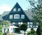
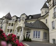
Romantik Hotel Neuhaus
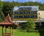
Literaturhotel Franzosenhohl
Kattenbusch
Sportalm Gipfelglück
Schloss Hotel Holzrichter
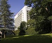
Mercure Hotel Luedenscheid
Zur Mühle
Spelsberg Gasthof
Alte Linden
Engelbert
Videos from this area
These are videos related to the place based on their proximity to this place.
Altena Verlassene Orte (Lost Places Urbex) Fabrikruine B & S 11.09.2014
Diese Fabrik von B & S in Altena ist schon seit Jahrzehnten verlassen, übriggeblieben ist nur eine Ruine. Der Gebäudekomplex auf der anderen Flussseite wurde teilweise umgenutzt.
Deutschland - Altena
Altena liegt im Sauerland. Hoch über der Stadt an der Lenne thront eine der Schönsten Hochburgen Deutschlands: Burg Altena. Auf der Burg gründete Richard Schirrmann die 1. Jugendherberge...
Altena - Stadt des Drahtes
Altena - Stadt des Drahtes Eine alte Dokumentation über die Stadt Altena in Westfalen und ihre Industrie Kultur. Ton Carolin Draber Wolgrang Klein Schnitt Renate Brandt Steve...
Löschzug Wache Feuerwehr Altena
Der Löschzug der Feuer- und Rettungswache Altena rückt zu einem Brandeinsatz aus.
Rundgang über das Mittelalter-Festival in Altena
Das 6. Mittelalter-Festival in Altena war ein Treffen vieler interessanter Persönlichkeiten. Einige davon redeten über ihr historisches Hobby vor unserer Kamera.
Wilfried Lieck vs. Marcus Steinfeld 4. Satz | TTC Altena ClubTV
22.04.2012 TTC Altena - 1. FC Köln 9:5 TT-Regionalliga West Saison 2011/2012 Wilfried Lieck vs. Marcus Steinfeld 4. Satz (11:9, 9:11, 11:9, 11:8) Double You schlägt wieder zul!
Videos provided by Youtube are under the copyright of their owners.
Attractions and noteworthy things
Distances are based on the centre of the city/town and sightseeing location. This list contains brief abstracts about monuments, holiday activities, national parcs, museums, organisations and more from the area as well as interesting facts about the region itself. Where available, you'll find the corresponding homepage. Otherwise the related wikipedia article.
Märkischer Kreis
The Märkischer Kreis is a district in central North Rhine-Westphalia, Germany. Neighbouring districts are Unna, Soest, Hochsauerland, Olpe, Oberbergischer Kreis, Ennepe-Ruhr, and the city of Hagen.
Hagen-Dahl
Dahl, now officially Hagen-Dahl, is a locality within the independent city of Hagen in the southeastern Ruhr, in Germany. It was incorporated into Hagen in 1975 together with Rummenohl and Priorei.
Hagen-Priorei
Priorei (officially Hagen-Priorei) is a small town on the River Volme in the Ruhr district of Germany. Administratively a part of the independent urban district of Hagen since 1975, it is situated some 12 km south of Hagen city centre. Priorei is best known for an ancient tree, believed to be over 1000 years old, the Priorlinde.
Hagen-Rummenohl
Rummenohl, now officially Hagen-Rummenohl, is a locality within the independent city of Hagen in the eastern part of the Ruhr, in Germany. It was incorporated into Hagen in 1975 together with Dahl and Priorei. The first element in the placename, rum- may indicate that in prehistoric times it was a location for fertility rites.
Ennepe
The Ennepe is a river and a left tributary of the Volme in Northern Sauerland.
Hönne
The Hönne is a left tributary river to the Ruhr, flowing through the northern Sauerland hills in North Rhine-Westphalia, Germany. The spring of the Hönne is located in the west of Neuenrade at 437m above sea level. After 33 km the river ends near the town of Fröndenberg. The total catchment area of the river is 262 km². Most notable is the narrow valley between Balve and Menden, where the Hönne has carved 60m deep into Devonian limestone.
Klusenstein Castle
Klusenstein is a castle in Hemer, Germany, located on a 60m high cliff above the valley of the Hönne river. The castle was built in 1353 as a boundary fortification of the earldom Mark.
Hagen-Hohenlimburg
Hagen-Hohenlimburg (formerly known as Limburg an der Lenne, changed to Hohenlimburg in 1903), on the Lenne river, is a borough of the city of Hagen in North Rhine-Westphalia, Germany. Hohenlimburg was formerly the chief town of the county of Limburg-Hohenlimburg in medieval Germany, first documentary mentioned 1230, and belonged to the counts of Limburg.
Wörden
Wörden is a subdivision of Nachrodt-Wiblingwerde, North Rhine-Westphalia, Germany. The elevation is 429 m (1410 ft) and the Time zone (est) is UTC+1.
Nattenberg-Stadion
Nattenbergstadion is a multi-use stadium in Lüdenscheid, Germany. It is currently used mostly for football matches and hosts the home matches of Rot-Weiß Lüdenscheid. The stadium is able to hold 17,000 people.
Eissporthalle Iserlohn
Eissporthalle Iserlohn GEOCACHE is an arena in Iserlohn, Germany. It is primarily used for ice hockey and is the home arena of Iserlohn Roosters. It opened in 1971 and holds 4,999 People
Werdohl-Elverlingsen Power Station
Werdohl-Elverlingsen Power Station is a coal and gas fired power station in the state of North Rhine-Westphalia in Germany.
Walburgisgymnasium
The Walburgisgymnasium is a private secondary school and located in Menden (Sauerland), Germany, with 1,200 pupils and 78 teachers. The order is based in Bestwig.
Dechen Cave
The Dechen Cave at Iserlohn in Germany is one of the most beautiful and most visited show caves in Germany. It is located in the northern part of the Sauerland at Iserlohn (Grüne district). 360 metres of the 870-metre long cave have been laid out for visitors, beginning at the spot where, in 1868, the cave was discovered by two railway workers. The workers dropped a hammer into a rock crevice which turned out to be the entrance to a dripstone cave when they were searching for the lost tool.
Märkische Museum Railway
The Märkische Museum Railway (Märkische Museums-Eisenbahn) or MME is a German railway society that was founded in order to show narrow gauge vehicles in operation on small branch lines.
Business and Information Technology School
The Business and Information Technology School (BiTS Iserlohn) is a private state approved university of applied science based in Iserlohn. The BiTS Iserlohn was founded in 2000 and currently approx. 1.000 students are enrolled in 7 undergraduate and 2 postgraduate programs. In 2008 The US-American education services company Laureate Education bought 76% of the shares. In the beginning of 2010 Laureate bought the remaining 24% of the shares and is now the sole holder of the BiTS.
Altena Castle
Altena Castle is a Medieval hill castle in the town of Altena in western Germany. The castle was erected by the early Counts of Berg - supposedly around 1108 or in the early 12th century. Eventually, the House of Berg abandoned Altena and moved their residence to Hamm. In 1912, Richard Schirrmann established the world's first youth hostel within the castle, which is still in use today (Jugendherberge Burg Altena).
Hohenhof
Hohenhof is a 1908-built Art Nouveau villa, located within Gartenstadt Hohenhagen in the city of Hagen, Germany. The villa was designed by Belgian architect Henry van de Velde as a Gesamtkunstwerk - incorporating shell, accessories, furnishings, landscape and all into the building's design. The client, German industrialist and arts patron Karl Ernst Osthaus, used the building as his family home until his death in 1921.
Schwerte (Ruhr) station
Schwerte station is a through station in the town of Schwerte in the German state of North Rhine-Westphalia. The station was opened with the section of the Hagen–Hamm railway between Hagen and Holzwickede, opened by the Bergisch-Märkische Railway Company (German: Bergisch-Märkische Eisenbahn-Gesellschaft, BME) on 1 April 1867. It has six platform tracks and it is classified by Deutsche Bahn as a category 6 station.
Kulturhaus Lüdenscheid
Kulturhaus Lüdenscheid is a theatre in North Rhine-Westphalia, Germany.
Elsey Abbey
Elsey Abbey, earlier Elsey Priory is a former women's religious house located near Elsey, now part of Hohenlimburg, Hagen, Germany. It was founded in about 1220 by Friedrich von Isenberg for Premonstratensian canonesses and endowed with the local parish church and other possessions. In the 15th century it became a house of secular canonesses of the nobility under an abbess. In the 16th century during the Reformation the parish became Protestant and the abbey followed suit in due course.


