Safety Score: 3,0 of 5.0 based on data from 9 authorites. Meaning we advice caution when travelling to Germany.
Travel warnings are updated daily. Source: Travel Warning Germany. Last Update: 2024-05-04 08:22:41
Delve into Essig
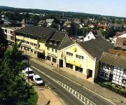
Essig in Cologne District (North Rhine-Westphalia) is a city located in Germany about 308 mi (or 496 km) south-west of Berlin, the country's capital town.
Current time in Essig is now 09:00 AM (Sunday). The local timezone is named Europe / Berlin with an UTC offset of 2 hours. We know of 11 airports closer to Essig, of which 5 are larger airports. The closest airport in Germany is Norvenich Airport in a distance of 16 mi (or 25 km), North-West. Besides the airports, there are other travel options available (check left side).
There are several Unesco world heritage sites nearby. The closest heritage site in Germany is Castles of Augustusburg and Falkenlust at Brühl in a distance of 12 mi (or 19 km), North. We saw 3 points of interest near this location. In need of a room? We compiled a list of available hotels close to the map centre further down the page.
Since you are here already, you might want to pay a visit to some of the following locations: Euskirchen, Weilerswist, Berg, Kirchsahr and Alfter. To further explore this place, just scroll down and browse the available info.
Local weather forecast
Todays Local Weather Conditions & Forecast: 18°C / 64 °F
| Morning Temperature | 7°C / 44 °F |
| Evening Temperature | 15°C / 60 °F |
| Night Temperature | 12°C / 53 °F |
| Chance of rainfall | 0% |
| Air Humidity | 45% |
| Air Pressure | 1010 hPa |
| Wind Speed | Gentle Breeze with 6 km/h (4 mph) from East |
| Cloud Conditions | Few clouds, covering 17% of sky |
| General Conditions | Light rain |
Monday, 6th of May 2024
12°C (53 °F)
11°C (52 °F)
Moderate rain, light breeze, overcast clouds.
Tuesday, 7th of May 2024
16°C (61 °F)
11°C (52 °F)
Light rain, gentle breeze, overcast clouds.
Wednesday, 8th of May 2024
16°C (61 °F)
11°C (52 °F)
Light rain, light breeze, overcast clouds.
Hotels and Places to Stay
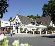
Waldhotel Rheinbach
Weidenbrück
Hotel Mitte Alte Süsswarenfabrik
Nord
Zum Schwan Garni
Streng
Burg Heimerzheim
St. Michael Hotel Garni
Videos from this area
These are videos related to the place based on their proximity to this place.
Graupner Minitaxi model aircraft trip
A small trip over the country with an on board camera via 2.4 Ghz radio contact.
Ultralite Ultraleicht Fliegerfest Weilerswist 2008
Film with english commend: Every year erverybody can join the flying celebration of the ul-club fluggruppe nordeifel in weilerswist. The flying show with ul-planes, trikes, gyrocopter and you...
RC Bagger Menck M90 lädt Sattelkipper Teil 1 cable backhoe
ferngesteuerte Modelle gebaut im Maßstab 1:16, Eigenbau in Metall. Radio controlled models scale 1:16, scratch build with metal.
2009 Dom-Esch (Euskirchen) 4x4 Offroad-Trial
1. + 2. Lauf 2009 zum GWV Rhein-Eifel-Luxembourg Pokal, 25.+26. April 2009 in Dom-Esch (Euskirchen) Homepage: http://www.gwv-rhein-eifel.de Alle Fotos unter: http://www.flickr.com/photos/rockopa/sets.
2009 Dom-Esch (Euskirchen) 4x4 Offroad-Trial
1. + 2. Lauf 2009 zum GWV Rhein-Eifel-Luxembourg Pokal, 25.+26. April 2009 in Dom-Esch (Euskirchen) Homepage: http://www.gwv-rhein-eifel.de Alle Fotos unter: ...
2010 Dom-Esch (Euskirchen) - GWV 4x4 Offroad Trial
2. Lauf 2010 zum GWV Rhein-Eifel-Luxembourg Pokal, 18. April 2010 Homepage: http://www.gwv-rhein-eifel.de Alle Fotos unter: http://www.flickr.com/photos/rockopa/sets.
Die Vergessenenmp4 voll
Infofilm der Bürgerinitiative Lebenswertes Swisttal e.V. zur Windradplanung - hier am Beispiel benachteiligter Bürger des nahe des Ortsteils Ollheim.
Gewitterstimmung 01072013 über Swisttal ( NRW )
Hier ein längeres Video von einem Multizellengewitter das am 1.07.2013 wütete. Es brachte heftigen Starkregen. Dabei wurden in der Region zahlreiche Unwetter...
Windmaster 2 Sturm 27.10.2013
Einsatz des Windmesser Windmaster 2 am 27.10.2013 in der Region Swisttal ( NRW ) auf einem Feld zwischen Rheinbach Oberdrees und Swisttal Odendorf nähe der B56/B266 zwischen Rheinbach ...
Videos provided by Youtube are under the copyright of their owners.
Attractions and noteworthy things
Distances are based on the centre of the city/town and sightseeing location. This list contains brief abstracts about monuments, holiday activities, national parcs, museums, organisations and more from the area as well as interesting facts about the region itself. Where available, you'll find the corresponding homepage. Otherwise the related wikipedia article.
Miel (Swisttal)
Miel is a farming village in the municipality Swisttal in the North-Rhine-Westphalian Rhein-Sieg district. It is situated approx. 16 km southwest of Bonn. In 2007 it had 1072 inhabitants.
Odendorf
Odendorf is a village in Germany, belongs to the municipality of Swisttal, County of Rhein-Sieg in North-Rhine-Westphalia. The Village is situated approx. 20 km southwest of Bonn. In 2007 it had 3581 inhabitants.
Ludendorf
Ludendorf is a village in the municipality Swisttal in the North-Rhine-Westphalian Rhein-Sieg district. It is situated approx. 18 km southwest of Bonn. On January 1, 2007 the village had a population of 539. The city hall of the municipality Swisttal is located between Ludendorf and the neighboring village Swisttal-Essig.
Ollheim
Ollheim is a farming village in the municipality Swisttal in the North-Rhine-Westphalian Rhein-Sieg district. It is situated approx. 19 km west of Bonn. In 2007 it had 723 inhabitants.
Swisttal-Essig
Essig is a village in the municipality Swisttal in the North-Rhine-Westphalian Rhein-Sieg district of Germany. It is situated approx. 18 km southwest of Bonn. In 2007 it had 428 inhabitants. The city hall of the municipality Swisttal is located between Essig and the neighboring village Ludendorf.
Straßfeld
Straßfeld is a village in the municipality Swisttal in the North-Rhine-Westphalian Rhein-Sieg district. It is situated approx. 24 km west of Bonn. In 2007 it had 465 inhabitants.
Strassfeld Airfield
Strassfeld Airfield is an abandoned World War II military airfield located in Germany, about 5 miles east-northeast of Euskirchen (Nordrhein-Westfalen); approximately 310 miles southwest of Berlin.


