Safety Score: 3,0 of 5.0 based on data from 9 authorites. Meaning we advice caution when travelling to Germany.
Travel warnings are updated daily. Source: Travel Warning Germany. Last Update: 2024-04-27 08:23:39
Explore Hackemühlen
Hackemühlen in Lower Saxony is a city in Germany about 194 mi (or 313 km) north-west of Berlin, the country's capital.
Local time in Hackemühlen is now 03:20 PM (Saturday). The local timezone is named Europe / Berlin with an UTC offset of 2 hours. We know of 9 airports in the vicinity of Hackemühlen, of which 3 are larger airports. The closest airport in Germany is Nordholz Airport in a distance of 21 mi (or 33 km), West. Besides the airports, there are other travel options available (check left side).
There are several Unesco world heritage sites nearby. The closest heritage site is Wadden Sea in Denmark at a distance of 25 mi (or 40 km). The closest in Germany is Town Hall and Roland on the Marketplace of Bremen in a distance of 42 mi (or 40 km), West. If you need a place to sleep, we compiled a list of available hotels close to the map centre further down the page.
Depending on your travel schedule, you might want to pay a visit to some of the following locations: Lamstedt, Hollnseth, Armstorf, Mittelstenahe and Osten. To further explore this place, just scroll down and browse the available info.
Local weather forecast
Todays Local Weather Conditions & Forecast: 15°C / 60 °F
| Morning Temperature | 5°C / 41 °F |
| Evening Temperature | 15°C / 59 °F |
| Night Temperature | 10°C / 50 °F |
| Chance of rainfall | 0% |
| Air Humidity | 65% |
| Air Pressure | 1009 hPa |
| Wind Speed | Gentle Breeze with 8 km/h (5 mph) from North |
| Cloud Conditions | Broken clouds, covering 67% of sky |
| General Conditions | Light rain |
Sunday, 28th of April 2024
19°C (66 °F)
10°C (50 °F)
Light rain, moderate breeze, overcast clouds.
Monday, 29th of April 2024
16°C (61 °F)
12°C (53 °F)
Overcast clouds, light breeze.
Tuesday, 30th of April 2024
20°C (67 °F)
13°C (55 °F)
Light rain, gentle breeze, overcast clouds.
Hotels and Places to Stay
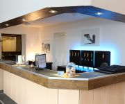
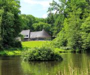
Zur Linde Landhotel
Hotel Speisefabrik Hemmoor
Forsthaus Ferienhotel am Dobrock
Videos from this area
These are videos related to the place based on their proximity to this place.
Der Rüttler | Kreidesee Hemmoor (1)
Tauchgang zum Wahrzeichen des Kreidesees inkl. einem Besuch beim zweiten Teil der Treppe.
Hemmoor 2014 (1) (Tauchsportgemeinschaft Hagen)
Einige Eindrücke von der Vereinsfahrt 2014 nach Hemmoor. Fotos sind hier zu finden: http://tsg-hagen.de/index.php/138.
Abgestürztes Flugzeug im Kreidesee Hemmoor
Film über den Flieger im Kreidesee in Hemmoor. In dem Flugzeug sitzt noch das Skelett des Bankräubers, der auf der Flucht in den Kreidesee Hemmoor abstürzte. In dem Flugzeug bedindet sich...
Dezembertauchgang im Kreidesee Hemmoor
Enstpannter Tauchgang mit zwei JJ-CCR's in Hemmoor Von Einstieg 2 zur Holztreppe, durch den Rüttler vorbei an den Autowracks und zum Sportboot/Computertisch. Die Sicht war nicht sooo ...
Kreidesee Hemmoor Mai 2014 / Tauchen mit der Tauchschule Ruhrpott Divers
Tauchausfahrt zum Kreidesee Hemmoor mit der TRPD, Rüttler uns vieles mehr... schön wars :)
Hemmoor Kreidesee 2013 - Cold Blood Divers
JOIN OUR SITE ON FACEBOOK - http://www.facebook.com/coldblooddivers Diving in the underwater forrest, on the airplane, the rüttler and all the other stuff left from the mine. Fantastic dives...
Videos provided by Youtube are under the copyright of their owners.
Attractions and noteworthy things
Distances are based on the centre of the city/town and sightseeing location. This list contains brief abstracts about monuments, holiday activities, national parcs, museums, organisations and more from the area as well as interesting facts about the region itself. Where available, you'll find the corresponding homepage. Otherwise the related wikipedia article.
Börde Lamstedt
Börde Lamstedt is a Samtgemeinde ("collective municipality") in the district of Cuxhaven, in Lower Saxony, Germany. It is situated approx. 35 km east of Bremerhaven, and 15 km north of Bremervörde. Its seat is in the village Lamstedt. The Samtgemeinde Börde Lamstedt consists of the following municipalities: Armstorf Hollnseth Lamstedt Mittelstenahe
Westerberg (Lamstedt)
The Westerberg is a low ridge in North Germany in the north of the collective municipality of Börde Lamstedt in the state of Lower Saxony. It is covered with mixed forest and, like the nearby Wingst ridge, it is an end moraine from the Saale glaciation period. Together with the Wingst it forms part of the eastern boundary of Land Hadeln. The Georgenhöhe ("George Heights") is its highest elevation at 66 metres .


