Safety Score: 3,0 of 5.0 based on data from 9 authorites. Meaning we advice caution when travelling to Germany.
Travel warnings are updated daily. Source: Travel Warning Germany. Last Update: 2024-04-27 08:23:39
Touring Großlangheim
Großlangheim in Regierungsbezirk Unterfranken (Bavaria) with it's 1,536 residents is a town located in Germany about 235 mi (or 379 km) south-west of Berlin, the country's capital place.
Time in Großlangheim is now 03:36 PM (Saturday). The local timezone is named Europe / Berlin with an UTC offset of 2 hours. We know of 11 airports nearby Großlangheim, of which 5 are larger airports. The closest airport in Germany is Bamberg-Breitenau Airport in a distance of 32 mi (or 52 km), East. Besides the airports, there are other travel options available (check left side).
There are several Unesco world heritage sites nearby. The closest heritage site in Germany is Würzburg Residence with the Court Gardens and Residence Square in a distance of 14 mi (or 22 km), West. Need some hints on where to stay? We compiled a list of available hotels close to the map centre further down the page.
Being here already, you might want to pay a visit to some of the following locations: Rodelsee, Wiesenbronn, Albertshofen, Sommerach and Kitzingen. To further explore this place, just scroll down and browse the available info.
Local weather forecast
Todays Local Weather Conditions & Forecast: 16°C / 61 °F
| Morning Temperature | 5°C / 41 °F |
| Evening Temperature | 15°C / 60 °F |
| Night Temperature | 9°C / 48 °F |
| Chance of rainfall | 0% |
| Air Humidity | 56% |
| Air Pressure | 1010 hPa |
| Wind Speed | Gentle Breeze with 6 km/h (4 mph) from North-West |
| Cloud Conditions | Few clouds, covering 12% of sky |
| General Conditions | Few clouds |
Sunday, 28th of April 2024
18°C (64 °F)
12°C (54 °F)
Scattered clouds, moderate breeze.
Monday, 29th of April 2024
17°C (63 °F)
13°C (55 °F)
Light rain, light breeze, overcast clouds.
Tuesday, 30th of April 2024
22°C (72 °F)
15°C (59 °F)
Light rain, light breeze, scattered clouds.
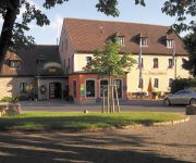
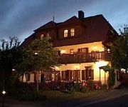
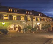
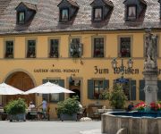
Hotels and Places to Stay
Akzent Hotel Franziskaner
Zum Rödelseer Schwan
Kitzinger Hof
Grüner Baum
Weinblatt
Deutsches Haus
Bayerischer Hof Hotel & Restaurant
Zum Weißen Lamm Weingut
Akzent Hotel Am Bach
Schwarzes Ross Gasthof
Videos from this area
These are videos related to the place based on their proximity to this place.
Fly with the Bumblebee over the 9 Circuit Vine Labyrinth at Wiesenbronn (Germany)
Aufgenommen am 4. Oktober 2014.
Büffel e.V. - TG Würzburg | Kitzingen, 19.05.2012 | 4x 400m
Der Büffel eV ist mal wieder auf freiem Fuß und gewinnt gleich mal die Staffel über 4x 400m. Fanseite: https://www.facebook.com/Bueffel.eV.
Erste Starts bei der Windenerprobung
Nach ca. 10 Jahren Bauzeit die ersten Erprobungsstarts mit unserer neuen Winde. Geschleppt wird ein DuoDiscus. Seillänge ca. 1200m. Vermessene Leistung: 352,9 PS; 563 Nm Drehmoment ...
Segelflugwetterbericht vs. Realität am 15.08.2010
Mäßige Thermik bis 1400m sagt der Wetterbericht. Doch seht selbst. Mehr Infos unter http://www.lsc-kitzingen.de/Blog.html.
Erster regulärer Einsatz der neuen Winde
Mehr Infos: http://www.lsc-kitzingen.de/Neue-Winde-Erste-regulaere-Starts_Blog_211_kkdetail_view_blog.html.
12 Loopings mit nur 110m Höhenverbrauch
Irgendwie bin ich beim Kunstflug in einen Bart gerumpelt. Bei den Loopings 3-10 hatte ich überhaupt keinen Höhenverlust. Beim 8. Looping bei 1:25 klopfe ich auf den Höhenmesser, weil ich...
PIK-Fun
Zuerst habe ich versucht, ob ich mit meiner PIK-20D trudeln kann. Leider geht sie aufgrund vorderster Schwerpunktlage sofort wieder raus :-( Danach habe ich die Höhe abgebaut. Nicht ganz...
enduro Trip ATV crash trx450 |raptor 700| |polaris 525| crash trx450
Kolejna weekendowa wycieczka na Cieśle i odkrywanie nowych miejscówek występują yamaha raptor 700 x2 , polaris outlaw 525, i Honda TRX 450, również nie obyło się bez małych rolek...
ATV trip along the river A.P.T POZNAN CAM-AM 1000 & KFX 700 & RAPTOR 700 & GRYZLI 700
Cam-am 1000 kawasaki kfx 700 yamaha gryzli 700 yamaha raptor 700 kymco maxxer 300.
Videos provided by Youtube are under the copyright of their owners.
Attractions and noteworthy things
Distances are based on the centre of the city/town and sightseeing location. This list contains brief abstracts about monuments, holiday activities, national parcs, museums, organisations and more from the area as well as interesting facts about the region itself. Where available, you'll find the corresponding homepage. Otherwise the related wikipedia article.
Schwanberg
For the town in Styria, see Schwanberg, Austria. Schwanberg is an elevation in the rural district of Kitzingen, Regierungsbezirk Lower Franconia, Bavaria, Germany. In ancient times the elevation, part of the Steigerwald, was used by the Celts as a castle and can safely be assumed to be regarded as a Holy Mountain since then. Later the counts of Castell build a castle which is still existing today. The southern parts are used for growing wine. The rest of the elevation is covered by forest.
Kitzingen Army Airfield
For the civil airport use of this facility after 2007, see: Kitzingen Airport Harvey Barracks/Kitzingen Army Airfield is a former United States Army 1st Infantry Division (1st ID) facility in Germany, located about 2 miles east-northeast of Kitzingen (Bavaria), about 240 miles southwest of Berlin. Formerly part of the United States Army Würzburg military community, it was a 1st ID garrison since 1996 and prior to that it was home to 3rd ID 2nd Brigade.
Kitzingen Airport
For the military use of this facility prior to 2007, see Kitzingen Army Airfield Kitzingen Airport is a general aviation airport located in Germany, about 2 miles southwest of Kitzingen (Bavaria); approximately 230 miles southwest of Berlin. The airport was opened as a private, general aviation facility after the closure of the United States Army Kitzingen Army Airfield in March 2007. It offers private aircraft and charter operations.
Wehrbach (Nidda)
Wehrbach (Nidda) is a river of Hesse, Germany.


