Safety Score: 3,0 of 5.0 based on data from 9 authorites. Meaning we advice caution when travelling to Germany.
Travel warnings are updated daily. Source: Travel Warning Germany. Last Update: 2024-04-28 08:22:10
Explore Pfronstetten
Pfronstetten in Tübingen Region (Baden-Württemberg) with it's 1,581 inhabitants is a city in Germany about 343 mi (or 553 km) south-west of Berlin, the country's capital.
Local time in Pfronstetten is now 10:39 AM (Sunday). The local timezone is named Europe / Berlin with an UTC offset of 2 hours. We know of 8 airports in the vicinity of Pfronstetten, of which 3 are larger airports. The closest airport in Germany is Stuttgart Airport in a distance of 29 mi (or 47 km), North. Besides the airports, there are other travel options available (check left side).
There are several Unesco world heritage sites nearby. The closest heritage site in Germany is Monastic Island of Reichenau in a distance of 42 mi (or 68 km), South. If you need a place to sleep, we compiled a list of available hotels close to the map centre further down the page.
Depending on your travel schedule, you might want to pay a visit to some of the following locations: Zwiefalten, Gomadingen, Langenenslingen, Altheim and Emeringen. To further explore this place, just scroll down and browse the available info.
Local weather forecast
Todays Local Weather Conditions & Forecast: 17°C / 63 °F
| Morning Temperature | 6°C / 43 °F |
| Evening Temperature | 11°C / 52 °F |
| Night Temperature | 9°C / 48 °F |
| Chance of rainfall | 0% |
| Air Humidity | 50% |
| Air Pressure | 1012 hPa |
| Wind Speed | Gentle Breeze with 9 km/h (5 mph) from South-East |
| Cloud Conditions | Overcast clouds, covering 100% of sky |
| General Conditions | Light rain |
Monday, 29th of April 2024
15°C (58 °F)
10°C (49 °F)
Light rain, gentle breeze, overcast clouds.
Tuesday, 30th of April 2024
18°C (65 °F)
12°C (54 °F)
Scattered clouds, gentle breeze.
Wednesday, 1st of May 2024
20°C (68 °F)
13°C (55 °F)
Light rain, gentle breeze, overcast clouds.
Hotels and Places to Stay
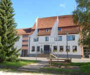
Speidels BrauManufaktur Speidel's Brauerei
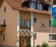
Rose Biohotel
Videos from this area
These are videos related to the place based on their proximity to this place.
H&P Ferienpark Lauterdörfle in Hayingen
Lauterdörfle Hayingen mit seinen Stadtteilen Anhausen, Indelhausen im Lautertal, Ehestetten und Münzdorf gehört seit Jahren zu den beliebten Ferien- und Ausflugsorten auf der Schwäbischen...
Bootsunfall Wimsener Höhle, Feuerwehr Reutlingen Tauchergruppe & DLRG Wasserrettung im Einsatz
Zu einem Bootsunfall in der Wimsener Höhle zwischen Hayingen und Zwiefalten kam die Feuerwehr Reutlingen mit der Tauchergruppe/Wasserrettung und die Deutsche Lebensrettungs Gesellschaft ...
Zum VU, Feuerwehr Pfronstetten & Sonnenbühl Abt. Undingen, und ein RTW DRK
Auf Einsatzfahrt zu einem Verkehrsunfall auf der Verbindungsstraße zwischen Hayingen und Aichstetten mit Verletzten und Personensuche, waren die Feuerwehr Pfronstetten und die Feuerwehr ...
Cavalon - Sonntagsflügle am 24.08.2014
Kleines Ausflügle mit dem Cavalon von Hayingen nach Riedlingen und zurück.
Tragschrauber MT03 Intro
Unser Tragschrauber MT03 auf dem Flugplatz Hayingen. Gefilmt mit GoPro Hero 3 black Edition auf meinem Quadrocopter Flat Head 650 mit Tarot Gimble.
Naturerlebnis Wimsener Höhle (Friedrichshöhle)
Das auch als Friedrichshöhle bekannte Naturdenkmal Wimsener Höhle gehört zu den Highlights im Geopark und Biosphärengebiet Schwäbische Alb. Sie ist die einzige mit dem Boot befahrbare...
Videos provided by Youtube are under the copyright of their owners.
Attractions and noteworthy things
Distances are based on the centre of the city/town and sightseeing location. This list contains brief abstracts about monuments, holiday activities, national parcs, museums, organisations and more from the area as well as interesting facts about the region itself. Where available, you'll find the corresponding homepage. Otherwise the related wikipedia article.
Swabian Jura
The Swabian Jura, sometimes also given the name Swabian Alps in English, is a low mountain range in Baden-Württemberg, Germany, extending 220 km from southwest to northeast and 40 to 70 km (to mi) in width. It is named after the region of Swabia. The Swabian Jura occupies the region bounded by the Danube in the southeast and the upper Neckar in the northwest. In the southwest it rises to the higher mountains of the Black Forest. The highest mountain of the region is the Lemberg (1,015 m).


