Safety Score: 2,8 of 5.0 based on data from 9 authorites. Meaning we advice caution when travelling to Poland.
Travel warnings are updated daily. Source: Travel Warning Poland. Last Update: 2024-04-27 08:23:39
Discover Niedów
Niedów in Powiat zgorzelecki (Województwo Dolnośląskie) is a town in Poland about 271 mi (or 436 km) west of Warsaw, the country's capital city.
Current time in Niedów is now 04:19 PM (Saturday). The local timezone is named Europe / Warsaw with an UTC offset of 2 hours. We know of 9 airports near Niedów, of which 4 are larger airports. The closest is airport we know is Dresden Airport in Germany in a distance of 53 mi (or 86 km). The closest airport in Poland is Copernicus Wrocław Airport in a distance of 83 mi (or 86 km), West. Besides the airports, there are other travel options available (check left side).
There are several Unesco world heritage sites nearby. The closest heritage site is Muskauer Park / Park Mużakowski in Germany at a distance of 39 mi (or 63 km). The closest in Poland is Churches of Peace in Jawor and Świdnica in a distance of 53 mi (or 63 km), North. Looking for a place to stay? we compiled a list of available hotels close to the map centre further down the page.
When in this area, you might want to pay a visit to some of the following locations: Zgorzelec, Goerlitz, Markersdorf, Konigshain and Piensk. To further explore this place, just scroll down and browse the available info.
Local weather forecast
Todays Local Weather Conditions & Forecast: 17°C / 63 °F
| Morning Temperature | 6°C / 42 °F |
| Evening Temperature | 18°C / 64 °F |
| Night Temperature | 10°C / 50 °F |
| Chance of rainfall | 0% |
| Air Humidity | 44% |
| Air Pressure | 1013 hPa |
| Wind Speed | Gentle Breeze with 7 km/h (4 mph) from North |
| Cloud Conditions | Scattered clouds, covering 37% of sky |
| General Conditions | Scattered clouds |
Sunday, 28th of April 2024
18°C (65 °F)
13°C (55 °F)
Overcast clouds, moderate breeze.
Monday, 29th of April 2024
21°C (69 °F)
15°C (59 °F)
Overcast clouds, moderate breeze.
Tuesday, 30th of April 2024
21°C (69 °F)
15°C (59 °F)
Sky is clear, moderate breeze, clear sky.
Hotels and Places to Stay
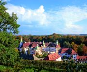
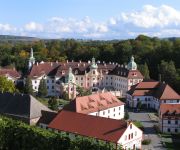
Gästehäuser St. Marienthal
Kloster St. Marienthal
Videos from this area
These are videos related to the place based on their proximity to this place.
BLACK BIRD koncert - relacja, Zawidów, 23.11.2013
ZALECANE ODTWARZANIE W JAKOŚCI FULL HD Ośrodek Kultury w Zawidowie oraz Modern Studio, mają przyjemność zaprosić na relację z koncertu grupy BLACK BIRD który odbył się 23.11.2013....
Manewry lokomotyw S200 w Zawidowie
Lokomotywy S200 przewoźnika STK manewrują po granicznej stacji Zawidów.
Zgorzelec, przerwanie zapory na Witce, TVN24.pl - 07.08.2010.
Video vom gebrochenen Staudamm der Wittig (n. Gorlitz). Wczoraj wieczorem po przerwaniu tamy prawie 5mln litrów wody ze sztucznego zalewu na Witce wylało się i popłynęło w kierunku Zgorzelca.
Ośrodek Wypoczynkowy i Sportów Wodnych „Witka
Ośrodek Wypoczynkowy i Sportów Wodnych „Witka" położony jest nad brzegiem zalewu rzeki Witka, pośród zieleni i lasów. Cisza, bliskość przyrody oraz akwenu wodnego sprawia, iż jest...
Brejlovce czyli 753 w Zawidowie
Film przedstawia czeskie lokomotywy spalinowe serii 753 "Brejlovce" czyli Okularniki w obsłudze pociagów towarowych w rejonie Zawidowa.
Droga wojewódzka nr 352: Sulików - Zgorzelec
Przejazd drogą wojewódzką nr 352 z Sulikowa (od skrzyżowania z drogą wojewódzką nr 357) do Zgorzelca. Początkowy fragment nagrania obejmuje drogę wojewódzką nr 355.
Grenzübergang Ostritz (D) - Krzewina / Grunau (PL) Border crossing
Standing in the middle of the border bridge across river Neisse. First looking to the west towards Ostritz in Germany, then panning the camera to the east towards Krzewina / Grunau in Poland....
Ostritz
Geschichte auf Reklamemarken & Siegelmarken aus veikkos-archiv Schon vor 100 Jahren wurde für Konsumprodukte geworben. Damals nannte man die Werbung jedoch Reklame und jede Firma ...
Videos provided by Youtube are under the copyright of their owners.
Attractions and noteworthy things
Distances are based on the centre of the city/town and sightseeing location. This list contains brief abstracts about monuments, holiday activities, national parcs, museums, organisations and more from the area as well as interesting facts about the region itself. Where available, you'll find the corresponding homepage. Otherwise the related wikipedia article.
Wilka
Wilka is a village in the administrative district of Gmina Sulików, within Zgorzelec County, Lower Silesian Voivodeship, in south-western Poland, close to the Czech border. Prior to 1945 it was in Germany. It lies approximately 6 kilometres south-west of Sulików, 13 kilometres south of Zgorzelec, and 142 kilometres west of the regional capital Wrocław.
Wilka-Bory
Wilka-Bory is a village in the administrative district of Gmina Sulików, within Zgorzelec County, Lower Silesian Voivodeship, in south-western Poland, close to the Czech border. Prior to 1945 it was in Germany. It lies approximately 6 kilometres south-west of Sulików, 13 kilometres south of Zgorzelec, and 143 kilometres west of the regional capital Wrocław.
Kostrzyna, Lower Silesian Voivodeship
Kostrzyna is a village in the administrative district of Gmina Zgorzelec, within Zgorzelec County, Lower Silesian Voivodeship, in south-western Poland, close to the German border. Prior to 1945 it was in Germany. It lies approximately 15 kilometres south of Zgorzelec and 144 km west of the regional capital Wrocław.
Łomnica, Zgorzelec County
Łomnica is a village in the administrative district of Gmina Zgorzelec, within Zgorzelec County, Lower Silesian Voivodeship, in south-western Poland, close to the German border. Prior to 1945 it was in Germany. It lies approximately 11 kilometres south of Zgorzelec and 143 km west of the regional capital Wrocław.
Niedów
Niedów (German: Nieda, 1937-45: Wolfsberg} is a village in the administrative district of Gmina Zgorzelec, within Zgorzelec County, Lower Silesian Voivodeship, in south-western Poland, close to the German border. Prior to 1945 it was in Germany. It lies approximately 13 kilometres south of Zgorzelec, and 144 kilometres west of the regional capital Wrocław. The village has a population of 15.
Radomierzyce, Zgorzelec County
Radomierzyce is a village in the administrative district of Gmina Zgorzelec, within Zgorzelec County, Lower Silesian Voivodeship, in south-western Poland, close to the German border. Prior to 1945 it was in Germany. It lies approximately 10 kilometres south of Zgorzelec, and 146 kilometres west of the regional capital Wrocław.
Spytków
Spytków is a village in the administrative district of Gmina Zgorzelec, within Zgorzelec County, Lower Silesian Voivodeship, in south-western Poland, close to the German border. Prior to 1945 it was in Germany. It lies approximately 14 kilometres south of Zgorzelec and 144 km west of the regional capital Wrocław.
Golin, Lubusz Voivodeship
Golin is a village in the administrative district of Gmina Jasień, within Żary County, Lubusz Voivodeship, in western Poland. Before 1945 the area was part of Germany.


