Safety Score: 3,0 of 5.0 based on data from 9 authorites. Meaning we advice caution when travelling to Germany.
Travel warnings are updated daily. Source: Travel Warning Germany. Last Update: 2024-05-02 08:23:34
Discover Sibbersdorf
Sibbersdorf in Schleswig-Holstein is a place in Germany about 160 mi (or 257 km) north-west of Berlin, the country's capital city.
Current time in Sibbersdorf is now 08:16 PM (Thursday). The local timezone is named Europe / Berlin with an UTC offset of 2 hours. We know of 12 airports near Sibbersdorf, of which 5 are larger airports. The closest airport in Germany is Lübeck Blankensee Airport in a distance of 24 mi (or 39 km), South. Besides the airports, there are other travel options available (check left side).
There are several Unesco world heritage sites nearby. The closest heritage site in Germany is Hanseatic City of Lübeck in a distance of 20 mi (or 32 km), South. We encountered 5 points of interest in the vicinity of this place. If you need a hotel, we compiled a list of available hotels close to the map centre further down the page.
While being here, you might want to pay a visit to some of the following locations: Kirchnuchel, Kasseedorf, Eutin, Suesel and Schonwalde am Bungsberg. To further explore this place, just scroll down and browse the available info.
Local weather forecast
Todays Local Weather Conditions & Forecast: 21°C / 69 °F
| Morning Temperature | 11°C / 51 °F |
| Evening Temperature | 15°C / 58 °F |
| Night Temperature | 11°C / 53 °F |
| Chance of rainfall | 0% |
| Air Humidity | 66% |
| Air Pressure | 1006 hPa |
| Wind Speed | Moderate breeze with 12 km/h (7 mph) from South-West |
| Cloud Conditions | Scattered clouds, covering 35% of sky |
| General Conditions | Light rain |
Friday, 3rd of May 2024
20°C (67 °F)
12°C (53 °F)
Light rain, moderate breeze, few clouds.
Saturday, 4th of May 2024
13°C (55 °F)
10°C (50 °F)
Light rain, light breeze, overcast clouds.
Sunday, 5th of May 2024
12°C (54 °F)
10°C (50 °F)
Moderate rain, moderate breeze, overcast clouds.
Hotels and Places to Stay
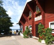
Uklei-Fährhaus Cafe-Restaurant-Ho
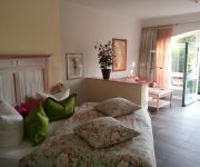
EUT - IN Alte Straßenmeisterei
Das kleine Hotel
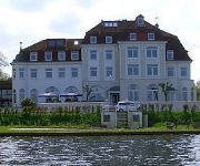
SeeSchloss am Kellersee
Videos from this area
These are videos related to the place based on their proximity to this place.
Mein Immenhofbesuch im Juli 2013
Hier seht ihr ein kleines Video von meinem Immenhof - Besuch im Juli 2013. Ich habe nur den Hof und nicht die anderen Drehorte besucht. Das war vielleicht für längere Zeit mein letzter Besuch,...
Seggerling sailing
Seggerling sailing in summer 2010. Kellersee/North Germany Seggerling is a class, ideal for self building.
Der Immenhof
In diesem Video zeige ich euch den berühmten Immenhof. Auch ein kleine Rundgang durch das Herrenhaus ist zu bestaunen. Ich wünsche euch viel Spass bei meinem kleinen Rundgang.
Immenhof Drehorte 2014
In diesem Video könnt ihr euch einen Vergleich der Drehorte der Immenhof - Filme der 50er Jahre und wie es heute dort aussieht ansehen. Um besser zu erkennen um welchen Drehort es sich handelt, ...
BangbüX - Cable Wasserski Wakeboard Park Süsel 05 / 2013
Die ersten Testaufnahmen mit der GoPro Hero 3 Black Edition im Wasserski und Wakeboard Park Süsel.Weitere Videos folgen in Kürze.
Panoramavideo über Schönwalde am Bungsberg
Panoramavideo über Schönwalde am Bungsberg- gefilmt aus einem 30 Meter Hubsteiger.
DE Bungsberg
Eine 109,9 km lange Strecke mit 880hm die durch die Holsteinische Schweiz führt. Nach ~50km wird auf den höchsten (160 hm) Berg Schleswig Holsteins hochgefahren. Die Abfahrtsneigung wurde...
[Gefahrgutalarm Landespolizeischule Eutin] Großeinsatz für die Einsatzkräfte der Region (HD)
Großalarm in Eutin (Schleswig.Holstein). In der Landespolizeischule Eutin im Ortsteil Füssenau, kam es zu einem Gefahrgutunfall. Großalarm für die Einsatzkräfte der Region Eutin, Lübeck,...
Silvester 2010-2011 in Eutin (Zeitraffer,Time Lapse)
Silvester 2010-2011 in Eutin Zeitraffer Aufnahme der Elisabethstraße.
Jan Gerfast Bluesband Bluesfest Eutin 2012
Great Bluesrock and Chicagoblues from Sweden at the Bluesfest Eutin 2012.
Videos provided by Youtube are under the copyright of their owners.
Attractions and noteworthy things
Distances are based on the centre of the city/town and sightseeing location. This list contains brief abstracts about monuments, holiday activities, national parcs, museums, organisations and more from the area as well as interesting facts about the region itself. Where available, you'll find the corresponding homepage. Otherwise the related wikipedia article.
Großer Eutiner See
The Großer Eutiner See is a lake in Holstein Switzerland, Schleswig-Holstein, Germany. It lies northeast of the town of Eutin. It has an area of 230 hectares, is up to 17 metres deep and lies at a height of about 26.7 m above sea level. It northern side borders directly on the woods of the Seeschaarwald. In the western part of the lake, separated by the Bebensund Bridge, the Fissauer Bucht, its main inflow, the River Schwentine enters, and then leaves again a little further west.
Sibbersdorfer See
The Sibbersdorfer See is a lake in the district of Ostholstein within the region known as Holstein Switzerland in the North German state of Schleswig-Holstein. It lies between Sibbersdorf and Fissau, north of the Großer Eutiner See, near the town of Eutin. It has an area of 60 hectares, is up to 7 metres deep, lies at an elevation of about 26.8 m above sea level and is crossed by the River Schwentine.
Ukleisee
Ukleisee is a lake in Landkreis Ostholstein, Schleswig-Holstein, Germany. At an elevation of 26.5 m, its surface area is 0.32 km². This lake is (as numerous other lakes in this area) a kettle hole, remaining from Weichselian glaciation.
Stendorfer See
The Stendorfer See is a lake west of Kasseedorf in Holstein Switzerland, Schleswig-Holstein, Germany. The lake lies east of the Stendorf Manor House in the parish of Kasseedorf and is surrounded by a rolling moraine landscape. The lake is oblong in shape with a maximum length of about 1,500 metres and a maximum width of about 700 metres. It has an area of some 54 hectares and a maximum depth of about 8 metres, the deepest point being near its northeastern shore.
Eutin Castle
Eutin Castle in Eutin in the north German district of Ostholstein is the cultural centre and nucleus of the town and, together with Gottorf and Glücksburg Castles, belongs to the most important courtly secular buildings in the state of Schleswig-Holstein. The four-winged palace originated from a medieval castle and was expanded over several centuries into a Residenz. The castle originally belonged to the Lübeck prince-bishops, later it became the summer residence of the Dukes of Oldenburg.
Pheasant Island (Eutin)
Pheasant Island is one of the two islands in the south of the lake of Großer Eutiner See, which itself lies in the borough of Eutin in the district of Ostholstein in the German state of Schleswig-Holstein. The island is about 150 × 200 metres across. From the 9th century, Pheasant Island was the site of a Wendish castle which was given the name Utin and was the centre of the eponymous Gau. The castle was linked to the shore over a bridge.
Utin (castle)
Utin (in Latin letters VTIN - also "Uthine") was the name of a Wendish castle that was built in the 9th century on Pheasant Island in the lake known as the Großer Eutiner See in what is now the German state of Schleswig-Holstein. It was the centre of the eponymous Wendish Gau. The castle was linked to the shore via a bridge next to which a settlement, also called Utin, grew up. The castle was destroyed by the Holcetae tribe when they conquered Wagria in 1138/39.


!['[Gefahrgutalarm Landespolizeischule Eutin] Großeinsatz für die Einsatzkräfte der Region (HD)' preview picture of video '[Gefahrgutalarm Landespolizeischule Eutin] Großeinsatz für die Einsatzkräfte der Region (HD)'](https://img.youtube.com/vi/ei8MOBaiclQ/mqdefault.jpg)


