Safety Score: 3,0 of 5.0 based on data from 9 authorites. Meaning we advice caution when travelling to Germany.
Travel warnings are updated daily. Source: Travel Warning Germany. Last Update: 2024-05-17 08:07:57
Discover Oberehe
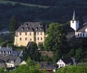
The district Oberehe of Oberehe-Stroheich in Rhineland-Palatinate is a district in Germany about 325 mi south-west of Berlin, the country's capital city.
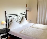
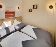
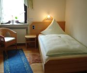
Looking for a place to stay? we compiled a list of available hotels close to the map centre further down the page.
When in this area, you might want to pay a visit to some of the following locations: Dreis-Bruck, Dockweiler, Betteldorf, Hohenfels-Essingen and Hinterweiler. To further explore this place, just scroll down and browse the available info.
Local weather forecast
Todays Local Weather Conditions & Forecast: 13°C / 56 °F
| Morning Temperature | 11°C / 51 °F |
| Evening Temperature | 15°C / 58 °F |
| Night Temperature | 9°C / 48 °F |
| Chance of rainfall | 3% |
| Air Humidity | 83% |
| Air Pressure | 1010 hPa |
| Wind Speed | Gentle Breeze with 7 km/h (4 mph) from East |
| Cloud Conditions | Overcast clouds, covering 100% of sky |
| General Conditions | Light rain |
Sunday, 19th of May 2024
13°C (55 °F)
10°C (49 °F)
Light rain, gentle breeze, overcast clouds.
Monday, 20th of May 2024
20°C (67 °F)
13°C (55 °F)
Light rain, light breeze, scattered clouds.
Tuesday, 21st of May 2024
16°C (61 °F)
12°C (54 °F)
Light rain, gentle breeze, overcast clouds.
Hotels and Places to Stay
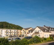
EIFELTRAUM mediterana Entspannen im Land der Vulkane
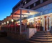
EIFELTRAUM Magma
Kurfürstliches Amtshaus Dauner Burg Schloßhotel
Vulkan Stuben
Landart Hotel Vulkaneifel Beim Brauer
Stadt Daun
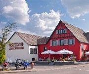
Beim Holzschnitzer Landgasthof
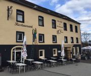
Beim Heines
Videos from this area
These are videos related to the place based on their proximity to this place.
Dreimühlen-Wasserfall | Mechernich | Rhein-Eifel.TV
http://www.rhein-eifel.tv/dreimuehlen-wasserfall.htm - Der nach der benachbarten Ruine Dreimühlen benannte Wasserfall bei Üxheim-Ahütte im Dreieck der Ortschaften Ahütte, Niederehe und...
Damaszener Messer, Messerschmiede Woelund, Eifel - Germany HD
Herstellung Damaszener Messer [dt.] Damaszener Messer zählen zu den leistungsfähigsten Messern der Schmiedezunft. Sie verbinden lange anhaltende Schärfe der Klinge mit der Bruchsicherheit...
Rallye Oberehe 2011 WP3 Loogh/Walsdorf - BMW 318 iS -
Rallye Oberehe 2011 -- Oberehe 40 years on stage -- Rallye Oberehe 2011 WP3 Loogh/Walsdorf - BMW 318 iS - Es war sehr nass bei der diesjährigen Rallye Oberehe. Das Video wurde mit einem...
Rallye Oberehe 2011 WP3 Loogh/Walsdorf - Peugeot 306-
Rallye Oberehe 2011 -- Oberehe 40 years on stage -- WP3 Loogh/Walsdorf - Peugeot 306- Es war sehr nass bei der diesjährigen Rallye Oberehe. Das Video wurde mit einem Handy aufgenommen...
Bundes BdSJ: Auf dem Nürburgring / Die BJT 2012 in Daun / Tag 2 (2/4)
Ihr seht hier den Rückblick auf den zweiten Tag der BJT 2012 in Daun (Eifel) in der Diözese Trier. Dies ist nur eines von vielen Videos vom zweiten Tag. Auf diesem seht ihr die Tagestour...
Zugvögel über Daun-Waldkönigen
11.2.2014. Die armen Viecher fliegen seit Wochen im Kreis und wissen nicht ob ab in den Süden, oder doch wieder nordwärts...
Adler- und Wolfspark | Rhein-Eifel.TV
http://www.rhein-eifel.tv/adler-und-wolfspark.htm - Film über Adler- und Wolfspark auf der Kasselburg in Pelm bei Gerolstein mit Greifvogelflugschau und Wolfsfütterung. Der bekannte Tierpark...
Videos provided by Youtube are under the copyright of their owners.
Attractions and noteworthy things
Distances are based on the centre of the city/town and sightseeing location. This list contains brief abstracts about monuments, holiday activities, national parcs, museums, organisations and more from the area as well as interesting facts about the region itself. Where available, you'll find the corresponding homepage. Otherwise the related wikipedia article.
Vulkaneifel
Vulkaneifel is a district (Kreis) in the northwest of the state Rhineland-Palatinate, Germany. It is the least densely populated district in the state and the fourth most sparsely populated district in Germany. The administrative centre of the district is in Daun. Neighboring districts are Euskirchen, Ahrweiler, Mayen-Koblenz, Cochem-Zell, Bernkastel-Wittlich, and Bitburg-Prüm.
Hotspot (geology)
The places known as hotspots or hot spots in geology are volcanic regions thought to be fed by underlying mantle that is anomalously hot compared with the mantle elsewhere. They may be unanimously hot, and provide a great deal of molten magma. They may be on, near to, or far from tectonic plate boundaries. There are two hypotheses to explain them. One suggests that they are due to hot mantle plumes that rise as thermal diapirs from the core-mantle boundary.
Eifel Transmitter
The Eifel Transmitter is an FM and TV transmission facility for the German broadcasting company of SWR and is located on the Scharteberg near Kirchweiler, Germany. Until 1985, the Scharteberg transmitter used a 160 metre tall guyed mast. However this mast did not allow good reception in deep valleys, so in 1985 a new, 302 metre tall, guyed, steel framework mast was built, becoming the tallest structure of Rhineland-Palatinate.
Hoher List Observatory
The Hoher List Observatory (German: Observatorium Hoher List) is an astronomical observatory located about 60 km south of Bonn, Germany, near the town of Daun in the mountain range of Eifel. The observatory is operated by the Argelander Institute for Astronomy of the University of Bonn. Until the 1940s, Bonn astronomical observations were carried out mainly from Argelander's old observatory in Bonn itself.
Adenau (Verbandsgemeinde)
Adenau is a Verbandsgemeinde ("collective municipality") in the district of Ahrweiler, in Rhineland-Palatinate, Germany. The seat of the municipality is in Adenau. The Verbandsgemeinde Adenau consists of the following Ortsgemeinden ("local municipalities", population in 2006 in parentheses):
Gerolstein (Verbandsgemeinde)
Gerolstein is a Verbandsgemeinde ("collective municipality") in the district Vulkaneifel, in Rhineland-Palatinate, Germany. The seat of the Verbandsgemeinde is in Gerolstein. The Verbandsgemeinde Gerolstein consists of the following Ortsgemeinden ("local municipalities"):
Hillesheim (Verbandsgemeinde)
Hillesheim is a Verbandsgemeinde ("collective municipality") in the district Vulkaneifel, in Rhineland-Palatinate, Germany. The seat of the Verbandsgemeinde is in Hillesheim. The Verbandsgemeinde Hillesheim consists of the following Ortsgemeinden ("local municipalities"): Basberg Berndorf Dohm-Lammersdorf Hillesheim Kerpen Nohn Oberbettingen Oberehe-Stroheich Üxheim Walsdorf
Kelberg (Verbandsgemeinde)
Kelberg is a Verbandsgemeinde ("collective municipality") in the district Vulkaneifel, in Rhineland-Palatinate, Germany. The seat of the Verbandsgemeinde is in Kelberg. The Verbandsgemeinde Kelberg consists of the following Ortsgemeinden ("local municipalities"):
Südschleife
The Nürburgring Südschleife (south loop) was a German motor racing circuit which was built at the same time as the world-famous Nürburgring Nordschleife (north loop). These two layouts were joined together by the Start und Ziel (start/finish) area and could therefore be driven as one track that was over 28 kilometres long.
Büchelstein
Büchelstein is a mountain of Bavaria, Germany.
Lissingen Castle
Lissingen Castle is a well-preserved former moated castle dating to the 13th century. It is located on the River Kyll in Gerolstein in the administrative district of Vulkaneifel in Rhineland-Palatinate, Germany. From the outside it appears to be a single unit, but it is a double castle; an estate division in 1559 created the so-called lower castle and upper castle, which continue to have separate owners.
Wallender Born
The Wallender Born or Wallenborn [1 1] (popularly known as the Brubbel) is a cold water geyser in the village Wallenborn (Eifel district, Germany). It is adjacent to the reactivated 2006 Geyser Andernach on the value Namedyer an active cold water geyser in Germany. Experts disagree on whether the Wallender Born can be described as eruptive course. At least gas periodic outbreaks have witnessed since time immemorial.


