Safety Score: 3,0 of 5.0 based on data from 9 authorites. Meaning we advice caution when travelling to Germany.
Travel warnings are updated daily. Source: Travel Warning Germany. Last Update: 2024-05-16 08:19:50
Explore Rom
The district Rom of Lasserg in Rhineland-Palatinate is located in Germany about 305 mi south-west of Berlin, the country's capital.
If you need a place to sleep, we compiled a list of available hotels close to the map centre further down the page.
Depending on your travel schedule, you might want to pay a visit to some of the following locations: Burgen, Moselkern, Macken, Hatzenport and Wierschem. To further explore this place, just scroll down and browse the available info.
Local weather forecast
Todays Local Weather Conditions & Forecast: 15°C / 59 °F
| Morning Temperature | 11°C / 52 °F |
| Evening Temperature | 14°C / 56 °F |
| Night Temperature | 12°C / 53 °F |
| Chance of rainfall | 9% |
| Air Humidity | 89% |
| Air Pressure | 1008 hPa |
| Wind Speed | Gentle Breeze with 8 km/h (5 mph) from South-East |
| Cloud Conditions | Overcast clouds, covering 100% of sky |
| General Conditions | Moderate rain |
Saturday, 18th of May 2024
16°C (61 °F)
12°C (53 °F)
Light rain, light breeze, overcast clouds.
Sunday, 19th of May 2024
15°C (60 °F)
12°C (53 °F)
Light rain, light breeze, overcast clouds.
Monday, 20th of May 2024
18°C (65 °F)
12°C (54 °F)
Light rain, gentle breeze, broken clouds.
Hotels and Places to Stay
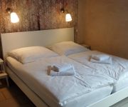
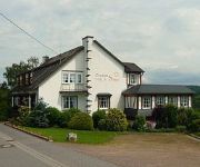
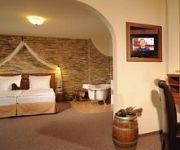
Parkhotel Krähennest Moselstern Hotel
Waldeck Mosellandhotel
Romantisches Hotel zur Post
Traube Niederfell Gasthaus
Hotel Pastis
Landhaus Sonne Garni
Ehrenburg
Lellmann
Traube
Sewenig Weingut-Brennerei
Videos from this area
These are videos related to the place based on their proximity to this place.
Münstermaifeld | Kirche | Rhein-Eifel.TV
http://www.rhein-eifel.tv/muenstermaifeld-kirche.htm - Die ehemalige Stiftskirche St. Martin und St. Severus in Münstermaifeld wird auch als "Maifeldmünster" bezeichnet. Sie wurde im 12....
22.10.09, 18:30 Uhr: Christoph 23 in Münstermaifeld zur Menschenrettung
22.10.09, 18:30 Uhr: der Cristoph 23 landete in Münstermaifeld unterhalb des Friedhofes zur Menschenrettung Da die Crew des Hubschraubers keine Daten zum Patienten rausgibt, konnte man...
Burg Eltz - die Burg der vielen Epochen
Unzerstört , die Burg aus dem Mittelalter - Anschrift : Gräflich Eltz`sche Kastellanei Burg Eltz ,D - 56294 Münstermaifeld , Tel: ( 02672) 950500.
Reineke Fuchs Mörzer Rezitäter Orginal
Reineke Fuchs von Wolfgang Goethe in eine OpenAir Aufführung im idyllischen Schrumpftal bei Münstermaifeld/Mörz.
Der Führerschein
Elisabeth Wölbert (Jahrgang 1925) erzählt vom ersten Führerschein in Münstermaifeld und von der Prüfung, welche ihr Vater dazu bestehen musste. Auszug aus der DVD "En Meensterer verzellt".
Meensterer Spottvöjel
Rudi Schlegel (Jahrgang 1929) erinnert an die "Meensterer Eckensteher", die sich bevorzugt an der Ecke Bornstraße/Untertorstraße aufhielten und so manchen Schabernack trieben. Auszug aus...
Weihnachtsmarkt Mörz von Henny Monzel
In dem kleinen Ort Mörz gibt es einen der schönsten Weihnachtsmärkte.
Nasse's Nachtleben
Christel Tenhonsel (Jahrgang 1919) erinnert sich an die Metternicher "Nachteulen", die öfter der Putzfrau im Weg standen. Auszug aus der DVD "En Meensterer verzellt".
Videos provided by Youtube are under the copyright of their owners.
Attractions and noteworthy things
Distances are based on the centre of the city/town and sightseeing location. This list contains brief abstracts about monuments, holiday activities, national parcs, museums, organisations and more from the area as well as interesting facts about the region itself. Where available, you'll find the corresponding homepage. Otherwise the related wikipedia article.
Mayen-Koblenz
Mayen-Koblenz is a district (Kreis) in the north of Rhineland-Palatinate, Germany. Neighboring districts are (from north clockwise) Ahrweiler, Neuwied, Westerwaldkreis, district-free Koblenz, Rhein-Lahn, Rhein-Hunsrück, Cochem-Zell, and Vulkaneifel.
Rhein-Hunsrück-Kreis
Rhein-Hunsrück is a district (Kreis) in the middle of Rhineland-Palatinate, Germany. The neighbouring districts are (from north clockwise) Mayen-Koblenz, Rhein-Lahn, Mainz-Bingen, Bad Kreuznach, Birkenfeld, Bernkastel-Wittlich, Cochem-Zell.
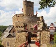
Eltz Castle
Burg Eltz is a medieval castle nestled in the hills above the Moselle River between Koblenz and Trier, Germany. It is still owned by a branch of the same family that lived there in the 12th century, 33 generations ago. The Rübenach and Rodendorf families' homes in the castle are open to the public, while the Kempenich branch of the family uses the other third of the castle.
Nature One
Nature One is one of the largest European open air Electronic music festivals, featuring many renowned DJs from Germany and all over the world. In significance it is not as big as Mayday nor as old, having started 3 years later than the Mayday festival. However attendance has surpassed the Mayday, even when one takes into account that the Mayday only lasts one evening, while the Nature One has 2 main evenings with additional smaller events from Thursday till Sunday.
BGM-109G Ground Launched Cruise Missile
The Ground Launched Cruise Missile, or GLCM, (officially designated BGM-109G Gryphon) was a ground-launched cruise missile developed by the United States Air Force in the last decade of the Cold War.
Goloring
The Goloring is an ancient earthworks monument located near Koblenz, Germany. It was created in the Bronze Age era, which dates back to the Urnfield culture. During this time a widespread solar cult is believed to have existed in Central Europe. The Goloring consists of a circular ditch of 175 metres in diameter with an outside embankment extending to 190 metres. Technically this makes the structure a henge monument, although the use of the term henge outside of Britain is sometimes disputed.
Pydna (missile base)
Pydna is a former American missile base in Kastellaun, Germany. Nuclear-equipped MGM-1 Matador, MGM-13 Mace and Nike-Hercules Missiles were stationed here. It now hosts Nature One, a famous open-air electronic music festival. Festival facilities now utilize the very bunkers that were once home to 64 Ground-Launch Cruise Missiles (GLCM) (BGM-109), Tactical Nuclear Missiles, under the operational control of the 38th Tactical Missile Wing of the United States Air Force.
Bundesautobahn 61
Bundesautobahn 61 is an autobahn in Germany that connects the border to the Netherlands near Venlo in the northwest to the interchange with A 6 near Hockenheim. In 1965, this required a redesign of the Hockenheimring. The autobahn runs parallel to the A 3 on the opposite side of the Rhine.
Elzbach
The Elzbach is a small river in Rhineland-Palatinate, Germany, a left tributary of the Moselle. It rises in the Eifel, near Kelberg. The Elz flows through Monreal and along the castle Burg Eltz. It flows into the Moselle in Moselkern, in the Verbandsgemeinde of Treis-Karden.
Maifeld
Maifeld is a Verbandsgemeinde ("collective municipality") in the district Mayen-Koblenz, in Rhineland-Palatinate, Germany. It is situated south-east of Mayen, and west of Koblenz. The seat of the municipality is in Polch. The Verbandsgemeinde Maifeld consists of the following Ortsgemeinden ("local municipalities"):
Untermosel
Untermosel is a Verbandsgemeinde ("collective municipality") in the district Mayen-Koblenz, in Rhineland-Palatinate, Germany. It is situated along the lower course of the Mosel, south-west of Koblenz. The seat of the municipality is in Kobern-Gondorf. The Verbandsgemeinde Untermosel consists of the following Ortsgemeinden ("local municipalities"): Alken Brodenbach Burgen Dieblich Hatzenport Kobern-Gondorf Lehmen Löf Macken Niederfell Nörtershausen Oberfell Winningen
Bischofstein Castle (Germany)
Bischofstein Castle is a castle on the Moselle in Germany. The castle sits between Moselkern and Hatzenport and across from the borough of Burgen. It was a stronghold belonging to the Archbishops of Treves. A characteristic attribute of the castle are its tall cylindrical donjon tower girt round with a white plaster streak about halfway up and the ruined chapel adjoining it. The castle was built in 1270, destroyed in 1689 and rebuilt again in 1930.
Waldeck Castle
Castle Waldeck within the limits of the village of Dorweiler in Dommershausen in the Rhein-Hunsrück-Kreis in Rhineland-Palatinate was the main seat of the Hunsrück Family Boos. The ruin lies high above the Baybach valley. William I of Heinzenberg built the fortress in 1150 and, in so doing, established the "Boos-Waldeck" house which was later to become widespread.
Treis-Karden (Verbandsgemeinde)
Treis-Karden is a Verbandsgemeinde ("collective municipality") in the district of Cochem-Zell, in Rhineland-Palatinate, Germany. The seat of the Verbandsgemeinde is in Treis-Karden. The Verbandsgemeinde of Treis-Karden consists of the following Ortsgemeinden ("local municipalities"):
Mendig (Verbandsgemeinde)
Mendig is a Verbandsgemeinde ("collective municipality") in the district Mayen-Koblenz, in Rhineland-Palatinate, Germany. The seat of the municipality is in Mendig. The Verbandsgemeinde Mendig consists of the following Ortsgemeinden ("local municipalities"): Bell Mendig Rieden Thür
Emmelshausen (Verbandsgemeinde)
Emmelshausen is a Verbandsgemeinde ("collective municipality") in the Rhein-Hunsrück district, in Rhineland-Palatinate, Germany. Its seat is in Emmelshausen. The Verbandsgemeinde Emmelshausen consists of the following Ortsgemeinden ("local municipalities"):
Kastellaun (Verbandsgemeinde)
Kastellaun is a Verbandsgemeinde ("collective municipality") in the Rhein-Hunsrück district, in Rhineland-Palatinate, Germany. Its seat is in Kastellaun. The Verbandsgemeinde Kastellaun consists of the following Ortsgemeinden ("local municipalities"):
Kolliger Mühle
The Kolliger Mühle is a watermill in Kollig, in the German Eifel region, 30 km. west of Koblenz and 13 k. from the river Moselle. The water wheel of the Kolliger Mühle is driven by the water of a small river, the Elzbach, also called the Elz. It is one of a great number of watermills in the Eifel region. Other watermills in the neighbourhood are the Gehringer Mühle and the Ölmühle. The oldest part of the mill probably dates from the 17th century.
Moselle Viaduct
The Moselle Viaduct carries the Bundesautobahn 61 over a meander of the river Moselle, connecting the Hunsrück and Eifel mountain ranges. It was built between 1969 and 1972 between the German villages Winningen and Dieblich, about 10 kilometres southwest of Koblenz, where the river Moselle flows into the river Rhine. Moselle Viaduct is also the name of the 1974 bridge where Bundesautobahn 1 between Wittlich and Trier crosses the river Moselle near Schweich.
89th Tactical Missile Squadron
The 89th Tactical Missile Squadron is an inactive United States Air Force unit. Its last assignment was with the 38th Tactical Missile Wing, based at Wueschheim Air Station, West Germany. It was inactivated on 22 August 1990.
Mendig Air Base
Mendig Air Base is a former military airfield located southeast of the city of Mendig, Rhineland-Palatinate, Germany. Until 2007, it was the home of the German Army Aviators School, equipped with seven CH-53 Sea Stallion helicopters. The airfield was closed on 31 December 2007 and the last personnel moved out on 30 June 2008.
Castle Kastellaun
Castle Kastellaun is a ruined medieval castle in Kastellaun in the Rhein-Hunsrück district in Rheinland-Palatinate, Germany.
Koblenz-Winningen Airport
Koblenz-Winningen Airport is a regional airport in Germany. It supports general aviation with no commercial airline service scheduled.


