Safety Score: 3,0 of 5.0 based on data from 9 authorites. Meaning we advice caution when travelling to Germany.
Travel warnings are updated daily. Source: Travel Warning Germany. Last Update: 2024-05-04 08:22:41
Delve into Brohl
The district Brohl of Brohl-Lützing in Rhineland-Palatinate with it's 355 habitants Brohl is a subburb in Germany about 297 mi south-west of Berlin, the country's capital town.
If you need a hotel, we compiled a list of available hotels close to the map centre further down the page.
While being here, you might want to pay a visit to some of the following locations: Rheinbrohl, Hammerstein, Burgbrohl, Gonnersdorf and Leutesdorf. To further explore this place, just scroll down and browse the available info.
Local weather forecast
Todays Local Weather Conditions & Forecast: 14°C / 57 °F
| Morning Temperature | 7°C / 45 °F |
| Evening Temperature | 10°C / 51 °F |
| Night Temperature | 9°C / 48 °F |
| Chance of rainfall | 7% |
| Air Humidity | 57% |
| Air Pressure | 1015 hPa |
| Wind Speed | Gentle Breeze with 6 km/h (4 mph) from North |
| Cloud Conditions | Overcast clouds, covering 100% of sky |
| General Conditions | Moderate rain |
Sunday, 5th of May 2024
14°C (57 °F)
11°C (52 °F)
Light rain, gentle breeze, overcast clouds.
Monday, 6th of May 2024
17°C (62 °F)
11°C (53 °F)
Light rain, light breeze, overcast clouds.
Tuesday, 7th of May 2024
14°C (57 °F)
10°C (50 °F)
Light rain, light breeze, overcast clouds.
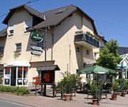
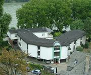
Hotels and Places to Stay
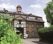
Schloss Burgbrohl Wellness- & Tagungshotel
Hotel am Ochsentor
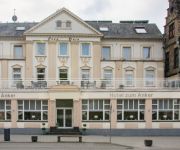
Hotel zum Anker
Zur Engelsburg
Cafè am Rheinsteig Pension
Burgklause
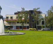
Park-Hotel Bad Hönningen
Vier Jahreszeiten Rhein-Hotel
Klein & Fein
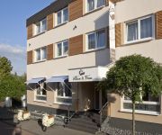
Villa am Rhein
Videos from this area
These are videos related to the place based on their proximity to this place.
Bad Breisig Mod Weekender 2010 Party Day 3
People dancing at Bad Breisig Mod Weekenender 2010 day 3.
MS Asbach am 17.07.2013 vor Bad Breisig.
MS Asbach fährt am 17.07.2013 von Bad Breisig nach Bad Hönningen. Das Schiff beendet damit die Linienfahrt von Mainz nach Bad Breisig.
Feldbohne on Tour - Angeln am Rhein 21.04.13
Angeln am Rhein, Hammerstein (Insel) RLP (50.47444 7.35059). Korrektur Fisch:Schwarzmundgrundel sind das gewesen! Danke an Hr. Waldemar Akst Video war geplant wie das zuvor zum testen von...
Kasbachtal Railway and Vulkan Express Brohltabahn, October 2011
During our recent trip to Remagen we also visited the Kasbachtal Railway on the opposite banks of the Rhine at Linz. We then visited the Vulkan Express at Brohl.
90 Seconds Photo Presentation LIMES Action
One more - here are new photos of our start event of "LIMES Action". In april and may 2012 there will be some more events in the Limes region of rheineland-palatinate mit entrepreneurs and...
Dampfsonderfahrt Königsdampf und Schaufelrad Teil 4
S 3/6 und 01 066 am 01.05.2011 in Bad Hönningen auf dem Weg nach Mainz.
Train DB en passage (part 1)
Train DB de marchandises en passage en gare de Brohl entre Köln et Koblenz - 28/06/2008.
Videos provided by Youtube are under the copyright of their owners.
Attractions and noteworthy things
Distances are based on the centre of the city/town and sightseeing location. This list contains brief abstracts about monuments, holiday activities, national parcs, museums, organisations and more from the area as well as interesting facts about the region itself. Where available, you'll find the corresponding homepage. Otherwise the related wikipedia article.
Ludendorff Bridge
The Ludendorff Bridge (known frequently by English speaking people during World War II as the Bridge at Remagen) was a railroad bridge across the Rhine River in Nazi Germany, connecting the villages of Remagen and Erpel between two ridges of hills flanking the river. Remagen is located close to and south of the city of Bonn.
Wied (river)
The Wied is a river in Rhineland-Palatinate, Germany, right tributary of the Rhine. It is 102 km long. It flows generally south-west, through the Westerwald hills. Its source is near Dreifelden. It flows through Altenkirchen, Neustadt (Wied) and Waldbreitbach, and ends in the Rhine in Neuwied.
Maria Laach Abbey
Maria Laach Abbey is a Benedictine abbey situated on the southwestern shore of the Laacher See (Lake Laach), near Andernach, in the Eifel region of the Rhineland-Palatinate in Germany. It is a member of the Beuronese Congregation within the Benedictine Confederation. The abbey was known for nearly 770 years as "Abtei Laach" ("Abbatia Lacensis" or "Laach Abbey", meaning the "Lake Abbey") until 1862 when the Jesuits added the name "Maria".
Pellenz
Pellenz is a Verbandsgemeinde ("collective municipality") in the district Mayen-Koblenz, in Rhineland-Palatinate, Germany. It is situated north-east of Mayen, and south of Andernach. The seat of the municipality is in Andernach, which is not part of the municipality itself. The Verbandsgemeinde Pellenz consists of the following Ortsgemeinden ("local municipalities"): Kretz Kruft Nickenich Plaidt Saffig
Laacher See
Laacher See or Laach Lake (in English) is a volcanic crater lake with a diameter of two kilometres in Rhineland-Palatinate, Germany, about 40 kilometres south of Bonn. It is in the Eifel mountain range, and is part of the 'East Eifel volcanic field'. The lake was formed by a Plinian eruption approximately 12,900 years ago with a Volcanic Explosivity Index of 6, similar to the the Pinatubo eruption of 1991.
Brohltal
Brohltal is a Verbandsgemeinde ("collective municipality") in the district of Ahrweiler, in Rhineland-Palatinate, Germany. It is situated approx. 30 km north-west of Koblenz. The seat of the municipality is in Niederzissen. The Verbandsgemeinde Brohltal consists of the following Ortsgemeinden ("local municipalities"):
Martinus-Gymnasium Linz
The Martinus-Gymnasium Linz (MGL) is a public Gymnasium in Linz/Rhine, Germany. The educational establishment has more than 900 pupils (aged 11–19) and about 70 teachers. Founded over 300 years ago, the Martinus-Gymnasium is one of the oldest schools in Rhineland-Palatinate. It is named after Saint Martin of Tours who is its patron. Headmaster of Martinus-Gymnasium is Mr. Axel Brott since February 2008.
Bad Breisig (Verbandsgemeinde)
Bad Breisig is a Verbandsgemeinde ("collective municipality") in the district of Ahrweiler, in Rhineland-Palatinate, Germany. The seat of the municipality is in Bad Breisig. The Verbandsgemeinde Bad Breisig consists of the following Ortsgemeinden ("local municipalities"): Bad Breisig Brohl-Lützing Gönnersdorf
Bad Hönningen (Verbandsgemeinde)
Bad Hönningen is a Verbandsgemeinde ("collective municipality") in the district of Neuwied, in Rhineland-Palatinate, Germany. The seat of the Verbandsgemeinde is in Bad Hönningen. The Verbandsgemeinde Bad Hönningen consists of the following Ortsgemeinden ("local municipalities"): Bad Hönningen Hammerstein Leutesdorf
Linz am Rhein (Verbandsgemeinde)
Linz am Rhein is a Verbandsgemeinde ("collective municipality") in the district of Neuwied, in Rhineland-Palatinate, Germany. The seat of the eponymously named Verbandsgemeinde is in the town of Linz am Rhein. The Verbandsgemeinde Linz am Rhein consists of the following Ortsgemeinden ("local municipalities"): Dattenberg Kasbach-Ohlenberg Leubsdorf Linz am Rhein Ockenfels Sankt Katharinen Vettelschoß
Waldbreitbach (Verbandsgemeinde)
Waldbreitbach is a Verbandsgemeinde ("collective municipality") in the district of Neuwied, in Rhineland-Palatinate, Germany. The seat of the Verbandsgemeinde is in Waldbreitbach. The Verbandsgemeinde Waldbreitbach consists of the following Ortsgemeinden ("local municipalities"): Breitscheid Datzeroth Hausen (Wied) Niederbreitbach Roßbach
Mendig (Verbandsgemeinde)
Mendig is a Verbandsgemeinde ("collective municipality") in the district Mayen-Koblenz, in Rhineland-Palatinate, Germany. The seat of the municipality is in Mendig. The Verbandsgemeinde Mendig consists of the following Ortsgemeinden ("local municipalities"): Bell Mendig Rieden Thür
Rederscheid
Rederscheid is a village in the municipality of Windhagen in the district of Neuwied, Rhineland-Palatinate, Germany. The village has about 500 inhabitants in 100 households. Rederscheid was incorporated into Windhagen on November 8, 1970.
Breite Heide
Breite Heide is a locality in the municipality Rheinbreitbach in the district of Neuwied in Rhineland-Palatinate, Germany.
Frohnen
Frohnen is a locality in the municipality Windhagen in the district of Neuwied in Rhineland-Palatinate, Germany.
Hallerbach
Hallerbach is a locality in the municipality Windhagen in the district of Neuwied in Rhineland-Palatinate, Germany.
Schweifeld
Schweifeld is a locality in the municipality Windhagen in the district of Neuwied in Rhineland-Palatinate, Germany.
Ginsterhahn
Ginsterhahn is a locality in the municipality Sankt Katharinen in the district of Neuwied in Rhineland-Palatinate, Germany.
Notscheid
Notscheid is a locality in the municipality Sankt Katharinen in the district of Neuwied in Rhineland-Palatinate, Germany.
Strödt
Strödt is a locality in the municipality Sankt Katharinen in the district of Neuwied in Rhineland-Palatinate, Germany.
Steinshardt
Steinshardt is a locality in the municipality Sankt Katharinen in the district of Neuwied in Rhineland-Palatinate, Germany.
Mendig Air Base
Mendig Air Base is a former military airfield located southeast of the city of Mendig, Rhineland-Palatinate, Germany. Until 2007, it was the home of the German Army Aviators School, equipped with seven CH-53 Sea Stallion helicopters. The airfield was closed on 31 December 2007 and the last personnel moved out on 30 June 2008.
Andernach station
Andernach station is the transportation hub of the city of Andernach in the German state of Rhineland-Palatinate. It is a middle-sized stations with thousands of passengers each day. It is currently classified by Deutsche Bahn as a category 4 station. After completion of the renovation, it will be classified as a category 3 station. It has four passenger paltforms (tracks 1, 2, 3 and 24), three with a length of more than 280 m, and sidings and freight tracks.
Remagen station
Remagen station is on the Left Rhine line in the city of Remagen in the German state of Rhineland-Palatinate. It is classified by Deutsche Bahn as a category 4 station. The station is served by regular regional services as well as Intercity and EuroCity services. It is also the starting point of the Ahr Valley Railway (Ahrtalbahn).
Apollinariskirche, Remagen
The Apollinariskirche is a church on the site of a Roman temple on the Apollinarisberg, a hill above the German town of Remagen. That hill was known as the Martinsberg in the 5th and 6th centuries, presumably after a Frankish chapel there dedicated to Saint Martin, patorn of the Franks. In the 9th century this chapel was replaced by a Romanesque church. In 1110 the Benedictines of the Michaelsberg Abbey, on the initiative of the people of Remagen, set up a provost there.


