Safety Score: 3,0 of 5.0 based on data from 9 authorites. Meaning we advice caution when travelling to Germany.
Travel warnings are updated daily. Source: Travel Warning Germany. Last Update: 2024-04-29 08:03:39
Discover Keyenberg
Keyenberg in Cologne District (North Rhine-Westphalia) is a place in Germany about 315 mi (or 507 km) west of Berlin, the country's capital city.
Current time in Keyenberg is now 08:58 AM (Tuesday). The local timezone is named Europe / Berlin with an UTC offset of 2 hours. We know of 9 airports near Keyenberg, of which 5 are larger airports. The closest airport in Germany is Mönchengladbach Airport in a distance of 11 mi (or 18 km), North. Besides the airports, there are other travel options available (check left side).
There are several Unesco world heritage sites nearby. The closest heritage site in Germany is Aachen Cathedral in a distance of 26 mi (or 41 km), South-West. If you need a hotel, we compiled a list of available hotels close to the map centre further down the page.
While being here, you might want to pay a visit to some of the following locations: Titz, Juchen, Moenchengladbach, Viersen and Schwalmtal. To further explore this place, just scroll down and browse the available info.
Local weather forecast
Todays Local Weather Conditions & Forecast: 19°C / 66 °F
| Morning Temperature | 11°C / 52 °F |
| Evening Temperature | 19°C / 67 °F |
| Night Temperature | 15°C / 59 °F |
| Chance of rainfall | 2% |
| Air Humidity | 66% |
| Air Pressure | 1016 hPa |
| Wind Speed | Gentle Breeze with 6 km/h (4 mph) from West |
| Cloud Conditions | Overcast clouds, covering 98% of sky |
| General Conditions | Light rain |
Wednesday, 1st of May 2024
18°C (65 °F)
15°C (60 °F)
Heavy intensity rain, light breeze, overcast clouds.
Thursday, 2nd of May 2024
20°C (68 °F)
11°C (52 °F)
Moderate rain, fresh breeze, overcast clouds.
Friday, 3rd of May 2024
11°C (53 °F)
10°C (50 °F)
Moderate rain, moderate breeze, overcast clouds.
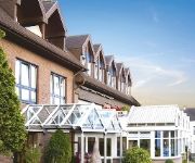
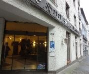
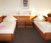
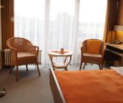
Hotels and Places to Stay
Freiraum stattHotel
Elisenhof
Spickhofen
Haus Kaiser Garni
Akzent Hotel Landhaus Heinen
Montana
T3 Cityloft
Landhaus Göddertzhof
Rheydter Residenz
Kelzenberg Landgasthof
Videos from this area
These are videos related to the place based on their proximity to this place.
ABGEHOLZT - ein Ort in der Identitätskrise
Der Ort Holz liegt im Dreieck Düsseldorf, Aachen und Mönchengladbach, im nördlichen Teil des Tagebaus Garzweiler 2, 300m von der A46. Leider auf der falschen Seite... Diese Audioslideshow...
Flugtag 2014 Mönchengladbach Wanlo
Über Mönchengladbach Wanlo war die Freiheit am Wochenende wohl grenzenlos. Der Segelflugplatz Wanlo war am 23. und 24. August 2014 für zwei Tage lang der zentrale Dreh- und Angelpunkt...
Monster Machine! Worlds biggest excavator in full operation part 1 / Bagger 288
During our excursion to Garzweiler II we had an encounter with the worlds biggest bucket wheel excavator, Bagger 288 ( Excavator 288 ) build by Krupp in 1978. It is the largest moving land...
Tagebau Garzweiler, Bagger 258
Hier sieht man gut, mit welcher Geschwindigkeit die Maschinen arbeiten.
Sprengung Wasserturm Holz durch das THW
Sprengung Wasserturm Holz durch das THW Gefilmt mit der Canon EOS5D MKII mit EF 70-200/2,8L IS @ 200mm.
Garzweiler
Ein kleiner Rundflug entlang des Tagebaus Garzweiler. Leider mit einer ungeplanten Außenlandung. Comments please :) Setup: DJI Naza mit GPS Coptercity DJI Spider Rahmen ...
Wickrather Schlosspark Turnier 2008
CityVision berichtet über das Wickrather Schlosspark Turnier 2008. www.cityvision.de www.rothermel-catering.de www.schlossparkturnier.de.
Videos provided by Youtube are under the copyright of their owners.
Attractions and noteworthy things
Distances are based on the centre of the city/town and sightseeing location. This list contains brief abstracts about monuments, holiday activities, national parcs, museums, organisations and more from the area as well as interesting facts about the region itself. Where available, you'll find the corresponding homepage. Otherwise the related wikipedia article.
Niers
The Niers is a river in Germany and the Netherlands, right tributary to the river Meuse. Its source is near Erkelenz, south of Mönchengladbach, in North Rhine-Westphalia (Germany). The Niers flows through Mönchengladbach, Viersen, Wachtendonk, Geldern and Goch before flowing into the Meuse just across the border with the Netherlands, in Gennep. Its total length is 116 km - 108 km in Germany, 8 km in the Netherlands.
Odenkirchen
Odenkirchen is a former town in Germany, presently part of the city Mönchengladbach. It is situated on the river Niers, 21 miles by rail south-west of Düsseldorf. It has a railway station, on the line from Mönchengladbach to Grevenbroich and Cologne. Pop. (2000) 19,993. Odenkirchen became a town in 1856. See Wiedemann, Geschichte der ehemaligen Herrschaft und des Hauses Odenkirchen (Odenkirchen, 1879).
Beckrath
Beckrath is a village in North Rhine-Westphalia, Germany, 315 miles (507 km) west of Berlin, 6.1 miles (9.9 km) south of Mönchengladbach.
Köhm
Köhm is a river of North Rhine-Westphalia, Germany.


