Safety Score: 3,0 of 5.0 based on data from 9 authorites. Meaning we advice caution when travelling to Germany.
Travel warnings are updated daily. Source: Travel Warning Germany. Last Update: 2024-05-05 08:24:42
Delve into Thier
The district Thier of Ahe in Cologne District (North Rhine-Westphalia) is a district located in Germany about 276 mi west of Berlin, the country's capital town.
In need of a room? We compiled a list of available hotels close to the map centre further down the page.
Since you are here already, you might want to pay a visit to some of the following locations: Lindlar, Engelskirchen, Kurten, Marienheide and Much. To further explore this place, just scroll down and browse the available info.
Local weather forecast
Todays Local Weather Conditions & Forecast: 15°C / 60 °F
| Morning Temperature | 7°C / 44 °F |
| Evening Temperature | 13°C / 56 °F |
| Night Temperature | 11°C / 52 °F |
| Chance of rainfall | 1% |
| Air Humidity | 54% |
| Air Pressure | 1011 hPa |
| Wind Speed | Gentle Breeze with 7 km/h (4 mph) from East |
| Cloud Conditions | Broken clouds, covering 50% of sky |
| General Conditions | Light rain |
Monday, 6th of May 2024
12°C (53 °F)
11°C (52 °F)
Moderate rain, light breeze, overcast clouds.
Tuesday, 7th of May 2024
16°C (61 °F)
11°C (51 °F)
Light rain, light breeze, overcast clouds.
Wednesday, 8th of May 2024
15°C (60 °F)
11°C (51 °F)
Light rain, gentle breeze, broken clouds.
Hotels and Places to Stay
Landgut Stüttem
Bellevue Privatzimmer
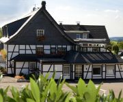
Tönnes Landgasthof
Landhotel Napoleon
Artgenossen
Zum Holländer
Engelskirchen
Biesenbach
Haus Koppelberg
Haus am Markt
Videos from this area
These are videos related to the place based on their proximity to this place.
Erwin der dicke Schneemann - Steffi und Frank
Passend zum (vielleicht) letzten Schnee in diesem Jahr. .-)
CityKart Wipperfürth 2012 Onboard
Zusammenschnitt des CityKart Events 2012 in Wipperfürth. Onboard Perspektive des Fahrers Florian Boxberg vom Holz-Richter Racing-Team.
AVT-Gummikette, Anti-Vibration-Track
Anti-Vibrations-Ketten AVT ist die Neuentwicklung der Gummibandkettentechnologie. Mit den einzelnen rautenförmigen Gliedern und einer durchgängigen Laufrollenführung ist die Vibration der...
Karturnier MSC Wipperfuerth Mai 2003
Trainingsfahrten von Florian Boxberg zum ADAC Jugend Kart Slalom Turnier des MSC Wipperfürth im Jahre 2003.
Parrot Bebop Aerialmovie Ommerborn, Steuern im Profimodus!
Der ausgetauschte Paarot bebop machte eine gute Figur. Im Profimodus der "Handysteuerung" kam ich sehr gut klar. The exchanged Parrot bebop made a good impression. In the professional mode...
Videos provided by Youtube are under the copyright of their owners.
Attractions and noteworthy things
Distances are based on the centre of the city/town and sightseeing location. This list contains brief abstracts about monuments, holiday activities, national parcs, museums, organisations and more from the area as well as interesting facts about the region itself. Where available, you'll find the corresponding homepage. Otherwise the related wikipedia article.
Bergisches Land
The Bergisches Land (Country of Berg or Land of Berg) is a low mountain range region within the state of North Rhine-Westphalia, Germany, east of Rhine river, south of the Ruhr. The landscape is shaped by woods, meadows, rivers and creeks and contains over 20 artificial lakes. Wuppertal is the biggest town and seen as the region's capital, whereas the southern part nowaday has closer economic and socio-cultural ties to Cologne.
Oberbergischer Kreis
The Oberbergischer Kreis is a Kreis in the state of North Rhine-Westphalia, Germany. Neighboring districts are Ennepe-Ruhr, Märkischer Kreis, Olpe, Altenkirchen, Rhein-Sieg, Rheinisch-Bergischer Kreis, and the urban districts Remscheid and Wuppertal.
Ennepe
The Ennepe is a river and a left tributary of the Volme in Northern Sauerland.
Wiehltal bridge
The Wiehltal Bridge is a highway bridge on the A 4 motorway between Cologne and Olpe over the Wiehltal valley at Engelskirchen, North Rhine-Westphalia, Germany.
Vordermühle
Vordermühle is village in the town of Wipperfürth which is a Northrhine-Westfalian municipality in the Oberbergischer Kreis, about 40 km north-east of Cologne.
Wipperfeld
Wipperfeld is village and a district in the town of Wipperfürth which is a Northrhine-Westphalian municipality in the Oberbergischer Kreis, about 40 km north-east of Cologne.
Lüttringhausen
Lüttringhausen is a district of the German town of Remscheid with a population of 17,857 in 2005; 11,829 in 1905; 13,560, mostly Evangelical, in 1910.
Bergisch Gladbach Observatory
The Bergisch Gladbach Observatory is an astronomical observatory located in Bergisch Gladbach, Germany, at {{#invoke:Coordinates|coord}}{{#coordinates:51|05|15.4|N|7|29|08.8|E|type:landmark_region:DE | |name= }}. Its observatory code is 621. Astronomer Wolf Bickel.
Wefelpütt
Wefelpütt is a small village in Germany with only 63 inhabitants. Since 1929 it belongs to the city of Wuppertal.
Dahlerau train disaster
The Dahlerau train disaster was a railway accident that took place on May 27, 1971 in Dahlerau, a small town belonging to Radevormwald in West Germany, in which a freight train and a passenger train crashed into each other. Forty-six people perished in the accident; forty-one were senior year pupils of the Geschwister-Scholl-Schule in Radevormwald.
Dahlerau
Dahlerau is a borough of Radevormwald, located in the Oberbergischer Kreis, North Rhine-Westphalia, Germany. It is located in the valley of the river Wupper and situated about 7 km by road away from Radevormwald city centre. Dahlerau was the site of a severe train disaster in 1971.
Archbishop of St. Angela Gymnasium
Archbishop of St. Angela Gymnasium is a German catholic Gymnasium located in Wipperfürth, North Rhine-Westphalia.
Sülz Valley Railway
|} The Sülz Valley Railway is a formerly 45 km long, partly disused railway line from Mülheim via Bergisch Gladbach, Bensberg, Rösrath, Hoffnungsthal and Immekeppel to Lindlar in the German state of North Rhine-Westphalia. S-Bahn services operate on the section between Cologne and Bergisch Gladbach, which is electrified. The remaining section was never electrified and is now largely closed, although some of it is used for freight.
Gelpe
Gelpe is a river of North Rhine-Westphalia, Germany.
Halstenbach (Agger)
Halstenbach (Agger) is a river of North Rhine-Westphalia, Germany.
Hönnige (Wupper)
Hönnige (Wupper) is a river of North Rhine-Westphalia, Germany.
Kerspe
Kerspe is a river of North Rhine-Westphalia, Germany.
Leppe
Leppe is a river of North Rhine-Westphalia, Germany.
Scheuerbach
Scheuerbach is a river of North Rhine-Westphalia, Germany.
Wiehl (Agger)
Wiehl (Agger) is a river of North Rhine-Westphalia, Germany.
Remscheid-Lennep station
Remscheid-Lennep station is in the city of Remscheid in the German state of North Rhine-Westphalia. It is the second most important station in the city after Remscheid Hauptbahnhof. The station is located west of the old centre of Lennep and is classified by Deutsche Bahn as a category 4 station.
Wuppertal-Ronsdorf station
Wuppertal-Ronsdorf station is a station on the Wuppertal-Oberbarmen–Solingen railway in the German state of North Rhine-Westphalia. It is classified by Deutsche Bahn as a category 5 station. It is unusual in that it was once connected to lines with three different gauges.


