Safety Score: 3,0 of 5.0 based on data from 9 authorites. Meaning we advice caution when travelling to Germany.
Travel warnings are updated daily. Source: Travel Warning Germany. Last Update: 2024-04-26 08:02:42
Explore Stierstadt
Stierstadt in Regierungsbezirk Darmstadt (Hesse) is located in Germany about 264 mi (or 424 km) south-west of Berlin, the country's capital.
Local time in Stierstadt is now 05:01 AM (Saturday). The local timezone is named Europe / Berlin with an UTC offset of 2 hours. We know of 12 airports in the wider vicinity of Stierstadt, of which 5 are larger airports. The closest airport in Germany is Frankfurt am Main International Airport in a distance of 11 mi (or 18 km), South. Besides the airports, there are other travel options available (check left side).
There are several Unesco world heritage sites nearby. The closest heritage site in Germany is Messel Pit Fossil Site in a distance of 20 mi (or 32 km), South-East. We found 4 points of interest in the vicinity of this place. If you need a place to sleep, we compiled a list of available hotels close to the map centre further down the page.
Depending on your travel schedule, you might want to pay a visit to some of the following locations: Bad Homburg vor der Hoehe, Wehrheim, Frankfurt am Main, Kriftel and Schmitten. To further explore this place, just scroll down and browse the available info.
Local weather forecast
Todays Local Weather Conditions & Forecast: 17°C / 63 °F
| Morning Temperature | 6°C / 42 °F |
| Evening Temperature | 18°C / 64 °F |
| Night Temperature | 13°C / 56 °F |
| Chance of rainfall | 0% |
| Air Humidity | 44% |
| Air Pressure | 1009 hPa |
| Wind Speed | Gentle Breeze with 8 km/h (5 mph) from North-West |
| Cloud Conditions | Broken clouds, covering 69% of sky |
| General Conditions | Broken clouds |
Sunday, 28th of April 2024
16°C (60 °F)
12°C (53 °F)
Overcast clouds, gentle breeze.
Monday, 29th of April 2024
17°C (62 °F)
14°C (58 °F)
Light rain, light breeze, overcast clouds.
Tuesday, 30th of April 2024
22°C (72 °F)
15°C (60 °F)
Moderate rain, light breeze, scattered clouds.
Hotels and Places to Stay
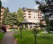
The Rilano Hotel Frankfurt Oberursel
Mercure Hotel Frankfurt Eschborn Helfmann Park
Parkhotel am Taunus
Mercure Hotel Frankfurt Eschborn Sued
Dorint Oberursel
Mercure Hotel Frankfurt Eschborn Ost
MOXY Frankfurt Eschborn
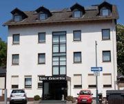
Concordia
Beuss
Central
Videos from this area
These are videos related to the place based on their proximity to this place.
Holz-Terrasse und andere Holzbauarbeiten für Oberursel, Bad Homburg - BohnHolzbau
Holz-Terrasse und andere Holzbauarbeiten für Oberursel, Bad Homburg - weitere Infos unter http://www.bohnholzbau.de/terrassen/
Bürgerschoppen Steinbach Taunus 1 Mai 2014
Rund um den Finanzplatz Eschborn-Frankfurt Bürgermeister Naas Grabiger Würste.
Steinbach/Ts. (HG) - St. Georg - Plenum
Plenum der evangelischen St. Georgskirche Steinbach (Taunus) zum Einläuten des Sonntags Disposition: 1 dis", 1699 J. Schneidewind, Frankfurt - St. Georg 2 fis", 1956 Gebr. Rincker, Sinn -...
Maislabyrinth / Corn Maze in Oberursel Weisskirchen / Frankfurt am Main
Flight with a quadrocopter over the corn maze in Oberursel Weisskirchen near Frankfurt am Main Germany. Quadrocopertflug über das Maislabyrinth in Oberursel Weisskirchen bei Frankfurt am...
Kerb Weißkirchen Fassanstich
Eröffnung der Kerb in Oberursel-Weißkirchen am 8. September 2012. Fassanstich durch Frank Metlicar, General Manager Mövenpick Hotel Frankfurt/Oberursel und einer der Sponsoren der Kerb....
Fahrt zur Arbeit auf der A5/A661 Darmstadt - Oberursel
Fahren Sie mit mir auf der A5 und der A661 von Darmstadt-Eberstadt nach Oberursel zu Thomas Cook. In nur 8 Minuten erleben was oft eine Stunde dauert.
Musical Miracle Gymnasium Oberursel
"Miracle - Wunderkinder" ist das 25. Musical des Gymnasiums Oberursel. Es wurde am 7., 8. und 9. November 2014 in der Neuen Aula des Gymnasiums Oberursel aufgeführt. Skript, Regie, Kostüme...
private Feuershow in Oberursel (zur 6. Oberurseler Feyerey) - für Renaldo und Ines - Die Spießer
private Feuershow als nachträgliches Hochzeitsgeschenk für Renaldo und Ines vom Spießer-Stand Feuershow: - Jana Bales - Frauke Anacker - Isabelle Zentner - Marcel Feldbusch Musik:...
BÜ Oberursel Frankfurter Ldstr. mit VT 2E+BR 423
Da dieser Bahnübergang im Zuge des Hessentags in spätestens einem Jahr einer Personenunterführung gewichen sein wird, hier noch mal zum Gedenken eine (etwas ältere) Aufnahme der Anlage....
Videos provided by Youtube are under the copyright of their owners.
Attractions and noteworthy things
Distances are based on the centre of the city/town and sightseeing location. This list contains brief abstracts about monuments, holiday activities, national parcs, museums, organisations and more from the area as well as interesting facts about the region itself. Where available, you'll find the corresponding homepage. Otherwise the related wikipedia article.
Weißkirchen radio transmitter
The transmitter Weißkirchen is a medium wave broadcasting facility located near Weißkirchen, Oberursel, Germany. It is the most powerful European AM transmitter of the American Forces Network and transmits on 873 kHz with a power of 150 kilowatts. It started operation in May 1951 on 872 kHz and moved its frequency to 873 kHz in 1978 according the regulations of Waveplan of Geneva. Its aerial consists of three guyed lattice steel masts built in 1954/55.
Frankfurt International School
The Frankfurt International School (FIS) is an English-language day school located in Oberursel, near Frankfurt am Main, Germany. Founded in 1961, it is the largest and second oldest international school in Germany and provides instruction to almost 1800 students from over fifty countries from age three to grade twelve. FIS consists of the Primary School (First Steps to grade one), Elementary School (grades two to five), and Upper School (grades six to twelve).
1. FC Eschborn
1. FC Eschborn is a German association football club which plays in Eschborn, a suburb of Frankfurt, Hesse.
Camp King
Camp King is a site on the outskirts of Oberursel, Taunus, with a long history. It began as a school for agriculture under the auspices of the University of Frankfurt. During World War II, the lower fields became an interrogation center for the German Air Force. After World War II, the United States Army also used it as an interrogation center and intelligence post. In 1968, it became the command and control center for the United States Army Movements Control Agency - Europe.
Humboldtschule, Bad Homburg
The Humboldtschule is one of two Gymnasiums, besides the Kaiserin-Friedrich-Gymnasium (KFG), in Bad Homburg vor der Höhe, Hesse, Germany. The eponyms are Alexander (1769–1859) and Wilhelm von Humboldt (1767–1835). Since November 2000 the school is a recognized UNESCO project school (UNESCO-Projektschule). In the school year 2008/2009, the school had 134 teachers and 1,602 students. Starting with school year 2009/2010 the school has 1,750 students. The history of the school goes back to 1900.
Oberursel station
Oberursel (Taunus) station is a station on S-Bahn line S5 in Oberursel (Taunus), near Frankfurt am Main, Germany on the Homburg line. The former Mountain Railway ran from the station to Hohemark; it is now part of U-Bahn line U3.
Urselbach
Urselbach is a river of Hesse, Germany.
Niederhöchstadt station
Niederhöchstadt station is a junction station in the Niederhöchstadt district of the town of Eschborn in the German state of Hesse. The stations of Eschborn and Eschborn Süd are nearby. Just north-west of the station the Limes Railway to Bad Soden separates from the Kronberg Railway to Kronberg. The station is classified by Deutsche Bahn as a category 5 station.


