Safety Score: 3,0 of 5.0 based on data from 9 authorites. Meaning we advice caution when travelling to Germany.
Travel warnings are updated daily. Source: Travel Warning Germany. Last Update: 2024-05-20 08:01:38
Discover Neutrauchburg
The district Neutrauchburg of Dengeltshofen in Tübingen Region (Baden-Württemberg) is a district in Germany about 365 mi south-west of Berlin, the country's capital city.
Looking for a place to stay? we compiled a list of available hotels close to the map centre further down the page.
When in this area, you might want to pay a visit to some of the following locations: Maierhofen, Gestratz, Gruenenbach, Stiefenhofen and Missen-Wilhams. To further explore this place, just scroll down and browse the available info.
Local weather forecast
Todays Local Weather Conditions & Forecast: 22°C / 71 °F
| Morning Temperature | 10°C / 51 °F |
| Evening Temperature | 19°C / 66 °F |
| Night Temperature | 14°C / 57 °F |
| Chance of rainfall | 0% |
| Air Humidity | 42% |
| Air Pressure | 1008 hPa |
| Wind Speed | Gentle Breeze with 7 km/h (4 mph) from South-West |
| Cloud Conditions | Clear sky, covering 5% of sky |
| General Conditions | Sky is clear |
Tuesday, 21st of May 2024
12°C (53 °F)
9°C (48 °F)
Moderate rain, gentle breeze, overcast clouds.
Wednesday, 22nd of May 2024
14°C (58 °F)
9°C (48 °F)
Light rain, gentle breeze, overcast clouds.
Thursday, 23rd of May 2024
15°C (59 °F)
11°C (51 °F)
Moderate rain, light breeze, overcast clouds.
Hotels and Places to Stay
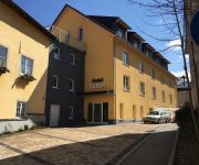
Sonne Neutrauchburg
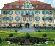
Schloss Neutrauchburg
Allgäuer Terrassenhotel
Berghotel Jägerhof
Naturlandhaus-Krone
Engel Brauereigasthof
Bären
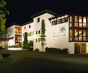
Hohe Linde
Zur Grenze Landhotel
Sontheim Landgasthof
Videos from this area
These are videos related to the place based on their proximity to this place.
Plätzle-Aktion: Mit Carin Wagner in Maierhöfen Rotweinherzen backen
Tag 5 unserer Plätzle-Aktion. Diesmal hat es das Plätzle-Team ins Westallgäu verschlagen, genauer gesagt zu Carin Wagner in Maierhöfen. Sie und ihr Mann kommen ursprünglich aus der Pfälzer...
Büchsenmachen vom Feinsten: Oswald Prinz fertigt exklusive Waffen für exklusive Kunden
Wenn wohlhabende Kunden extra aus Russland oder dem Arabischen Raum ins Allgäu kommen, dann muss das schon einen besonderen Grund haben - und den findet man im Keller von Oswald ...
Wanderung im Eistobel im Allgäu
Der Eistobel ist eine Schlucht des Flusses Obere Argen im Westallgäu. Er verläuft von der Ortschaft Schüttentobel bis etwa zur Argentobelbrücke, welche die Orte Maierhöfen und Grünenbach...
Flüssiges Gold: Regionale Honigproduktion für regionalen Laden
Der Hoimarkt in Kempten setzt auf Regionalität heißt: keine weiten Transportwege und damit Klimafreundlich! Und das heißt auch: hier verkaufen heimatverbundene Kleinunternehmer. das Sortiment...
Träume gehen in Erfüllung - Einzigartige Rarität mit unbeschreiblichem Ausblick - HD Version
In seiner Beschaffenheit und Lage einzigartige Immobilie im Allgäuer Voralpenland mit Panoramablick auf Allgäuer - Österreichische - und Schweizer Alpen und dem Bodensee.
Simson S51 - Ausflug Oldtimertreffen in Seltmans
Kleine Tour mit den Jungens zum Oldtimertreffen in Seltmans.
19. Juli 2014: Hochzeit von Simone und Franz
Gefeiert wurde am heissesten Tag des Jahres im Berghotel Jägerhof bei Isny. Ein schönes und echt schweisstreibedes Fest mit einer tollen kleinen Afterparty auf der Terrasse.
Videos provided by Youtube are under the copyright of their owners.
Attractions and noteworthy things
Distances are based on the centre of the city/town and sightseeing location. This list contains brief abstracts about monuments, holiday activities, national parcs, museums, organisations and more from the area as well as interesting facts about the region itself. Where available, you'll find the corresponding homepage. Otherwise the related wikipedia article.
Natural Science and Technical Academy Isny
The Natural Science and Technical Academy Isny (Naturwissenschaftlich-Technische Akademie Isny, NTA or NTA Isny) is a privately run, state-approved German university focusing in applied sciences, located in Isny im Allgäu. Since its founding in 1945, it has had a steadily expanding scope, including food chemistry (1967, expanded 1994 to include environmental analysis), physical electronics (1968), pharmaceutical chemistry (1972), and computer science (1992).
Allgäu
The Allgäu is a southern German region in Swabia. It covers the south of Bavarian Swabia and southeastern Baden-Württemberg. The region stretches from the prealpine lands up to the Alps. The main rivers flowing through the Allgäu are the Lech and Iller.
Herlazhofen
Herlazhofen is a village in the South-German region Allgäu. The population is approximately 1000 inhabitants.
Molasse basin
The Molasse basin is a foreland basin north of the Alps, that formed during the Oligocene and Miocene epochs. The basin formed due to the flexure of the European plate under the weight of the orogenic wedge of the Alps that was forming to the south. In geology, the name "molasse basin" is sometimes also used in a general sense for a synorogenic (formed contemporaneously with the orogen) forelandbasin of the type north of the Alps.
Illerwinkel
Illerwinkel is a Verwaltungsgemeinschaft (federation of municipalities) in the district of Unterallgäu in Bavaria, Germany. It consists of the following municipalities: Kronburg Lautrach
Waltrams
Waltrams is a village located outside the town of Weitnau, in the Oberallgäu district of Bavaria, Germany.
St. George's Abbey, Isny
St. George's Abbey, Isny (German: Kloster St. Georg) in Isny im Allgäu in Baden-Württemberg, Germany, is a former Benedictine abbey founded in 1096 and secularised in 1802.
Großer Alpsee
Großer Alpsee is a lake in Bayerisch Schwaben, Bavaria, Germany. At an elevation of 724,63 m, its surface area is 247.3 ha.
Thalkirchdorf
Thalkirchdorf is part of the municipality of Oberstaufen in Oberallgäu in the German state of Bayern. The area was occupied since at least 250 BC, when the Roman road Via Decia was built through the Konstanz valley. In the AD 14th century, this was an important route for the transport of salt, an important good at the time.
Meggen Lawn Cross
Meggen Lawn Cross is a mutual overnatural ground picture in Meggen a village, which belongs to Argenbühl in Ravensburg District. Meggen Lawn Cross occurred first on June 30, 1972 in form of a spot without vegetation. Later a cross with a length of 3.3 metres and a width of 1.6 metres occurred. The cross appears each year again. Its origin is unknown. According to investigations of Hohenheim university it is not caused by chemicals or by physical influence.
Raggenhorn
Raggenhorn is a mountain of Baden-Württemberg, Germany.
Schwarzer Grat
Schwarzer Grat is a mountain of Baden-Württemberg, Germany.
Wachbühl
Wachbühl is a mountain of Baden-Württemberg, Germany.
Hohenkapf
Hohenkapf is a mountain of Bavaria, Germany.
Iberg (Allgäu)
Iberg (Allgäu) is a mountain of Bavaria, Germany.
Immenstädter Horn
Immenstädter Horn is a mountain of Bavaria, Germany.
Riedholzer Kugel
Riedholzer Kugel is a mountain of Bavaria, Germany.
Leiblach
The Leiblach is a 33 km long tributary of Lake Constance and the Rhine River. Its source is near the German municipality of Heimenkirch, flowing to the southwest. Near the Austrian town of Hohenweiler, the river joins a small tributary, the Rickenbach. This tributary forms a part of the Austrian-German border, and below the confluence the border continues to follow the Leiblach, eventually emptying into Lake Constance between the German town of Lindau and the Austrian town of Lochau.
Kürnach (Eschach)
Kürnach is a river of Bavaria, Germany.
Steinebach (Kinzig)
Steinebach (Kinzig) is a river of Hesse, Germany.
Borlasbach
Borlasbach is a river of Saxony, Germany.
Leutkirch station
Leutkirch station is the station of the town of Leutkirch im Allgäu in the German state of Baden-Württemberg. It is classified by Deutsche Bahn as a category 5 station and has two platform tracks. The station is located on the network of the Bodensee-Oberschwaben Verkehrsverbund and belongs to fare zone 68. The address of the station is Bahnhof 1. The station was opened on 1 September 1872 as the terminus of the Württemberg Allgäu Railway.


