Safety Score: 3,0 of 5.0 based on data from 9 authorites. Meaning we advice caution when travelling to Germany.
Travel warnings are updated daily. Source: Travel Warning Germany. Last Update: 2024-05-04 08:22:41
Discover Unterallemühl
The district Unterallemühl of Allemühl in Karlsruhe Region (Baden-Württemberg) is a subburb in Germany about 288 mi south-west of Berlin, the country's capital city.
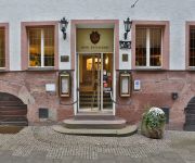
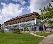
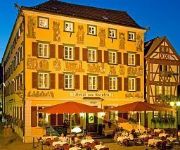
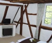
If you need a hotel, we compiled a list of available hotels close to the map centre further down the page.
While being here, you might want to pay a visit to some of the following locations: Neunkirchen, Zwingenberg, Aglasterhausen, Reichartshausen and Rothenberg. To further explore this place, just scroll down and browse the available info.
Local weather forecast
Todays Local Weather Conditions & Forecast: 17°C / 63 °F
| Morning Temperature | 9°C / 48 °F |
| Evening Temperature | 17°C / 62 °F |
| Night Temperature | 13°C / 55 °F |
| Chance of rainfall | 0% |
| Air Humidity | 51% |
| Air Pressure | 1014 hPa |
| Wind Speed | Gentle Breeze with 7 km/h (4 mph) from North-West |
| Cloud Conditions | Overcast clouds, covering 97% of sky |
| General Conditions | Light rain |
Sunday, 5th of May 2024
15°C (58 °F)
12°C (54 °F)
Moderate rain, gentle breeze, overcast clouds.
Monday, 6th of May 2024
13°C (56 °F)
12°C (54 °F)
Moderate rain, gentle breeze, overcast clouds.
Tuesday, 7th of May 2024
12°C (53 °F)
10°C (50 °F)
Light rain, light breeze, overcast clouds.
Hotels and Places to Stay
Krone- Post Jung
Stumpf NaturKulturHotel
Karpfen
Altes Badhaus
Zum weissen Lamm
Hirsch
Videos from this area
These are videos related to the place based on their proximity to this place.
Blade 350 QX3 - Ein Tag über Eberbach am Neckar - HD
Flycam Flug in HD mit dem Blade 350 QX3 - Ein Tag über Eberbach am Neckar.
Monster Truck Show in Eberbach
Ein kleiner Teil der Monster Truck Show in Eberbach weitere Videos auf unserem Kanal.
BÜ Eberbach Quellenweg mit ITINO
Eine der wenigen erhaltenen Blinklichtanlagen der Odenwaldbahn - und eine der noch wenigeren mit Wecker - befindet sich in Eberbach nahe dem Endbahnhof der Strecke. Genauer gesagt gibt es ...
Karnevalfreunde Haidebow Eberbach 2012
Die Karnevalfreunde Haidebow als Pippi Langstrumpf auf dem Fastnachtsumzug in Eberbach.
2014 Neckarsteig Hirschhorn Eberbach Teufelstein
Wanderung im Vorfrühling durch die Wälder am Neckar. Besichtigung der malerischen Orte und der Aussichtspunkte. Kuriositäten: Nilgänse am Neckar, eine Ziege die aus dem Automaten knabbert...
Inaugural German Hash-A-Thon in Eberbach | 4x 10,55km Läufe sollten Marathon werden
FIRST GERMAN HASH-A-THON in Eberbach (bei Heidelberg) Der Plan 4 Läufe a 10,55km... Hier nun die Fakten! 1. Lauf (True Trail) 12,5km 2. Lauf (True Trail) 13,5km 3. Lauf (True Trail) 12km 4....
Blade 350 QX3 - Neckarschleuse Rockenau - in HD
Mit dem Blade 350 QX3 die Neckarschleuse Staustufe bei Rockenau Eberbach - in HD.
Sporttag der Volksbank Neckartal am 14. Juli 2012 mit vier Spitzensportlern
Exklusives Sportevent der Volksbank Neckartal anlässlich des Internationalen Jahres der Genossenschaften mit Timo Bracht, Hanka Kupfernagel, Michael Kochendörfer und Alessandro Sepp in ...
Videos provided by Youtube are under the copyright of their owners.
Attractions and noteworthy things
Distances are based on the centre of the city/town and sightseeing location. This list contains brief abstracts about monuments, holiday activities, national parcs, museums, organisations and more from the area as well as interesting facts about the region itself. Where available, you'll find the corresponding homepage. Otherwise the related wikipedia article.
Odenwald
The Odenwald is a low mountain range in Hesse, Bavaria and Baden-Württemberg in Germany.
Hardberg Mountain
Hardberg Mountain is a mountain in Germany. It is home to the Hardberg Transmission Tower, a 135-metre-high free-standing lattice tower on the Hardberg mountain in Germany at {{#invoke:Coordinates|coord}}{{#coordinates:49|32|28|N|8|48|17|E|type:landmark | |name= }}. The Hardberg Transmission Tower is 135 metres high, weighs 130 tons and stands on an area of 12 * 12 metres. See also: List of towers
Schönau Abbey
Schönau Abbey (Kloster Schönau) in Schönau in the Odenwald, in the Rhein-Neckar-Kreis in Baden-Württemberg, was a Cistercian monastery founded in 1142 from Eberbach Abbey. The present settlement of Schönau grew up round the monastery. By the end of the 12th century Schönau was already in use as a burial place of the Staufen family: in 1195 Conrad of Hohenstaufen, Count Palatine of the Rhine, was buried here, as were his son of the same name, probably in 1186, and both his wives.
Dietmar-Hopp-Stadion
Dietmar-Hopp-Stadion is a football ground in Sinsheim, Baden-Württemberg, Germany. The 6,350-capacity stadium is the home of 1899 Hoffenheim II, and was home to the Hoffenheim senior side until their promotion to the First Bundesliga for 2008-09. It is named after SAP AG co-founder and 1899 Hoffenheim chairman, Dietmar Hopp. As the stadium does not meet the standards for the First Bundesliga, it has been replaced by the Rhein-Neckar Arena.
Darsberg
Darsberg is a small village next to and part of Neckarsteinach. The place is famous for its carnival tradition of rolling a firewheel down a hill.
Reisenbach Telecommunication Tower
Reisenbach Telecommunication Tower is among the tallest structures in the Northern parts of Baden-Württemberg. Only the two masts of Donebach longwave transmitter are taller in the Mudau community. As the masts of Donebach transmitter, Reisenbach Telecommunication Tower is property of Deutsche Telekom AG. It is a concrete telecommunication tower from the FMT3 type. It is among the tallest standardised telecommunication towers of the Deutsche Telekom AG.
Überwald (Bergstraße)
The Überwald is a wooded area in the southeast of Bergstraße district in Hesse, Germany, between the “Anterior” and “Hinder” Odenwald, comprising the communities of Abtsteinach, Grasellenbach and Wald-Michelbach. Wald-Michelbach is the Überwald’s central community. The name was likely first used by the inhabitants of the neighbouring Weschnitz valley.
Kinzert
Kinzert is a mountain of Baden-Württemberg, Germany.
Stiefelhöhe
Stiefelhöhe is a Odenwald mountain of Baden-Württemberg, Germany.
Hardberg (Odenwald)
Hardberg is a Odenwald mountain in Hesse, Germany.
Krähberg
Krähberg is a Odenwald mountain in Hesse, Germany.
Elsenz (river)
Elsenz is a river of Baden-Württemberg, Germany.
Laxbach
Laxbach is a river of Hesse, Germany.
Tromm (Odenwald)
Tromm is a Odenwald mountain in Hesse, Germany.


