Safety Score: 3,0 of 5.0 based on data from 9 authorites. Meaning we advice caution when travelling to France.
Travel warnings are updated daily. Source: Travel Warning France. Last Update: 2024-05-04 08:22:41
Discover Meuvaines
Meuvaines in Calvados (Normandy) with it's 146 citizens is a town in France about 136 mi (or 219 km) west of Paris, the country's capital city.
Current time in Meuvaines is now 05:30 PM (Saturday). The local timezone is named Europe / Paris with an UTC offset of 2 hours. We know of 13 airports near Meuvaines, of which 5 are larger airports. The closest airport in France is Caen-Carpiquet Airport in a distance of 12 mi (or 19 km), South-East. Besides the airports, there are other travel options available (check left side).
There are several Unesco world heritage sites nearby. The closest heritage site in France is Le Havre, the City Rebuilt by Auguste Perret in a distance of 32 mi (or 52 km), East. Looking for a place to stay? we compiled a list of available hotels close to the map centre further down the page.
When in this area, you might want to pay a visit to some of the following locations: Bayeux, Caen, Saint-Lo, Vire and Le Havre. To further explore this place, just scroll down and browse the available info.
Local weather forecast
Todays Local Weather Conditions & Forecast: 15°C / 59 °F
| Morning Temperature | 6°C / 42 °F |
| Evening Temperature | 14°C / 57 °F |
| Night Temperature | 8°C / 46 °F |
| Chance of rainfall | 0% |
| Air Humidity | 65% |
| Air Pressure | 1010 hPa |
| Wind Speed | Gentle Breeze with 6 km/h (3 mph) from North-West |
| Cloud Conditions | Clear sky, covering 4% of sky |
| General Conditions | Light rain |
Sunday, 5th of May 2024
15°C (58 °F)
12°C (53 °F)
Moderate rain, gentle breeze, overcast clouds.
Monday, 6th of May 2024
15°C (58 °F)
11°C (51 °F)
Light rain, gentle breeze, broken clouds.
Tuesday, 7th of May 2024
15°C (59 °F)
10°C (50 °F)
Light rain, gentle breeze, clear sky.
Hotels and Places to Stay
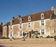
Ferme de la Rançonnière ou Manoir de Mathan
Gold Beach Hôtel
Hostellerie St-Martin Logis
Hotel De Normandie Logis
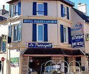
Hotel d'Arromanches
Mountbatten
Les Villas d'Arromanches
Ibis Budget Bayeux
Videos from this area
These are videos related to the place based on their proximity to this place.
Emission échappé belle - Arromanches les Bains
Emission tournée avec le club Léo Lagrange section plongée Participants : Babasse, Jeef, alexis.
Balade en kayak autour des pontons d'Arromanches à Asnelles
Cette balade en kayak au départ d'Asnelles vous permettra d'aller au plus près des pontons du port artificiel d'Arromanches sur les plages du débarquement. Pendant 2h, votre guide vous fera...
Route 143
Epaves du débarquement, Plongée sur les Routes 143 au large d'Arromanches, Octobre 2014. avec Asnelles Plongée Léo Lagrange.
Vols à Vers sur mer pour changer
Vols en pleine nature au dessus des plages mythiques du Débarquement en Normandie.entre Vers sur mer et Asnelles En fond, les vestiges des pontos du port artificiel d'Arromanche. dommage...
Behind Gold Beach, Normandy
A very short look at the terrain behind the Gold Beach sector of the D-Day landings at Ver-sur-Mer, Normandy. Want to travel to this location but do not know how to find it? Battlefields...
COURSEULLES sur MER, balade, port, marché - AU P'TIT M
Holidays in Normandie. In the landings beachs ! Juno !
Meeting Creully 2014 - Les avions du 6 juin 44
Creully, le 6 juin 2014, the D-Day... Le jour le plus long... Les 07 et 08 juin 2014, "Le Stade d'Aéromodélisme Régional de Creully" célébrait sur sa plateforme la 8ème édition du meeting...
Meeting Creully 2014 - Les planeurs du 6 juin 2014
Creully, le 6 juin 2014, the D-Day... Le jour le plus long... Les 07 et 08 juin 2014, "Le Stade d'Aéromodélisme Régional de Creully" célébrait sur sa plateforme la 8ème édition du meeting...
Meeting Creully 2014 - Les avions du 6 juin 2014
Creully, le 6 juin 2014, the D-Day... Le jour le plus long... Les 07 et 08 juin 2014, "Le Stade d'Aéromodélisme Régional de Creully" célébrait sur sa plateforme la 8ème édition du meeting...
Videos provided by Youtube are under the copyright of their owners.
Attractions and noteworthy things
Distances are based on the centre of the city/town and sightseeing location. This list contains brief abstracts about monuments, holiday activities, national parcs, museums, organisations and more from the area as well as interesting facts about the region itself. Where available, you'll find the corresponding homepage. Otherwise the related wikipedia article.
Invasion of Normandy
The Invasion of Normandy was the invasion and establishment of Allied forces in Normandy, France, during Operation Overlord in 1944 during World War II. It was the largest amphibious operation ever to take place. Allied land forces that saw combat in Normandy on 6 June came from Canada, the Free French Forces, the United Kingdom, and the United States.
Normandy landings
The Normandy landings, codenamed Operation Neptune, were the landing operations of the Allied invasion of Normandy, in Operation Overlord, during World War II. The landings commenced on Tuesday, 6 June 1944 (D-Day), beginning at 6:30 am British Double Summer Time (GMT+2). In planning, as for most Allied operations, the term D-Day was used for the day of the actual landing, which was dependent on final approval.
Gold Beach
Gold Beach was the code name of one of the D-Day landing beaches that Allied forces used to invade German-occupied France on 6 June 1944, during World War II. Gold Beach lay in the area assigned to the 50th (Northumbrian) Infantry Division commanded by Major General Douglas Alexander Graham, and the 8th Armoured Brigade. These were part of XXX Corps, commanded by Lieutenant General Gerard Bucknall, which in turn was part of Lieutenant General Miles Dempsey's British 2nd Army.
Ferme de la Rançonnière
The Ferme de la Rançonniere is a farm located in the Calvados region, Normandy, France. The first buildings were constructed in the 13th century, when the residence was called La Ferme de Biéville. At that time, Normandy was suffering from the tensions between the English crown and the kingdom of France, which eventually evolved into the Hundred Years War.
Manoir de Mathan
The Manoir de Mathan is a manor house located in the town of Crépon in the Calvados region of France. The original structure was built in 1605, when it included a coach entry, which has since been removed. At that time, the manor belonged to the Hue de Mathan family after whom it was named. As well as the main house, there was a cellar, kitchen garden, and a bread oven in a separate outbuilding. A pond fed by a stream that flowed through the grounds completed the ensemble.
Bazenville Airfield
Bazenville Airfield is a former World War II airfield, located 1.8 km east of Bazenville in the Basse-Normandie region, France. The airfield was located only 5 kilometers southwest from the Normandy Gold landing beach, and when it opened the frontline was only 9 kilometers away.


