Safety Score: 3,0 of 5.0 based on data from 9 authorites. Meaning we advice caution when travelling to France.
Travel warnings are updated daily. Source: Travel Warning France. Last Update: 2024-04-29 08:03:39
Explore Étrez
Étrez in Ain (Auvergne-Rhône-Alpes) with it's 699 inhabitants is a city in France about 219 mi (or 352 km) south-east of Paris, the country's capital.
Local time in Étrez is now 09:47 PM (Monday). The local timezone is named Europe / Paris with an UTC offset of 2 hours. We know of 9 airports in the vicinity of Étrez, of which two are larger airports. The closest airport in France is Mâcon-Charnay Airport in a distance of 19 mi (or 30 km), West. Besides the airports, there are other travel options available (check left side).
There are several Unesco world heritage sites nearby. The closest heritage site in France is Historic Site of Lyons in a distance of 43 mi (or 69 km), South-West. If you need a place to sleep, we compiled a list of available hotels close to the map centre further down the page.
Depending on your travel schedule, you might want to pay a visit to some of the following locations: Bourg-en-Bresse, Louhans, Macon, Nantua and Lons-le-Saunier. To further explore this place, just scroll down and browse the available info.
Local weather forecast
Todays Local Weather Conditions & Forecast: 13°C / 55 °F
| Morning Temperature | 9°C / 48 °F |
| Evening Temperature | 15°C / 59 °F |
| Night Temperature | 12°C / 53 °F |
| Chance of rainfall | 7% |
| Air Humidity | 67% |
| Air Pressure | 1019 hPa |
| Wind Speed | Light breeze with 5 km/h (3 mph) from South-East |
| Cloud Conditions | Overcast clouds, covering 100% of sky |
| General Conditions | Moderate rain |
Tuesday, 30th of April 2024
19°C (65 °F)
11°C (52 °F)
Light rain, light breeze, overcast clouds.
Wednesday, 1st of May 2024
16°C (61 °F)
11°C (53 °F)
Light rain, light breeze, overcast clouds.
Thursday, 2nd of May 2024
8°C (47 °F)
8°C (46 °F)
Light rain, gentle breeze, overcast clouds.
Hotels and Places to Stay
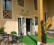
Le Pillebois INTER-HOTEL
Videos from this area
These are videos related to the place based on their proximity to this place.
Présentation Flash Mob Bourg en Bresse 2013
Voici la chorégraphie de votre Flash Mob Bourg en Bresse 2013. Retrouvez-nous sur facebook : Flash Mob Bourg en Bresse. Faites tourner et venez danser nombreux pour la GV et l'association ...
Présentation Dos Chorégraphie Flash Mob Bourg en Bresse 2013
Voici la présentation de dos de la chorégraphie de votre Flash Mob Bourg en Bresse 2013. ATTENTION !!! Il s'agit d'une BATTLE Filles / Garçons ! Plus d'info dans la vidéo et sur la vidéo...
Décomposition de dos de la chorégraphie Flash Mob Bourg en Bresse 2013
Voici la décomposition de dos de la chorégraphie de votre Flash Mob Bourg en Bresse 2013. ATTENTION !!! Il s'agit d'une BATTLE Filles / Garçons ! Plus d'info dans la vidéo. Retrouvez-nous...
Sleepy Labeef Attignat Bluemonday 2012 (France)
Sleepy Labeef at Attignat Bluemonday festival 2012 (France)
Wayne Hancock- Juke Joint Jumping.
Wayne Hancock performing in France, Good Rockin Tonight Festival 2012.
ORAGE 10 06 2014
Violent orage, mardi 10 juin 2014, sur Viriat et proches alentours avec très forte pluie, grêle, vent tournoyant. 32mm en 40minutes.
Discours avant-match juniors RCVM vs. Anncey 2012-2013
Discours du capitaine dans les vestiaires avant le match contre Annecy philipponneau. Victoire 45-0 du R.C.V.M..
Videos provided by Youtube are under the copyright of their owners.
Attractions and noteworthy things
Distances are based on the centre of the city/town and sightseeing location. This list contains brief abstracts about monuments, holiday activities, national parcs, museums, organisations and more from the area as well as interesting facts about the region itself. Where available, you'll find the corresponding homepage. Otherwise the related wikipedia article.
Sâne Morte
The Sâne Morte (French: la Sâne Morte, the dead Sâne) is a 54.6 km long river in the Ain and Saône-et-Loire départements, eastern France. Its source is at Foissiat. It flows generally north-northwest. It is a right tributary of the Sâne Vive into which it flows at Ménetreuil.


