Discover Red Hill
The district Red Hill of in Mornington Peninsula (Victoria) is a subburb in Australia about 311 mi south-west of Canberra, the country's capital city.
If you need a hotel, we compiled a list of available hotels close to the map centre further down the page.
While being here, you might want to pay a visit to some of the following locations: Melbourne, Currie, Hay, Canberra and . To further explore this place, just scroll down and browse the available info.
Local weather forecast
Todays Local Weather Conditions & Forecast: 17°C / 62 °F
| Morning Temperature | 12°C / 54 °F |
| Evening Temperature | 17°C / 63 °F |
| Night Temperature | 16°C / 61 °F |
| Chance of rainfall | 0% |
| Air Humidity | 50% |
| Air Pressure | 1023 hPa |
| Wind Speed | Moderate breeze with 11 km/h (7 mph) from South |
| Cloud Conditions | Broken clouds, covering 69% of sky |
| General Conditions | Broken clouds |
Monday, 29th of April 2024
14°C (58 °F)
13°C (56 °F)
Light rain, moderate breeze, overcast clouds.
Tuesday, 30th of April 2024
14°C (57 °F)
11°C (52 °F)
Overcast clouds, moderate breeze.
Wednesday, 1st of May 2024
16°C (61 °F)
13°C (56 °F)
Sky is clear, moderate breeze, clear sky.
Hotels and Places to Stay
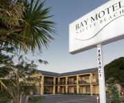
Bay Motel Safety Beach
WALTZING MATILDA HOTEL
Videos from this area
These are videos related to the place based on their proximity to this place.
Kite Flying at Dromana
Watch as a long line of joined kites is lifted into the sky at Dromana, Victoria, Australia. For more visit: http://theworklife.com.
Pam Fisher, Pipes and Peninsula Pumps Service (Dromana, VIC 3936)
IRRIGEAR Member Pam Fisher of Pipes and Peninsula Pumps Service co-runs a successful pump and irrigation business located in the Mornington Peninsula, Victoria. In this video, Pam describes...
Seadoo Spark First Ride GoPro Hero 3
First ride of the new Seadoo spark, filmed on the GoPro Hero 3 silver edition. Dromana, Victoria, Australia! Please click adds, more videos soon.
Videos provided by Youtube are under the copyright of their owners.
Attractions and noteworthy things
Distances are based on the centre of the city/town and sightseeing location. This list contains brief abstracts about monuments, holiday activities, national parcs, museums, organisations and more from the area as well as interesting facts about the region itself. Where available, you'll find the corresponding homepage. Otherwise the related wikipedia article.
Shire of Mornington Peninsula
The Shire of Mornington Peninsula is a local government area in Victoria, Australia. It is located to the south of the city of Melbourne on the Mornington Peninsula. It has an area of 723 square kilometres. According to the 2011 Census, it has a population of 144,608 people. The Shire of Mornington Peninsula came into existence on 15 December 1994 when the Kennett Liberal government amalgamated the previous Shires of Flinders, Hastings and Mornington.
Mornington Peninsula
This article contains information about the geographical landform, for the locality, see; Shire of Mornington Peninsula The Mornington Peninsula is a peninsula located south-east of Melbourne, Australia. It is surrounded by Port Phillip to the west, Western Port to the east and Bass Strait to the south, and is connected to the mainland in the north. Geographically, the peninsula begins its protrusion from the mainland in the area between Pearcedale and Frankston.
Arthurs Seat, Victoria
Arthurs Seat is a hill and locality on the Mornington Peninsula, within the Shire of Mornington Peninsula, about 75 km south east of Melbourne, Australia. Arthurs Seat is a major tourist attraction, owing to its natural bushland, sweeping views and man-made attractions. The hill rises to 305 metres above sea level. The underlying rocks are Devonian granite, bounded to the west by the Selwyn Fault.
Dromana, Victoria
Dromana is a suburb south of Melbourne, the capital city of Victoria, Australia, and is located on the Mornington Peninsula. Its Local Government Area is the Shire of Mornington Peninsula.
Main Ridge, Victoria
Main Ridge is a rural locality south of Melbourne, Victoria, Australia, located south of and inland from Rosebud on the Mornington Peninsula, and was originally known as Main Creek. Its Local Government Area is the Shire of Mornington Peninsula. At the 2011 census, Main Ridge had a population of 469. The district consists of the western spine of Arthurs Seat and the southern hinterlands.
Merricks, Victoria
Merricks is a small town in Victoria, Australia, located in the southeastern Mornington Peninsula between Hastings and Flinders. Its Local Government Area is the Shire of Mornington Peninsula.
Merricks Beach, Victoria
Merricks Beach is a small seaside village on the Mornington Peninsula Victoria, Australia. It is located on the eastern side of the peninsula on the Western Port Bay. It is one of the few coastal places within a 100 km radius of Melbourne that has been basically untouched by development. Its Local Government Area is the Shire of Mornington Peninsula.
Merricks North, Victoria
Merricks North is a rural locality in the south side of Victoria, Australia. Its Local Government Area is the Shire of Mornington Peninsula.
Mount Martha, Victoria
Mount Martha is a suburb in Melbourne, Victoria, Australia, located 60 km south-east of Melbourne's central business district. Its Local Government Area is the Shire of Mornington Peninsula. It is located on the south-eastern shores of Port Phillip and offers a bathing beach. A boardwalk winds its way for over 5 km along the Balcombe Creek, its North beach mouth to the Briars Historic Park. The suburb's highest point bears the area's name and reaches 160 m (540 ft).
Point Leo, Victoria
Point Leo is a town in the Shire of Mornington Peninsula, Victoria, Australia. Point Leo Foreshore Reserve provides excellent waves for surfing and is one of the closest surf beaches to Melbourne. At the 2011 census, Point Leo had a population of 159.
Red Hill, Victoria
Red Hill is a small rural community, located in the hinterland of the Mornington Peninsula, about an hour's drive south of Melbourne, in Victoria, Australia. The Local Government Area is the Shire of Mornington Peninsula. At the 2011 census, Red Hill had a population of 731.
Rosebud, Victoria
Rosebud is a sea side town on the Mornington Peninsula, Victoria, Australia located approximately 75 km southeast of the Melbourne City Centre. It is wedged between the lower slopes of Arthurs Seat, the shores of Port Phillip Bay and the plains of Boneo. Its Local Government Area is the Shire of Mornington Peninsula. Rosebud is a very popular tourist resort with families who appreciate its sandy beaches and shallow waters.
Red Hill South, Victoria
Red Hill South is a rural locality and town in Melbourne, Victoria, Australia. Its local government area is in the Shire of Mornington Peninsula. At the 2011 census, Red Hill South had a population of 1,172. There are several wineries in the area and it is referred to as the 'hinterland' of the Mornington Peninsula. Red Hill South Post Office opened on 22 January 1923.
Safety Beach, Victoria
Safety Beach is a suburb in Melbourne, Victoria, Australia. Its Local Government Area is the Shire of Mornington Peninsula. Safety Beach occupies slightly less than half the area of land between the foothills of Mount Martha and Arthurs Seat and borders Port Philip Bay to its west. There is a large inland harbour and residential development in Safety Beach named Martha Cove, named after its location in the cove at the foot of Mount Martha. The project was heavily protested by residents.
Shoreham, Victoria
Shoreham is a town south of Melbourne, Victoria, Australia, located in the southern Mornington Peninsula region on the Western Port. Its Local Government Area is the Shire of Mornington Peninsula. It is a coastal recreation resort notable for its pine-covered cliffs and foreshore reserve. At the 2011 census, Shoreham had a population of 434.
McCrae, Victoria
McCrae is a suburb of Melbourne, Victoria, Australia. Its local government area is the Shire of Mornington Peninsula. McCrae is known for the McCrae Lighthouse. No longer an operating lighthouse, it marked the turning point for shipping in the main navigational channels between Port Phillip Heads and Melbourne. Recently a new shopping center called McCrae Plaza opened and it included a Bilo Supermarket, which later became a Coles Supermarket.
Red Hill railway station
Red Hill railway station was located on the Red Hill railway line. The line was opened in 1921 and was one of the more short-lived branch lines on the Victorian Railways closing in 1953 along with a few other smaller branch lines in the railways system. Following official closure of the line, trains (railmotors) continued to run as far as Balnarring to cater for the Balnarring picnic races, Lord Somers camp and a Railway Historical Society tour in 1956.
Merricks railway station
Merricks railway station was located on the Red Hill railway line. The line was opened in 1921 and was one of the more short lived branch lines on the Victorian Railways closing in 1952 with many other smaller branch lines in the railways system.
Shire of Flinders (Victoria)
The Shire of Flinders was a local government area encompassing the extremity of the Mornington Peninsula about 65 kilometres south of Melbourne, the state capital of Victoria, Australia. The shire covered an area of 324 square kilometres, and existed from 1874 until 1994.
Red Hill Rail Trail
Red Hill Rail Trail is a 6.5 kilometre rail trail connecting Red Hill with Merricks, on the Mornington Peninsula, Victoria, Australia. It is primarily used by horse riders. Its surface is gravel and dirt.
Tuerong, Victoria
Tuerong is a rural locality of the Mornington Peninsula on Western Port, lying inland between the coastal suburbs of Mount Martha, Hastings and Moorooduc South. Its Local Government Area is the Shire of Mornington Peninsula.
McCrae Homestead
McCrae Homestead is an historic property located in McCrae, Victoria, Australia. It was built at the foot of Arthurs Seat, a small mountain, near the shores of Port Phillip in 1844 by Andrew McCrae, a lawyer, and his wife Georgiana Huntly McCrae (15 March 1804 – 24 May 1890), a portrait artist of note. The homestead is under the care of the National Trust of Australia, and is open to the public. Volunteers who are knowledgeable about the history of the house conduct tours and answer questions.
Heronswood, Victoria
Heronswood is a historic property that was built in 1864 and is located in Dromana, Victoria. A Gothic Revival house built in 1874, and highly picturesque, it incorporates the original shingled roofed cottage that was the first structure built on 46 acres. Heronswood is classified by the National Trust of Australia and is open to the public.
Balcombe Grammar School
Balcombe Grammar School is an independent, co-educational primary and secondary day school located in Mount Martha, Victoria, Australia. It is a member of the Victorian Ecumenical System of Schools (VESS) which comprises eighteen schools throughout Victoria and is a member of the Association of Independent Schools of Victoria (AISV).
Mornington Peninsula (wine)
The Mornington Peninsula is an Australian wine region located south of Melbourne, Victoria. It is a cool climate region that focuses on Pinot Noir production but has had success with other varietals including Chardonnay, Pinot Gris and Tempranillo. The region is known for its medium bodied, dry wines and sparkling wines that show structure and complexity. The still wine versions of Chardonnay reflect a diversity of styles, all typically unoaked, from more citrus to more tropical fruit flavors.


