Delve into Mount Martha
The district Mount Martha of in Mornington Peninsula (Victoria) with it's 17,087 habitants Mount Martha is a district located in Australia about 307 mi south-west of Canberra, the country's capital town.
In need of a room? We compiled a list of available hotels close to the map centre further down the page.
Since you are here already, you might want to pay a visit to some of the following locations: Melbourne, Currie, Hay, Canberra and . To further explore this place, just scroll down and browse the available info.
Local weather forecast
Todays Local Weather Conditions & Forecast: 17°C / 63 °F
| Morning Temperature | 13°C / 55 °F |
| Evening Temperature | 15°C / 59 °F |
| Night Temperature | 14°C / 57 °F |
| Chance of rainfall | 0% |
| Air Humidity | 65% |
| Air Pressure | 1027 hPa |
| Wind Speed | Moderate breeze with 11 km/h (7 mph) from North-West |
| Cloud Conditions | Scattered clouds, covering 33% of sky |
| General Conditions | Scattered clouds |
Monday, 6th of May 2024
17°C (62 °F)
14°C (56 °F)
Sky is clear, moderate breeze, clear sky.
Tuesday, 7th of May 2024
14°C (57 °F)
12°C (54 °F)
Broken clouds, moderate breeze.
Wednesday, 8th of May 2024
17°C (62 °F)
13°C (56 °F)
Sky is clear, gentle breeze, clear sky.
Hotels and Places to Stay
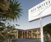
Bay Motel Safety Beach
BEST WESTERN PLUS BROOKLANDS
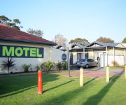
Mornington Motel
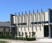
Norwood House Motel & Reception Centre
Videos from this area
These are videos related to the place based on their proximity to this place.
Mornington Peninsula Railway 30th and 125th
The Mornington Railway Preservation Society had a special celebration for the 30th anniversary of the society, and the 125th anniversary of the opening of the Mornington line. Here are a few...
Best Western Brooklands of Mornington
For Australia's biggest and best collection of hotel and travel videos go to www.trekabout.com.au _ - Award Winning Hotel Accommodation - Best Western Brooklands of Mornington has created...
Deegan 38 Tyres - The Tyre Place Mornington
Deegan 38 by Mickey Thompson Tires Aggressive Style and Performance - 50% Road & Sand , 50% Dirt & Mud The new Deegan 38 tyre from Mickey Thompson, designed in cooperation with racing ...
Mornington Massage
Specifik Kneads Massage Therapy located in Mornington - Mt Martha offers professional massage therapy specifically for you: SPORT - PREGNANCY - REMEDIAL.
Yoga Mornington | Yoga_Room_Welcome.mp4
The Yoga Mornington welcome video for new students visiting The Yoga Room on the Mornington Peninsula. An Ashtanga Yoga Studio. http://yogaroom.net.au.
Fletchers Sorrento - 32 Venice Street, Mornington - Joshua Callaghan
Rare corner allotment approx. 650sqm with approved Town Planning permit for 2 quality double storey townhouses.
Wild Storm in Mornington, Victoria
A storm with heavy rain, wind and lightning hits the Port Philip area in Victoria on the 25th of August 2009. This video shows what it looks like from the second story of my house in Mornington...
Maxxis AT-980
Introducing the new Maxxis AT-980 all-terrain tyre perfect for the harsh conditions found around Australia. Like all Maxxis 4x4 tyres the AT980 has been engineered using Virtual Intelligent...
Maxxis MT-764 Big Horn
Aggressive eagle traction design for excellent performance in mud and rocky conditions.
Silverstone Atlantis V7
The Silverstone Atlantis V7 marks a milestone in Silverstone Tyres history. It was developed together with Toyo Tyres of Japan, and is Silverstone's newest flagship product. The new Atlantis...
Videos provided by Youtube are under the copyright of their owners.
Attractions and noteworthy things
Distances are based on the centre of the city/town and sightseeing location. This list contains brief abstracts about monuments, holiday activities, national parcs, museums, organisations and more from the area as well as interesting facts about the region itself. Where available, you'll find the corresponding homepage. Otherwise the related wikipedia article.
Mornington Peninsula
This article contains information about the geographical landform, for the locality, see; Shire of Mornington Peninsula The Mornington Peninsula is a peninsula located south-east of Melbourne, Australia. It is surrounded by Port Phillip to the west, Western Port to the east and Bass Strait to the south, and is connected to the mainland in the north. Geographically, the peninsula begins its protrusion from the mainland in the area between Pearcedale and Frankston.
Arthurs Seat, Victoria
Arthurs Seat is a hill and locality on the Mornington Peninsula, within the Shire of Mornington Peninsula, about 75 km south east of Melbourne, Australia. Arthurs Seat is a major tourist attraction, owing to its natural bushland, sweeping views and man-made attractions. The hill rises to 305 metres above sea level. The underlying rocks are Devonian granite, bounded to the west by the Selwyn Fault.
Dromana, Victoria
Dromana is a suburb south of Melbourne, the capital city of Victoria, Australia, and is located on the Mornington Peninsula. Its Local Government Area is the Shire of Mornington Peninsula.
Merricks North, Victoria
Merricks North is a rural locality in the south side of Victoria, Australia. Its Local Government Area is the Shire of Mornington Peninsula.
Moorooduc, Victoria
Moorooduc is a suburb in Melbourne, Victoria, Australia. Its Local Government Area is the Shire of Mornington Peninsula. The Moorooduc Highway runs through the locality, being the main route between Melbourne and the Peninsula. Moorooduc Post Office opened on 27 August 1890 and closed in 1980. A study is currently being undertaken for a bypass to be constructed between EastLink at Seaford linking the Mornington Peninsula Freeway south of Moorooduc.
Mornington, Victoria
Mornington is a sea side town on the Mornington Peninsula, Victoria, Australia, located 57 km south-east of Melbourne's central business district. It is in the Local Government Area of the Shire of Mornington Peninsula. Mornington is known for its "village" atmosphere and its beautiful beaches. Mornington is a popular tourist destination with Melburnians who often make day trips to visit the area's bay beaches and wineries.
Mount Eliza, Victoria
Mount Eliza is an outer suburb south-east of Melbourne, Victoria, Australia. It is in the local government area of the Shire of Mornington Peninsula.
Mount Martha, Victoria
Mount Martha is a suburb in Melbourne, Victoria, Australia, located 60 km south-east of Melbourne's central business district. Its Local Government Area is the Shire of Mornington Peninsula. It is located on the south-eastern shores of Port Phillip and offers a bathing beach. A boardwalk winds its way for over 5 km along the Balcombe Creek, its North beach mouth to the Briars Historic Park. The suburb's highest point bears the area's name and reaches 160 m (540 ft).
Red Hill, Victoria
Red Hill is a small rural community, located in the hinterland of the Mornington Peninsula, about an hour's drive south of Melbourne, in Victoria, Australia. The Local Government Area is the Shire of Mornington Peninsula. At the 2011 census, Red Hill had a population of 731.
Safety Beach, Victoria
Safety Beach is a suburb in Melbourne, Victoria, Australia. Its Local Government Area is the Shire of Mornington Peninsula. Safety Beach occupies slightly less than half the area of land between the foothills of Mount Martha and Arthurs Seat and borders Port Philip Bay to its west. There is a large inland harbour and residential development in Safety Beach named Martha Cove, named after its location in the cove at the foot of Mount Martha. The project was heavily protested by residents.
Moorooduc railway station
Moorooduc railway station is located on Two Bays Road, Mount Eliza, Victoria, Australia. The station is home to the Mornington Railway Preservation Society. Adjacent to the station is the Mount Eliza Regional Park which incorporates the Moorooduc Quarry Flora and Fauna Reserve.
Tanti Park railway station
Tanti Park railway station is a single platform located on Bungower Road, Mornington, Victoria, Australia. It is the middle stop of three currently serviced by the tourist Mornington Railway. Since mid-2009, this station is unmanned and is now a pickup and drop-off point for passengers travelling on the tourist railway.
Mornington railway station
Mornington railway station was located on Railway Grove, Mornington, Victoria, Australia. The first train arrived on 10 September 1889 and the last one departed on 20 May 1981. In 1989 the old station site was sold off by the state government, and a shopping centre built over. On 19 September 2004 a plaque was unveiled adjacent to the site to commemorate 150 years of steam rail in Victoria.
Narambi railway station
Narambi railway station was a single platform located on the corner of Narambi Road and Richardson Drive, Mornington, Victoria, Australia. It has since been closed, with some of the platform infrastructure having been reused at the new site of Mornington railway station.
Mornington Railway
For the history of operations under the Victorian Railways, see Mornington railway line, Melbourne The Mornington Railway is a heritage railway near Mornington, a town on the Mornington Peninsula, near Melbourne, Victoria. The line is managed by the Mornington Railway Preservation Society and operates on part of the former Victorian Railways branch line which ran from Baxter to Mornington.
Devilbend Natural Features Reserve
Devilbend Natural Features Reserve is a 1,057 ha park on the Mornington Peninsula 55 km south-east of Melbourne, Australia, between Hastings and Mount Martha in the traditional country of the Bunurong people. It contains two decommissioned water-supply reservoirs, Devilbend and Bittern, which were the original reason the land now in the park was not developed and was protected from general public access.
The Peninsula School
The Peninsula School is an independent co-educational Anglican day and boarding school located in Mount Eliza, Victoria, Australia. Founded in 1961, the school is set on large hilly green fields overlooking Port Phillip Bay on the Mornington Peninsula. It is a member of the Associated Grammar Schools of Victoria. The school has a non-selective enrolment policy and currently caters for approximately 1,400 students from Pre-school to Year 12.
Mornington Tourist railway station
Mornington railway station is located on the corner of Yuilles Road and Watt Road in Mornington, Victoria, Australia. It is the new site of the terminus of the Mornington Railway line. The Mornington Heritage Railway has run services from there since 21 October 1997.
Sunnyside North Beach
Sunnyside North Beach is a clothes-optional beach located at Mount Eliza, Port Philip Bay, in the State of Victoria, Australia. It is designated as a legal nudist beach under the Nudity (Prescribed Areas) Act 1983.
Shire of Mornington (Victoria)
The Shire of Mornington was a local government area on the western Mornington Peninsula about 50 kilometres south of Melbourne, the state capital of Victoria, Australia. The shire covered an area of 90.65 square kilometres immediately to the south of Frankston, and existed from 1960 until 1994.
Padua College, Melbourne
Padua College is a Catholic co-educational Secondary College located in Victoria, Australia. The Mornington campus alone provides for approximately 2,000 students from across the Mornington Peninsula. The college also has a smaller campus in Rosebud (Year 7-10). Facilities include a bird hide and wetlands areas, natural bushland, drama rooms, art and media rooms, gymnasium, chapel, library, music rooms, tennis courts, basketball courts, food technology rooms, an aghort centre and two ovals.
Tuerong, Victoria
Tuerong is a rural locality of the Mornington Peninsula on Western Port, lying inland between the coastal suburbs of Mount Martha, Hastings and Moorooduc South. Its Local Government Area is the Shire of Mornington Peninsula.
Heronswood, Victoria
Heronswood is a historic property that was built in 1864 and is located in Dromana, Victoria. A Gothic Revival house built in 1874, and highly picturesque, it incorporates the original shingled roofed cottage that was the first structure built on 46 acres. Heronswood is classified by the National Trust of Australia and is open to the public.
Balcombe Grammar School
Balcombe Grammar School is an independent, co-educational primary and secondary day school located in Mount Martha, Victoria, Australia. It is a member of the Victorian Ecumenical System of Schools (VESS) which comprises eighteen schools throughout Victoria and is a member of the Association of Independent Schools of Victoria (AISV).
Mornington Peninsula (wine)
The Mornington Peninsula is an Australian wine region located south of Melbourne, Victoria. It is a cool climate region that focuses on Pinot Noir production but has had success with other varietals including Chardonnay, Pinot Gris and Tempranillo. The region is known for its medium bodied, dry wines and sparkling wines that show structure and complexity. The still wine versions of Chardonnay reflect a diversity of styles, all typically unoaked, from more citrus to more tropical fruit flavors.


