Discover Black Rock
The district Black Rock of in Bayside (Victoria) with it's 5,796 citizens Black Rock is a district in Australia about 294 mi south-west of Canberra, the country's capital city.
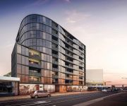
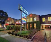
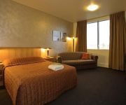
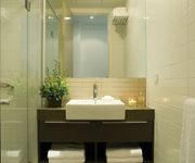
Looking for a place to stay? we compiled a list of available hotels close to the map centre further down the page.
When in this area, you might want to pay a visit to some of the following locations: Melbourne, Currie, Hay, Canberra and . To further explore this place, just scroll down and browse the available info.
Local weather forecast
Todays Local Weather Conditions & Forecast: 12°C / 54 °F
| Morning Temperature | 11°C / 52 °F |
| Evening Temperature | 12°C / 53 °F |
| Night Temperature | 11°C / 52 °F |
| Chance of rainfall | 0% |
| Air Humidity | 48% |
| Air Pressure | 1033 hPa |
| Wind Speed | Fresh Breeze with 16 km/h (10 mph) from North |
| Cloud Conditions | Broken clouds, covering 52% of sky |
| General Conditions | Broken clouds |
Sunday, 19th of May 2024
13°C (56 °F)
14°C (57 °F)
Light rain, fresh breeze, overcast clouds.
Monday, 20th of May 2024
14°C (57 °F)
14°C (56 °F)
Light rain, moderate breeze, broken clouds.
Tuesday, 21st of May 2024
15°C (58 °F)
14°C (57 °F)
Light rain, moderate breeze, scattered clouds.
Hotels and Places to Stay
The Sebel Melbourne Moorabbin
Best Western Plus Buckingham International
HEMISPHERE HOTEL
Caroline Apts Brighton
BRIGHTON SAVOY
QUEST BRIGHTON ON THE BAY
Brighton Bay Apartments
The Sebel Melbourne Moorabbin
PARKDALE MOTOR INN
Sandbelt Club Hotel
Videos from this area
These are videos related to the place based on their proximity to this place.
Highett Carpet Cleaning Melbourne - (03) 9111 5619 - Carpet Cleaning In Highett, VIC
Pocka Dola Carpet Cleaning Melbourne Highett Carpet Cleaning Melbourne - (03) 9111 5619 - Carpet Cleaning In Highett, VIC Hosted on the Pocka Dola Youtube Ch...
Highett Carpet Cleaning Melbourne | Carpet Cleaning In Highett, VIC
Highett Carpet Cleaning Melbourne - (03) 9111 5619 - Carpet Cleaning In Highett, VIC Pocka Dola Carpet Cleaning Melbourne Hosted on the Pocka Dola Youtube Ch...
Royal Park wetlands and views to Citylink
I wandered around the Royal Park wetlands and Ross Straw sportsfield to get to know the area where the proposed East West Tollroad Tunnel will come out of the tunnel to connect with the Tullamarine ...
Tasmania's east coast Birkborkasson's photos around Beaumaris, Australia (beaumaris tasmania)
Preview of Birkborkasson's blog at travelpod. Read the full blog here: http://www.travelpod.com/travel-blog-entries/birkborkasson/31/1199335500/tpod.html Thi...
Earthwatch ClimateWatch Marine Beach Video
ClimateWatch is a national program developed by Earthwatch Australia, Bureau of Meteorology and the University of Melbourne to better understand how climate change is affecting our wildlife....
Ricketts Point Sanctuary Port Phillip Bay Scuba Diving Victoria Australia 27.11.13
Ricketts Point Sanctuary at Port Phillip Bay is one of the many good sites do dive at the Bay, there you'll come across a few unique marine life such as soft corals, blue ring octopus, sharks...
Sandringham Carpet Cleaning Melbourne | Carpet Cleaning In Sandringham, VIC
Sandringham Carpet Cleaning Melbourne - (03) 9111 5619 - Carpet Cleaning In Sandringham, VIC Pocka Dola Carpet Cleaning Melbourne Hosted on the Pocka Dola Yo...
J7 SUB WRECK, SANDRINGHAM
Presenting the J-class submarine wreck at Sandringham Yacht Club in Melbourne, Australia. ADDITIONAL INFO: This J-class submarine, known as HMAS J7, was scuttled for use as a breakwater...
The Unconformity
Showing the development of my lastest piece of rock art, a future geological crossection after the seas level rise.
Videos provided by Youtube are under the copyright of their owners.
Attractions and noteworthy things
Distances are based on the centre of the city/town and sightseeing location. This list contains brief abstracts about monuments, holiday activities, national parcs, museums, organisations and more from the area as well as interesting facts about the region itself. Where available, you'll find the corresponding homepage. Otherwise the related wikipedia article.
City of Bayside
The City of Bayside is a local government area in Victoria, Australia. It is within the southern suburbs of Melbourne. It has an area of 36 square kilometres and has a estimated population of 96,329 people.
Black Rock, Victoria
Black Rock is a suburb in Melbourne, Victoria, Australia, 18 km south-east from Melbourne's central business district. Its Local Government Area is the City of Bayside. At the 2011 Census, Black Rock had a population of 5,944.
Hampton, Victoria
Hampton is a suburb in Melbourne, Victoria, Australia, 14 km (15/20 minutes drive along beach esplanade) south east from Melbourne's central business district. Its Local Government Area is the City of Bayside. At the 2011 Census, Hampton had a population of 12,482. Hampton is located in a wealthy bayside area of Melbourne, wedged between the suburbs of Brighton and Sandringham.
Highett, Victoria
Highett is a suburb in Melbourne, Victoria, Australia, 16 km south-east from Melbourne's central business district and 2 km east of Port Phillip Bay. Its Local Government Area is the City of Bayside and the City of Kingston. At the 2011 Census, Highett had a population of 10,263. Highett is bordered by Hampton/Sandringham to the west, Hampton East/Moorabbin to the north and Cheltenham to the east and south.
Sandringham, Victoria
Sandringham is a suburb of Melbourne, Victoria, Australia, located 16 km southeast of Melbourne's central business district. Its Local Government Area is the City of Bayside and federal division is the Goldstein. At the 2011 Census, Sandringham had a population of 9,309.
Moorabbin, Victoria
Moorabbin is a suburb in Melbourne, Victoria, Australia, 15 km south-east from Melbourne's central business district. Its Local Government Area is the City of Kingston. At the 2011 Census, Moorabbin had a population of 5,283. Most of the eastern side of Moorabbin has been an industrial area since the first development in the mid-1960s. Major industries with a presence in the area include Philip Morris and Coca-Cola.
Moorabbin railway station
Moorabbin is a railway station in Melbourne, Victoria, Australia, located in the suburb of Moorabbin on the Frankston railway line. Moorabbin is classed as a Premium Station and is in Metcard Zone 2.
Cheltenham railway station, Melbourne
Cheltenham is a railway station in Melbourne, Victoria, Australia, located in the suburb of Cheltenham on the Frankston railway line. Cheltenham is classed as a Premium Station and is in Metcard Zone 2.
Highett railway station
Highett is a railway station in Melbourne, Victoria, Australia, located in the suburb of Highett, on the Frankston railway line. Highett is unmanned and is in Metcard Zone 2.
Hampton railway station, Melbourne
Hampton is a railway station in Melbourne, Victoria, Australia, located in the suburb of Hampton, on the Sandringham railway line. Hampton station is unmanned and is in Metcard Zone 2.
Sandringham railway station
Sandringham is a railway station in Melbourne, Victoria, Australia, located in the suburb of Sandringham, on the Sandringham railway line. It is in Metlink Zone 2, is classed as a Premium Station and is the terminus for the Sandringham line. The trip to Flinders Street directly takes about 28–30 minutes.
Beaumaris, Victoria
Beaumaris is a suburb in Melbourne, Victoria, Australia, 20 km south-east from Melbourne's central business district. Its Local Government Area is the City of Bayside. At the 2011 Census, Beaumaris had a population of 12,829. Beaumaris is pronounced bo'morris, the town in Wales it is named after is pronounced byoo'maris. The suburb is located on Port Phillip.
Division of Goldstein
The Division of Goldstein is an Australian Electoral Division in Victoria. The division was created in 1984, when the former Division of Balaclava was abolished. It is named for Vida Goldstein, an early feminist parliamentary candidate. It is located in the bayside suburbs of Melbourne, including Beaumaris, Bentleigh, Brighton and Sandringham. It is a safe seat for the Liberal Party.
Westfield Southland
Westfield Southland shopping centre is a super regional retail complex located in the suburb of Cheltenham, approximately 16 kilometres from the Melbourne CBD in Victoria, Australia. Southland has a floor area of 130,033m². There are 416 retailers in Southland, including Myer, David Jones and Harris Scarfe. According to the Melbourne 2030 Metropolitan Strategy, Southland is recognised as one of twenty-six Principal Activity Centres.
History of New South Wales
The history of New South Wales refers to the history of the state of New South Wales and its preceding Indigenous and British colonial societies. The Mungo Lake remains indicate occupation of New South Wales by Aboriginal Australians for at least 40,000 years. The English navigator James Cook became the first European to map the coast in 1770 and a First Fleet of British convicts followed to establish a penal colony at Sydney in 1788.
Trevor Barker Beach Oval
The Trevor Barker Oval is an Australian rules football ground in Beach Road, Sandringham, Victoria Australia. It was named after the St Kilda Football Club champion Trevor Barker, who died of cancer in 1996 at the age of 39. Barker coached Sandringham to the 1992 and 1994 premierships against Williamstown and Box Hill respectively. The oval has a single grandstand, a social club and a capacity for 10,000. It is home to the Sandringham Football Club, who play in the Victorian Football League.
History of Australia (1606–1787)
The first definite sighting of Australia by European explorers was in 1606. This date marks the beginning of the written history of Australia. The documentation of Aboriginal history is challenging, because Aboriginal people lived in an oral culture prior to 1788. Although humans had lived in Australia for approximately 40-45,000 years (possibly more) before 1606, this time is regarded as belonging to the prehistory of Australia rather than history because of this lack of written documentation.
Royal Melbourne Golf Club
Royal Melbourne Golf Club is a 36-hole golf club in Australia, located in Black Rock, Victoria, a suburb of Melbourne. Its West and East courses are respectively ranked number 1 and 6 in Australia. The West course is ranked in the top ten courses in the world (or outside the United States). Founded in 1891, it is Australia's oldest extant and continually existing golf club.
Hampton East, Victoria
Hampton East is a suburb in Melbourne, Victoria, Australia, 15 km south-east from Melbourne's central business district. Its Local Government Area is the City of Bayside. At the 2011 Census, Hampton East had a population of 4,395.
City of Sandringham
The City of Sandringham was a local government area about 20 kilometres south of Melbourne, the state capital of Victoria, Australia, on the eastern side of Port Phillip. The city covered an area of 14.97 square kilometres, and existed from 1917 until 1994.
City of Moorabbin
The City of Moorabbin was a local government area about 20 kilometres southeast of Melbourne, the state capital of Victoria, Australia. The city covered an area of 53.13 square kilometres, and existed from 1862 until 1994.
Ricketts Point Marine Sanctuary
Ricketts Point Marine Sanctuary, located in Port Phillip 20 kilometres south east of Melbourne, Australia, is 115 hectares in size, stretching 500 metres out to sea between Table Rock Point in Beaumaris and Quiet Corner in Black Rock. The declaration of Ricketts Point as a marine sanctuary was a significant environmental achievement. The battle to win the Sanctuary began as early as 1986.
Sandringham College
Sandringham College is a multi campus secondary college located in the south-eastern suburbs of Melbourne, Victoria.
Mentone Girls' Secondary College
Mentone Girls' Secondary College is an all-girl's state school located in Mentone, in the Australian state of Victoria.
Hampton High School, Melbourne
Hampton High School was a secondary school in Ludstone Street, Hampton, Victoria 3188, Australia, a suburb of Melbourne. The school occupied the block bounded by Ludstone, Favril and Passchendaele Streets. It opened in 1935 and was closed in 1988. Its alumni are known as Old Hamptonians.


