Safety Score: 2,7 of 5.0 based on data from 9 authorites. Meaning we advice caution when travelling to United States.
Travel warnings are updated daily. Source: Travel Warning United States. Last Update: 2024-04-26 08:02:42
Discover Evandale Terrace
Evandale Terrace in Wood County (West Virginia) is a place in United States about 247 mi (or 397 km) west of Washington DC, the country's capital city.
Current time in Evandale Terrace is now 02:54 PM (Friday). The local timezone is named America / New York with an UTC offset of -4 hours. We know of 8 airports near Evandale Terrace, of which 3 are larger airports. The closest airport in United States is Mid Ohio Valley Regional Airport in a distance of 11 mi (or 18 km), North-East. Besides the airports, there are other travel options available (check left side).
Also, if you like playing golf, there are a few options in driving distance. If you need a hotel, we compiled a list of available hotels close to the map centre further down the page.
While being here, you might want to pay a visit to some of the following locations: Parkersburg, Marietta, Elizabeth, Saint Marys and Ripley. To further explore this place, just scroll down and browse the available info.
Local weather forecast
Todays Local Weather Conditions & Forecast: 21°C / 70 °F
| Morning Temperature | 4°C / 39 °F |
| Evening Temperature | 18°C / 64 °F |
| Night Temperature | 14°C / 58 °F |
| Chance of rainfall | 0% |
| Air Humidity | 48% |
| Air Pressure | 1023 hPa |
| Wind Speed | Gentle Breeze with 8 km/h (5 mph) from North |
| Cloud Conditions | Few clouds, covering 19% of sky |
| General Conditions | Few clouds |
Friday, 26th of April 2024
21°C (70 °F)
16°C (60 °F)
Light rain, gentle breeze, overcast clouds.
Saturday, 27th of April 2024
25°C (78 °F)
17°C (62 °F)
Scattered clouds, gentle breeze.
Sunday, 28th of April 2024
27°C (81 °F)
17°C (62 °F)
Broken clouds, gentle breeze.
Hotels and Places to Stay
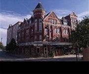
BLENNERHASSETT
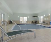
TownePlace Suites Parkersburg
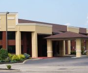
Hampton Inn - Suites Parkersburg Downtown
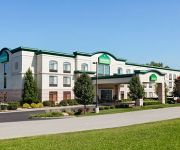
Holiday Inn Express & Suites PARKERSBURG - MINERAL WELLS
Hampton Inn Parkersburg-Mineral Wells WV
Comfort Inn near Grand Central Mall
WINGATE BY WYNDHAM VIENNA PARK
MICROTEL INN & SUITES BY WYNDH
Videos from this area
These are videos related to the place based on their proximity to this place.
Ohio Valley Speedway Late Model Feature Highlights 4-27-2013
Late Model feature highlights from the Ohio Valley Speedway near Lubeck, WV on 4-27-2013. www.OVDTR.com.
Ohio Valley Speedway OVSCA Sprint Car Feature Highlights 4-27-2013
Ohio Valley Sprint Car Association feature highlights from the Ohio Valley Speedway near Lubeck, WV on 4-27-2013. www.OVDTR.com.
Living Last Supper - Rockland Church - Belpre, OH
Filmed on Thursday, April 2nd 2015 - Rockland United Methodist Church - Belpre, OH -
Aerial Video of Belpre Ohio
Took this video using my FlyCamOne2 camera mounted on my modified EasyStar plane. Launched it from the railroad bank by my house. The video would have been much, much longer but the battery.
2006 Ford Mustang Used Cars Belpre OH
http://www.allmanspreowndautosllc.com This 2006 Ford Mustang is available from Allmans Preowned Autos, LLC. For details, call us at 740-315-5740.
Golden Tee Great Shot on Southern Oaks!
YOS hits an amazing shot at BUFFALO WILD WINGS, PARKERSBURG, WV!
Andy Griggs Are You Sure Hank Done It This Way live The Pour House August 16,2013
Andy Griggs performing at The Pour House Lubeck, West Virginia.
Ohio Valley Speedway AMRA Late Model Feature Highlights 4-6-2013
AMRA Late Model feature highlights from the Ohio Valley Speedway near Lubeck, WV on 4-6-2013. www.OVDTR.com.
194 Sunset Blvd, Parkersburg, WV 26101
For more details click here: http://www.visualtour.com/showvt.asp?t=3240972 194 Sunset Blvd Parkersburg, WV 26101 $129900, 3 bed, 2.5 bath, 1527 SF, MLS# 2...
Ohio Valley Speedway 4 Cylinder Feature Highlights 8-27-2011
4 Cylinder feature highlights from the Ohio Valley Speedway near Lubeck, WV on 8-27-2011. www.OVDTR.com.
Videos provided by Youtube are under the copyright of their owners.
Attractions and noteworthy things
Distances are based on the centre of the city/town and sightseeing location. This list contains brief abstracts about monuments, holiday activities, national parcs, museums, organisations and more from the area as well as interesting facts about the region itself. Where available, you'll find the corresponding homepage. Otherwise the related wikipedia article.
Belpre, Ohio
Belpre is a city in Washington County, Ohio, United States, along the Ohio River. The town was originally named Belle Prairie or "Beautiful Prairie. " Part of the Parkersburg-Marietta-Vienna, WV-OH Metropolitan Statistical Area, it is located about 14 miles downriver from Marietta. In 1870 the Baltimore and Ohio Railroad completed the Parkersburg Bridge (CSX) across the river; at 7,140 feet, it was reportedly the longest in the world. The population was 6,441 at the 2010 census.
Blennerhassett, West Virginia
Blennerhassett is a census-designated place (CDP) in Wood County, West Virginia, United States. It is part of the Parkersburg-Marietta-Vienna, WV-OH Metropolitan Statistical Area. The population was 3,089 at the 2010 census.
Lubeck, West Virginia
Lubeck is a census-designated place (CDP) in Wood County, West Virginia, United States. It is part of the Parkersburg-Marietta-Vienna, WV-OH Metropolitan Statistical Area. The population was 1,311 at the 2010 census.
Blennerhassett Island
Blennerhasset Island, an island on the Ohio River below the mouth of the Little Kanawha River, is located near Parkersburg in Wood County, West Virginia, USA. Historically, Blennerhassett Island was an Indian settlement, first known as Backus Island for Elijah Backus who purchased it in 1792. Now it is named for Harman Blennerhassett, a figure in the Aaron Burr treason conspiracy, who purchased the east end of the island in 1798.
Belpre High School
Belpre High School is a public high school in Belpre, Ohio, United States. It is the only high school in the Belpre City School District. Their nickname is the Golden Eagles.
Blennerhassett Island Bridge
Blennerhassett Island Bridge opened to traffic June 13, 2008. The bridge is a Network Arch Bridge constructed at a cost of $120 million over the Ohio River between Belpre, Ohio and Parkersburg, West Virginia. Construction of the bridge was completed by the Walsh Construction Company of Chicago. The completion of the span, which carries U.S. Route 50, completed Corridor D between Interstate 275 east of Cincinnati to Interstate 79 at Clarksburg, West Virginia.


