Safety Score: 2,7 of 5.0 based on data from 9 authorites. Meaning we advice caution when travelling to United States.
Travel warnings are updated daily. Source: Travel Warning United States. Last Update: 2024-04-23 08:18:23
Explore Point Pleasant
Point Pleasant in Mason County (West Virginia) with it's 4,276 inhabitants is located in United States about 274 mi (or 442 km) west of Washington DC, the country's capital.
Local time in Point Pleasant is now 09:46 AM (Tuesday). The local timezone is named America / New York with an UTC offset of -4 hours. We know of 8 airports in the wider vicinity of Point Pleasant, of which 3 are larger airports. The closest airport in United States is Tri-State/Milton J. Ferguson Field in a distance of 40 mi (or 65 km), South-West. Besides the airports, there are other travel options available (check left side).
Also, if you like golfing, there are multiple options in driving distance. If you need a place to sleep, we compiled a list of available hotels close to the map centre further down the page.
Depending on your travel schedule, you might want to pay a visit to some of the following locations: Gallipolis, Pomeroy, Winfield, Ripley and Athens. To further explore this place, just scroll down and browse the available info.
Local weather forecast
Todays Local Weather Conditions & Forecast: 18°C / 64 °F
| Morning Temperature | 6°C / 42 °F |
| Evening Temperature | 16°C / 60 °F |
| Night Temperature | 12°C / 54 °F |
| Chance of rainfall | 0% |
| Air Humidity | 39% |
| Air Pressure | 1017 hPa |
| Wind Speed | Gentle Breeze with 9 km/h (5 mph) from North-East |
| Cloud Conditions | Broken clouds, covering 66% of sky |
| General Conditions | Light rain |
Tuesday, 23rd of April 2024
11°C (52 °F)
7°C (45 °F)
Moderate rain, gentle breeze, overcast clouds.
Wednesday, 24th of April 2024
16°C (61 °F)
8°C (46 °F)
Overcast clouds, light breeze.
Thursday, 25th of April 2024
18°C (64 °F)
13°C (56 °F)
Light rain, gentle breeze, overcast clouds.
Hotels and Places to Stay
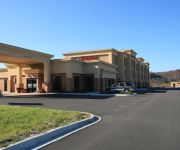
Hampton Inn Gallipolis
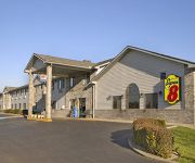
SUPER 8 GALLIPOLIS PT PLEASANT
Quality Inn Gallipolis
Videos from this area
These are videos related to the place based on their proximity to this place.
Mothman - Point Pleasant
Numerous accounts and eyewitnesses spotting the red-eyed creature, dubbed "Mothman" started in the small town of Point Pleasant, West Virginia. http://mothmanlives.com/
Plumber Point Pleasant WV | 304-935-5154 | Plumbing Services West Virginia
Plumber South Charleston WV | 304-935-5154 | Plumbing Services West Virginia Looking for the Best Plumber in West Virginia? We offer a complete plumbing service for new installations, repairs,...
Hurricane Middle School Redskins v Pt. Pleasant Middle School Big Blacks
I created this video with the YouTube Video Editor (http://www.youtube.com/editor)
West Virginia Trip
Trip we took to Point Pleasant, West Virginia. It was really cold. Bright Eyes - Lover I Dont Have To Love.
Mothman Festival 2014
The event is in September each year. Don't miss the famous “Mothman Statue”, Mothman Museum, to meet original eyewitnesses, authors and Mothman experts and the Point Pleasant River Museum...
Diesel Truck Pulls Mason County Fair 2012
Some trucks I filmed in the truck pull at the Mason County fair in Point Pleasant, WV and I threw a turbo tractor in at the end lol.
Kahlenberg Q-4 on M/V J.S. Lewis
This video was taken at Maritime Days in Point Pleasant, WV where the M/V J.S. Lewis was tied off and opened up for public tours. I convinced Capt. Steve Grossarth into giving a nice salute...
Gallipolis In Lights - City Park
Short video of the Christmas lights in Gallipolis, Ohio. We're a small town in Southeastern Ohio (right on the Ohio River), and now have a committee that helps spruce up our city park during...
Gallipolis Fireworks 2014
Fireworks for Independence Day at the Gallipolis City Park on July 5, 2014. :)
Videos provided by Youtube are under the copyright of their owners.
Attractions and noteworthy things
Distances are based on the centre of the city/town and sightseeing location. This list contains brief abstracts about monuments, holiday activities, national parcs, museums, organisations and more from the area as well as interesting facts about the region itself. Where available, you'll find the corresponding homepage. Otherwise the related wikipedia article.
Henderson, West Virginia
Henderson is a town in Mason County, West Virginia, United States, at the confluence of the Ohio and Kanawha Rivers. The population was 271 at the 2010 census. It is part of the Point Pleasant, WV–OH Micropolitan Statistical Area. The town was incorporated in 1893 and named for Samuel Bruce Henderson, who owned the townsite at the time.
Point Pleasant, West Virginia
Point Pleasant is a city in and the county seat of Mason County, West Virginia, United States, at the confluence of the Ohio and Kanawha Rivers. The population was 4,350 at the 2010 census. It is the principal city of the Point Pleasant, WV-OH Micropolitan Statistical Area.
Battle of Point Pleasant
The Battle of Point Pleasant — known as the Battle of Kanawha in some older accounts — was the only major action of Dunmore's War. It was fought on October 10, 1774, primarily between Virginia militia and American Indians from the Shawnee and Mingo tribes. Along the Ohio River near modern Point Pleasant, West Virginia, American Indians under the Shawnee Chief Cornstalk attacked Virginia militia under Colonel Andrew Lewis, hoping to halt Lewis's advance into the Ohio Country.
Silver Memorial Bridge
The Silver Memorial Bridge is a cantilever bridge which spans the Ohio River between Gallipolis, Ohio and Henderson, West Virginia. The bridge was completed in 1969, shortly after the Silver Bridge disaster, although it is located about 1 mile (1.6 km) downstream (south) of the original. The design of the bridge is much more proven than the ill fated eyebar chain suspension bridge, which collapsed in 1967.
Point Pleasant Rail Bridge
The Point Pleasant Rail Bridge is a cantilever bridge that crosses the Ohio River between Gallia County, Ohio and Point Pleasant, West Virginia. At the present time, the bridge is being used by Norfolk Southern for transporting goods from point to point via rail, but it was once used by Conrail, Penn Central, and the New York Central Railroad.
Fort Randolph (West Virginia)
Fort Randolph was an American Revolutionary War fort which stood at the confluence of the Ohio and Kanawha Rivers, where the town of Point Pleasant, West Virginia, is now located. Built in 1776 on the site of an earlier fort from Dunmore's War, the fort is best remembered as the place where the famous Shawnee Chief Cornstalk was murdered in 1777. The fort withstood attack by American Indians in 1778 but was abandoned the next year.
WVRR
WVRR ("Walk FM") is a Contemporary Christian formatted broadcast radio station licensed to Point Pleasant, West Virginia, serving the Mid-Ohio Valley. WVRR is owned and operated by Baker Family Stations as a simulcast of WPJY 88.7 FM in the Parkersburg, WV area.
WBYG
WBYG is a Country formatted broadcast radio station licensed to Point Pleasant, West Virginia, serving Point Pleasant, Mason County in West Virginia and Gallia County in Ohio. WBYG is owned and operated by Baker Family Stations.
Silver Bridge
The Silver Bridge was an eyebar-chain suspension bridge built in 1928 and named for the color of its aluminum paint. The bridge connected Point Pleasant, West Virginia and Gallipolis, Ohio, over the Ohio River. On December 15, 1967, the Silver Bridge collapsed while it was full of rush-hour traffic, resulting in the deaths of 46 people. Two of the victims were never found.


