Safety Score: 3,0 of 5.0 based on data from 9 authorites. Meaning we advice caution when travelling to United Kingdom.
Travel warnings are updated daily. Source: Travel Warning United Kingdom. Last Update: 2024-04-27 08:23:39
Explore Lhanbryde
Lhanbryde in Moray (Scotland) with it's 1,970 inhabitants is located in United Kingdom about 441 mi (or 710 km) north of London, the country's capital.
Local time in Lhanbryde is now 03:59 PM (Saturday). The local timezone is named Europe / London with an UTC offset of one hour. We know of 10 airports in the wider vicinity of Lhanbryde, of which 3 are larger airports. The closest airport in United Kingdom is RAF Lossiemouth in a distance of 7 mi (or 11 km), North-West. Besides the airports, there are other travel options available (check left side).
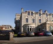
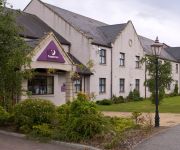
There are two Unesco world heritage sites nearby. The closest heritage site in United Kingdom is Heart of Neolithic Orkney in a distance of 95 mi (or 153 km), North. Also, if you like golfing, there are multiple options in driving distance. If you need a place to sleep, we compiled a list of available hotels close to the map centre further down the page.
Depending on your travel schedule, you might want to pay a visit to some of the following locations: Elgin, Inverness, Highland, Forfar and Dundee. To further explore this place, just scroll down and browse the available info.
Local weather forecast
Todays Local Weather Conditions & Forecast: 9°C / 48 °F
| Morning Temperature | 4°C / 39 °F |
| Evening Temperature | 9°C / 48 °F |
| Night Temperature | 4°C / 39 °F |
| Chance of rainfall | 1% |
| Air Humidity | 63% |
| Air Pressure | 1008 hPa |
| Wind Speed | Gentle Breeze with 8 km/h (5 mph) from North-West |
| Cloud Conditions | Overcast clouds, covering 100% of sky |
| General Conditions | Light rain |
Sunday, 28th of April 2024
7°C (45 °F)
4°C (40 °F)
Overcast clouds, gentle breeze.
Monday, 29th of April 2024
12°C (54 °F)
9°C (48 °F)
Overcast clouds, gentle breeze.
Tuesday, 30th of April 2024
13°C (56 °F)
9°C (49 °F)
Broken clouds, fresh breeze.
Hotels and Places to Stay
Videos from this area
These are videos related to the place based on their proximity to this place.
Elgin floods 2009 (4 Sep)
The River Lossie burst its banks in September 2009, leading to floods in Elgin.
Elgin Hare & Hound 2012.mpg
Off road Motor bike race, Scottish championship 2012 Hare & Hound round 4.
Elgin Cathedral
Elgin Cathedral often referred to as The Lantern of the North is a historic ruin in Elgin in Moray, the north-east of Scotland. It was established in 1224 but only reached completion near the...
Using the Toilet
The Disabled Living Center in Elgin, Moray aims to help people with all kinds of disability. This short film explores assisting people with accessing tolet facilities.
Bath and Shower
The Disabled Living Center in Elgin, Moray aims to help people with all kinds of disability. This short film explores assisting people with access to their bath and showers.
Videos provided by Youtube are under the copyright of their owners.
Attractions and noteworthy things
Distances are based on the centre of the city/town and sightseeing location. This list contains brief abstracts about monuments, holiday activities, national parcs, museums, organisations and more from the area as well as interesting facts about the region itself. Where available, you'll find the corresponding homepage. Otherwise the related wikipedia article.
Urquhart, Moray
Urquhart is a small village in Moray, Scotland with a population of 420 (as at the 2001 Census). It is approximately five miles east of Elgin, and between the villages of Lhanbryde and Garmouth.
Lhanbryde
Lhanbryde is a village in Moray, Scotland, four miles east of Elgin. Previously bisected by the A96, it was bypassed in the early 1990s and now lies to the north of this busy trunk road. The origin of the name "Lhanbryde" is thought to be Pictish, meaning the "Church Place of St Bride ". Why the name has emerged in modern times in its very Welsh form is unclear. The village name was recorded as Lamanbride in 1215; Lambride at the end of the 14th century; Lambry in 1600; and Longbride in 1750.
Urquhart Priory
Urquhart Priory was a Benedictine monastic community in Moray. It was founded by King David I of Scotland in 1136 as a cell of Dunfermline Abbey in the aftermath of the defeat of King Óengus of Moray. It remained a dependency of Dunfermline, and by 1454 had only 2 monks. The pope, Nicholas V, ordered it be merged with Pluscarden Priory.
List of United Kingdom locations: Lf-Litm
RAF Milltown
Royal Air Force Station Milltown or RAF Milltown is a former Royal Air Force station located south of the Moray Firth and 3.6 miles north east of Elgin, Scotland. Flying stopped in 1977 but the site is still used by the Ministry of Defence.


