Safety Score: 3,0 of 5.0 based on data from 9 authorites. Meaning we advice caution when travelling to United Kingdom.
Travel warnings are updated daily. Source: Travel Warning United Kingdom. Last Update: 2024-05-08 08:04:21
Touring Strathpeffer
Strathpeffer in Highland (Scotland) with it's 1,070 residents is a town located in United Kingdom about 455 mi (or 733 km) north-west of London, the country's capital place.
Time in Strathpeffer is now 02:12 AM (Thursday). The local timezone is named Europe / London with an UTC offset of one hour. We know of 11 airports nearby Strathpeffer, of which 3 are larger airports. The closest airport in United Kingdom is Inverness Airport in a distance of 19 mi (or 30 km), East. Besides the airports, there are other travel options available (check left side).
Also, if you like the game of golf, there are several options within driving distance. Need some hints on where to stay? We compiled a list of available hotels close to the map centre further down the page.
Being here already, you might want to pay a visit to some of the following locations: Highland, Inverness, Elgin, Stirling and Perth. To further explore this place, just scroll down and browse the available info.
Local weather forecast
Todays Local Weather Conditions & Forecast: 15°C / 59 °F
| Morning Temperature | 12°C / 54 °F |
| Evening Temperature | 15°C / 59 °F |
| Night Temperature | 12°C / 54 °F |
| Chance of rainfall | 0% |
| Air Humidity | 72% |
| Air Pressure | 1023 hPa |
| Wind Speed | Moderate breeze with 10 km/h (6 mph) from North-East |
| Cloud Conditions | Overcast clouds, covering 100% of sky |
| General Conditions | Overcast clouds |
Friday, 10th of May 2024
19°C (65 °F)
12°C (53 °F)
Overcast clouds, light breeze.
Saturday, 11th of May 2024
20°C (69 °F)
14°C (58 °F)
Overcast clouds, light breeze.
Sunday, 12th of May 2024
20°C (68 °F)
15°C (58 °F)
Light rain, gentle breeze, scattered clouds.
Hotels and Places to Stay
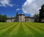
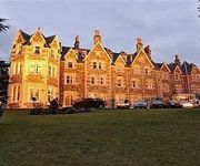
Coul House by strathpeffer Near Inverness
Ben Wyvis
MacKay's Hotel
Videos from this area
These are videos related to the place based on their proximity to this place.
Strathpuffer 10, 2013, 24 hour mountain bike race, Contin and Strathpeffer, Ross-Shire.
Strathpuffer 24 hour mountain bike race, 26/27 January 2013. The film is more for the benefit for the competitors, so that they can see themselves in action. The race starts at 10:00 am Saturday...
Rogie Falls - Highlands of Scotland
Rogie Falls (Gaelic: Eas Rothagaidh) are a series of waterfalls on the Black Water, a river in Ross-shire in the Highlands of Scotland. The falls are about 2 km north-west of the village of...
Strathpuffer 24 Hour Mountain Bike Race 2014, part 14. At the narrow bridge.
Filming started at about 13:25 PM on Saturday. Strathpuffer 24 Hour Mountain Bike Race, Strathpeffer near Inverness, Scotland, 18/19 January 2014. Rider's can enter as solo's, pair's or quad's....
Strathpuffer 2014 1, all(?) of the first lap riders.
Strathpuffer 24 Hour Mountain Bike Race, Strathpeffer near Inverness, Scotland,18/19 January 2014.
Strathpuffer 24 Hour Mountain Bike Race 2014, part 1 on Sunday AM.
First film from Sunday morning. Strathpuffer 24 Hour Mountain Bike Race, Strathpeffer near Inverness, Scotland, 18/19 January 2014. Rider's can enter as solo's, pair's or quad's. The race...
Strathpuffer 2014 2, further up the hill. Filming started at 10:48 AM Saturday.
Strathpuffer 24 Hour Mountain Bike Race, Strathpeffer near Inverness, Scotland,18/19 January 2014.
Strathpuffer 24 Hour Mountain Bike Race 2014, part 21.
The last one from Saturday, filmed at around 5:00 PM. An old bloke like me needs a good nights sleep. Strathpuffer 24 Hour Mountain Bike Race, Strathpeffer near Inverness, Scotland, 18/19 ...
Strathpuffer 24 Hour Mountain Bike Race 2014, part 3 on Sunday.
Strathpuffer 24 Hour Mountain Bike Race, Strathpeffer near Inverness, Scotland, 18/19 January 2014. Rider's can enter as solo's, pair's or quad's. The race starts at 10:00 AM on Saturday and...
Videos provided by Youtube are under the copyright of their owners.
Attractions and noteworthy things
Distances are based on the centre of the city/town and sightseeing location. This list contains brief abstracts about monuments, holiday activities, national parcs, museums, organisations and more from the area as well as interesting facts about the region itself. Where available, you'll find the corresponding homepage. Otherwise the related wikipedia article.
Clach an Tiompain
The Clach an Tiompain (in English, the "Sounding Stone") or The Eagle Stone is a small Class I Pictish stone located on a hill on the northern outskirts of Strathpeffer in Easter Ross, Scotland.
Highland Museum of Childhood
Highland Museum of Childhood is a museum in the restored railway station in Strathpeffer, Scotland.
Castle Leod
Castle Leod is located near Strathpeffer in the east of Ross-shire in the Scottish Highlands. It is currently the seat of the Chief of the Clan Mackenzie, although the lands belonged to the Chief of the Clan MacLeod of Lewis until the 17th century. It is a category A listed building, and the grounds are listed in the Inventory of Gardens and Designed Landscapes of Scotland, the national listing of significant gardens.
Battle of Drumchatt
The Battle of Drumchatt was a Scottish clan battle that took place in 1497. The Clan Mackenzie and possibly the Clan Munro defeated the Clan MacDonald of Lochalsh at Drumchatt (Druimchat) or "the Cat's Back", a ridge to the southeast of Strathpeffer.
Battle of Blar Na Pairce
The Battle of Blar na Pairce (Scottish Gaelic: Blàr na Pàirce "Battle of the Park") was a Scottish clan battle that took place just outside Strathpeffer some time between 1485 and 1491. It was fought between men of the Clan Donald or MacDonald and the Clan Mackenzie. The chief of Clan Donald, Lord of the Isles, had resigned the title of Earl of Ross to the king in 1477. After this the province of Ross was constantly invaded by the MacDonald islanders.
Strathpeffer Pavilion
Strathpeffer Spa Pavilion was commissioned by the Countess of Cromartie in the late 19th century, to serve as a social and entertainment centre for Strathpeffer's many visitors. Formerly just a collection of farms in a valley in the Highlands of Scotland, the village of Strathpeffer developed and became a popular health resort (then the most northerly spa in Europe) in the Victorian era, when local spring waters were discovered to have health-giving properties.
Black Water (Conon)
The Black Water is a river in the Highlands of Scotland. It begins at the confluence of the Glascarnoch River with the Abhainn Srath a' Bhàthaich, near where it is crossed by the Black Bridge, carrying the A835 road. It flows in a south-easterly direction past the village of Garve, then passing through Loch Garve and Loch na Cròic, and around Eilean nan Daraich. It flows over Rogie Falls, then past Contin, around Contin Island, before flowing into the River Conon near Moy Bridge.
Strathpeffer railway station
Strathpeffer railway station was a former station serving the small town of Strathpeffer in the county of Ross and Cromarty,, Scotland. Strathpeffer 265px The station in 2011, from the west end, when in use as an information office, cafe and retail shops. The railway line lay behind the bushes at right.


