Safety Score: 3,0 of 5.0 based on data from 9 authorites. Meaning we advice caution when travelling to United Kingdom.
Travel warnings are updated daily. Source: Travel Warning United Kingdom. Last Update: 2024-05-07 07:59:51
Delve into Ormeau
The district Ormeau of Castlereagh in Belfast (Northern Ireland) is a subburb in United Kingdom about 320 mi north-west of London, the country's capital town.
If you need a hotel, we compiled a list of available hotels close to the map centre further down the page.
While being here, you might want to pay a visit to some of the following locations: Belfast, Newtownabbey, Carrickfergus, Lisburn and Newtownards. To further explore this place, just scroll down and browse the available info.
Local weather forecast
Todays Local Weather Conditions & Forecast: 14°C / 57 °F
| Morning Temperature | 7°C / 45 °F |
| Evening Temperature | 14°C / 56 °F |
| Night Temperature | 8°C / 46 °F |
| Chance of rainfall | 0% |
| Air Humidity | 65% |
| Air Pressure | 1024 hPa |
| Wind Speed | Gentle Breeze with 6 km/h (4 mph) from South-East |
| Cloud Conditions | Overcast clouds, covering 100% of sky |
| General Conditions | Overcast clouds |
Wednesday, 8th of May 2024
17°C (63 °F)
12°C (53 °F)
Light rain, gentle breeze, overcast clouds.
Thursday, 9th of May 2024
16°C (60 °F)
11°C (51 °F)
Overcast clouds, gentle breeze.
Friday, 10th of May 2024
18°C (64 °F)
12°C (53 °F)
Light rain, light breeze, overcast clouds.
Hotels and Places to Stay
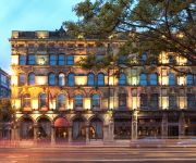
The Merchant Hotel
Hilton Belfast
Hastings Stormont
Belfast Apartment
Ten Square Hotel
Clayton Belfast
Central Belfast Apartments
PARK AVENUE HOTEL
Malmaison Belfast
Dream Apartments Obel Tower
Videos from this area
These are videos related to the place based on their proximity to this place.
Titanic Belfast is the best visitor attraction in Europe
Titanic Belfast has fended off one of the most iconic buildings in the world's most romantic city to be named the best visitor attraction in Europe. While the stunning 300m Eiffel Tower may...
The Making of Gregory by Gregory Jewellers
Since 1967 Gregory Jewellers has been creating renowned fine jewellery. Today it is a diversified brand boasting a portfolio of fine jewellery, watches and accessories consistently bound by...
The Cool Kitchen travels to India
Here is a short clip showing the highlights of our wonderful trip to India. Blog: http://thecoolkitchenandmore.blogspot.co.uk/ Twitter: https://twitter.com/HDennemeyer Facebook: https://www.fac...
Murals of East Belfast
There is a long tradition of mural painting in Belfast and though many of these are based on the city's past conflict, today more murals depicting the life, history and culture of East Belfast...
Jim Shannon MP outlines economic benefits of air connectivity and expansion #DUP2014
DUP Member of Parliament for Strangford, Jim Shannon MP, outlines the importance of increased air connectivity and expansion of UK airports as a means to NI economic growth, through increasing...
Pride of the Raven 22/2/2008
Clip of PoTR marching down Templemore Avenue on Sat 22/2/08 with the UDR lodge LOL 1970 en route to a memorial service in belfast city centre.
Harland & Wolff Cranes
Harland and Wolff Cranes are on Queen's Island. Goliath was constructed first in 1969 on site whereas it's brother David was completed whole and installed in 1974. One rises to 96m and...
The Cool Kitchen Travels: London PART 2
Blog: http://thecoolkitchenandmore.blogspot.co.uk/ Twitter: https://twitter.com/HDennemeyer Facebook: https://www.facebook.com/TheCoolKitchenAndMore Google +: https://plus.google.com/u/0/...
Bankcheck promotional video
Bankcheck - Independent banking analysts specialising in interest audits and banking advice. Visit http://www.bankcheck.co.uk for further information. BANKCheck Suite 409, City East...
CoderDojo Belfast
CoderDojo Belfast is a youth coding initiative based at Belfast Metropolitan College. Follow @CoderDojoBMC or visit www.coderdojobelfast.com for more info!
Videos provided by Youtube are under the copyright of their owners.
Attractions and noteworthy things
Distances are based on the centre of the city/town and sightseeing location. This list contains brief abstracts about monuments, holiday activities, national parcs, museums, organisations and more from the area as well as interesting facts about the region itself. Where available, you'll find the corresponding homepage. Otherwise the related wikipedia article.
Castlereagh (borough)
Castlereagh is a local government district with the status of borough in Northern Ireland. A mainly urban borough to the south of Belfast City, it is governed by Castlereagh Borough Council . Unusually, it has no natural borough centre. It consists mostly of suburbs of Belfast in the Castlereagh Hills (to the south-east of the city) with a small rural area in the south of the borough.
Glentoran F.C
Glentoran F.C. is a semi-professional football club in Northern Ireland. The club was founded in 1882 and plays its home games at the Oval in east Belfast. Club colours are green, red, and black. The clubs current manager is Eddie Patterson. Linfield and Glentoran are nicknamed Belfast's Big Two, as they have traditionally dominated local football in Northern Ireland since the demise of Belfast Celtic.
Ravenhill Stadium
Ravenhill Stadium is located in Belfast, Northern Ireland. It is the home ground of Ulster Rugby. It has a normal capacity of 12,300 and is owned by the Irish Rugby Football Union.
The Oval (Belfast)
The Oval is a football stadium in Belfast, Northern Ireland. The stadium has been home to Glentoran since 1892.
Belfast East (Dáil Éireann constituency)
Belfast East, was a former potential Dáil Éireann parliamentary constituency. It was a Dáil constituency from 1921 to 1922.
Cregagh
Cregagh is an area southeast of Belfast in County Down, Northern Ireland. It is the name of a townland and has been adopted as the name of an electoral ward of the Borough of Castlereagh. The townland dates back to mediaeval times, when it was part of the territory held by the O'Neills of Clannaboy. The area is centred on the Cregagh Road.
Strand Cinema
The Strand Cinema is an independent four-screen cinema in Belfast, Northern Ireland. It is one of the two remaining independent cinemas in Belfast, alongside the Queen's Film Theatre. It is located on the Holywood Road. It has long been acclaimed for being one of the cheapest cinemas in Belfast. Opened in 1935, the cinema's design was influenced by its proximity to the nearby shipyard of Harland & Wolff, featuring curved walls and portholed foyer.
Belfast East (Assembly constituency)
Belfast East is a constituency in the Northern Ireland Assembly. The seat was first used for a Northern Ireland-only election for the Northern Ireland Assembly, 1973.
Belfast East (Northern Ireland Parliament constituency)
Belfast East was a borough constituency of the Parliament of Northern Ireland from 1921 - 1929. It returned four MPs, using the single transferable vote method of proportional representation.
Castlereagh College
Castlereagh College was a further and higher education college in east Belfast. In 2007, it merged with the Belfast Institute of Further and Higher Education to form part of the Belfast Metropolitan College.
Belfast Victoria (Northern Ireland Parliament constituency)
Belfast Victoria was a constituency of the Parliament of Northern Ireland.
Belfast Pottinger (Northern Ireland Parliament constituency)
Belfast Pottinger was a constituency of the Parliament of Northern Ireland.
Belfast Bloomfield (Northern Ireland Parliament constituency)
Belfast Bloomfield was a constituency of the Parliament of Northern Ireland.
The Comber Greenway
The Comber Greenway is a 7-mile traffic-free section of the National Cycle Network, in development along the old Belfast-Comber railway line. The cycle path starts on Dee Street in Belfast and finishes at Comber. Now completed the Greenway provides an eco-friendly cycle path with views of Stormont and Scrabo Tower. The most recent addition to the route was in November 2008 when the final link between Old Dundonald Road/Comber Rd junction and Comber was opened. This added 2.5 km to the route.
Belfast Willowfield (Northern Ireland Parliament constituency)
Belfast Willowfield was a constituency of the Parliament of Northern Ireland.
Cluan Place
Cluan Place is a Protestant working-class area in eastern inner-city Belfast, in Northern Ireland. There is currently a peace line, separating the area from Roman Catholic Short Strand. Rioting between neighbouring Loyalist and Republican factions has been a feature of the area's recent past. See Battle of Saint Matthew's. The introduction of CCTV in the area, and in other similar places in the city, has had a positive effect with a drastic reduction in incidents there, and throughout Belfast.
A55 road (Northern Ireland)
The A55 road forms Belfast's outer-ring road.
Battle of St Matthew's
The Battle of St Matthew's or Battle of Short Strand was a gun battle fought between the Provisional Irish Republican Army (IRA) and Ulster loyalists on 27 June 1970. It took place in the area around St Matthew's Roman Catholic Church, which is in the mainly nationalist Short Strand district of Belfast. At the time it was the Provisional IRA's most significant operation in the Troubles up to then.
Bloomfield Collegiate School
Bloomfield Collegiate School is a girl's state grammar school in Belfast, Northern Ireland, for pupils in years 11-18.
Neill's Hill railway station
Neill's Hill railway station is a disused railway station / halt on the main line of the Belfast and County Down Railway. It ran from Queen's Quay, Belfast south to Newcastle, County Down in Northern Ireland. When the Belfast and County Down Railway was open, Neill's Hill railway station was the 4th station from Queen's Quay, Belfast.
Pottinger (District Electoral Area)
Pottinger is one of the nine district electoral areas (DEA) in Belfast, Northern Ireland. Located in the east of the city, the district elects six members to Belfast City Council and contains the wards of Ballymacarrett; Bloomfield; Orangefield; Ravenhill; The Mount and Woodstock.
Elmgrove Primary School
Elmgrove Primary School (Sometimes referred to as simply Elmgrove and originally known as Elmgrove Elementary School) is a large Primary School in Belfast, Northern Ireland. It opened in 1932 as Elmgrove Elementary School. In 2008 Elmgrove celebrated its 75th anniversary. Special medals made from Mambco, were given to all the pupils.
Knockbreda High School
Knockbreda High School (better known as Knockbreda or simply KHS) is a co-educational controlled secondary school situated in the outskirts of Belfast, Northern Ireland. The current principal is Mr Ian Berry. The school was formed in 1959 and mainly serves the residents of the areas that surround it which include Cregagh, Braniel, Woodstock and Belvoir.
Lagan Canal
The Lagan Canal was a 27-mile canal built to connect Belfast to Lough Neagh. The first section, which is a river navigation, was opened in 1763, and linked Belfast to Lisburn. The second section from Lisburn to Lough Neagh includes a small amount of river navigation, but was largely built as a canal. At its peak it was one of the most successful of the Irish canals, but ultimately it was unable to compete with road and rail transport, and the two sections were closed in 1954 and 1958.
Victoria Park, Belfast
Victoria Park was opened in 1906 in the Connswater area of Belfast. Belfast Harbour Commissioners investigated the idea in 1854, however the land was very marshy and needed draining near Belfast Lough. It was landscaped by Charles McKimm, who also built the Tropical Ravine in Botanic Gardens. Victoria Park contains a large lake.


