Safety Score: 3,0 of 5.0 based on data from 9 authorites. Meaning we advice caution when travelling to United Kingdom.
Travel warnings are updated daily. Source: Travel Warning United Kingdom. Last Update: 2024-04-19 08:03:45
Delve into Moneyreagh
Moneyreagh in Lisburn and Castlereagh (Northern Ireland) is a city located in United Kingdom about 316 mi (or 508 km) north-west of London, the country's capital town.
Current time in Moneyreagh is now 07:19 PM (Friday). The local timezone is named Europe / London with an UTC offset of one hour. We know of 8 airports closer to Moneyreagh, of which 3 are larger airports. The closest airport in United Kingdom is George Best Belfast City Airport in a distance of 6 mi (or 10 km), North. Besides the airports, there are other travel options available (check left side).
There is one Unesco world heritage site nearby. The closest heritage site is Brú na Bóinne - Archaeological Ensemble of the Bend of the Boyne in Ireland at a distance of 59 mi (or 95 km). Also, if you like playing golf, there are some options within driving distance. We saw 2 points of interest near this location. In need of a room? We compiled a list of available hotels close to the map centre further down the page.
Since you are here already, you might want to pay a visit to some of the following locations: Castlereagh, Belfast, Newtownards, Newtownabbey and Carrickfergus. To further explore this place, just scroll down and browse the available info.
Local weather forecast
Todays Local Weather Conditions & Forecast: 11°C / 52 °F
| Morning Temperature | 9°C / 47 °F |
| Evening Temperature | 9°C / 49 °F |
| Night Temperature | 3°C / 37 °F |
| Chance of rainfall | 0% |
| Air Humidity | 66% |
| Air Pressure | 1021 hPa |
| Wind Speed | Moderate breeze with 12 km/h (8 mph) from South-East |
| Cloud Conditions | Overcast clouds, covering 100% of sky |
| General Conditions | Overcast clouds |
Saturday, 20th of April 2024
12°C (54 °F)
6°C (42 °F)
Broken clouds, light breeze.
Sunday, 21st of April 2024
14°C (57 °F)
7°C (44 °F)
Broken clouds, light breeze.
Monday, 22nd of April 2024
14°C (56 °F)
9°C (48 °F)
Overcast clouds, moderate breeze.
Hotels and Places to Stay
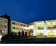
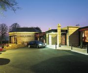
La Mon Hotel And Country Club
Hastings Stormont
PARK AVENUE HOTEL
Ivanhoe Hotel and Inn
Belfast Titanic Quarter
Videos from this area
These are videos related to the place based on their proximity to this place.
Field Marshal Montgomery claim first UK Championship
In the pleasant surroundings of the Stormont Estate in Belfast, and with superb support from Belfast City Council and BBC Northern Ireland, the first UK Pipe Band Championships took place on...
Plague Of The Daleks 3D animation
A short cgi animation featuring an audio excerpt from the excellent Big Finish Production 'Plague Of The Daleks' written by Mark Morris. Something is coming to Stockbridge. Something which...
DUP show contempt for talks process
Martin McGuinness has said the DUP showed utter contempt to the British and Irish governments by refusing to attend the opening of talks. Speaking after the opening session of talks, Mr McGuinnes...
What Carson saw .... Red Bull Ice Belfast 2015
Edward Carson's imposing statue dominates the Stormont skyline yielding brilliant views of the Ice Cross World Downhill Championship heat in Belfast, part of the Red Bull Crashed Ice series....
Jim Shannon MP outlines economic benefits of air connectivity and expansion #DUP2014
DUP Member of Parliament for Strangford, Jim Shannon MP, outlines the importance of increased air connectivity and expansion of UK airports as a means to NI economic growth, through increasing...
B17 flying fortress over Lisnabreeny US Cemetary Belfast
This is footage of a B17 flying fortress bomber( Sally B) flying over what was once Lisnabreeny Cemetary on Rocky Road, Belfast, Northern Ireland. 148 US Service personnel were buried there...
B17 Sally B at Lisnabreeny 14th Sept 2013 1080p HD
Superb flypast of the "Sally B" B-17 Flying Fortress at the Lisnabreeny memorial to the fallen US Service Personnel who died between 1943 and 1948 while in service in Northern Ireland during WW2.
Robinhall Open Championship 2014 (Bobby's 80th birthday gathering)
Recorded at Robinhall House 5th October 2014. A family & friends gathering to celebrate Robert (Bobby) Johnston's 80th birthday. Film recorded, produced & edited by Paul Marshall.
Videos provided by Youtube are under the copyright of their owners.
Attractions and noteworthy things
Distances are based on the centre of the city/town and sightseeing location. This list contains brief abstracts about monuments, holiday activities, national parcs, museums, organisations and more from the area as well as interesting facts about the region itself. Where available, you'll find the corresponding homepage. Otherwise the related wikipedia article.
La Mon restaurant bombing
The La Mon restaurant bombing was an incendiary bomb attack by the Provisional Irish Republican Army (IRA) on 17 February 1978. The target was a hotel/restaurant at Gransha in County Down, Northern Ireland. It was bombed as part of the IRA's campaign against economic targets. When the attack took place, there were 450 diners, hotel staff and guests inside the building.
Ouley Hill
At 180m, Ouley Hill is the highest hill in County Down Northern Ireland, lying between Carryduff and Saintfield. It was the site of a battle in the Irish Rebellion of 1798. Ouley Hill is accessible by the Killinure Road which runs across the highest part, there are several side road networks which straddle the peak, including Ouley Road itself.
Moneyreagh
Moneyreagh or Moneyrea (from Irish: Mónaidh Riabhach, meaning "grey bog or moor") is a small village and townland in County Down, Northern Ireland. It is just off the main road between Belfast and Ballygowan. It is situated in the civil parish of Comber and the historic barony of Castlereagh Lower The village's Non-Subscribing Presbyterian Church has a long history. The congregation dates back to the 18th century. The original meeting house was a barn-like building built in 1719.
A21 road (Northern Ireland)
The A21 is a road in County Down in Northern Ireland. The route commences in Bangor, passing through Newtownards, Comber, and Ballygowan, and finishes on the northern outskirts of Ballynahinch. There are two dual carriageway sections; between Bangor and Newtownards, and between Newtownards and Comber. The second of these passes near the northern shores of Strangford Lough through some of the best agricultural land in Ireland in the vicinity of Comber.
A23 road (Ireland)
The A23 is an 8.7 mile long road in County Down, in Northern Ireland. The route starts in near the Short Strand district in east Belfast and follows the Castlereagh Road through the southeastern suburbs of the city. Upon passing through the A55 Outer Ring Road, the A23 becomes the Ballygowan Road. It passes through the Castlereagh Hills and Roselawn Cemetery, where northern Irish footballer George Best is buried, and finishes in the village of Ballygowan at a roundabout with the A21.
Ballygowan railway station
Ballygowan railway station was on the Belfast and County Down Railway which ran from Belfast to Newcastle, County Down in Northern Ireland.


