Safety Score: 3,0 of 5.0 based on data from 9 authorites. Meaning we advice caution when travelling to United Kingdom.
Travel warnings are updated daily. Source: Travel Warning United Kingdom. Last Update: 2024-04-27 08:23:39
Explore Higher Town
Higher Town in Isles of Scilly (England) is located in United Kingdom about 290 mi (or 466 km) west of London, the country's capital.
Local time in Higher Town is now 07:44 PM (Saturday). The local timezone is named Europe / London with an UTC offset of one hour. We know of 9 airports in the wider vicinity of Higher Town, of which one is a larger airport. The closest airport in United Kingdom is St. Mary's Airport in a distance of 3 mi (or 5 km), South. Besides the airports, there are other travel options available (check left side).
There is one Unesco world heritage site nearby. It's Cornwall and West Devon Mining Landscape in a distance of 75 mi (or 121 km), East. If you need a place to sleep, we compiled a list of available hotels close to the map centre further down the page.
Depending on your travel schedule, you might want to pay a visit to some of the following locations: Sennen, St. Buryan, Penzance, Germoe and Wendron. To further explore this place, just scroll down and browse the available info.
Local weather forecast
Todays Local Weather Conditions & Forecast: 10°C / 51 °F
| Morning Temperature | 9°C / 47 °F |
| Evening Temperature | 9°C / 48 °F |
| Night Temperature | 9°C / 49 °F |
| Chance of rainfall | 3% |
| Air Humidity | 82% |
| Air Pressure | 1000 hPa |
| Wind Speed | Fresh Breeze with 13 km/h (8 mph) from South |
| Cloud Conditions | Broken clouds, covering 52% of sky |
| General Conditions | Light rain |
Sunday, 28th of April 2024
10°C (50 °F)
10°C (50 °F)
Light rain, fresh breeze, broken clouds.
Monday, 29th of April 2024
11°C (52 °F)
11°C (52 °F)
Moderate rain, high wind, near gale, overcast clouds.
Tuesday, 30th of April 2024
11°C (52 °F)
10°C (51 °F)
Light rain, strong breeze, overcast clouds.
Hotels and Places to Stay
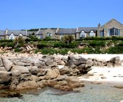
Karma St. Martin's
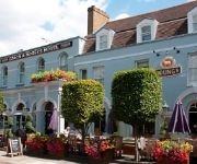
The Atlantic
The Coach & Horses
ST MARTIN'S ON THE ISLE
Videos from this area
These are videos related to the place based on their proximity to this place.
s/y Jagiellonia w drodze na Scilly
s/y "Jagiellonia" w drodze na Scilly. Trochę ładnych ujęć zrobionych w morzu i na wyspie St Mary's w Hugh Town.
3 Bay View - come2scilly Property Walkthrough
come2scilly presents a walkthrough video for the holiday property 3 Bay View located on St Mary's in the Isles of Scilly.
Laser Pico capsize, caught by homemade underwater camera!
Josh abandons ship, whilst sailing a Laser Pico, with homemade underwater camera, near Higher Town Beach, St Martins, Isles of Scilly.
Pub Costs - from radio scilly www.radioscilly.com
The application by the Bishop and Wolf to extend its hours on weekends has cost the local authorities. Radio Scilly gives a rundown of all the costs involved and the total amount. This is...
Newquay Boys leave St Mary's (with Shanties) [Part 1/3]
Newquay Boys and Bone Idol of Scilly bid farewell to the Pilot Gig racers as they depart the Scillonian III.
Rockside Cottage - come2scilly Property Walkthrough
come2scilly presents a walkthrough video for the holiday property Rockside Cottage located on St Mary's in the Isles of Scilly.
Videos provided by Youtube are under the copyright of their owners.
Attractions and noteworthy things
Distances are based on the centre of the city/town and sightseeing location. This list contains brief abstracts about monuments, holiday activities, national parcs, museums, organisations and more from the area as well as interesting facts about the region itself. Where available, you'll find the corresponding homepage. Otherwise the related wikipedia article.
Bant's Carn
Bant's Carn is a Scillonian entrance grave on the island of St Mary's in the Isles of Scilly. A military battery built in 1905 also stands nearby. The tomb measures around 8 metres in diameter and stands on a low platform 12 metres across. The entrance is 4.5 metres long and 1 metre high, with no roof. It is separated from the burial chamber by a jamb. The chamber itself measures around 5 metres in length and 1.5 metres in width and height, with four large capstones serving as a roof.
Porth Hellick Down
Porth Hellick Down is an area of downland on the east side of the island of St Mary's in the Isles of Scilly. Seven Scillonian entrance graves stand on the down in a general state of decay. The largest is the Great Tomb which has a 12 m diameter and a central burial chamber 3 m long and 1 m high. An unroofed passage 4.2 m long leads into the chamber at an angle. An encircling peristalith was destroyed during misguided restoration work by the Ministry of Works.
Wheel Wreck
The Wheel Wreck is the remains of a shipwreck lying in Crow sound off Little Ganinick in the Isles of Scilly. The wreck site consists of a discrete mound of cargo, that appears to consist of numerous sizes of different iron wheels, cogs, clack valves, tubes and boiler pipes. Lead scupper pipes and other small artefact material show the ship was once present, however, not much remains of this vessel today.
Isles of Scilly
The Isles of Scilly form an archipelago off the southwestern tip of the Cornish peninsula of Great Britain. Since 1890 the Islands have had a local authority separate from Cornwall's, but some services were combined with Cornwall and the islands are still part of the ceremonial county of Cornwall; the authority has otherwise had the status of a county council since the passing of the Isles of Scilly Order 1930. The council is currently known as the Council of the Isles of Scilly.
St Martin's Church, St Martin's
St Martin's Church, St Martin's is a parish church in the Church of England located in St Martin's, Isles of Scilly, UK.
Maypole, Isles of Scilly
Maypole is a hamlet located on the island of St. Mary's, the largest of the Isles of Scilly. It is a tourist and farming area. It also contains the only horse riding school in the islands.
Watermill Cove
Watermill Cove is on the north–west coast of St Mary’s, Isles of Scilly. The cove is within an Area of Outstanding Beauty, is a Geological Conservation Review site and was designated a Site of Special Scientific Interest (SSSI) in 1996.


!['Newquay Boys leave St Mary's (with Shanties) [Part 1/3]' preview picture of video 'Newquay Boys leave St Mary's (with Shanties) [Part 1/3]'](https://img.youtube.com/vi/CtFWK-JhiRo/mqdefault.jpg)


