Safety Score: 4,0 of 5.0 based on data from 9 authorites. Meaning please reconsider your need to travel to Switzerland.
Travel warnings are updated daily. Source: Travel Warning Switzerland. Last Update: 2024-05-10 08:04:54
Explore Hausen / Heisch
The district Hausen / Heisch of Hausen am Albis / Hausen (Dorf) in Bezirk Affoltern (Canton of Zurich) with it's 901 inhabitants Hausen / Heisch is located in Switzerland about 55 mi north-east of Bern, the country's capital.
If you need a place to sleep, we compiled a list of available hotels close to the map centre further down the page.
Depending on your travel schedule, you might want to pay a visit to some of the following locations: Horgen, Zug, Affoltern am Albis, Meilen and Zurich. To further explore this place, just scroll down and browse the available info.
Local weather forecast
Todays Local Weather Conditions & Forecast: 20°C / 68 °F
| Morning Temperature | 7°C / 45 °F |
| Evening Temperature | 19°C / 66 °F |
| Night Temperature | 11°C / 51 °F |
| Chance of rainfall | 0% |
| Air Humidity | 51% |
| Air Pressure | 1020 hPa |
| Wind Speed | Gentle Breeze with 6 km/h (4 mph) from South-West |
| Cloud Conditions | Clear sky, covering 8% of sky |
| General Conditions | Sky is clear |
Saturday, 11th of May 2024
21°C (71 °F)
13°C (55 °F)
Scattered clouds, light breeze.
Sunday, 12th of May 2024
24°C (75 °F)
14°C (58 °F)
Few clouds, light breeze.
Monday, 13th of May 2024
23°C (73 °F)
14°C (58 °F)
Light rain, light breeze, overcast clouds.
Hotels and Places to Stay
City Garden
Sedartis Swiss Quality
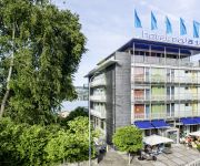
Belvoir Swiss Quality
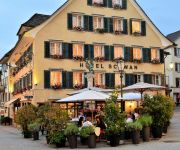
City Hotel Ochsen
Meierhof
Schwan Hotel und Taverne
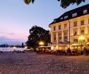
Löwen am See
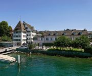
Sonne Romantik Seehotel
Parkhotel Zug
Kloster Kappel Seminarhotel und Bildungshaus
Videos from this area
These are videos related to the place based on their proximity to this place.
Seleger Moor, 17.05.2009
Seleger Moor, Sonntag, 17. Mai 2009. Das Seleger Moor ist geöffnet vom Ende April bis Ende Juli, von 8 bis 19 Uhr durchgehend, auch an allen Sonn- und Feiertagen. Anfang Mai bis mitte...
super tux 0.3.1 light and magic (53)
Last Level of the forest Island. Supertux 0.3.1 Take the right light (color) with u to overcome all obstacle.
fOG sKY fOG
dedicated to William Turner. action without action. a drive from under the fog into the blue sky, hoping to produce a romantic landscape movie, i was inspired: how would William Turner,...
Swiss Streetcars, Trolleybuses and Trains.
Public Transit powered by electricity is the cleanest, ecological, user and environment friendly solution. The governments should invest more finances into creating new public transit systems...
fOG aBOVE zURICH nEBELMEER
Fog altitude 600m, camera @ 800m. Nebelmeer auf 600m, Kamera auf 800m, gefilmt vom Albis. Une mer de brouillard Zurich Fog Albis brouillard.
Sihl Valley, Sihltal-Sihlwald- Forest-Switzerland-Natural Reserve
Video and Photos made by Cipriano Imperial Dream Production. ©2012 by CID-Production. Sihl Valley (Sihltal) near Zurich, located in Thalwil. Sihl Valley (German: Sihltal) is a river valley...
Blind Willie McTell - Forever On My Mind (Robert Weideli)
Played by Robert Weideli on a NRP Black Rust, Single Cone, 14 fretter.
Sihlwald vom 30. Oktober 2005
Normaler Sonntag in der Station Sihlwald im Sihltal bei Zürich, Museumsbahn, am 30. Oktober 2005. (älteres Videomaterial von mir). Viel Spass!
Videos provided by Youtube are under the copyright of their owners.
Attractions and noteworthy things
Distances are based on the centre of the city/town and sightseeing location. This list contains brief abstracts about monuments, holiday activities, national parcs, museums, organisations and more from the area as well as interesting facts about the region itself. Where available, you'll find the corresponding homepage. Otherwise the related wikipedia article.
Albis
The Albis is a chain of hills in the Canton of Zurich, Switzerland, stretching for some 19 km from Sihlbrugg in the south to Waldegg near Zurich in the north. The chain forms, among others, the border between the Affoltern and Horgen districts. The best known point is Uetliberg at 870 m, overlooking the city of Zurich. Other points of interest include the Albishorn (909m. ) the Bürglen (also known as Bürglenstutz, the highest peak, 914.6m.
Albis Pass
Albis Pass (el. 791 m. ) is a mountain pass in the Albis range in the canton of Zurich in Switzerland. It connects Langnau am Albis with the small village of Türlen on the Türlersee and, further on, Aeugst, Hausen, Mettmenstetten and Rifferswil. The road over the Albis pass is served hourly during daylight hours by a bus connecting Hausen am Albis to the train station in Thalwil.
Waldmannhalle
The Waldmannhalle is a stadium located in Baar, Switzerland. It was built in 1996-98 and has fixed seating for 1200 people. Seating capacity can be increased to 3000 for concerts and other cultural events. The stadium was designed by Stöckli, Schellinger + Partner Architekten
Schnabelburg Castle
Schnabelburg Castle was a small castle erected in 1150 by the lords of Eschenbach on the Albis chain South-west of Zurich, Switzerland, overlooking the nearby Schnabellücken pass. In 1309 the Schnabelburg was destroyed by the Habsburgs, in revenge for the participation of Walter von Eschenbach in the murder of Albert I of Germany. All that is left today is low ruins, reachable in about 30 minutes on foot from the Albis Pass.
Buechenegg Pass
Buechenegg Pass (el. 786 m. ) is a mountain pass in the canton of Zürich in Switzerland. It connects Langnau am Albis and Tägerst.
Türlersee
Türlersee is a lake in the district of Affoltern, Canton of Zurich, Switzerland. It lies on the border of the municipalities of Aeugst and Hausen am Albis at an elevation of 643 m. The lake has an area of 0.49 km² (maximum length 1.4 km, width 500 m).
Gottlieb Duttweiler Institute
The GDI Gottlieb Duttweiler Institute is an independent think-tank and the oldest organisation of its kind in Switzerland. It is located in Rüschlikon, near Zurich. Established on 1 September 1963, the research institute was conceived by and named after the founder of Migros, Gottlieb Duttweiler.
Zimmerberg
Zimmerberg (el. 769 metres) is a mountain and a region located in the district of Horgen in the canton of Zurich, Switzerland. Its name bases on the Old High German word zimbar in the meaning of lumber.
Sihlbrugg
Sihlbrugg is a village and important transportation node between the cantons of Zug (ZG) and Zürich (ZH) in Switzerland.
Sihl Valley
Sihl Valley is a river valley and belongs to the Zimmerberg-Sihltal region located in the district of Horgen in the canton of Zurich, Switzerland. Commonly Sihltal is used as the name of the lower Sihl valley, i.e. the area in the southwest of the city of Zürich.
IBM Zurich Research Laboratory
. 50x40pxThis article relies on references to primary sources. Please add references to secondary or tertiary sources. 40x40pxThis article appears to be written like an advertisement. Please help improve it by rewriting promotional content from a neutral point of view and removing any inappropriate external links. IBM Research - Zurich is the European branch of IBM Research. It was opened in 1956 and is located in Rüschlikon, near Zurich, Switzerland.
Sri Sivasubramaniar Temple
The Sri Sivasubramaniar Temple is a Hindu temple located in Adliswil in the Sihl Valley in the canton of Zürich, Switzerland.
Kappel Abbey
Kappel Abbey is a former Cistercian monks monastery located in Kappel am Albis in the Swiss canton of Zurich.
Binnig and Rohrer Nanotechnology Center
Binnig and Rohrer Nanotechnology Center in Rüschlikon/ZH is a Research Facility for Nanotechnology owned by IBM. This building was named after the two Nanotech-Pioneers and Nobelaureates Gerd Binnig and Heinrich Rohrer, who invented the Scanning Tunneling Microscope in the year 1986 in the Zurich Research Laboratory next to the Nano-Center. The Binnig and Rohrer Nanotechnology Center is specialized on Basic Research but also in photonics and nanotechnology.
Sihlwald railway station
Sihlwald is a railway station in the Sihl Valley, and the municipality of Horgen, in the Swiss Canton of Zurich. The station is on the Sihltal line, which is operated by the Sihltal Zürich Uetliberg Bahn (SZU). Sihlwald was the original terminus of the Sihtal line, which was opened from Bahnhof Selnau in 1892. In 1897 the Sihltal line was extended to Sihlbrugg station and a connection with the Zurich to Lucerne line of the Swiss Northeastern Railway (NOB).
Sihlbrugg railway station
Sihlbrugg is a railway station in the Swiss Canton of Zurich. Since December 2012, there are no passenger trains scheduled to stop at the station. Although named after the village of Sihlbrugg, the station is actually located nearly 3 kilometres north of the village, in the municipality of Horgen. The station is a junction point between the Swiss Federal Railways (SBB) line from Zug to Zurich Hauptbahnhof via Thalwil, and the Sihltal Zürich Uetliberg Bahn (SZU) line to Zurich via Sihlwald.
Thalwil railway station
Thalwil is a railway station in the municipality of Thalwil in the Swiss Canton of Zürich. The station is located on the Lake Zurich left bank (Zurich to Chur) main line and Zurich to Lucerne main line railways. To the Zurich side of the station, the Zimmerberg Base Tunnel diverges from the original lakeside line, whilst on the Lucerne side is the junction point where the Zurich to Chur and Zurich to Lucerne lines diverge.
Jenny Estate
Jenny Estate is a large estate in the municipality of Thalwil of the Canton of Zurich in Switzerland. It is a Swiss heritage site of national significance.
Horgen Oberdorf railway station
Horgen Oberdorf is a railway station in Switzerland, situated in the town of Horgen. The station is located on the Zürich to Lucerne railway line and is served by lines S21 and S24 of the Zurich S-Bahn. Horgen station should not be confused with the nearby, but lower level, Horgen railway station, which is on the Lake Zurich left bank railway line. The two stations are approximately 0.9 kilometres apart on foot.
Rüschlikon railway station
Rüschlikon is a railway station in Switzerland, situated near to the banks of Lake Zurich in the municipality of Rüschlikon. The station is located on the Lake Zurich left bank line, which originally formed part of the Zürich to Lucerne main line, although most main line trains now use the alternative Zimmerberg Base Tunnel routing. It is served by lines S8 and S24 of the Zurich S-Bahn.
Oberrieden railway station
Oberrieden is a railway station in Switzerland, situated on the banks of Lake Zurich in the town of Oberrieden. The station is located on the Lake Zurich left bank railway line and is served by line S8 of the Zurich S-Bahn. Oberrieden station should not be confused with the nearby, but higher level, Oberrieden Dorf railway station, which is on the Zürich to Lucerne railway line. The two stations are approximately 400 metres apart on foot.
Oberrieden Dorf railway station
Oberrieden Dorf is a railway station in Switzerland, situated on the banks of Lake Zurich in the town of Oberrieden. The station is located on the Zürich to Lucerne railway line and is served by lines S21 and S24 of the Zurich S-Bahn. Oberreiden station should not be confused with the nearby, but lower level, Oberrieden railway station, which is on the Lake Zurich left bank railway line. The two stations are approximately 400 metres apart on foot.
Langnau-Gattikon railway station
Langnau-Gattikon is a railway station in the Sihl Valley, and the municipality of Langnau am Albis, in the Swiss Canton of Zurich. Gattikon is an adjacent settlement, part of the municipality of Thalwil. The station is on the Sihltal line, which is operated by the Sihltal Zürich Uetliberg Bahn (SZU). The station is served by the following passenger trains:
Wildpark-Höfli railway station
Wildpark-Höfli is a railway station in the Sihl Valley, and the municipality of Langnau am Albis, in the Swiss Canton of Zurich. The station is on the Sihltal line, which is operated by the Sihltal Zürich Uetliberg Bahn (SZU). It takes its name from the nearby settlement of Höfli, and the Wildpark Langenberg, a nearby zoo. The station is served by the following passenger trains:
Sihlau railway station
Sihlau is a railway station in the Sihl Valley, and the municipality of Adliswil, in the Swiss Canton of Zurich. The station is on the Sihltal line, which is operated by the Sihltal Zürich Uetliberg Bahn (SZU). It takes its name from the nearby settlement of Sihlau. The station is served by the following passenger trains:


