Safety Score: 3,0 of 5.0 based on data from 9 authorites. Meaning we advice caution when travelling to Spain.
Travel warnings are updated daily. Source: Travel Warning Spain. Last Update: 2024-05-05 08:24:42
Explore el Prat de Sant Julià
The district el Prat de Sant Julià of Santa Maria de Corcó in Barcelona (Catalonia) is located in Spain about 337 mi east of Madrid, the country's capital.
If you need a place to sleep, we compiled a list of available hotels close to the map centre further down the page.
Depending on your travel schedule, you might want to pay a visit to some of the following locations: Tavertet, Vidra, Sant Feliu de Pallerols, Vilanova de Sau and Manlleu. To further explore this place, just scroll down and browse the available info.
Local weather forecast
Todays Local Weather Conditions & Forecast: 22°C / 71 °F
| Morning Temperature | 11°C / 51 °F |
| Evening Temperature | 20°C / 69 °F |
| Night Temperature | 14°C / 57 °F |
| Chance of rainfall | 0% |
| Air Humidity | 46% |
| Air Pressure | 1013 hPa |
| Wind Speed | Moderate breeze with 12 km/h (7 mph) from North-East |
| Cloud Conditions | Broken clouds, covering 57% of sky |
| General Conditions | Light rain |
Monday, 6th of May 2024
22°C (71 °F)
10°C (50 °F)
Light rain, moderate breeze, scattered clouds.
Tuesday, 7th of May 2024
15°C (59 °F)
8°C (46 °F)
Heavy intensity rain, gentle breeze, scattered clouds.
Wednesday, 8th of May 2024
21°C (70 °F)
11°C (52 °F)
Sky is clear, gentle breeze, clear sky.
Hotels and Places to Stay
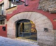
Museu Llegendes de Girona Hotel
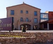
Hotel Vall de Bas
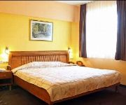
LUCKY LIGHT BOUTIQUE HOTEL SPA VELINGRAD
Videos from this area
These are videos related to the place based on their proximity to this place.
Estrena Gegantó Serrallonga de Tavertet
Estrena del gegantó Joan de Serrallonga de la colla gegantera de Tavertet (Osona) Construït a Creacions Tallaferro - Taller d'Escultura Gravat per DGC! Fotografia. www.creacionstallaferro.cat...
www.gigahertz.es Geobiologia Joan Carles López IV jornadas Ecoark(Tavertet)2.avi
Taller de prácticas de Geobiologia , sensibilidad personal en la localidad de Tavertet ( Barcelona), en las IV jornadas Ecoark 2011.
www.Gigahertz.es Geobiologia Joan Carles López IV jornadas Ecoark(Tavertet) 1
www.Gigahertz.es Geobiologia Joan Carles López IV jornadas Ecoark(Tavertet) 1.
Ruta senderisme Catalunya (Hostelets d'En Bas)
Ruta circular de 8,18 km Alçada màxima: 901 m Alçada mínima: 487 m Dificultat tècnica: Moderat Temps: 3 hores 19 minuts Coordenades: 1074 Data de pujada: 14 de febrer de 1015 Inici i final:...
Paseando en hand bike por Vall D'em Bas
Más información http://www.asaltodemata.com Un paseo en handbike por la Vall D'em Bas rodeados de naturaleza, campos, montañas... una forma divertida y sana de compartir experiencias con...
Videos provided by Youtube are under the copyright of their owners.
Attractions and noteworthy things
Distances are based on the centre of the city/town and sightseeing location. This list contains brief abstracts about monuments, holiday activities, national parcs, museums, organisations and more from the area as well as interesting facts about the region itself. Where available, you'll find the corresponding homepage. Otherwise the related wikipedia article.
Fluvià
The Fluvià is a river in Catalonia. It rises in the Serralada Transversal, passes through Olot, and flows into the Mediterranean Sea near Sant Pere Pescador.
Roda de Ter
Roda de Ter is a municipality in the comarca of Osona, province of Barcelona, Catalonia, Spain, near Vic, on the Ter River above the Sau Reservoir. Population: 5,435 (2004), area: 2.18 km². Its church is dedicated to St. Peter. Main monuments: Pont Vell ("Old Bridge") and the Capella del Sòl del Pont (Chapel of Sun of the Bridge). The Virgin Mary, La Mare de Déu del Sòl del Pont is the patron of the village. On the site of an Iberian town a Roman villa was established.
Les Masies de Roda
Les Masies de Roda is a municipality in the province of Barcelona, Catalonia, Spain. It is situated near the Ter River. It has an estimated population of 710, and an area of some 16.5 km². In the late 20th century the former municipality of Sant Pere de Roda was split into two, creating Les Masies de Roda and Roda de Ter. Les Masies de Roda is the rural part of the old united municipality.
Rupit
Rupit (officially part of Rupit i Pruit municipality) is a village in the county of Osona, in the subregion of the Collsacabra, in Catalonia, Spain. It is located at 822 m above sea level, 98 km from Barcelona.
Puigsacalm
Puigsacalm is the highest mountain of the Catalan Transversal Range, Catalonia, Spain. It has an altitude of 1512 metres above sea level.
Bellmunt (Sant Pere de Torelló)
Bellmunt (Sant Pere de Torelló) is a mountain of Catalonia, Spain. It has an altitude of 1246 metres above sea level. This mountain dominates the landscape of the Plain of Vic.
Rocallarga
Rocallarga is a mountain of the Guilleries Massif, Catalonia, Spain. It has an altitude of 1,186.5 metres above sea level.
Sant Benet (Susqueda)
Sant Benet (Susqueda) is a mountain of the Guilleries Massif, Catalonia, Spain. It has an altitude of 1,146.9 metres above sea level.
El Far (cim de Susqueda)
El Far (cim de Susqueda) is a mountain of the Guilleries Massif, Catalonia, Spain. It has an altitude of 1.122,8 metres above sea level. There is a chapel up de mountain known as Santuari del Far.
Escola d'Art i Superior de Disseny d'Olot
Escola d'Art i Superior de Disseny d'Olot is the main Design and Arts & Crafts school of the region of Girona. Since its foundation, it has maintained an active participation in the social, educational, economic and cultural life. The school is in Olot, a city with a population of over 27,000 inhabitants.
Sub-Pyrenees
The Sub-Pyrenees are a mountainous region in Catalonia, Spain, forming a section of the southern foothills of the Pyrenees. They are located at the eastern end of the Pre-Pyrenees, west of the Catalan Transversal Range, between the lower Ripollès and an area of the high Garrotxa.
Guilleries
The Guilleries Massif is a mountain system located at the apex of the Catalan Transversal Range and the Pre-Coastal Range.
Montdois
Montdois is a mountain of the Guilleries Massif, Catalonia, Spain. It has an altitude of 928.1 metres above sea level.
L'Agullola
L'Agullola is a mountain of the Guilleries Massif, Catalonia, Spain. It has an altitude of 921.9 metres above sea level. The plateau known as Pla de Fàbregues lies NW of the summit. L'Agullola Grossa is a sharp rocky outcrop rising just SE of the cliff wall.
Turó del Castell (Tavertet)
Turó del Castell is a mountain of the Guilleries Massif, Catalonia, Spain. It has an altitude of 851.1 metres above sea level. The Susqueda reservoir lies off the southern slopes of the mountain. The high plateau lying ENE of the mountain is known as Pla del Castell. A rocky outcrop known as Puig de la Força (739 m) rises WSW of the summit.
Church of Sant Romà
The Church of Sant Romà is a submerged church located in Sant Romà de Sau, a village now submerged under the Sau dam, in the municipality of Vilanova de Sau, Catalonia, Spain.
Santuari de Bellmunt
The Santuari de Bellmunt (sanctuary of Bellmunt in Catalan) is a sanctuary in the municipality of Sant Pere de Torelló, which is located on top of the Serra of Bellmunt at 1246 m altitude. There is a viewpoint from where visitors can see the plain of Vic, the Pyrénées, the Gesa Valley, and Bisaura. Along the sanctuary is a refuge and a restaurant, all built on the rock. It can be accessed on foot or by car from Sant Pere de Torelló, and from Vidrà only on foot.
Les Planes d'Hostoles
Les Planes d'Hostoles is a village and municipality in the province of Girona and autonomous community of Catalonia, Spain. The municipality covers an area of 37.51 square kilometres and as of 2011 had a population of 1708 people.
Les Preses
Les Preses is a village and municipality in the province of Girona and autonomous community of Catalonia, Spain. The municipality covers an area of 9.42 square kilometres and as of 2011 had a population of 1745 people.
Sant Feliu de Pallerols
Sant Feliu de Pallerols is a village in the province of Girona and autonomous community of Catalonia, Spain. The municipality covers an area of 34.8 square kilometres and as of 2011 had a population of 1330 people.
La Vall d'en Bas
La Vall d'en Bas is a village and municipality in the province of Girona and autonomous community of Catalonia, Spain.
Vallfogona de Ripollès
Vallfogona de Ripollès is a village in the province of Girona and autonomous community of Catalonia, Spain.
Santa Pau
Santa Pau is a village and municipality in the province of Girona and autonomous community of Catalonia, Spain.
Verdaguer House-Museum
The Verdaguer House-Museum is a literary museum in Folgueroles, birthplace of poet Jacint Verdaguer, in the region of Osona. It was opened in 1967 and is part of the Barcelona Provincial Council Local Museum Network.
El Ter Industrial Museum – Can Sanglas
The El Ter Industrial Museum (Catalan: Museu Industrial del Ter) or MIT, in Manlleu, is a museum about the territory and society whose impact goes beyond the building walls and the collection within, in order to emphasize the value of the industrial and natural heritage of the middle basin of the Ter.


