Safety Score: 3,3 of 5.0 based on data from 9 authorites. Meaning please reconsider your need to travel to Netherlands.
Travel warnings are updated daily. Source: Travel Warning Netherlands. Last Update: 2024-05-04 08:22:41
Delve into Spangen
The district Spangen of Rotterdam in Gemeente Rotterdam (South Holland) with it's 10,285 habitants Spangen is a subburb in Netherlands about 37 mi south-west of Amsterdam, the country's capital town.
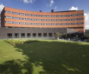
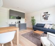
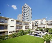
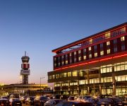
If you need a hotel, we compiled a list of available hotels close to the map centre further down the page.
While being here, you might want to pay a visit to some of the following locations: The Hague, Haarlem, Heemskerk, Amsterdam and Utrecht. To further explore this place, just scroll down and browse the available info.
Local weather forecast
Todays Local Weather Conditions & Forecast: 15°C / 60 °F
| Morning Temperature | 8°C / 46 °F |
| Evening Temperature | 14°C / 56 °F |
| Night Temperature | 9°C / 49 °F |
| Chance of rainfall | 20% |
| Air Humidity | 61% |
| Air Pressure | 1013 hPa |
| Wind Speed | Gentle Breeze with 7 km/h (5 mph) from North |
| Cloud Conditions | Overcast clouds, covering 95% of sky |
| General Conditions | Heavy intensity rain |
Sunday, 5th of May 2024
15°C (60 °F)
11°C (52 °F)
Moderate rain, gentle breeze, overcast clouds.
Monday, 6th of May 2024
17°C (63 °F)
12°C (54 °F)
Light rain, gentle breeze, overcast clouds.
Tuesday, 7th of May 2024
17°C (62 °F)
10°C (50 °F)
Broken clouds, gentle breeze.
Hotels and Places to Stay
Rotterdam Marriott Hotel
Van der Valk Hotel Rotterdam-Blijdorp
Stroom
Stayci Apartments Museumpark Deluxe
Bilderberg Parkhotel
Best Western Plus Rotterdam Airport Hotel
Worldhotel Wings Rotterdam The Hague Airport
PREMIER SUITES PLUS Rotterdam
Port Hotelport
Shortstay Rotterdam Apartments
Videos from this area
These are videos related to the place based on their proximity to this place.
Speeltijd voor ijsbeertje Vicks in Blijdorp - Playtime polar bear Vicks in Rotterdam Zoo
Ijsbeertje Vicks vermaakt regelmatig zijn publiek (en vooral de kinderen) in zijn Arctische verblijf. Al duikend daagt hij zijn toeschouwers uit mee te doen met zijn spelerij onder water. Neus...
Slotenmaker Rotterdam Heijplaat Bel 010-7420353
Slotenmaker Rotterdam Heijplaat Bel 010-7420353. De Slotenmaker Rotterdam staat in Heijplaat voor u klaar. http://www.deslotenmakerrotterdam.nl/ Bent u uw sleutel vergeten? Is uw slot kapot?...
Heijplaat: Operatie Heijplaat
Heijplaat - Mei 2012 -- filmpje t.b.v. Symposium: Gebiedsontwikkeling door de ogen van een student.
Enabling Rapid Innovation for the City of Rotterdam
The City of Rotterdam's Henk van der Rijt explains how the RAIN experience enabled him to understand that "rapid innovation can be done" with the right enablers. For more information visit...
Landing Aqualiner RDM Heijplaat
Ten tijde van deze opname lag er als proefproject een drijvende woning langs het steiger. It's moving babe...
De Aanval - mei 1940, vijf dagen strijd om Rotterdam
http://www.deaanval1940.nl tentoonstelling DE AANVAL mei 1940, vijf dagen strijd om Rotterdam 30 april t/m 25 oktober 2015 in de Onderzeebootloods RDM Rotterdam – Heijplaat Van 10 tot...
ZOOmer in Diergaarde Blijdorp - Summer in Rotterdam Zoo
Het is ZOOmer in Diergaarde Blijdorp. Neem een duik in waterwerelddeel Oceanium, slenter langs de zeeleeuwen, ijsberen, prairiehondjes en bizons. Een ontdekkingsreis vol onverwachte ...
Videos provided by Youtube are under the copyright of their owners.
Attractions and noteworthy things
Distances are based on the centre of the city/town and sightseeing location. This list contains brief abstracts about monuments, holiday activities, national parcs, museums, organisations and more from the area as well as interesting facts about the region itself. Where available, you'll find the corresponding homepage. Otherwise the related wikipedia article.
Delfshaven
Delfshaven is a borough of Rotterdam on the right bank of river Nieuwe Maas, in South Holland, the Netherlands. It was a separate municipality until 1886. The town of Delfshaven grew around the port of the city of Delft. Delft itself was not located on a major river, so in 1389 a harbour was created about 10 km due south of the city, to be able to receive seafaring vessels and avoid tolls being levied by the neighbouring and competing city of Rotterdam.
Oceanium
The Oceanium is an aquarium that opened in 2001 in Diergaarde Blijdorp, a zoo in Rotterdam, Netherlands. The Oceanium lies in the expansion area of the zoo, which includes a new entrance and parking area, and was the biggest project to date for the zoo. The area around the Oceanium is home to projects depicting the Americas. The Oceanium is also home to scientific research into the conservation of coral.
Sparta Stadion Het Kasteel
Sparta-Stadion Het Kasteel is a football stadium in Rotterdam, Netherlands. It is the home ground of Sparta Rotterdam. It has a capacity of 11,026.
Diergaarde Blijdorp
Diergaarde Blijdorp is a zoo in the northwestern part of Rotterdam, one of the oldest zoos in the Netherlands. In 2007 it celebrated its 150th anniversary. Diergaarde Blijdorp is a member of the Dutch Zoo Federation (NVD) and the European Association of Zoos and Aquaria (EAZA).
Coolhaven (Rotterdam Metro)
Coolhaven is an underground subway station in the Dutch city of Rotterdam. It is served by Rotterdam Metro lines A, B, and C. The station, with one island platform, opened on May 10, 1982 as the western terminus of the East-West Line (also formerly called Calandlijn). Coolhaven was the terminus until 1986, when the line was extended to Marconiplein. The station is named for the adjacent Coolhaven harbour basin. At the end of 2006 the station was renovated.
Oud- en Nieuw-Mathenesse
Oud- en Nieuw-Mathenesse is a former municipality in the Dutch province of South Holland. It was located to the west of Schiedam. The municipality existed between 1817 and 1868, when it merged with Schiedam. The area is now divided between Schiedam and Rotterdam, and is completely coveered by residential areas and the Merwehaven port.
Overschie
Overschie is a neighbourhood of Rotterdam, Netherlands, formerly a separate village with its own municipality. The village of Overschie was located on the intersection of four rivers called "Schie": the Delftsche Schie, Schiedamsche Schie, Delfshavensche Schie, and Rotterdamsche Schie. It was a separate municipality between 1817 and 1941, when it merged with Rotterdam. Immediately after the Second World War, the construction of a large suburb was begun southeast of the village.
Pilgrim Fathers Church
The Old or Pilgrim Fathers' Church (Dutch: Oude of Pelgrimvaderskerk Rotterdam-Delfshaven) is a church located in Rotterdam-Delfshaven, in the Netherlands.
Delfshaven (Rotterdam Metro)
Delfshaven is an underground subway station in the Dutch city of Rotterdam. It is served by lines A, B, and C of the Rotterdam Metro. The station is part of the two station long extension of the East-West Line (or Caland line) and opened on April 25, 1986. This extension connected the line's former terminus Coolhaven with the new Marconiplein station. In 2001, Delfshaven station was renovated. Since then, the walls of the station show traditional Delft blue motives.
Marconiplein (Rotterdam Metro)
Marconiplein is an underground subway station in the Dutch city of Rotterdam, and is part of Rotterdam Metro lines A, B, and C. The station is part of the two station long extension of the East-West Line (also formerly called Caland line) and opened on April 25, 1986. This extension connected the new Marconiplein and Delfshaven stations with the line's former terminus Coolhaven. Until November 4, 2002, Marconiplein station was the western terminus of the East-West Line.
Marnix Gymnasium
The Marnix Gymnasium is a secondary school located in Rotterdam, Netherlands. The school is named after Philips of Marnix, lord of Saint-Aldegonde. It teaches only the highest variant of secondary education in the Netherlands and prepares students for a tertiary education at Dutch universities.
Van Nelle Factory
The former Van Nelle Factory on the Schie river in Rotterdam, is one of the most important historic industrial buildings in the world.
Bospolder-Tussendijken
Bospolder-Tussendijken is a neighborhood of Rotterdam, The Netherlands.
Heijplaat
Heijplaat is a neighborhood of Rotterdam, Netherlands.
Kleinpolder
Kleinpolder is a neighborhood of Rotterdam, Netherlands.
Middelland
Middelland is a neighborhood of Rotterdam, Netherlands.
Nieuw-Mathenesse
Nieuw-Mathenesse is a neighborhood of Rotterdam, Netherlands.
Nieuwe Westen
Nieuwe Westen is a neighborhood of Rotterdam, Netherlands.
Schiemond
Schiemond is a neighborhood of Rotterdam, Netherlands.
Spaanse Polder
Spaanse Polder is a neighborhood of Rotterdam, Netherlands.
Spangen
Spangen is a neighborhood of Rotterdam, Netherlands. It is in the west of the city with about 9500 inhabitants. From the entrance of Spangen to the center is formed by the Mathenesserbrug across the Delfshavense Schie. The design of the area is world famous among architects and urban planners, but for the casual visitor it is not the first thing that strikes. Spangen is socio-economically one of the poorest neighborhoods of the country.
Oud-Mathenesse
Oud-Mathenesse is a neighborhood of Rotterdam, Netherlands.
Dutch ship Delft (1783)
The Delft was a Dutch 56-gun fourth rate ship of the line of the navy of the Dutch Republic and the Batavian Republic. The order to construct the ship was given on 27 May 1782 by the Admiralty of the Meuse. The ship was commissioned on 16 May 1783 by the United Netherlands Navy. On 24 December 1787 the Delft set sail on a mission against the Barbary pirates and protected Dutch traders in the Mediterranean.
Beukelsdijk
Beukelsdijk is a street in Rotterdam, which connects Rotterdam with Schiedam and which leads from the crossing with the Henegouwerlaan near the tunnel traverse (where it continues from the Weena), to the Burgemeester Meineszplein in the neighbourhood Middelland, where it continues as the Beukelsweg. The G.W. Burgerplein (where the villa in which Pim Fortuyn lived is located) lies next to the Beukelsdijk.
Richard Visser
Richard Visser is a Dutch pastry chef (aged 42 in December 2011) who runs a pastry stand (Dutch: Richard Visser's Gebakkraam; located on the corner of the Heemraadssingel and the Vierambachtsstraat in Rotterdam) which mainly sells oliebollen. In 2011 his oliebollen have been named the best in the Netherlands by the Algemeen Dagblad national newspaper in their AD-Oliebollentest for the eighth time in the 19th year the test was held.


