Safety Score: 3,3 of 5.0 based on data from 9 authorites. Meaning please reconsider your need to travel to Netherlands.
Travel warnings are updated daily. Source: Travel Warning Netherlands. Last Update: 2024-05-04 08:22:41
Discover Terbregge
The district Terbregge of Rotterdam in Gemeente Rotterdam (South Holland) with it's 3,525 citizens Terbregge is a subburb in Netherlands about 33 mi south-west of Amsterdam, the country's capital city.
If you need a hotel, we compiled a list of available hotels close to the map centre further down the page.
While being here, you might want to pay a visit to some of the following locations: The Hague, Haarlem, Amsterdam, Heemskerk and Utrecht. To further explore this place, just scroll down and browse the available info.
Local weather forecast
Todays Local Weather Conditions & Forecast: 15°C / 58 °F
| Morning Temperature | 8°C / 46 °F |
| Evening Temperature | 13°C / 55 °F |
| Night Temperature | 10°C / 50 °F |
| Chance of rainfall | 1% |
| Air Humidity | 65% |
| Air Pressure | 1014 hPa |
| Wind Speed | Gentle Breeze with 8 km/h (5 mph) from North-West |
| Cloud Conditions | Overcast clouds, covering 100% of sky |
| General Conditions | Light rain |
Sunday, 5th of May 2024
16°C (62 °F)
11°C (51 °F)
Light rain, gentle breeze, broken clouds.
Monday, 6th of May 2024
16°C (60 °F)
12°C (53 °F)
Moderate rain, gentle breeze, overcast clouds.
Tuesday, 7th of May 2024
11°C (52 °F)
11°C (51 °F)
Light rain, gentle breeze, overcast clouds.
Hotels and Places to Stay
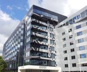
Mainport Hotel
Rotterdam Marriott Hotel
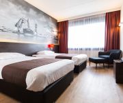
Bastion Hotel Rotterdam Alexander
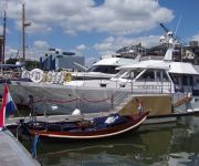
Maria Callas Yachthotel
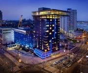
Inntel Hotels Rotterdam Centre
Hilton Rotterdam
NH Capelle
NH Atlanta Rotterdam
nhow Rotterdam
Suitehotel Pincoffs
Videos from this area
These are videos related to the place based on their proximity to this place.
MTB Bergschenhoek
Actiebeelden van een prachtig parcours in Bergschenhoek op een zonnige herfstdag in 2011.
Mountainbike Parcours Bergschenhoek
Het gehele mountainbike parcours Bergschenhoek in de avonduren. Het parcours was zeer goed te bereiden, nadat het net gemaaid was en het de afgelopen weken nauwelijks heeft geregend.
MTB parcour van Bergschenhoek met de Garmin VIRB
1e deel van het parcour van Outdoor Valley tot aan het hoogste punt bij de skiberg. Gefilmd met de VIRB in 720P HD en 50 fps.
Mountainbikeroute Bergschenhoek
Mountainbikeroute Bergschenhoek. Aantal kilometers: 7,3 km. Aantal hoogtemeters: 78 hm. Meer informatie vind je op: http://www.ridemymtb.com.
Dutch/Belgium Nationals @ Mvb Racing Bnk 2014
The Dutch/Belgium Nationals at the track of Mvb Racing Bergschenhoek.
Senioren Lead 1, 2009
Nikki van Bergen en Tim Reuser tijdens de eerste senioren lead competitiewedstrijd van 2009 in Outdoor Valley, Bergschenhoek.
Rc Rock Crawler/Scaler Mvb racing Compilation 2012
Multiple cars on different tracks. Mvb Racing Bergschenhoek www.mvbracing.nl www.rcracing.nl.
Tollerwandeling Lage Bergsche Bos 30-06-2013
Dit is een videoverslag van de wandeling op 30-06-2013 in Het Lage Bergsche Bos bij Bergschenhoek. Er waren voornamelijk Tollers aanwezig, maar ook een aantal andere rassen. Evert Kipp had...
Videos provided by Youtube are under the copyright of their owners.
Attractions and noteworthy things
Distances are based on the centre of the city/town and sightseeing location. This list contains brief abstracts about monuments, holiday activities, national parcs, museums, organisations and more from the area as well as interesting facts about the region itself. Where available, you'll find the corresponding homepage. Otherwise the related wikipedia article.
Bergschenhoek
Bergschenhoek is a town and former municipality in the Netherlands. It is situated roughly 10 km to the north of Rotterdam in the province of South Holland. The former municipality had a population of 16,608 in 2006, and covered an area of 15.52 km² (5.99 mile²) of which 0.63 km² (0.24 mile²) is water.
Hillegersberg
Hillegersberg is a neighborhood of Rotterdam, Netherlands. It was founded as a village in the Middle Ages (by legend because the giantess Hillegonda dropped some sand from her apron and Hillegersberg was founded on the mound which was formed by that). Hillegersberg remained a separate municipality until 1941, when it was amalgamated into Rotterdam as part of the new sub-municipality of Hillegersberg-Schiebroek.
Het Slaakhuis
Het Slaakhuis is a squat in Rotterdam, the Netherlands. It is located on a street called Slaak and was squatted in May 2003. Initially the space hosted film nights, workshops, parties and a cafe. There was a free shop and lessons were taught in Dutch and kung fu. The building is a six-storey office block, which was formerly the headquarters of a socialist newspaper, Het Vrije Volk. It was built in 1955.
Hazelaarweg Stadion
Hazelaarweg Stadion is a multi-use stadium in Rotterdam, Netherlands, run by the biggest hockey club in the Netherlands, HC Rotterdam. It is currently used mostly for field hockey matches and hosted matches for the 2001 Men's Champions Trophy. The stadium holds 10,000 people and was built in 2000.
Kralingen-Crooswijk
Kralingen-Crooswijk is a township of the city of Rotterdam, Netherlands. It is located at the immediate east of the city's centre. As of 2005 it has about 52,379 inhabitants and has a territory of about 1,286 ha. It consists of the two boroughs Kralingen and Crooswijk, the former being a village itself until it was incorporated in the city of Rotterdam in the late 19th century.
Binnenhof (Rotterdam Metro)
Binnenhof is a subway station on Line A of the Rotterdam Metro and is situated in Rotterdam-Ommoord. It is the northern terminus of the line. Trains departing from here will depart for Schiedam Centrum for most of the day. After 5pm their destination will be Kralingse Zoom and at night Alexander. This station was opened on May 28, 1983 when the East-West Line or Calandlijn was extended from its previous terminus Capelsebrug. Note that this section uses overhead wires to provide traction power.
Kralingen
Kralingen is a former village in the Dutch province of South Holland, now a neighbourhood of Rotterdam. It is located about 3 kilometres east of the city centre, in the borough Kralingen-Crooswijk. Kralingen was a separate municipality until 1895, when it merged with Rotterdam. Previously, the high society of the growing city had their pleasure gardens and villas erected there in the 19th century, on the eastern outskirts of the village.
Schiebroek
Schiebroek is a former village in the Dutch province of South Holland. It is now a neighbourhood of Rotterdam, and part of the borough of Hillegersberg-Schiebroek. Schiebroek was a separate municipality between 1817 and 1941, when it became part of Rotterdam.
Arboretum Trompenburg
Arboretum Trompenburg is a botanical garden in Rotterdam, the Netherlands, which hosts a large collection of woody as well as herbaceous plants. It occupies an area of 7 ha and is situated 4 m below sea level, so a system of canals is used to drain the land. The history of the garden dates back to the 19th century. Since 1958 it has been open to the public daily for a small fee.
Oostplein (Rotterdam Metro)
Oostplein is an underground subway station in the city of Rotterdam, located on the Rotterdam Metro lines A, B, and C. The station opened on May 10, 1982, on the same date that the East-West Line (also formerly called the Caland line), of which it is a part, was opened. The station is located near the border between the city center and the borough Kralingen-Crooswijk. Overground people can get on at RET-Rotterdam tram lines 7 and 21. Previous Line Next
Romeynshof (Rotterdam Metro)
Romeynshof is a subway station on line A of the Rotterdam Metro system, and is situated in Rotterdam-Ommoord. It is located between Graskruid station, where lines A and B split, and Binnenhof station, the northern terminus of line A. Trains coming from Binnenhof will depart for Schiedam Centrum for most of the day. After 5 pm their destination will be Kralingse Zoom and at night Alexander.
Graskruid (Rotterdam Metro)
Graskruid is a subway station on lines A and B of the Rotterdam Metro and is situated in the northeastern part of Rotterdam. At Graskruid station, the track splits into the two station short Line A branch and the longer Line B branch. The station consists of an island platform between two running tracks. This station was opened on May 28, 1983 when the East-West Line (also formerly called Caland line) was extended from its previous terminus Capelsebrug.
Capelsebrug (Rotterdam Metro)
Capelsebrug is a subway station on lines A, B, and C of the Rotterdam Metro. The station is situated in the eastern part of Rotterdam in the Netherlands, at the border with the municipality Capelle aan den IJssel. At Capelsebrug station, lines A and B turn north towards Schenkel station, while line C continues east towards Slotlaan station.. The westbound trains stop at either side of an island platform between two running tracks, while all eastbound trains share one platform.
Gerdesiaweg (Rotterdam Metro)
Gerdesiaweg is an underground subway station in the city of Rotterdam, located on the Rotterdam Metro lines A, B, and C. The station opened on May 10, 1982, on the same date that the East-West Line (also formerly called the Caland line), of which it is a part, was opened. The station is located to the east of the city center, in the borough Kralingen-Crooswijk.
Voorschoterlaan (Rotterdam Metro)
Voorschoterlaan is an underground subway station in the city of Rotterdam, located on the Rotterdam Metro lines A, B, and C. The station opened on May 10, 1982, on the same date that the East-West Line (also formerly called the Caland line), of which it is a part, was opened. The station is located to the east of the city center, in the borough Kralingen-Crooswijk. Overground people can get on at RET-Rotterdam tram line 7. Previous Line Next
Admiraliteitsbrug
The Admiraliteitsbrug is a drawbridge over the Buizengat in Rotterdam. The bridge is located on Willem Ruyslaan and connects oostzeedijk to the Maasboulevard. The bridge has a passage width of 9.20 m and a vertical clearance of 2.75 m . The bridge is unmanned and any request to open it must be submitted to the ministry (aangevraagd) at the Boerengatbrug. The bridge will not be operated if the Boerengatbrug or Oostbrug is opened or when the dam is closed.
Berg en Broeksche Verlaat
The Berg en Broeksche Verlaat is a canal lock in Rotterdam between the River Rotte and 2 peat bogs. It was built in 1866 and has Rijksmonument status.
Boezembrug
The Boezembrug is a bridge in Rotterdam, part of the Gouda Roadway. The Bosom bridge connects both banks of the Boezem. The bridge is a Rijksmonument designed by S. J. Rutgers in 1903.
Crooswijk
Crooswijk is a neighborhood of Rotterdam, The Netherlands. Crooswijk lies between the districts Kralingen, Oude Noorden and Centrum. Crooswijk was once known for its Marines barracks. Many streets bear witness to a military history of the Marine Corps: Tamboerstraat, Pijperstraat, Schuttersveld, Excercitiestraat, Vaandrigstraat. Crooswijk also has an industrial past. Jamin, Heineken Brewery and many abattoirs were established there. These industries have given way to housing.
110-Morgen
110-Morgen is a neighborhood of Rotterdam, Netherlands.
Kleiwegkwartier
Kleiwegkwartier is a neighborhood of Rotterdam, Netherlands.
Molenlaankwartier
Molenlaankwartier is a neighborhood of Rotterdam, Netherlands.
Terbregge
Terbregge is a neighborhood of Rotterdam, Netherlands.
Varenbuurt
Varenbuurt is a neighborhood of Rotterdam, Netherlands.
American International School of Rotterdam


