Safety Score: 3,3 of 5.0 based on data from 9 authorites. Meaning please reconsider your need to travel to Netherlands.
Travel warnings are updated daily. Source: Travel Warning Netherlands. Last Update: 2024-05-04 08:22:41
Delve into Schiebroek
The district Schiebroek of Rotterdam in Gemeente Rotterdam (South Holland) with it's 16,305 habitants Schiebroek is a district located in Netherlands about 34 mi south-west of Amsterdam, the country's capital town.
In need of a room? We compiled a list of available hotels close to the map centre further down the page.
Since you are here already, you might want to pay a visit to some of the following locations: The Hague, Haarlem, Heemskerk, Amsterdam and Utrecht. To further explore this place, just scroll down and browse the available info.
Local weather forecast
Todays Local Weather Conditions & Forecast: 16°C / 61 °F
| Morning Temperature | 8°C / 46 °F |
| Evening Temperature | 13°C / 55 °F |
| Night Temperature | 9°C / 49 °F |
| Chance of rainfall | 20% |
| Air Humidity | 64% |
| Air Pressure | 1012 hPa |
| Wind Speed | Gentle Breeze with 7 km/h (4 mph) from North-West |
| Cloud Conditions | Broken clouds, covering 52% of sky |
| General Conditions | Heavy intensity rain |
Sunday, 5th of May 2024
15°C (59 °F)
11°C (52 °F)
Moderate rain, gentle breeze, broken clouds.
Monday, 6th of May 2024
17°C (63 °F)
12°C (53 °F)
Light rain, gentle breeze, overcast clouds.
Tuesday, 7th of May 2024
16°C (62 °F)
10°C (51 °F)
Broken clouds, gentle breeze.
Hotels and Places to Stay
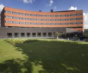
Rotterdam Marriott Hotel
Van der Valk Hotel Rotterdam-Blijdorp
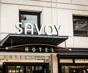
Hampshire Hotel Savoy Rotterdam
citizenM Rotterdam
Bilderberg Parkhotel
Hilton Rotterdam
PREMIER SUITES PLUS Rotterdam
NH Atlanta Rotterdam
Stayci Apartments Museumpark Deluxe
Worldhotel Wings Rotterdam The Hague Airport
Videos from this area
These are videos related to the place based on their proximity to this place.
Paintball Manege Rotterdam
Wedstijdje paintball in Rotterdam bij de Paintball Manege. Gespeeld op 7 juni 2014.
Hollands Christelijk Mannenkoor, Berkel en Rodenrijs
Commercial van het "Hollands Christelijk Mannenkoor" olv. Arjan Breukhoven. Meld je nu aan als lid - www.hcm.nu Iedere maandagavond repeteren wij in Kerkgebouw de Ark, Oranjestraat in Berkel...
16-03-13 ABWC Wedstrijd - Klasse 112 - Berkel en Rodenrijs - Deel 3 Baan 1
Artikel: http://www.rfgfotografie.nl/?p=458 Beste, Hierbij presenteer ik u mijn recentste video. Dit betreffende de brandweerwedstrijd van Gisteren, georganiseerd door/in brandweer Berkel...
Lipdub de Kleine Kapitein Berkel en Rodenrijs
Ter gelegenheid van het 5 jarig bestaan van basisschool de Kleine Kapitein in Berkel en Rodenrijs hebben we een lipdub gemaakt met de hele school. Een Lipdub is een muziekclip die in één...
Bijen Imker Andre Berkel en Rodenrijs Part 1
Bijen Imker Andre Berkel en Rodenrijs, Bijenvolk in tuin Bijen bij Berkel en Rodenrijs Killer Bees.
Videos provided by Youtube are under the copyright of their owners.
Attractions and noteworthy things
Distances are based on the centre of the city/town and sightseeing location. This list contains brief abstracts about monuments, holiday activities, national parcs, museums, organisations and more from the area as well as interesting facts about the region itself. Where available, you'll find the corresponding homepage. Otherwise the related wikipedia article.
Berkel en Rodenrijs
' is a town and former municipality in the Western part of the Netherlands, and is located in the Dutch province of South Holland.
Rotterdam The Hague Airport
Rotterdam The Hague Airport, located 3 NM north northwest of Rotterdam, is the Netherlands' third largest airport, coming after Amsterdam Airport Schiphol and Eindhoven Airport (measured in passengers). From the airport, there are amongst others daily services to London, Faro, Rome, Vienna, Madrid, Munich and Barcelona and charter flights. The airport handled 1,146,692 passengers in 2010.
Islamic University of Rotterdam
The Islamic University of Rotterdam (Islamitische Universiteit Rotterdam) also known by its acronym IUR is a vocational university founded in 1997. It is a member of the Federation of the Universities of the Islamic World. Although the Islamic University of Rotterdam has eleven courses which can be followed, only the professional master programme for Islamic Moral Guiding has been accredited by NVAO, the official accreditation organisation of the Netherlands and Flanders.
Hazelaarweg Stadion
Hazelaarweg Stadion is a multi-use stadium in Rotterdam, Netherlands, run by the biggest hockey club in the Netherlands, HC Rotterdam. It is currently used mostly for field hockey matches and hosted matches for the 2001 Men's Champions Trophy. The stadium holds 10,000 people and was built in 2000.
Oude Noorden
Oude Noorden (Old North) is an area of north Rotterdam, Netherlands and is part of the borough Noord. It has approximately 18,000 inhabitants. The district has much pre World War I and World War II architecture still in existence. It has a vibrant though somewhat discreet artistic community. In 2009 Eberhard van der Laan, the Minister of Housing, referred to the neighbourhood as the third worst in his "40 problem neighbourhoods" list.
Schiebroek
Schiebroek is a former village in the Dutch province of South Holland. It is now a neighbourhood of Rotterdam, and part of the borough of Hillegersberg-Schiebroek. Schiebroek was a separate municipality between 1817 and 1941, when it became part of Rotterdam.
Battle of Rotterdam
The Battle of Rotterdam was a Second World War battle fought during the Battle of the Netherlands. Fought between 10–14 May 1940, it was a German attempt to seize the Dutch city. It ended in a German victory, following the Rotterdam Blitz.
Rotterdam Delftsche Poort railway station
Rotterdam Delftsche Poort was a railway station of the Hollandsche IJzeren Spoorweg-Maatschappij in Rotterdam, The Netherlands located on the Oude Lijn from Amsterdam Willemspoort station to Rotterdam. The station was located east of the present-day Rotterdam Centraal.
Rotte (river)
The Rotte is a river the in Rhine-Maas-delta in the Netherlands. The Rotte is the namesake of the city of Rotterdam: the city was founded in the 13th Century when a dam was built across the river. It rises in Moerkapelle in the so-called Green Heart. It flows past Bleiswijk and Bergschenhoek; and then the village of Hillegersberg, which was built on a sand dune and was one of the few places in the marsh land that could be permanently settled before the dikes were constructed.
Provenierskerk
The Our Lady of the Holy Rosary Church, also known as the Provenierskerk or Proveniershuis Singelkerk was a Roman Catholic church on the Proveniershuis canal in Rotterdam. The church was built between 1898 and 1899 by the architectural firm of Albert Margry and Joseph Snickers. Margry designed a three-aisled church in neo-Gothic style, with a tower next to the facade. Provenierskerk was consecrated on May 8, 1899 by the Bishop of Haarlem.
Berg en Broeksche Verlaat
The Berg en Broeksche Verlaat is a canal lock in Rotterdam between the River Rotte and 2 peat bogs. It was built in 1866 and has Rijksmonument status.
Blijdorp district
Blijdorp is a neighbourhood in northern Rotterdam and is part of the borough Noord. The neighbourhood has around 9500 inhabitants.
Agniesebuurt
Agniesebuurt is a neighborhood of Rotterdam, Netherlands.
Liskwartier
Liskwartier is a neighborhood of Rotterdam, Netherlands.
Bergpolder
Bergpolder is a neighborhood of Rotterdam, Netherlands.
Provenierswijk
Provenierswijk is a neighborhood of Rotterdam, Netherlands.
Crooswijk
Crooswijk is a neighborhood of Rotterdam, The Netherlands. Crooswijk lies between the districts Kralingen, Oude Noorden and Centrum. Crooswijk was once known for its Marines barracks. Many streets bear witness to a military history of the Marine Corps: Tamboerstraat, Pijperstraat, Schuttersveld, Excercitiestraat, Vaandrigstraat. Crooswijk also has an industrial past. Jamin, Heineken Brewery and many abattoirs were established there. These industries have given way to housing.
110-Morgen
110-Morgen is a neighborhood of Rotterdam, Netherlands.
Kleiwegkwartier
Kleiwegkwartier is a neighborhood of Rotterdam, Netherlands.
Molenlaankwartier
Molenlaankwartier is a neighborhood of Rotterdam, Netherlands.
Zestienhoven (district)
Zestienhoven is a neighborhood of Rotterdam, Netherlands.
Rotterdam Blitz
The Bombing of Rotterdam (occasionally referred to as the Rotterdam Blitz) refers to the aerial bombardment of Rotterdam by the German Air Force on 14 May 1940, during the German invasion of the Netherlands in World War II. The objective was to support the German troops fighting in the city, break Dutch resistance and force the Dutch to surrender.
Sportpark Laag Zestienhoven
Sportpark Laag Zestienhoven is a cricket ground in Rotterdam, the Netherlands. The first recorded match on the ground came in 1963 when RG Inglese's XI played The Forty Club. The ground later held six matches in the 1990 ICC Trophy. The ground held a single Women's One Day International in 2003 when Ireland Women played Pakistan Women. The ground is used by VOC Cricket Club.
Bergweg
Bergweg is a street in Rotterdam, which connects Rotterdam with Bergschenhoek through Hillegersberg. Nowadays the Bergweg is a road in the neighborhood Oude Noorden between the Schiekade and Gordelweg. The buildings mostly dating from the early twentieth century. In the street lies the Rotterdam Noord railway station and the closed Bergweg railway station.
American International School of Rotterdam


